You are using an out of date browser. It may not display this or other websites correctly.
You should upgrade or use an alternative browser.
You should upgrade or use an alternative browser.
Earthquakes around the world
- Thread starter pescado
- Start date
angelburst29
The Living Force
A 6.0-magnitude earthquake hit Japan Saturday evening outside Tokyo, shaking buildings in the capital, but no tsunami warning was issued, the country's meteorological agency said.
07.07.2018 - Strong 6.0 Earthquake Felt in Tokyo - Reports
Strong 6.0 Earthquake Felt in Tokyo – Reports
The epicenter of the 6.0 magnitude earthquake was in Chiba Prefecture near Tokyo, at a depth of 50 km.
The underground shocks lasted for about 10 seconds and were felt in all prefectures in the central and north-eastern parts of the country, including the Japanese capital.
Local residents have been told not to panic and remain calm.
Despite the fact that the tsunami warning was canceled a few minutes after the earthquake, residents of the country have been asked not to approach the shoreline.
A crisis headquarters under the office of Japanese Prime Minister Shinzo Abe has been created to engage in collection and analysis of information as to the possible consequences of the earthquake and to coordinate the work of the relevant departments related to their elimination.
Unforeseen situations at Japanese nuclear power stations have not been recorded following the earthquake, the Japanese Committee for the Control of Atomic Energy reported.
The earthquake happened amid heavy rainfalls that have been afflicting Japan for several days, killing more than 30 people.
10 km
Ditrianum Published on Jul 7, 2018 / 8:19
In the first week three alignments occurred involving Venus, Mercury and Uranus. Later on the 7th the Moon also aligns with Uranus and this may trigger larger seismic activity from the 7th to the 10th. One of the most critical areas currently seems the West Pacific (Japan, China, Taiwan) Similar planetary geometry that triggered large earthquakes in the past, is also covered in this update. Current Seismic Indicator: http://www.ditrianum.org
In the first week three alignments occurred involving Venus, Mercury and Uranus. Later on the 7th the Moon also aligns with Uranus and this may trigger larger seismic activity from the 7th to the 10th. One of the most critical areas currently seems the West Pacific (Japan, China, Taiwan) Similar planetary geometry that triggered large earthquakes in the past, is also covered in this update. Current Seismic Indicator: http://www.ditrianum.org
M 6.0
160km SSE of Sayhut, Yemen
Time2018-07-15 13:09:16 (UTC)
Location13.819°N 51.651°E
Depth10.0 km
https://twitter.com/SafeLiveAlert/status/1019147018210545664Translated from Spanish by Microsoft
 was registered
  the limits of Michoacán and Jalisco
 Our app sent only a notification announcing the movement

 Coalcomán, Mich. Prof 10km
Earthquake, Magnitude 5.0 - MICHOACAN, MEXICO - 2018 July 17, 08:54:45 UTC
Depth 89 km
Distances189 km S of Guadalajara, Mexico / pop: 1,641,000 / local time: 03:54:50.3 2018-07-17
73 km SE of Colima, Mexico / pop: 128,000 / local time: 03:54:50.3 2018-07-17
23 km N of Coalcomán de Matamoros, Mexico / pop: 10,800 / local time: 03:54:50.3 2018-07-17
Earthquake, Magnitude 6.0 - SANTA CRUZ ISLANDS - 2018 July 17, 07:02:54 UTC
Depth 60 km

Side Note:
M 6.0 - 92km WSW of Chernabura Island, Alaska
Earthquake, Magnitude 5.8 - PUEBLA, MEXICO - 2018 July 19, 13:31:52 UTC
Depth10 km
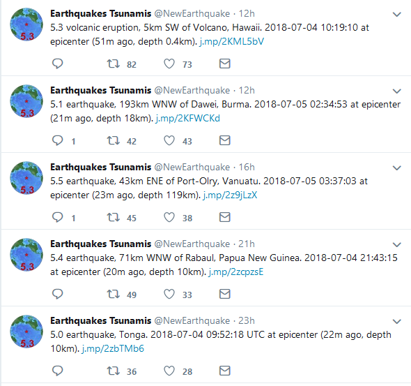
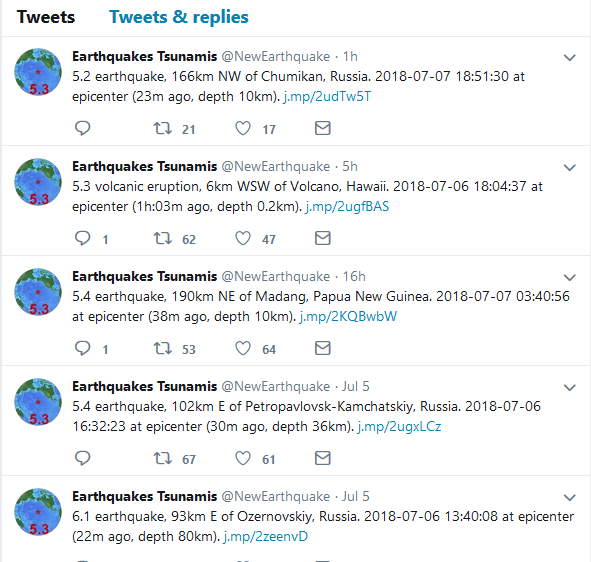
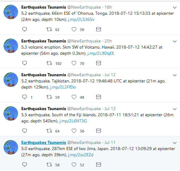
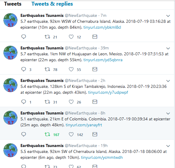
Earthquakes Tsunamis (@NewEarthquake) | Twitter
Translated from Spanish by Microsofe
Via@CEPCO_GobOax: No damage #sismo in the regions of the isthmus, coast, basin, Glen, central valleys, north and South Mountains the Mixteca #Oaxaca is monitored
https://pbs.twimg.com/media/DieYSxgW0AIOiRi.jpg:large
TheEarthMaster Published on Jul 17, 2018
Side-note:
Earthquake, Magnitude 5.8 - PUEBLA, MEXICO - 2018 July 19, 13:31:52 UTC
Depth10 km
Earthquakes Tsunamis (@NewEarthquake) | Twitter
Translated from Spanish by Microsofe
Via
https://pbs.twimg.com/media/DieYSxgW0AIOiRi.jpg:large
Side-note:
Last edited:
Earthquake Video: Kilauea Volcano - 1 April to 30 June 2018 - Strange Sounds
By Strange Sounds Jul 21, 2018
The NWS’s Pacific Tsunami Warning Center (PTWC) mitigates tsunami hazards in Hawaii produced by large, distant earthquakes throughout the Pacific Ocean, but PTWC also issues warnings for tsunamis generated by earthquakes within the State of Hawaii itself. The last such dangerous tsunami was generated by a 7.7 magnitude earthquake on the Big Island of Hawaii in 1975. Small earthquakes generated by volcanic activity are far more common, and typically have a magnitude less than 3.0 and occur a few times a day. That changed on the afternoon of April 30. 2018, when an earthquake “swarm” began within Kilauea Volcano such that earthquakes began to occur far more frequently, about 100 per day.
This animation begins a month earlier on April 1 to start with a more typical earthquake pattern and proceeds forward in time at a rate of one day per second. The size of the circles indicate their magnitude, and color represents their depth. Three days before the swarm began the lava within the “Overlook crater” inside of Halema`uma`u Crater overflowed then retreated back below its rim. Then on April 30 the 35 year-old Pu`u `O`o eruption ceased and its cone partially collapsed. This event coincided with the start of a swarm of volcanic earthquakes on Kilauea’s East Rift Zone, a feature extending from the volcano’s summit that carries magma underground through its flank. Eruptions can take place anywhere along this rift zone as well as at the volcano’s summit. Earthquake occurrence then moved northeast along the rift zone away from the summit, suggesting the movement of magma below ground in this direction. Magma reached the surface and erupted as lava on the afternoon of May 3 and is still ongoing (1 July 2018).
4K
At the same time lava began to drain from the “Overlook crater” and by May 15 its lava lake had dropped 100s of feet then produced steam-driven explosions when it interacted with ground water. Some of these explosions were strong enough to register as magnitude 5.0 earthquakes and send ash clouds to 30,000 ft. above sea level. By the end of May, however, these explosions changed their character such that they no longer produced large steam-driven ash clouds. The walls of Halema`uma`u had begun to collapse, thus widening Halema`uma`u and burying the “Overlook crater” as magma continued to drain from the summit to feed the flank eruption. These collapses seem to release trapped volcanic gas rather than groundwater steam and produce only small ash clouds, though they still release explosive energy greater than magnitude 5.0 earthquakes and occur about once per day. Black circles represent these volcanic explosions in the animation, with their size indicating their energy release in equivalent earthquake magnitude. This explosive activity also continues today.
This animation includes charts showing some statistics about the earthquake activity. The top graph shows the maximum magnitude per day for earthquakes in white and explosions in black. The bottom graph shows the total number of seismic events per day. Since the eruption began the frequency of earthquakes initially increased to about 100 per day and their magnitudes exceeded magnitude 4.0. The largest earthquake struck on the afternoon of May 4 with a magnitude of 6.9 and produced numerous aftershocks. This largest earthquake also moved the flank of Kilauea Volcano as much as 20 inches seaward. With the subsidence of Kilauea Caldera and the collapse of Halema`uma`u the number of earthquakes dramatically increased to more than 700 per day.
Though PTWC monitors all earthquakes in Hawaii, including this ongoing activity, the primary responsibility for mitigating volcanic hazards in the State of Hawaii rests with the USGS’s Hawaiian Volcano Observatory who publishes updates daily and advises local emergency managers.
Earthquake swarm near London, UK
Posted by TW on July 20, 2018
Ten seismic events have been detected in the Newdigate, Surrey area of the United Kingdom, between Dorking and Gatwick airports near London, since April 1, 2018. Magnitudes of this cluster of events range from 1.5 to 3.0. There are fears that quakes might be caused by nearby fracking operations.
According to the British Geological Survey (BGS), the ninth and tenth events took place at around 04:00 and 13:30 UTC on July 18 with magnitudes of 2.0ML and 2.6ML, respectively. The quakes hit at a shallow depth between 500 m (1 640 feet) and 2 km (1.2 miles).
Dr. Stephen Hicks from Southampton University said a 0.4 aftershock had been measured after the second quake.
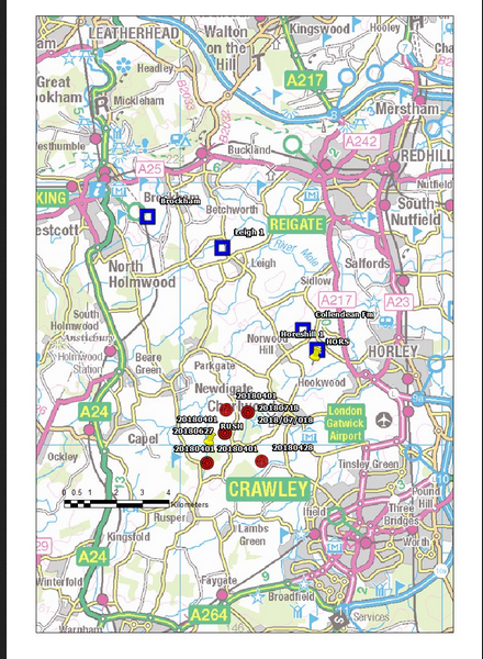
The strongest quake so far was a M3.0 on July 5. It was felt by more than 800 people who reported it to the BGS.
Residents are expressing fears that quakes are being caused by fracking operations at nearby Horse Hill while oil exploration company UKOG insists that there is no link with the quakes. They claim that work at the site does not involve subsurface drilling and 'so has little to no seismic impact on the surrounding area.'
"We are seeking to better understand what's going on," said BGS seismologist David Galloway.
"We will find out what is the cause. We live on a dynamic planet, but we are looking at the issue of oil exploration in the area to see if it is connected. But it could be entirely natural. Plates move about all the time. They're bashing and moving away from each other."
Further work may be able to determine if any connection exists, BGS said. "As an independent and impartial provider of geospatial data, we hope that our continuing high quality real-time seismic monitoring will produce a comprehensive and open data-set. We will continue to analyze this data as the situation develops allowing us and anyone else to investigate the causal factors of these events."
List of all earthquakes detected by the BGS around the British Isles in the last 50 days can be found at the following link
By Strange Sounds Jul 21, 2018
The NWS’s Pacific Tsunami Warning Center (PTWC) mitigates tsunami hazards in Hawaii produced by large, distant earthquakes throughout the Pacific Ocean, but PTWC also issues warnings for tsunamis generated by earthquakes within the State of Hawaii itself. The last such dangerous tsunami was generated by a 7.7 magnitude earthquake on the Big Island of Hawaii in 1975. Small earthquakes generated by volcanic activity are far more common, and typically have a magnitude less than 3.0 and occur a few times a day. That changed on the afternoon of April 30. 2018, when an earthquake “swarm” began within Kilauea Volcano such that earthquakes began to occur far more frequently, about 100 per day.
This animation begins a month earlier on April 1 to start with a more typical earthquake pattern and proceeds forward in time at a rate of one day per second. The size of the circles indicate their magnitude, and color represents their depth. Three days before the swarm began the lava within the “Overlook crater” inside of Halema`uma`u Crater overflowed then retreated back below its rim. Then on April 30 the 35 year-old Pu`u `O`o eruption ceased and its cone partially collapsed. This event coincided with the start of a swarm of volcanic earthquakes on Kilauea’s East Rift Zone, a feature extending from the volcano’s summit that carries magma underground through its flank. Eruptions can take place anywhere along this rift zone as well as at the volcano’s summit. Earthquake occurrence then moved northeast along the rift zone away from the summit, suggesting the movement of magma below ground in this direction. Magma reached the surface and erupted as lava on the afternoon of May 3 and is still ongoing (1 July 2018).
4K
At the same time lava began to drain from the “Overlook crater” and by May 15 its lava lake had dropped 100s of feet then produced steam-driven explosions when it interacted with ground water. Some of these explosions were strong enough to register as magnitude 5.0 earthquakes and send ash clouds to 30,000 ft. above sea level. By the end of May, however, these explosions changed their character such that they no longer produced large steam-driven ash clouds. The walls of Halema`uma`u had begun to collapse, thus widening Halema`uma`u and burying the “Overlook crater” as magma continued to drain from the summit to feed the flank eruption. These collapses seem to release trapped volcanic gas rather than groundwater steam and produce only small ash clouds, though they still release explosive energy greater than magnitude 5.0 earthquakes and occur about once per day. Black circles represent these volcanic explosions in the animation, with their size indicating their energy release in equivalent earthquake magnitude. This explosive activity also continues today.
This animation includes charts showing some statistics about the earthquake activity. The top graph shows the maximum magnitude per day for earthquakes in white and explosions in black. The bottom graph shows the total number of seismic events per day. Since the eruption began the frequency of earthquakes initially increased to about 100 per day and their magnitudes exceeded magnitude 4.0. The largest earthquake struck on the afternoon of May 4 with a magnitude of 6.9 and produced numerous aftershocks. This largest earthquake also moved the flank of Kilauea Volcano as much as 20 inches seaward. With the subsidence of Kilauea Caldera and the collapse of Halema`uma`u the number of earthquakes dramatically increased to more than 700 per day.
Though PTWC monitors all earthquakes in Hawaii, including this ongoing activity, the primary responsibility for mitigating volcanic hazards in the State of Hawaii rests with the USGS’s Hawaiian Volcano Observatory who publishes updates daily and advises local emergency managers.
Earthquake swarm near London, UK
Posted by TW on July 20, 2018
Ten seismic events have been detected in the Newdigate, Surrey area of the United Kingdom, between Dorking and Gatwick airports near London, since April 1, 2018. Magnitudes of this cluster of events range from 1.5 to 3.0. There are fears that quakes might be caused by nearby fracking operations.
According to the British Geological Survey (BGS), the ninth and tenth events took place at around 04:00 and 13:30 UTC on July 18 with magnitudes of 2.0ML and 2.6ML, respectively. The quakes hit at a shallow depth between 500 m (1 640 feet) and 2 km (1.2 miles).
Dr. Stephen Hicks from Southampton University said a 0.4 aftershock had been measured after the second quake.
The strongest quake so far was a M3.0 on July 5. It was felt by more than 800 people who reported it to the BGS.
Residents are expressing fears that quakes are being caused by fracking operations at nearby Horse Hill while oil exploration company UKOG insists that there is no link with the quakes. They claim that work at the site does not involve subsurface drilling and 'so has little to no seismic impact on the surrounding area.'
"We are seeking to better understand what's going on," said BGS seismologist David Galloway.
"We will find out what is the cause. We live on a dynamic planet, but we are looking at the issue of oil exploration in the area to see if it is connected. But it could be entirely natural. Plates move about all the time. They're bashing and moving away from each other."
Further work may be able to determine if any connection exists, BGS said. "As an independent and impartial provider of geospatial data, we hope that our continuing high quality real-time seismic monitoring will produce a comprehensive and open data-set. We will continue to analyze this data as the situation develops allowing us and anyone else to investigate the causal factors of these events."
List of all earthquakes detected by the BGS around the British Isles in the last 50 days can be found at the following link
Earthquake, Magnitude 5.6 - ISLAND OF HAWAII, HAWAII - 2018 July 24, 16:41:10 UTC
Translated from Spanish by Microsoft
How important is the depth of earthquakes? Same magnitude: • 5.9 Oaxaca-19/07/18 No damage • 5.9 Iran-22/07/18 damage and a hundred injured. Focus depth on each earthquake: • 63 km in Oaxaca. • 5 km in Iran. The more depth the intensity will be lower.
Oneearth
The Force is Strong With This One
Earthquake, Magnitude 4.4 - BAJA CALIFORNIA, MEXICO - 2018 July 25, 20:17:55 UTC
Depth 10 km
Current World Earthquake Map https://earthquake.usgs.gov/earthquak...
Recent California and Nevada Earthquakes http://scedc.caltech.edu/recent/
Earthquake, Magnitude 5.7 - SOUTH SANDWICH ISLANDS REGION - 2018 July 25, 19:45:06 UTC
Depth 136 km
Jan 27, 2016 #340
Last edited: