Earth Changes and the Human-Cosmic Connection

mkrnhr said:
Pashalis said:
This would explain why usually asteroids are not in glowing mode, as is the case with asteroids in stationary clouds, asteroids following a circular orbit around the Sun, and asteroids located in the belt between Mars and Jupiter.
What is a stationary cloud in the above quote? I can't find a translation of it in german nor a description of the term in english.

The rest of the sentence explains what it is. It applies to the asteroid belt, Kuiper belt etc. and also to the Trojans. Maybe "circumstellar disc" (zirkumstellare Scheibe ?) would work?

Thanks! So I'll work with "zirkumstellare Scheibe" respectively "protoplanetare Scheibe" and hope that is right...
 
Pashalis said:
Thanks! So I'll work with "zirkumstellare Scheibe" respectively "protoplanetare Scheibe" and hope that is right...

"protoplanetare" (proto=before planets) doesn't seem right, it assumes a gas cloud around a young star, about to form a planetary system (according to the standard model). "zirkumstellare" (circling=around star) is more general and includes the asteroids in a stable orbit (almost circular) around the actual sun. OSIT
 
From both a translational perspective as well as in terms of content I completely agree with mkrnhr on this one.

Protoplanetare Scheibe would definitely be off-putting for German readers IMO given the context of the subject at hand.
 
Just cross posting here for all who is translating or who is going to translate the Pierre's book. There was a copy infringement (image 66) and a small error in the book.

Image 66 was remade by aimarok and has now Sott.net copyright. It can be downloaded here:

https://docviewer.yandex.com/?url=ya-disk-public%3A%2F%2FOvXvFUaAFPjtE3RcC%2FuEYob1Pks1U8KwE%2F7n9wfoOYE%3D%3A%2FOriginal%2F066.svgz&name=066.svgz&c=5687f1c451af

Don't be confused by the file extension. It's a self-extracting file.

Regarding the error in the text. Based on the email exchange with Pierre:

There is indeed a mistake. Actually, in his book Muller mentions the presence of iridium in the E-O layers and in the C-T layer.

Original
Berkeley physicist Richard Muller discovered another significant clue in May 1986 when he
compiled the iridium levels measured at the Eocene-Oligocene (E-O) boundary, which marked the
mass extinction that occurred between 39 and 35 million years ago, in 66 different locations across
the five inhabited continents. As shown on the map in figure 39, the results were unexpected: in
each of those 66 different locations, Muller found abnormal levels of iridium.92

Modified
Berkeley physicist Richard Muller discovered another significant clue in May 1986 when he
compiled the iridium levels measured at the Cretacious-Tertiary (C-T) boundary, which marked the
mass extinction that occurred about 65 million years ago, in 66 different locations across
the five inhabited continents. As shown on the map in figure 39, the results were unexpected: in
each of those 66 different locations, Muller found abnormal levels of iridium.92

Then, Muller and his team checked level of iridium at the Eocene-Oligocene (E-O) boundary which marked the extinction of the dinosaurs and occurred between 39 and 35 million years ago. They soon found similarly abnormal levels of iridium. Those results were independantly confirmed by researcher R. Ganapathy.
 
Hi, sometimes I go and look out the links from ECHCC quotes to see more updates, yesterday was looking for _http://www.spaceandscience.net/ quote, page 143, and the site is for sale?, but found the same quote at John L. Cassey book "Dark Winter: How the Sun Is Causing a 30-Year Cold Spell",here: _https://books.google.com.mx/books?id=DLB_BAAAQBAJ&pg=PT90&lpg=PT90&dq=global+cooling+begins+and+global+warming+ends+ssrc&source=bl&ots=fseJx9RRS9&sig=kh3Luu7jPXZC1W7SddQQnX6dgTQ&hl=es-419&sa=X&ved=0ahUKEwis0ZSl1JHKAhVMHD4KHfrfAJgQ6AEIIDAA#v=onepage&q=global%20cooling%20begins%20and%20global%20warming%20ends%20ssrc&f=false

I would assume you already knew it, and was wondering if you know where to see/read info about newest data including the "reloaded" El Niño (2015) warmer ones to see how things are going -so to speak, for example, found at _http://www.sidc.be/silso/home, their latest bulletin of sunspots (Sunspot Index and Long-term Solar Observations, World Data Center supported by the ICSU - WDS, 2015 n◦ 11, Provisional international and normalized hemispheric daily sunspot numbers for November 2015) in which I do not understand much, though, but the graphics help.

Ah!, by the way, thank you very much for all of the graphics/drawings/diagrams/images included in the book, because it had helped me a lot to get familiarized with many terms and to be able to understand better, I was a little apprehensive because, I did not do well at science at school, now, it's been a fascinating experience!! Had not finished, yet. :)
 
mabar said:
I would assume you already knew it, and was wondering if you know where to see/read info about newest data including the "reloaded" El Niño (2015) warmer ones to see how things are going -so to speak, for example, found at _http://www.sidc.be/silso/home, their latest bulletin of sunspots (Sunspot Index and Long-term Solar Observations, World Data Center supported by the ICSU - WDS, 2015 n◦ 11, Provisional international and normalized hemispheric daily sunspot numbers for November 2015) in which I do not understand much, though, but the graphics help.

That's indeed an important point. El Nino is currently stronger than it's ever been over the past 70 years and it's still growing.

It seems to be the spike mentioned in a 1998 transcript. Actually I kept looking for this spike over the last years and couldn't find it simply because there was no spike at the time. The El Nino exceptional spike only started a few weeks ago.

Now, interestingly, the 1998 transcript mentioned the El Nino spike in relation to an hypothetic 10.4 quake in the north East pacific:

session 4/7/1998 said:
A: In Florida now, where to next? How about a shattering subduction quake in Pacific Northwest of U.S.? We estimate 10.4 on the Richter scale. We have warned of Rainier. Imagine a 150 meter high tsunami in Puget Sound...
Q: (L) Does this subduction quake have anything to do with that UFO that buried itself in the Pacific?
A: All are interconnected.
Q: (L) The information I got on that was that it was about 600 mile north and east of Hawaii. A couple of submersibles were sent down and disappeared or were destroyed or didn't come back... it is
supposedly giving off a lot of energy. Any comment?
A: No.
Q: (L) Should I follow that direction?
A: All directions lead to lessons.
Q: (L) Now, you have mentioned this earthquake. I know that you don't usually give predictions, why have you done so now?
A: We do not give time tables.
Q: (L) Anything else other than a tsunami in Puget Sound and a big subduction quake... 10.4 on the Richter scale is almost inconceivable.
A: Rainier... caldera.
Q: (L) What about the caldera?
A: Expect one.
Q: (L) Other than floods, anything else for Florida upcoming?
A: All areas experience accelerating "freak weather patterns."
Q: (L) Okay, all of these freaky weather patterns and bizarre things going on the planet, how does it relate to the comet cluster and the brown star? Is it related?
A: Human experiential cycle intersects.
Q: (L) Any specific physical manifestation of either this brown star or this comet cluster or this realm border, that is related to these events on the planet?
A: Approach of wave stimulates precursor activity which in turn causes effects which in turn stimulates further "heating up" of activity...
Q: (L) I thought it was curious that you used the term 'birth of the spike.' Is there something or someone that was born at that particular time?
A: No. Spike is as on a graph...
Q: (L) Okay, is there anyway we could graph this ourselves, and if so, what types of events would we include to create the background data?
A: "El Nino, La Nina," etc...

The session above was actually the second one to mention 'el Nino'. The first one occurred in 1997 and mentioned 'el Nino' in relation to 'reverberating' quakes and eruptions.

22/8/1997 said:
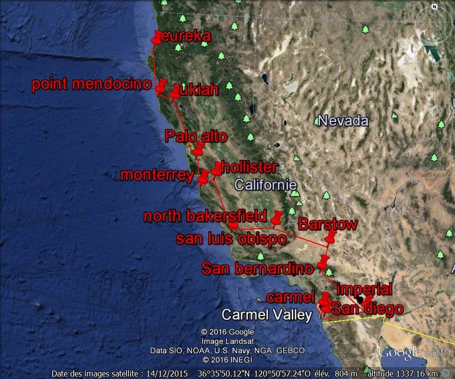
Q: Okay. Now, we are onto the subject of our friendly local volcano down on Montserrat. What is it up to?
A: Seismic swarms... Much fear and concern by officials; muted...
Q: Can you give us an idea about what this volcano is going to do? What are the percentages in favor of a cataclysmic eruption in the near future?
A: Look to geologic map patterning for answer.
Q: What in particular should we be looking for?
A: Sequences, locators, historical telltale hints and signs. The signs always point the way for those who bother to read.
Q: Is there something about sequences of locators? Is it like a moving series in a general direction or pattern?
A: Yes.

Q: What general way does the sequence move? East to West? What?
A: Reverberatory.
Q: So, if something occurs in one place...
A: Like the wavelets in a small pool of water.
Q: Well, where does the stone drop?
A: Look to 18 degrees North and South.
Q: What, in specific, is at 18 degrees, that we need to see?
A: Magnetic colliders that balance.
Q: What do they balance? Magnetic fields of the earth?
A: Close.
Q: Would there be specific points along this 18 degree line, and if so, how many lines of longitude apart would they be?
A: Think of a parallelogram.
Q: What is this parallelogram going to tell us?
A: Cosmic "puncture points."
Q: You mean like cosmic windows?
A: Closer.
Q: And these parallelograms are located along the 18 degree lines of latitude.
A: Yes.
Q: And these parallelogram windows... do they straddle this line, or are they above or below it?
A: Near, as measured on the surface.
Q: Where do they originate from? Within the globe, or externally?
A: Both, as in positive/negative charge.
Q: What is within the globe, the positive or negative?
A: Think of static electricity to "ground" your answer.
Q: How many of these parallelograms are there along this 18 degree line of latitude?
A: Four shooting energy bars.
Q: Where are they shooting energy to, space?
A: And back.
Q: Okay...
A: Like a double double-helix, centered at core of the planet.
Q: Do you mean a double helix that winds from the core and touches the surface at the outer turns and then winds back again?
A: Need not "wind." The "strands" can be perfectly straight in orientation.
Q: Well, I thought that a helix implied a spiral shape... Are the ends of it at the core and go to the surface, not winding around the surface...
A: Close. Do not you see Laura? If you were to draw this correctly, you would unite the very core of any sphere with all of creation?
Q: Well, I am having a hard time creating a mental image here!
A: We will represent it for you. [Planchette inscribes four lines from
Q: Where do they originate from? Within the globe, or externally?
Q: What is within the globe, the positive or negative?
Q: How many of these parallelograms are there along this 18 degree line of latitude?
Q: Where are they shooting energy to, space?
A: Okay...
Q: Do you mean a double helix that winds from the core and touches the surface at the outer turns and then winds back again?
Q: Well, I thought that a helix implied a spiral shape... Are the ends of it at the core and go to the surface, not winding around the surface...
A: We will represent it for you. [Planchette inscribes four lines from center of board to each of four corners and back.] Now, geometrically expand and interpolate.
Q: So, you have four lines leading out from the center. And each line represents a 'double helix.'
A: Close.
Q: So, this line is really a double line...? How do we include the hydrogen bonds?
A: Bonds are not necessary, as we are not speaking of DNA.
Q: So, it does have a positive and negative line?
A: Yes.
Q: Is this just lines, or conduits of energy, or is it segmented in some way?
A: Conduit which radiates cosmic balancing principle.
Q: Okay, and each point where these conduits reach the surface, expresses as a parallelogram shaped area on the surface?
A: Close.
Q: And all of these double lines, or conduits, come out in the general area of 18 degrees of latitude.
A: Yes.

Q: So, those are the points we are looking for to find activity, to then relate to other points around the globe?
A: In cyclical sequence. Your "El Nino" ties into this too! Why do you think the ocean water warms up so much, where it does, and
cyclically at regular intervals?

In the above we have El Nino powered by 'Conduit which radiates cosmic balancing principle' that are located along the 18 degree latitude lines. An increase in this energetic activity triggers ('stone drop') swarms of quakes and eruptions that develop in a reverberating way.

Interestingly, concomitant with the current record high El Nino are several seismic events all occurring in the North East Pacific.

A first precursor were hundreds of tremors recorder around Puget Sounds. As much as 427 were recorded on January 4th reaching 4.3 on the Richter scale (Puget is the place that was mentioned in relation to a 150 meter wave).
Then, on January 22nd was witnessed a tsunami-like wave
And, on January 24th, a 7.1 quake hit Alaska (Southwest of Anchorage)

Are these related 'reverbarating' seismic events (quake swarms)? Are they triggered by El Nino? Are these precursors to the 10.4 earthquake mentioned above?

Notice that the Richter scale is logarithmic. It means that a 10.4 quake is 10X stronger than a 9.4 quake (for comparison the Fukushima quake was 'only' 9.0).

The ideas exposed above were discussed during the last session (25/1/2016) that you can find here
 
Parallelograms:
Draw a line from Lima in Peru to Mexico City in Mexico.
From Mexico City to Puerto Rico.
The parallelogram would be completed at a point on the West coast of Brazil (not currently a hotspot)
These would be hot spots at approximately 18 degrees of latitude.
also where the El Nino rises in the Pacific.

There is another set of hot spots:
From the Southern part of India to the top of the Philippines, and in the south from the North-West tip of Australia (not currently a hot spot) to the islands of New Caledonia, to complete this parallelogram.
These are all at approximately 18 degrees of latitude.

Other interesting points may be to the south of Hawaii, and the island of Tonga, both currently hot spots.
Worth keeping an eye on these places.
 
In the 23/1/16 session, we brought up the correlation between El Nino spike and a 10.4 earthquake that may occur off the western coast of North America. In conjunction with this topic we also discussed the 'predictions' made in 1994:

session 3/12/94 said:
Ukraine explosion; chemical or nuclear. Hawaii crash; aviation, possibly involving military. More California seismic activity after 1st of year: San Diego, San Bernardino, North Bakersfield, Barstow: all are fracture points. Hollister, Palo Alto, Imperial, Ukiah, Eureka, Point Mendocino, Monterrey, Offshore San Luis Obispo, Capistrano, Carmel: these are all stress points of fracture in sequence. "Time" is indefinite. Expect gradual destruction of California economy as people begin mass exodus. Also, Shasta erupts; Lassen activity. Ocean floor begins to subside. Leave channel open and pause: Queen Elizabeth serious illness; blood related. Princess Diana suicide attempt. Gas explosions this winter in NE United States, Texas and other. Supernova and unusual weather all over. Memphis feels tremors. Minneapolis banking scandal relates to mysterious Nordic covenant. Evangelical sexual tryst exposed. Gold is discovered in California after one of the quakes. UFOs dramatic increase and Gulf Breeze gets swarmed, becomes massive "Mecca". Laura sees much more UFO activity. Huge wave of UFO activity. All manner and origins. Just you wait, it will give you chills and that feeling in the pit of your stomach. Many aliens will appear and we will be visible too. Think of it as a convention. All must awaken to this. It is happening right now. The whole populace will play individual roles according to their individual frequencies. This is only the beginning. Just you wait "Henry Higgins," just you wait!

In the above excerpt I bolded what is relevant to California seismic activity and started to wonder if there may be a relation between the El Nino spike, the 10.4 quake and those stress points fracturing in sequence. To have an idea of the location of those stress points, here is the following map:

fault_line.jpg


The red line links all the 'stress points' mentioned in the transcript. Interestingly, the red line follows a path quite similar to the San Andrea fault:

san_andreas_fault_map_380.jpg


The San Andrea fault is a 'transform fault' with the American plate moving to the South East and the Pacific plate moving to the North West (see black arrows in the picture above).

When subjected to massive stress (like a 10.4 subduction quake in the nearby Cascadia region) a transform fault like San Andrea can collapse into a rift valley. For example, the great rift valley in Africa (30 to 100 km wide, 6000 km long and depth ranging from a few 100's to several 1000's meters) is a transform fault.

In addition to the 'precursors' mentioned earlier in this thread, two other events may be related to the ongoing seismic activity along the US west coast:
1/ the methane leak discovered in October 2015 in San Bernardino, which is one of the stress points mentioned in 1994, may be due to a recently formed crack that damaged the methane well leading to the release of underground methane. [Added: The methane leak is not located in San Bernardino but San Fernardo which is about 80 miles from the red line joining the potential fracture points]
2/ On January 17th, the data buoy in the previously mentioned Cascadia subduction region that within minutes measured a one meter increase in ocean depth suggesting a substantial movement of the pacific plate subducting under the American plate. Interestingly after the release of the news the MSM were busy normalizing the event.

The above can make one wonder if the sinking of California ot at least its coastal strip is purely metaphoric:

session 26/11/94 said:
when people like Scallion and Sun Bear and others say California is going to fall into the ocean, they are not saying that the whole state, right along the border is going to fall into the ocean, they are using the term California to indicate that the ocean ledge along the fault line has a probability of breaking off and sinking on the water side, because it is a major fracture. We understand that that is not literal.
Are you telling us that there is more involved here as far as the way we are hearing what these predictions say?
A: Yes.
Q: (T) Are we understanding what you are saying?
A: Some.
Q: (T) So, when we talk about California falling into the ocean, we are not talking about the whole state literally falling into the ocean?
A: In any case, even if it does, how long will it take to do this?
Q: (LM) It could take three minutes or three hundred years. (T) Yes. That is "open" as you would say.
A: Yes. But most of your prophets think it is not open.
Q: (J) Yeah, because they think they have the only line on it. (T) Okay. So they are thinking in the terms that one minute California
will be there and a minute and a half later it will be all gone. Is this what you are saying?
A: Or similar.
Q: (T) So, when we are talking: "California will fall into the ocean, which is just the analogy we are using, we are talking about, as far
as earth changes, is the possibility that several seismic events along the fault line, which no one really knows the extent of...
A: Or it all may be symbolic of something else.
 
  • Like
Reactions: Ca.
More on the El Nino destruction on the Pacific Coast with cliff erosion so bad in Pacifica CA that apartment buildings are in danger of falling into the ocean.
El Nino wreaking havoc on Pacific Coast from Chile to California

And regarding ocean depths (or heights in this case): NASA just launched the Jason-3 satellite to measure ocean heights.
Meet Jason-3, NASA's newest ocean monitoring satellite

The joint US-European oceanographic satellite is tasked with measuring ocean topography, monitor hurricanes, and supplement data for forecasting. That sounds a bit funny because isn't sea level, well, level?

But the ocean isn't flat. Wind and waves create tiny frantic ripples up through graceful undulations, while the moon pulls up enormous tidal bulges. Water contracts and expands with temperature, and gets piled up by impatient currents. It all adds up to sea surfaces that can vary by as much as 6.5 feet (2 meters). (And that's before dealing with the relative rise and fall of coastlines themselves making "sea level" an almost laughably inconsistent standard.

But why bother measuring how sea surface heights change?
 
The ocean floor subsidence near off the coast of the Cascadia area came to my mind too, when the 1994 predictions were reposted. If there's a major crumbling away in that entire region (not like to happen gently either) the ocean wave it generates will be mind-boggling. This first tiny slippage is a warning.
 
The methane leak is in the Aliso Canyon/Porter Ranch area in the northwest of Los Angeles city, and about 80 miles to the west of San Bernardino city. Based on distance, I think it may be a little bit of a stretch to say that the methane leak is in San Bernardino.
 
hlat said:
The methane leak is in the Aliso Canyon/Porter Ranch area in the northwest of Los Angeles city, and about 80 miles to the west of San Bernardino city. Based on distance, I think it may be a little bit of a stretch to say that the methane leak is in San Bernardino.

Oupsss. My bad. I mixed up San Bernardino and San Fernando. I added a comment about this mistake in the original post. Thanks for pointing it out. :-[
 
Another event potentially related to the above is the massive sinkhole that appeared in Harbor, Oregon on January 29th. Harbor is about 80 miles North of Eureka (Northern end of the line connecting 'fracture points').
 
Back
Top Bottom