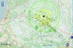
Earthquakes around the world

mkrnhr said:
When the speed (yellow, fourth panel) and density (orange, third panel) are high, and often when the Bz component of the magnetic field (red, first panel) goes negative with a high amplitude, there is more seismic activity or weather extremes. That's my limited observation FWIW.

They're not the only factors of course.

Thanks for the explanation mkrnhr, that was quite helpful, i'll try and keep an eye on those in future. My knowledge and technical understanding is limited which is why the KP index has been quite handy! It's also good to know it is something worthy of keeping an eye on.

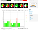
For the moment it dropped to 2, never reaching 6 in the end (attached image below)

And for anyone, like me, who doesn't necessarily know what they're looking at/for - i find this page a useful collation of some of the instruments: http://vibesoftheuniverse.cba.pl/index.php/en/ or if you want to get around it on Adblocker, just remove the last part http://vibesoftheuniverse.cba.pl/ - it's the 'Vibes of the Universe' youtubers page and it is quite handy, with headers for them and all. (see the image of the KP index below for a small snapshot - i also just noticed he also has Europe and other areas' satellite date on the right hand side, for me, that's cool - lots of instruments are on there actually)

Also:
http://www.sott.net/article/316977-Asias-Tallest-Volcano-Spews-Ash-Into-the-Air said:
Asia's Tallest Volcano Spews Ash Into the Air

The 15,580-feet volcano in Russia's Kamchatka peninsula has been rumbling to life since the beginning of April. It has been almost continuously active for the past 50 years but the number of tremors and ash eruptions has been on the rise lately.
4.3 24km NNW of Severo-Kuril'sk, Russia 2016-04-24 06:10:39 UTC 153.1 km

And


5.2
246km SW of Biha, Indonesia 2016-04-24 04:32:28 UTC 32.8 km
 

Attachments

  • VIbes 24.04.16.png
    VIbes 24.04.16.png
    140.9 KB · Views: 199
M 4.5 - MADEIRA ISLANDS, PORTUGAL REGION - 2016-04-24 15:53:59 UTC
http://www.emsc-csem.org/Earthquake/earthquake.php?id=502655
 
Strong eruption of San Cristobal volcano, Nicaragua (Video)
http://thewatchers.adorraeli.com/2016/04/23/strong-eruption-of-san-cristobal-volcano-nicaragua/

April 22. 2016 - A new eruption of San Cristobal volcano, Nicaragua started at 16:20 UTC on April 22, 2016. Over the next 2 hours, 10 explosions were observed. The last time this volcano erupted was on June 12, 2015.

The explosion expelled columns of ash, gas and rock fragments that reached 2 000 m (6 561 feet).

Similar eruptions of San Cristobal was observed in June 2015:

According to INETER, about 41 gas explosions occurred at San Cristóbal between 13:54 and 16:25 local time on June 6, 2015. The strongest one occurred at 13:55, and generated an ash plume that rose 200 m (656 feet) above the crater rim and drifted SE. After the short period of increased activity, San Cristóbal returned to a calm state.

INETER reported that at 09:07 local time on June 23, 2015, an explosion at San Cristóbal generated a gas-and-ash plume that rose 2 km (6 561 feet) and drifted SE. An explosion at 18:35 produced a gas plume with low ash content; the height of the plume was unable to be determined due to inclement weather. INETER noted that seismicity remained at background levels. Seismic signals detected a lahar between 18:50 and 19:29; an observer reported that the small lahar descended the W and SW flanks.

Geological summary

The San Cristóbal volcanic complex, consisting of five principal volcanic edifices, forms the NW end of the Marrabios Range. The symmetrical 1745-m-high youngest cone, named San Cristóbal (also known as El Viejo), is Nicaragua's highest volcano and is capped by a 500 x 600 m wide crater.


Current eruptions at Santa Maria (Santiaguito) the strongest in recent years, Guatemala (Video)
http://thewatchers.adorraeli.com/2016/04/23/current-eruptions-at-santa-maria-santiaguito-the-strongest-in-recent-years-guatemala/

In a special report published 15:40 UTC on April 23, INSIVUMEH reported that Santa Maria (Santiaguito) volcano is experiencing the highest level of explosive activity observed in recent years, with violent eruptions accompanied by ash columns reaching 4.5 - 5 km (14 760 - 16 404 feet) above sea level and pyroclastic flows.

Ashfall is being reported over 60 km (37 miles) from the crater, in the departments of Quetzaltenango, Retalhuleu and Mazatenango. Abundant ash fall is reported in villages near the volcano. The villages of Loma Linda and San Marcos Palajujoj are the most affected and are experiencing constant ashfall.

The eruptions are creating pyroclastic flows reaching 3 km (1.9 miles) to the east and west and are accompanied by rumblings and shock waves.

"This explosive activity is the highest recorded in the last two years," INSIVUMEH said and added that eruptions recorded and observed in the last 4 days have been more violent, expelling volcanic material at a distance of 3 km (1.9 miles).

The volcano has the ability to generate violent eruptions, similar or stronger than those of May 9, 2014, the agency warned.

Ash is present in the atmosphere at a distance of 25 km (15.5 miles) to the west, southwest, southeast and east at an altitude of 4 km (13 120 feet) or more.
 
Today

5.6 81km WSW of Puerto Madero, Mexico 2016-04-25 07:07:09 UTC 25.5 km

3.7 17km NNE of Fritz Creek, Alaska 2016-04-25 06:24:26 UTC 38.6 km

4.4 87km S of Severo-Kuril'sk, Russia 2016-04-25 01:12:44 UTC 88.9 km

4.5 South of the Fiji Islands 2016-04-25 01:12:03 UTC 519.5 km

Yesterday

4.5 22km SSE of Pijijiapan, Mexico 2016-04-24 23:50:54 UTC 101.0 km

5.3 150km NE of Neiafu, Tonga 2016-04-24 22:24:34 UTC 11.2 km

5.0 26km NNW of Ishkashim, Tajikistan 2016-04-24 21:43:10 UTC 113.8 km

5.5 44km SW of Bristol Island, South Sandwich Islands 2016-04-24 08:38:00 UTC 10.0 km
 
The earthquake struck early Monday morning Béarn (Pyrenees)

Did you feel the quake? Monday morning at 6:44, the earth began to shake in the Pyrenees-Atlantiques. According to preliminary information of the National Seismic Monitoring Network (RéNaSS), the earthquake of magnitude 4.

Its epicenter was located north of Lacq, to Urdès (latitude: 43.44 °, longitude: -0.59 °), but the tremors were recorded in all of western Béarn even further.

Firefighters received four calls about the quake, but none of which required emergency services. It was simply "concerned people who wanted to know if they were the only ones to have felt, explained the fire hall manager. These calls were from the area of Artix, Lons and Mourenx".

The Central Seismological Bureau conducted a French map (updated regularly) of the phenomenon, according to testimony 191 identified:

The epicenter is quite far from the castle, but is that the team felt something?

http://www.sudouest.fr/2016/04/25/tremblement-de-terre-dans-les-pyrenees-atlantiques-ce-lundi-matin-2340772-4344.php
 

Attachments

  • 2340999_728_seisme3.jpg
    2340999_728_seisme3.jpg
    69.9 KB · Views: 154
Today:

5.7 178km N of Tanahmerah, Indonesia 2016-04-26 04:19:52 UTC 75.0 km

4.7 53km W of Huarmey, Peru 2016-04-26 02:08:05 UTC 47.7 km

4.6 12km SSE of El Carmen, Colombia 2016-04-26 01:50:15 UTC 123.0 km

4.6 47km SW of Borujen, Iran 2016-04-26 00:33:36 UTC 10.0 km
Yesterday:

3.6 127km NNE of Vieques, Puerto Rico 2016-04-26 00:23:38 UTC 76.0 km

4.3 65km SW of Ovalle, Chile 2016-04-25 22:20:49 UTC 23.9 km

5.2 123km NNE of Visokoi Island, South Georgia and the South Sandwich Islands 2016-04-25 21:47:15 UTC 10.0 km

4.6 5km WSW of Montecristi, Ecuador 2016-04-25 21:15:53 UTC 10.0 km

4.5 41km WSW of San Antonio, Chile 2016-04-25 20:10:35 UTC 24.5 km

5.3 86km WNW of Itbayat, Philippines 2016-04-25 18:13:13 UTC 10.0 km

3.1 63km W of Rincon, Puerto Rico 2016-04-25 14:57:12 UTC 8.0 km

4.5 69km WNW of La Ligua, Chile 2016-04-25 14:01:46 UTC 22.4 km
 
We didn't feel any earthquake, but I woke up with a headache. The weather has also been rather nasty for weeks.

Meanwhile:

Small earthquake felt around Vienna
_http://www.thelocal.at/20160425/small-earthquake-felt-in-vienna-austria

Published: 25 Apr 2016 13:01 GMT+02:00

The earthquake measurement website EMSC confirmed an earthquake happened 18 kilometres south-west of Vienna at around 12.28pm.

EMSC measured the magnitude around 4.4, although the Austrian Central Institute for Meteorology and Geodynamics said it was 4.1.

Residents writing on social media confirmed feeling the earthquake, the centre of which was in Raum Alland in Lower Austria, throughout Vienna, including the 3rd, 9th, 13th, and 19th districts.

“Short but scary”, is how Twitter user Velina Tchakarova described it. Writing on the EMSC website, witnesses described the floor and ceiling “moving some centimeters” and they felt the “chair bounce and desk move”

It is not unknown for Austria to experience small earthquakes, with the most recent one of a similar magnitude thought to have occurred in Lower Austria in 2013. Another similar quake hit Carinthia in January 2015.

Geologists warned last December, however, that the Vienna region is at risk of being hit by a strong earthquake at some point in the future.

A seismically active fault system runs deep under the Vienna Basin geological area, which covers Vienna, Lower Austria and parts of Slovakia and the Czech Republic.

Because many of the fault lines have been inactive for the last 200 or 300 years they are not thought to be hazardous.

However, geologist Dr. Kurt Decker from the University of Vienna told The Local that the risk of a large-scale earthquake occurring in the Vienna region has been underestimated and that scientists must examine historical data more closely.

"There are half a dozen known fault lines under the Vienna Basin which are moving at a very slow rate, but we believe that every 20,000 years or so they are capable of causing an earthquake on the scale of 6.0 or 7.0 on the Richter scale,” he added.
 
Magnitude 5.5
Region SOUTH OF AFRICA
Date time 2016-04-27 02:04:03.9 UTC
Location 52.69 S ; 26.03 E
Depth 10 km

http://m.emsc.eu/earthquake/earthquake.php?evid=503092
 
5.2 magnitude earthquake 52 km from San Antonio de los Cobres, Salta, Argentina
about an hour ago
UTC time: Wednesday, April 27, 2016 10:13 AM
Your time: Wednesday, April 27 2016 12:13 PM
Magnitude Type: mb
USGS page: M 5.2 - 52km W of San Antonio de los Cobres, Argentina
USGS status: Reviewed by a seismologist
Reports from the public: 0 people

More recently:


10 minutes ago 1.8 magnitude, 0 km depth
Volcano, Hawaii, United States
about an hour ago 2.0 magnitude, 8 km depth
Coalinga, California, United States
about an hour ago 1.6 magnitude, 10 km depth
San Jacinto, California, United States

http://earthquaketrack.com/recent
 
http://earthquake-report.com/2016/04/27/minor-earthquake-caucasus-region-russia-on-april-27-2016/

http://m.emsc.eu/earthquake/earthquake.php?evid=503161
Magnitude 3.5
Region CAUCASUS REGION, RUSSIA
Date time 2016-04-27 07:38:53.3 UTC
Location 43.12 N ; 46.18 E
Depth 10 km
 
5.0 65km NNE of Taitung City, Taiwan 2016-04-27 18:19:05 UTC 10.0 km

4.9 North of Ascension Island 2016-04-27 17:14:14 UTC 10.0 km

2.9
48km S of Redoubt Volcano, Alaska 2016-04-27 16:12:57 UTC 111.1 km

3.7 11km N of Luther, Oklahoma 2016-04-27 15:44:55 UTC 4.7 km

5.3 34km NE of Hualian, Taiwan 2016-04-27 15:17:13 UTC 8.3 km

4.6 262km NW of Saumlaki, Indonesia 2016-04-27 14:07:45 UTC 124.9 km

5.8 61km WSW of Puerto Madero, Mexico 2016-04-27 12:51:22 UTC 35.0 km
 
New Zealand Volcano is showing signs of new activity:

http://www.nzherald.co.nz/nz/news/article.cfm?c_id=1&objectid=11630191 said:


White Island eruption overnight


By - Bay of Plenty Times
11:48 AM Thursday Apr 28, 2016

SCCZEN_A_200813jb02bop_620x310.jpg

White Island eruption in 2013. Photo/John Borren


White Island erupted last night.

The volcanic island, off the coast of the Bay of Plenty, erupted yesterday between 9.30pm and 11pm, GNS Science said.

As a consequence of this activity the Volcanic Alert Level is now raised to Level 3 (Minor Volcanic Eruption) and the Aviation Colour Code to Orange.

No eruptive activity has been seen since about 11pm yesterday.

The eruption was accompanied by a moderately elevated seismic activity, GNS said. The seismic activity is now back to normal.

Material appears to have been deposited over north side of the crater floor and up onto north crater wall. There is not yet a clear view of crater area visible from cameras.

Volcanologists are monitoring the volcano and further information will be
released as soon as it is available.

Over the last couple of weeks, GNS scientists have observed a fall of 2m in the water level of the crater lake. However, they have not noted any changes in other monitored parameters, like the amount of volcanic gas being emitted, fumarole temperatures and the presence of volcanic tremor or earthquakes.

During a visit last week by GNS volcanologist Brad Scott he was able to confirm the lake level had dropped 2m in the last 2 weeks. The lake was now about the same level as it was in 2014. The drop in water level of the crater lake has revealed several islands or crater outlines and the lake temperature has increased 2C, from 56C to 58C, since February.

There had been a small decrease in the temperature of the hottest fumarole (169C to 161C) since February. The SO2 gas output has ranged between 90 and 480 tonnes per day (1.0 to 5.5 kg per second) of gas during the last 5 weeks. These are typical values for White Island.

The level of volcanic tremor continues to vary, but remains below those observed in 2012 when unrest was stronger and small eruptions occurred.
 
USGS said:
4.3 8km W of Chatelaillon-Plage, France 2016-04-28 06:46:50 UTC 10.0 km

2.6 8km SW of Yale, Oklahoma 2016-04-28 06:20:28 UTC 6.6 km

3.1 57km WNW of Tok, Alaska 2016-04-28 04:54:25 UTC 13.9 km

3.1 57km E of Old Iliamna, Alaska 2016-04-28 03:51:44 UTC 185.7 km

3.0 8km SSW of Perry, Oklahoma 2016-04-28 02:12:59 UTC 11.5 km

5.6 62km WNW of Panguna, Papua New Guinea 2016-04-28 01:17:13 UTC 128.1 km
 
USGS is saying M4.3 while the same earthquake is being said to be M5 by this source

http://www.emsc-csem.org/Earthquake/earthquake.php?id=503343&keepThis=true&TB_iframe=true&height=650&width=850&caption=EMSC+-+Last+50+earthquakes+worldwide+M4%2B said:
Magnitude ML 5.0
Region FRANCE
Date time 2016-04-28 06:46:50.4 UTC
Location 46.04 N ; 1.09 W
Depth 10 km
Distances 358 km S of Saint Helier, Jersey / pop: 28,000 / local time: 07:46:50.4 2016-04-28
125 km SW of Poitiers, France / pop: 85,960 / local time: 08:46:50.4 2016-04-28
15 km S of La Rochelle, France / pop: 76,810 / local time: 08:46:50.4 2016-04-28
4 km S of Châtelaillon-Plage, France / pop: 6,059 / local time: 08:46:50.4 2016-04-28
Global view
Source parameters reviewed by a seismologist

More information at: links on the page

Laboratoire de Détection et de Géophysique Bruyères-le-Châtel, France
Réseau National de Surveillance Sismique Strasbourg, France
Bureau Central Sismologique Francais (BCSF) Strasbourg, France
Plan Séisme (Information sur les bons gestes à appliquer en cas de séisme)


503343.global.thumb.jpg


Added: from the links (this is registering it as M5.2 - but it just happened so i guess that's to be expected?)


http://www-dase.cea.fr/evenement/evenements.php?type=alerte&identifiant=20160428-064652&lang=en said:
ALERTE-CARTE-20160428-064652.jpg


Seismic alert

28/04/2016 06:46:52 UT
16 km SE of La Rochelle (17)
Latitude = 46 Deg 5 MN NORTH ( 46.08)
Longitude = 0 Deg 59 MN WEST ( -0.98)
Magnitude = 5.2 (Ml)


THE MOST RECENT EARTHQUAKE LOCATED LESS THAN 100Km AWAY (Source: DASE)
10/02/2016 21:52:50 46.58N 1.14W Magnitude = 2.1

THE 5 STRONGEST EARTHQUAKES LOCATED LESS THAN 100Km AWAY
(Source: DASE, Search since 1970)

07/09/1972 22:26:57 45.91N 1.54W Magnitude = 5.2
08/06/2001 13:26:53 46.67N 1.09W Magnitude = 5.1
18/04/2005 06:42:49 45.92N 1.42W Magnitude = 4.7
10/10/1977 06:05:56 45.95N 1.44W Magnitude = 4.7
28/09/2010 11:29:39 45.95N 1.42W Magnitude = 4.5
 
https://www.rt.com/news/341204-earthquake-strikes-southwestern-france/ said:

Magnitude 5.0 earthquake strikes Charente-Maritime area, southwestern France


Published time: 28 Apr, 2016 07:06
Edited time: 28 Apr, 2016 07:17
Get short URL
© Google Maps
© Google Maps
179
An earthquake registering 5.0 on the Richter scale has struck the southwest of France near the city of La Rochelle. The quake hit at 08:45 local time at a depth of 15 kilometers.

Writing on Twitter, Laurent Simon from Bordeaux said the earthquake was “a very small one,” but it was an “interesting feeling.”

Sophie Thurlow mentioned that she woke up to her “room shaking."

The epicenter of the quake was eight kilometers southeast of La Rochelle, which is a port on the Bay of Biscay with a population of just over 75,000. There are no reports of any damage so far.
5721b8e3c3618833538b4582.jpg

Sital Dahone ‎@GatoDahone

Tremblement de terre à Rochefort en charente maritime
ChHFwbYWYAApzkG.jpg

7:52 AM - 28 Apr 2016

DETAILS TO FOLLOW
 
Back
Top Bottom