Pearce
Jedi Master
Reports from Louisiana
More on the fire
Weiterleitungshinweis
www.google.com
Hurricane Laura updates: Lafayette Parish issues curfew for Thursday night
The National Hurricane Center said the storm's sustained winds measured at 150 mph, just short of reaching Category 5 storm status, as it moved slowly across the southwestern and western part of the state and Texas.
At about 11 a.m., the center of the storm was near Natchitoches, Winn Bienville, Red River and Jackson parishes with sustained winds of 75 mph, bringing damaging winds and flooding to central and northern Louisiana.
The curfew for Lafayette Parish was extended and will go into effect at 8 p.m. Thursday and lift at 6 a.m. Friday.
"The curfew will help keep roads clear to allow crews to safely work while cleaning up storm debris," accord to a press release from Lafayette Consolidated Government.
A fire has broken out on the west side of Lake Charles, causing gases and smoke to plume over I-10.
The fire seems to have erupted at a chemical plant site or oil refinery, according to multiple reports on social media.
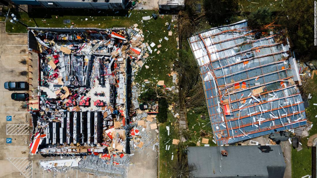
Aerial footage shows extensive damage throughout the area as wind gusts topped out at 130 mph.
Storm chasers with Metro Video Services captured video of a gutted convention center. All the windows were blown out and some of the structures failed and collapsed. Other video captured windows being shattered on a skyscraper.
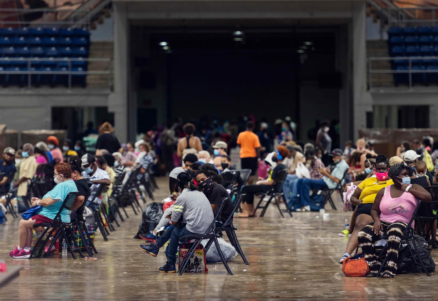
So far, there have not been any confirmed reports of injuries, although local officials reported that people who had planned to ride out the storm were calling for help.


Hurricane Laura Kills at Least 6 People in Louisiana (Published 2020)
After landfall overnight with 150 m.p.h. winds, Laura ripped northward. Officials confirmed at least six deaths tied to the storm, and hundreds of thousands of people have lost power.www.nytimes.com
Hurricane Laura Live Updates: Storm Plows Through Louisiana
After landfall overnight as a Category 4 hurricane with 150 m.p.h. winds, Laura has ripped northward, sowing destruction even as its winds diminish. One death was confirmed and hundreds of thousands of people lost power.
RIGHT NOW
A fire has broken out at the BioLab chemical plant in Westlake, La., outside Lake Charles, in the wake of the storm. Residents are being told to stay indoors.
Hurricane Laura sweeps ashore as one of most powerful storms ever to hit the U.S.
After making landfall as one of the strongest storms to hit Louisiana on record, Hurricane Laura steamrolled up through the state on Thursday, leaving a trail of far-flung damage in its wake.
The storm, which came ashore near Cameron, La., after midnight as a Category 4 hurricane, brought 150-mile-an-hour winds and a major storm surge out of the Gulf, ripping the facades off brick buildings in Lake Charles, La., and swatting telephone poles to the ground. Laura weakened as it moved inland, but remained destructive, with strong winds and heavy rain, and the potential to spawn deadly tornadoes.
The first confirmed U.S. death from the storm was that of a 14-year-old girl in Leesville, La., a small city about 100 miles inland. According to the Louisiana governor’s office, the girl was killed when a tree fell on her family’s home.
PHOTOS/VIDEOS: Storm Damage from Hurricane Laura across La.
Hurricane Laura made landfall in southwest Louisiana as a strong Category 4 storm on Thursday, Aug. 27 around 1 a.m.www.wafb.com
BATON ROUGE, La. (WAFB) - Hurricane Laura is impacting the entire state of Louisiana as it moves further inland.
More on the fire
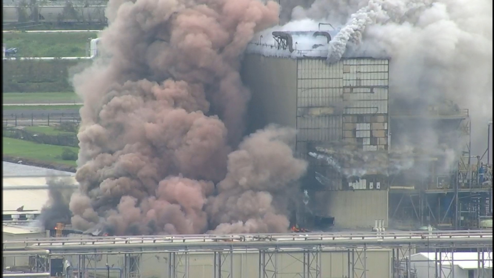
Fire breaks out at industrial facility near Lake Charles after Hurricane Laura
A poisonous mixture billowed out of the facility, putting an even bigger strain on people already dealing with Laura's aftermath.abc13.com
WESTLAKE, Louisiana -- A chemical plant in the middle of hurricane-ravaged southwest Louisiana caught fire Thursday morning, sending thick smoke billowing into the air.
Witnesses said they saw the smoke rolling north across I-10 coming from a facility. Officials at BioLab confirmed the fire was at their plant, according to KPLC-TV in Lake Charles.
BioLab manufactures chlorine-based products, according to a 2017 story on the company.