meadow_wind
Jedi
Province of Quebec, Canada (Pictures from Montréal)
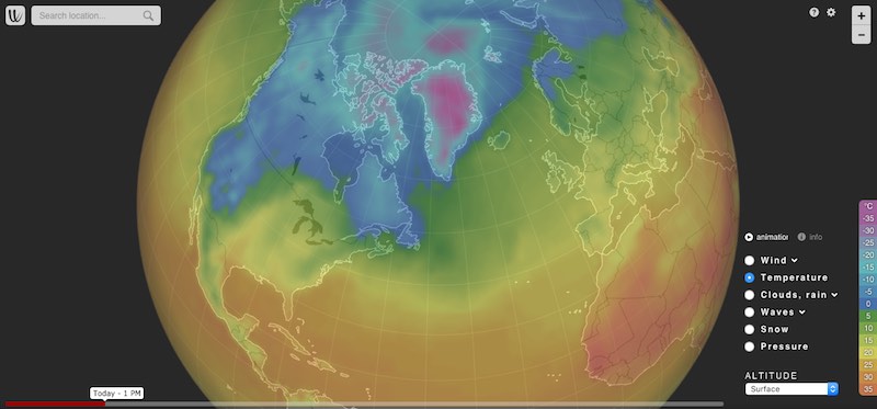
Early snow Storm: 15-20 cm of wet heavy snow
From 3 December pm to 4 December am
Many broken branches and trees everywhere
Neige : pannes de courant et sorties de route - MétéoMédia
Publié le 4 décembre 2023 à 6h30
La situation s'est compliquée sur les routes du Québec lundi matin. De nombreuses écoles ont décidé de fermer en raison des conditions météorologiques. Depuis 4 h du matin, de nombreuses sorties de route ont également été à déplorer sur le réseau routier, notamment dans la région métropolitaine. Vers 11 h, on déplorait plus de 100 000 pannes de courant, un chiffre qui a baissé progressivement par la suite.
The situation became complicated on the roads of Quebec Monday morning. Many schools have decided to close due to weather conditions. Since 4 a.m., numerous road trips have also been reported on the road network, particularly in the metropolitan region. Around 11 a.m., there were more than 100,000 power outages, a figure which gradually decreased thereafter.
Breakdowns to deplore
As of Monday morning, more than 100,000 customers were without power due to the storm. The heavy, sticky snow, full of moisture, puts pressure on the branches which fall on the electrical wires in places. Even the threads gave way. At the end of the morning, this figure gradually decreased.

Schools closed
Although the FAE-affiliated school strike is already giving many students a day off in the province, some schools affiliated with other unions have chosen to close for the day due to road conditions or power outages. This is the case of the Samares School Service Center and the establishments of the Eastern Townships School Service Center and three establishments of the Sir-Wilfrid-Laurier School Service Center. In total, 82 schools in Lanaudière also chose to close. In the province, nearly 200 schools are closed.
Le MTQ rapporte également sur sa carte interactive une majorité de routes ayant une chaussée complètement enneigée dans la province.
Dangerous road conditions
Collisions, loss of control, road trips and accidents: the snow-covered road and reduced visibility surprised motorists this Monday morning. The system in place having brought heavy accumulations of snow, the roads have quickly become dangerous since Sunday afternoon. Before 6 a.m. Monday, dozens of incidents had already been reported by the Quebec Ministry of Transport (MTQ), all located in the greater Montreal region. The roads will remain snow-covered in the afternoon even if the snow intensity will remain low. With some wind in the national capital, visibility will be reduced in places.
The MTQ also reports on its interactive map a majority of roads having completely snow-covered roads in the province.


Early snow Storm: 15-20 cm of wet heavy snow
From 3 December pm to 4 December am
Many broken branches and trees everywhere
Neige : pannes de courant et sorties de route - MétéoMédia
Publié le 4 décembre 2023 à 6h30
La situation s'est compliquée sur les routes du Québec lundi matin. De nombreuses écoles ont décidé de fermer en raison des conditions météorologiques. Depuis 4 h du matin, de nombreuses sorties de route ont également été à déplorer sur le réseau routier, notamment dans la région métropolitaine. Vers 11 h, on déplorait plus de 100 000 pannes de courant, un chiffre qui a baissé progressivement par la suite.
The situation became complicated on the roads of Quebec Monday morning. Many schools have decided to close due to weather conditions. Since 4 a.m., numerous road trips have also been reported on the road network, particularly in the metropolitan region. Around 11 a.m., there were more than 100,000 power outages, a figure which gradually decreased thereafter.
Des pannes à déplorer
Lundi matin, plus de 100 000 clients ont été privés d'électricité en raison de la tempête. La neige lourde et collante, gorgée d'humidité, met de la pression sur les branches qui tombent sur les fils électriques par endroits. Des fils eux-mêmes ont cédé. En fin de matinée, ce chiffre diminuait progressivement.Breakdowns to deplore
As of Monday morning, more than 100,000 customers were without power due to the storm. The heavy, sticky snow, full of moisture, puts pressure on the branches which fall on the electrical wires in places. Even the threads gave way. At the end of the morning, this figure gradually decreased.
Écoles fermées
Même si la grève des écoles affiliées à la FAE donne déjà congé à de nombreux élèves dans la province, quelques écoles affiliées à d'autres syndicats ont choisi de fermer pour la journée en raison des conditions routières ou des pannes de courant. C'est le cas du Centre de services scolaires des Samares et des établissements du Centre de services scolaires Eastern Townships et de trois établissements du Centre de services scolaires Sir-Wilfrid-Laurier. En tout, 82 écoles dans Lanaudière ont aussi choisi de fermer. Dans la province, c'est près de 200 écoles qui sont fermées.Schools closed
Although the FAE-affiliated school strike is already giving many students a day off in the province, some schools affiliated with other unions have chosen to close for the day due to road conditions or power outages. This is the case of the Samares School Service Center and the establishments of the Eastern Townships School Service Center and three establishments of the Sir-Wilfrid-Laurier School Service Center. In total, 82 schools in Lanaudière also chose to close. In the province, nearly 200 schools are closed.
Conditions routières dangereuses
Accrochages, pertes de maîtrise, sorties de route et accidents : la chaussée enneigée et la visibilité réduite surprennent les automobilistes en ce lundi matin. Le système en place ayant amené de fortes accumulations de neige, les routes se sont avérées dangereuses rapidement depuis dimanche après-midi. Avant 6 h lundi, des dizaines d'incidents étaient déjà rapportés par le ministère des Transports du Québec (MTQ), tous situés dans la grande région de Montréal. Les chaussées vont rester enneigées en après midi même si l'intensité de de la neige va rester faible. Avec un peu de vent dans la capitale nationale, la visibilité sera réduite par endroits.Le MTQ rapporte également sur sa carte interactive une majorité de routes ayant une chaussée complètement enneigée dans la province.
Dangerous road conditions
Collisions, loss of control, road trips and accidents: the snow-covered road and reduced visibility surprised motorists this Monday morning. The system in place having brought heavy accumulations of snow, the roads have quickly become dangerous since Sunday afternoon. Before 6 a.m. Monday, dozens of incidents had already been reported by the Quebec Ministry of Transport (MTQ), all located in the greater Montreal region. The roads will remain snow-covered in the afternoon even if the snow intensity will remain low. With some wind in the national capital, visibility will be reduced in places.
The MTQ also reports on its interactive map a majority of roads having completely snow-covered roads in the province.