Earthquakes around the world

IRIS Earthquake Science Published on Jul 19, 2015
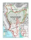
The Pacific Northwest is host to more than the anticipated megathrust earthquake that will happen off the Cascadia coast in the future. That earthquake will be due to the stress building between the Juan de Fuca and North American plates as the oceanic Juan de Fuca plate dives deep beneath the Pacific Northwest.
However, there are also deep earthquakes within the subducting plate, and shallow earthquakes in the overlying continental crust. This is because of additional forces acting on the region besides subduction-zone processes.
Written and directed by Dr. Robert Butler, University of Portland, OR Animation and graphics by Jenda Johnson, Earth Sciences Animated Narrated by Roger Groom, teacher, Mount Tabor Middle School Portland OR Science advisor: Dr. Ray Wells, U.S.Geological Survey Reviewed by: Dr. Rob Witter, U.S. Geological Survey


American Earthquakes on Twitter
 
Note the size of this Earthquake:

2018-12-11 02:26:30.6
8hr 07min ago 58.65S 26.44W 150 7.1 SOUTH SANDWICH ISLANDS REGION

from:
_Earthquakes today | Earthquake today | earthquake | earthquakes


Note the odd wave form appearing on this display, in the region of that earthquake, and seemingly originating out of the west coast of Africa.:

MIMIC-TPW "1"

from:
_MIMIC-TPW

I could not say if the two are related, however this is a strange phenomenon.
 
Published on Dec 11, 2018


Translated from Spanish by Microsoft
We are at the end of the year 2018, we left a survey to choose which earthquake impacted them more in this 2018, the deep quake #Fiji, the seismic sequence in #Lombok(#Indonesia), the seismic sequence in #Mayotte(#France ) o The earthquake of #BuenosAires(#Argentina).


Jamie Gurney on Twitter
After May postponed the Brexit vote in Parliament, the country is so determined to go back in time that even quakes occurred in the wrong order Also, hello Preston New Road seismicity! Where have you been for the last month? @seismo_steve
 
Last edited:
Earthquake update 12/12/2018
Published on Dec 12, 2018

Tennessee Struck By The Largest Earthquake In 45 Years
Thu, 12/13/2018 - 22:20


SCSN | Southern California Seismic Network
Southern California Earthquake Data Center at Caltech
Use the map below to explore recent earthquake activity. This map shows the earthquake feed from the USGS for all earthquakes in the last 7 days within the SCSN reporting region. Expand the left sidebar to view the event listing; selecting an event will highlight its map location. Once selected, for further information, clicking an event ID (ex. ci38354200) link will take you to the USGS page for that event. Events are color-scaled by the time they occurred (red: within 1 hour; blue: within 1 day; yellow: within 7 days; grey: older) and size-scaled by their magnitude, as repressented in the legend below.

Please note that not all earthquake information displayed on this map may have been reviewed by a seismologist, and automated solutions are likely to be updated. The map updates every 5 minutes with the most recent earthquake data available, the same refresh rate as the USGS earthquake feed

f61cb435aef77c7a484877f049da8872.png


edbb2db13bbafd272cc6135ffab9d6b2.png


Strange Quake Signature
CaSeismograph Published on Dec 13, 2018
 
5.6-magnitude earthquake strikes off West Australian coast – USGS
Edited time: 16 Dec, 2018 15:17
A 5.6-magnitude earthquake has struck some 1,000 kilometers north-west off the coast of Perth, Australia according to the US Geological Survey. The quake hit at a depth of 10 kilometers (6 miles).


No tsunami threat has been issued, according to the latest updates from the Joint Australian Tsunami Warning Centre.


The quake struck in the Indian Ocean at 10:26pm local time, about 116 kilometers (72 miles) southwest of Coral Bay.


That is bizarre. Anybody find any news item on that?

Had not found much except that, there was another explosion in November this year at pretty much the same place (+-KM) and, that Battle Mountain is also known by its fireworks.
from USGS
M 2.2 Explosion - 36km SW of Battle Mountain, Nevada
  • 2018-11-01 19:42:57 (UTC)
  • 40.447°N 117.284°W
  • 0.0 km depth
https://earthquake.usgs.gov/earthquakes/eventpage/nn00663766/executive

---this could be an answer, but had not find any recent, though ...

https://youtu.be/_KuGizBjDXo
 
M 2.2 Explosion - 36km SW of Battle Mountain, Nevada
Time 2018-11-01 19:42:57 (UTC)
Location 40.447°N 117.284°W
Depth 0.0 km depth
https://earthquake.usgs.gov/earthquakes/eventpage/nn00663766/executive
---
M 3.1 Explosion- 58km N of Battle Mountain, Nevada
Time 2018-12-16 21:48:09 (UTC)
Location 41.166°N 116.846°W
Depth 0.0 km
https://earthquake.usgs.gov/earthquakes/eventpage/nn00670366/region-info
Another one
M 1.7 Explosion - 74km NNE of Tonopah, Nevada
Time 2018-12-18 23:05:03 (UTC)
Location 38.716°N 117.026°W
Depth 3.3 km depth
https://earthquake.usgs.gov/earthquakes/eventpage/nn00670702/executive

c.a. saw the video of the blastings in Potosí Road, but it figures to me to far away, like 400 km? ... I noticed that the tree explosions had been over the Great Basin ... I'm still looking for more info ...


Last edited:
Another one
M 1.7 Explosion - 74km NNE of Tonopah, Nevada
Time 2018-12-18 23:05:03 (UTC)
Location 38.716°N 117.026°W
Depth 3.3 km depth
https://earthquake.usgs.gov/earthquakes/eventpage/nn00670702/executive

c.a. saw the video of the blastings in Potosí Road, but it figures to me to far away, like 400 km? ... I noticed that the tree explosions had been over the Great Basin ... I'm still looking for more info ...
--time went out, sorry for the duplication--
... there had been many earthqukes in Nevada, and over the Great Basin, see this map Nevada Seismological Lab, it does specify if it was an explosion or earthquake, I'm entretaining checking out if there were more :)

image from wikipedia from By LynnWysong - Own work, CC BY-SA 4.0, File:Great Basin Ecoregions.jpg - Wikimedia Commons
 

Attachments

  • 371px-Great_Basin_Ecoregions.jpg
    371px-Great_Basin_Ecoregions.jpg
    64 KB · Views: 3
Earthquake, Magnitude 7.4 - KOMANDORSKIYE OSTROVA REGION - 2018 December 20, 17:01:54 UTC
MagnitudeMw 7.4RegionKOMANDORSKIYE OSTROVA REGION
Date time2018-12-20 17:01:54.3 UTCLocation55.07 N ; 164.77 E
Depth10 km
Distances2153 km NE of Sapporo-shi, Japan / pop: 1,884,000 / local time: 02:01:54.3 2018-12-21
460 km NE of Petropavlovsk-Kamchatskiy, Russian Federation / pop: 188,000 / local time: 05:01:54.3 2018-12-21
395 km E of Esso, Russian Federation / pop: 2,000 / local time: 05:01:54.3 2018-12-21
Testimonies


Last edited:
--time went out, sorry for the duplication--
... there had been many earthqukes in Nevada, and over the Great Basin, see this map Nevada Seismological Lab, it does specify if it was an explosion or earthquake, I'm entretaining checking out if there were more :)
image from wikipedia from By LynnWysong - Own work, CC BY-SA 4.0, File:Great Basin Ecoregions.jpg - Wikimedia Commons

Definite rocking in NV. Thanks for the update.


Earthquake, Magnitude 5.7 - KOMANDORSKIYE OSTROVA REGION - 2018 December 20, 17:19:30 UTC
 
December 20, 2018 - No damage to Russia's Kamchatka reported after Quake - RIA
No damage to Russia's Kamchatka reported after quake - RIA | Reuters

Russia’s Emergencies Ministry said that, according to preliminary information, there was no damage to Kamchatka peninsula following Thursday’s powerful quake, RIA news agency reported.

An earthquake with a magnitude of 7.4 struck off Russia’s far east, the United States Geological Survey (USGS) said.


December 20, 2018 - Powerful Earthquake strikes off Russia's far east, no tsunami threat
Powerful earthquake strikes off Russia's far east, no tsunami threat | Reuters

A major earthquake with a magnitude of 7.4 struck off Russia’s sparsely populated far east on Thursday, but officials said the threat of a tsunami had passed and no damage was reported.

The quake off Russia’s Kamchatka peninsula, which was initially measured at magnitude 7.8 by the United States Geological Survey (USGS), before being revised downwards, struck 82 km (50 miles) west of Nikolskoye at a depth of 9 km.

The Pacific Tsunami Warning Centre at first said hazardous tsunami waves from the earthquake were possible within 300 km of the epicenter along the coasts of Russia, but later said the threat of tsunami had passed.

Russian RIA and TASS news agencies, citing officials at the local Emergencies Ministry, also said there was no threat of a tsunami following the quake. No damage was reported, they said.
 
Back
Top Bottom