Well, aside from the fact that the C's said that it was not MH370 on that video, I did find the conversation very interesting, I would recommend it. The guy being interviewed truly did quite a lot of research on the events surrounding MH370.I found it to be consistent with what the C's said on the subject, without coming out and saying it. Reasons are presented for targeting of this particular flight, then POOF! Video does look like a window opened.
You are using an out of date browser. It may not display this or other websites correctly.
You should upgrade or use an alternative browser.
You should upgrade or use an alternative browser.
Malaysia Airlines Flight 370 - Missing Plane
- Thread starter Khalsa
- Start date
portobello
Padawan Learner
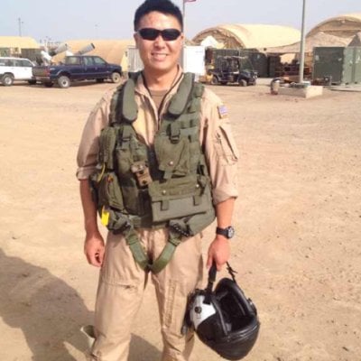
Ashton Forbes is convinced he's uncovered the "new" identity of suspected 'MH370' video leaker - Edward Lin.
Ashton believes that former US Navy Lt. Cmdr. Edward Lin (charged with espionage a decade ago) is the original leaker of the 'MH370' videos who also goes by the name of Edward Siraya, owner of HomeHelpersHomeCare.
More on Edward Lin in the articles below:

 www.navytimes.com
Ashton believes that former US Navy Lt. Cmdr. Edward Lin (charged with espionage a decade ago) is the original leaker of the 'MH370' videos who also goes by the name of Edward Siraya, owner of HomeHelpersHomeCare.
More on Edward Lin in the articles below:
The strange case of Lt. Cmdr. Edward Lin
Inside the spy probe of an officer's ties to Taiwan. Was he really a spy?
www.navytimes.com
Last edited:
portobello
Padawan Learner
Posting another informative article on Lin for archiving purposes.

 news.usni.org
Edward Lin Admits to Disclosing Classified Information, Not to Espionage
Lt. Cmdr. Edward Lin, 40, a Navy officer accused of espionage has pleaded guilty to less serious charges as part of a negotiated plea deal.
Edward Lin Admits to Disclosing Classified Information, Not to Espionage
Sam LaGrone
May 4, 2017 12:34 PM - Updated: May 4, 2017 7:27 PM
Lt. Cmdr. Edward Lin
NAVAL STATION NORFOLK, Va. — A Navy officer accused of espionage has pleaded guilty to less serious charges as part of a negotiated plea deal.
Lt. Cmdr. Edward Lin, 40, admitted to the charges during a court-martial before a military judge on Thursday.
Last year the military had accused Lin of two instances of espionage, three instances of attempted espionage and several instances of mishandling classified information and failing to report contact with foreign agents.
The new deal allows Lin to plead not guilty to military espionage charges but guilty to charges that include failing to report foreign contacts, mishandling classified information and disclosing secret information to a female friend working for a Taiwanese political party in Washington, D.C. and an undercover FBI agent posing as an employee of Taiwan’s ministry of foreign affairs.
Lin was arrested on Sept. 11, 2015 at the Honolulu International Airport on his way to Shanghai, China to visit a Chinese national he met online – a female prison guard.
The arrest also followed several meetings with an undercover FBI agent who operated under the alias, “Katherine Wu.” Over a series of meetings from August to September in 2015, Lin told the agent general details of his secretive unit — Special Projects Patrol Squadron Two ‘Wizards’ (VPU-2). The Wizards, based at Marine Corps Air Station Kaneohe, Hawaii, use specialized signals intelligence aircraft to collect data on potential U.S. adversaries as part of one of the most secretive units in the service.
In addition to passing information classified as secret to the FBI agent, Lin also offered his opinion on international developments in the Western Pacific to the employee of the Taiwanese political party over a period of about two years starting in 2012.
During the trial, Lin admitted to using secret information he gained during a 2009 exercise when he was assigned to PACOM to tell the employee of the political party how the U.S. believed, “a certain entity would act in a certain way.”
Lin admitted he had agreed not to acknowledge, confirm or deny the information related to his work at VPU-2 and the operational details learned during the 2009 exercise.
Following Lin’s arrest, NCIS and federal investigators interrogated Lin and combed through his possessions and his electronic correspondence.
Based on the evidence, the government also charged Lin with not reporting foreign contacts he had with naval attaches at the Taipei Economic and Cultural Representative Office – Taiwan’s embassy equivalent in Washington – an American employee of a Taiwanese political party and female Chinese national massage therapist to whom Lin loaned money.
He also pleaded guilty to two instances of mishandling classified material. In 2014, Lin had accidentally left two flight manifests in his flight suit from a deployment that included search and rescue code names. When filled out, the documents were classified secret. During a customs search at the San Francisco airport, a Homeland Security officer discovered the manifests and Lin asked the officer to destroy the documents in violation of procedure.
Federal investigators also found study notes for unit training Lin made from memory in his apartment that the government determined were secret and improperly stored.
To round out the charges, Lin also admitted to giving an incorrect U.S. address on a leave request on two separate foreign trips – one to Taiwan in which he met the head of the Taiwanese Navy and the planned trip to Shanghai where he was to meet the Chinese prison guard.
The charges to which Lin has plead guilty are serious and carry a maximum penalty of more than 30 years, forfeiture of pay and dismissal from the service. However, the actions outlined in the Thursday military trial are less severe compared to the espionage charges that would have put Lin behind bars for life if he was convicted.
Lin knew some of the Navy’s most sensitive secrets from his time not only at VPU-2 but also as a congressional liaison where he would have been privy to the Navy’s black program portfolio, several sources have confirmed to USNI News. If he was inclined, his knowledge could be extremely useful to potential U.S. adversaries, the sources said.
But the evidence presented at daylong trial didn’t uncover a master spy but a middle aged naval officer in the midst of a divorce who used some of his lower level knowledge to impress women.
“It sounds like they thought they had Al Capone but they got the gang that couldn’t shoot straight,” Rob “Butch” Bracknell, a former Marine and military lawyer, told USNI News on Thursday.
Now that he’s admitted guilt to the charges, Lin will face a sentencing hearing in early June. U.S. Fleet Forces commander Adm. Phil Davidson will assign the final punishment based on guidance from the military judge.
Lin has been held in pre-trial confinement of the service since his arrest on Sept. 11, 2015.
Originally from Taiwan, Lin joined the Navy as an enlisted sailor in 1999, a year after becoming a U.S. citizen.
portobello
Padawan Learner
Ashton Forbes pulled no punches on his latest live stream.
Recap:
- Edward Lin was arrested on September 11, 2015, sentenced to 6 years in prison after pleading guilty to 'mishandling classified information' as opposed to espionage.
- Edward's lawyer is Larry D. Younger and represented Lin in his trial back in 2017.
- USNI excerpt: Lt. Cmdr. Edward Lin, 40, was sentenced to a nine-year sentence with the last three years suspended as part of a pre-trial agreement with the government. Along with a 646-day credit for time served in pre-trial confinement, Lin could be released from the brig in about four years.
- Edward Siraya worked for amazon from June 2020 to November 2022, meaning he was probably released earlier (possibly for good behavior).
- Edward Chieh-Liang Lin changed his name to Edward James Siraya 2-3 months after Ashton publicly identified him as the suspected leaker of the MH370 videos in 2023.
- Ashton's attempts to get in touch with Edward have so far been unsuccessful.
- Edward's book: Uncompromised Care: Holistic Strategies for Confident and Empowered Home Care (2025)
- Edward's sister is attorney Jenny Lin Naylor.
- Jenny is currently 'providing expert legal advice and counsel to the 'Office of Countering Weapons of Mass Destruction' in the U.S. Department of Homeland Security.
- Previous employment includes: National Guard Bureau, CDC
- Published article:
- The Third Nuclear Age
- Abstract: Since the end of the Cold War, the bipolar competition and cooperation between the United States and Russia have sustained global strategic stability in the second nuclear age. However, destabilizing technologies in the hands of the United States, Russia, and China will markedly change the strategic landscape in the near future. This article asserts that a technology-enabled, multipolar competition will usher in the third nuclear age, which may be identified by three trends: (1) a new arms race with revolutionary weapons that challenge the existing deterrence paradigm; (2) an entanglement of nuclear and non-nuclear force and doctrinal development in the multipolar competition; and (3) a state-driven model of innovation. The article then concludes that new thinking on deterrence geometry, global governance of nuclear nonproliferation and arms control, and nuclear strategy will be needed to maintain strategic stability in the third nuclear age.
- Full article.
- Jenny's husband is 'National security reporter and author' - Sean D. Naylor, who has also appeared on the Danny Jones podcast.
- Sean D. Naylor's substack: The High Side | Sean D. Naylor | Substack
- Previous employment includes: Yahoo! News, The New York Times, Foreign Policy, Army Times, NBC News
- Books:
Last edited:
Don't remember this being posted at the time, and couldn't find it with a quick search, so apologies if it's been brought up before. I just saw this on Twitter, a Reddit post summarizing two videos (drone and satellite) that some believe to be MH370 disappearing midair, while surrounded by three orbs. Just want to park it here for archival purposes, and also, regardless of their provenance, because the vids are kinda cool. Plus, if this guy's analysis is legit, they can't be easily dismissed as hoaxes (though they may be). That said, here are the videos:
[See Original Post for the videos]
A reply:
What follows, is something I just came across while looking at Laura's latest post about this W.R. Schock, QBD guy. I don't know how I ended up there, anymore. Probably while clicked through what that Schock guy claims on X and/or I was searching something related to that.
Anyway, here is what I have found. In a file attached to this post, I have compiled all the links/sources for what follows. I came across a guy by the name of "Ashton Forbes". He claims that he has done a quite extensive deep dive/investigation into "what happened with MH370" for about 7 months with the help of a group on X he created for that purpose. In short, if I got it correctly from glancing over his claims, he came across two videos that were published on a YouTube channel, shortly after MH370 disappeared in 2014. That YouTube channel doesn't exist anymore, but those videos are still available to watch on the Wayback Machine (I checked and both claims in the last sentence are true). Interestingly, though, all the other videos on that deleted YouTube channel on the Wayback Machine don't seem to exist anymore (just a coincidence?). Most of what he claims/says seems to rest on "the validity" of those two videos... One video was supposedly taken by a "Spy Satellite USA-229" while the other is a video supposedly from a drone (MQ-1C Gray Eagle). Both videos seem to show the same (passenger?) plane flying over/under clouds and above water, from different angles. The plane seems to fly a rather harsh/curvy maneuver and then "orbs/UFO's" start to circle around the plane during the flight until both the plane and the orbs "vanish into thin air"!:
Hoax or not? If you want, you can take a look at the source material in the attachment. It seems to me that Ashton Forbes makes a number of good points that speak against a hoax. It might be consistent with what the C's have said about MH370? He seems to think that what can be seen is "secret technology from us humans rather than aliens". If the videos are real; I would tend to think that it is more likely that we see a 4D UFO type thing. Also, if the videos are real; I think he makes some good points about the fact that there are two angles of the footage, that might indeed suggest some kind of human involvement in what happened. If so, my guess would be that what we can see is maybe a mixture between both elements, 3D and 4D? As we know, apparently, the separation between both realms gets quite murky and/or difficult to separate at "certain levels" in the "secret government". Here is what the C's have said on March 22nd, 2014, about MH370:
In the attachment to this post, you can find all the links/sources.
This was discussed on this thread at length last year. Check out the beginning of the discussion here - it's interesting! Also, the Cs were later asked about those orb videos. Here's what they said:
Meanwhile, Ashton Forbes was interviewed by Candace Owens and I found what he said very interesting and especially the last section when he talks about science and “free energy“:
If you keep what the C‘s said about those two videos in mind as possibility, the above discussion becomes quite a bit more complicated to sort out.
What I found rather concerning and bad though was how he handled the situation with the supposed original leaker of one (or both?) of those videos:
Not only did he spell out his full name and rank two times, but he doubled down on making the situation for that guy and/or his family (quite possibly) even worse/difficult/dangerous with what he said. I found that a pretty bad thing to do, no matter what the reason is why he decided to do so.
Ashton makes a very good case, but I'm not sure I buy most of the details. From the very beginning he has been an obnoxious egotist about his position, making it difficult to judge how many of his arguments are honest and how many are just him denying any possible contrary evidence. He blocks anyone who even slightly criticizes them, and has threatened people in DMs for questioning him on even minor points.Meanwhile, Ashton Forbes was interviewed by Candace Owens and I found what he said very interesting and especially the last section when he talks about science and “free energy“:
If you keep what the C‘s said about those two videos in mind as possibility, the above discussion becomes quite a bit more complicated to sort out.
What I found rather concerning and bad though was how he handled the situation with the supposed original leaker of one (or both?) of those videos:
Not only did he spell out his full name and rank two times, but he doubled down on making the situation for that guy and/or his family (quite possibly) even worse/difficult/dangerous with what he said. I found that a pretty bad thing to do, no matter what the reason is why he decided to do so.
He still denies that stock VFX graphics were used for the portal, even though it's obvious that each frame of the portal came directly from that old video file. Someone also found the graphics of the clouds used - more stock photography. He claims there is no evidence that those images were online before the MH370 videos came out, implying that they were uploaded after only to make it look like they weren't original to the videos. But the guy that took the pictures, and the site that originally hosted them both say they are preexisting. (To be fair, I don't think there's an archive.org snapshot of the stock photo site showing when they are supposed to have been uploaded originally. If I remember correctly, the site owner says everything was switched over to another server. So there's a chance they're lying, but I'd say it's a slim one.)
And as for the alleged leaker, Aston is convinced it's that guy, but there's no evidence that it is. Aston just thinks it "must be" that guy.
Basically, he is way too confident in his own conclusions - the perennial flaw of the conspiracy theorist.
Ashton makes a very good case, but I'm not sure I buy most of the details. From the very beginning he has been an obnoxious egotist about his position, making it difficult to judge how many of his arguments are honest and how many are just him denying any possible contrary evidence. He blocks anyone who even slightly criticizes them, and has threatened people in DMs for questioning him on even minor points.
He still denies that stock VFX graphics were used for the portal, even though it's obvious that each frame of the portal came directly from that old video file. Someone also found the graphics of the clouds used - more stock photography. He claims there is no evidence that those images were online before the MH370 videos came out, implying that they were uploaded after only to make it look like they weren't original to the videos. But the guy that took the pictures, and the site that originally hosted them both say they are preexisting. (To be fair, I don't think there's an archive.org snapshot of the stock photo site showing when they are supposed to have been uploaded originally. If I remember correctly, the site owner says everything was switched over to another server. So there's a chance they're lying, but I'd say it's a slim one.)
And as for the alleged leaker, Aston is convinced it's that guy, but there's no evidence that it is. Aston just thinks it "must be" that guy.
Basically, he is way too confident in his own conclusions - the perennial flaw of the conspiracy theorist.
Not the best signs about Ashton Forbes integrity and critical thinking capabilities.
More signs from today that don’t paint the nicest picture of Ashton Forbes character:
Trending content
-

-

-
Thread 'Coronavirus Pandemic: Apocalypse Now! Or exaggerated scare story?'
- wanderingthomas
Replies: 30K -