Prehistoric Tesla Valve for agriculture?

monotonic

The Living Force
Did the Water People Invent the Tesla Valve Before Tesla ?

Apparently these structures that can be seen from satellite images look very similar to what what we know as a Tesla valve:

50°34'17.1"N 108°28'35.5"W

It appears to be a lake with a river inlet and outlet. The structure seems to be channeling the flow of water through the lake. Assuming it is what it looks like to me, as a Tesla valve is directional, this means the original constructors expected the river flow to reverse direction periodically. A Tesla valve allows fluid to move in one direction but blocks it in the other direction by say a factor of 15x, depending on the effectiveness of the implementation.

If analyzed as a circuit, the Tesla valves are in series from inlet to outlet, but in parallel to each valve is some other structure. If the water flow is from top to bottom, then the valves will obstruct flow, and this will cause more water to flow through the parallel structures. If the flow reverses however, there is an easy path for the water to take upwards without affecting the parallel structures.
 
If you look at the section of the nearby river running closest to it, you see very similar structures. Perhaps the people who made the lake structure learned from the natural river formations, or perhaps these structures are even man made? Of course maybe that section of the river never even existed at the time.

Google Maps
 
Hi Monotonic, the location you listed is most likely a Potash evaporation pond. Sask is the largest miner and exporter of Potash in the world. You'll notice at the north end of the lake there are large alkaline deposits visible. I've been to St. Victor and the Bentonite is a clay and in another part of the province. Although you are right about St. Victor having some ancient connections. The petroglyphs are some of the strangest I've ever seen... | Tourism Saskatchewan
 
Interesting point. Although it doesn't look like any potash pond I saw in the image search. I can't find any reference at all to this site despite being so conspicuous in the satellite photos, and it is not present on the map view. I can glimpse it in the street view, and it looks like it may just be dirt scraped into all these strange shapes.
 
I couldn't find any direct reference to that location being a mine either. But it looks pretty recent to me and the channels cut into the pond are sharp lines into soft soil - if it wasn't in use - I think they would have eroded within a few decades. And you're right - the evaporator ponds I've seen don't resemble it much.

Also in the "Land Before Time" article above that proposes the Tesla Water Valve explanation, there are some curious references. "Water People" is a term I've never come across in referencing per-historic cultures in the prairies. Also the idea of the structure being a carving in that area would be highly unlikely. The area is rolling top soil - sometimes twenty feet deep to hit bed rock. So there's nothing to carve. I think the idea of hydrological engineering in that area is a tough one to prove. The area would have been covered by a glacier until approx. 15kya. The Younger Dryas probably re-glaciated it at 12.7kya. After that there is no record that I've seen of large scale agriculture or even enough indications of enough population density to warrant that scale of work. The Saskatchewan river is so close and has always been a major trade route (historically and pre-historically) any resources of food, building materials etc. are close at hand.

That being said, there are hundreds of pre-contact mounds and earthworks recorded in Manitoba and Sask - though none of the ones I've seen resemble the structure above. The larger mounds and town sites that are left tend to be clustered on the Souris and Pembina River Valleys (all of the major sites on the Red River were ploughed by the 1910's). Most of the remaining ones are on private property and difficult to directly access. Parks Canada compiled an extensive survey in the late 70's simply entitled "323" that begins with La Verendreye's journals of the area in the 1730's right up until "modern" archaeology takes over in the 60's. http://parkscanadahistory.com/series/mrs/323.pdf

The site mentioned above is pretty close to Swift Current and not far from the Saskatchewan River or the Trans-Canada Highway. If by chance it is an ancient construction, it would be by far the largest ancient structure not mentioned in any literature I've come across for western Canada. The local historical societies tend to archive the original settlers reports of mound excavation (treasure hunting) from the time of settlement in the 1880's - so there are a number of records out there. That particular area would have had homesteading by the 1890's and large scale farming before WWI (you can see on Google earth that there is a cattle farm on the banks of that particular pond). Aerial surveys would have been done in the 30's. So to go unnoticed until now - would be a major find. My guess is it could be a Tesla Valve-like construction - just a recent one to extract potash.

But the shapes are very intriguing. Definitely worth a closer look at the old records.
 
I spent a few hours reviewing Western Sask archaeology - and found nothing remotely similar to this area or structure. But what's really weird is digging into Potash mining. There is NOTHING like this structure in any major potash mining site. Without a doubt there are tons of potash/alkaline deposits around the area. But this area is not "massively" mined like other areas south of it. I'm pretty convinced it is relatively modern though (or rebuilt?). If you look in the middle of the pond/lake, just north of the grain silos, there is a road that once cut through the lake and ends up on the other side - that is now under water. Strangely bisecting the two parts of these structures.

I don't know what this is, but it is really weird. The scale of these structures compared to the cattle and wheat farms on the banks of the water are massive. I've been sucked into weird Google earth anomalies before - and they do exist, but a lot of them are completely speculative. Most of them are not geographically available to visit. This one is for me. From what I've dug into - I don't think we're getting an answer on the internet. I'll bug my buddy from Calgary to stop there when he comes back to Winnipeg in July. He may or may not buy into it. If he doesn't, I'll head out there and get pics next summer.
 
When you study enough of the strange water creations of North America and you come across more that show same though in design as the Tesla Valve Lake mystery , you do realize that something is not right with everything. North America was fully worked before modern man took over and lied about it all . The Water People Of North America . There is many areas just like the Tesla Valve design in other areas to see.
 
If it is indeed just dirt scraped into weird shapes, then the whole thing may be gone, and perhaps Google just got lucky to get the satellite photo at the right time. Perhaps a temporary structure to remove silt from the nearby water source for agricultural use? I'm not a farmer, but I suspect I've heard about silt problems in water pipes.

One of the first things I thought is that the arcs in the "valve" parts are broken, and that this may destroy the Tesla valve theory. But then I realized if there was a current, these places would be experiencing the most force and so would erode the fastest. This could also be true if they are just dirt, but happening over the course of months rather than thousands of years.
 
I spent a few hours reviewing Western Sask archaeology - and found nothing remotely similar to this area or structure. But what's really weird is digging into Potash mining. There is NOTHING like this structure in any major potash mining site. Without a doubt there are tons of potash/alkaline deposits around the area. But this area is not "massively" mined like other areas south of it. I'm pretty convinced it is relatively modern though (or rebuilt?). If you look in the middle of the pond/lake, just north of the grain silos, there is a road that once cut through the lake and ends up on the other side - that is now under water. Strangely bisecting the two parts of these structures.

I don't know what this is, but it is really weird. The scale of these structures compared to the cattle and wheat farms on the banks of the water are massive. I've been sucked into weird Google earth anomalies before - and they do exist, but a lot of them are completely speculative. Most of them are not geographically available to visit. This one is for me. From what I've dug into - I don't think we're getting an answer on the internet. I'll bug my buddy from Calgary to stop there when he comes back to Winnipeg in July. He may or may not buy into it. If he doesn't, I'll head out there and get pics next summer.
I hope you get a close up of this mystery from someone..
 
Hi peaceart, I don't think I'll get out as far as Swift Current this summer, but almost for sure next. What interests me about The Water People of North America page is that the map at the top of the page shows a good number of mounds/hydrological sites in SW Manitoba and the Interlake region. I'm actually spending a week at the end of July in SW Manitoba - part of which will include photographing the two largest mounds in Manitoba - Sykes and Mc Kay. I can't blow up the major map large enough to see exactly where the Manitoba locales are, but I see there are co-ordinates on each of the individual maps - so I will try that first. Thanks for the info!
 
I went through all the co-ordinates on "The Water People" page - amazing amount of work. I have no idea how you could find those sites in such obscure areas. Some of the remote ones in BC and Alberta definitely seem unlikely to be modern. The South Dakota and North Dakota sites may be nuclear waste sites or silos. There would be no way to confirm those as it's the USA and I'm sure the locations are classified. But everything in Canada sure is interesting. I couldn't find anything in Manitoba, but if there is something I'm missing, peaceart, please point me in the right direction.
 
I went through all the co-ordinates on "The Water People" page - amazing amount of work. I have no idea how you could find those sites in such obscure areas. Some of the remote ones in BC and Alberta definitely seem unlikely to be modern. The South Dakota and North Dakota sites may be nuclear waste sites or silos. There would be no way to confirm those as it's the USA and I'm sure the locations are classified. But everything in Canada sure is interesting. I couldn't find anything in Manitoba, but if there is something I'm missing, peaceart, please point me in the right direction.
The whole of the world is fully worked is all I can say . In North America is the oldest of it all I have come across .. They taught evverything with what they did upon the land .. There are many sites I can sow in North America that are just as unique .. Manitoba shows amazing work also .. Many areas . I will present a map soon enough to showcase that it crosses from one end to another .. They shaped what we all live in ..
 
Related to this post :
45°37'34.76"N, 99°52'25.26"W

44°52'39.38"N, 99°13'53.95"W

Plus mounds of interest..
 
I think I found out what the proposed Tesla Valve near Cabri, Saskatchewan is. If you look on Google Earth just south of it at 50.30'33 N and 108.24'43 West - you'll find Snakehole Lake where there is a large Sodium Sulphate mining operation. The mystery lake to the north is actually a dessication pond for the sodium sulphate operations.

Here's a link listing the site and means of sodium sulphate extraction in the area.


It took a bit of digging, but I figured out what a lot of these odd shaped Google Earth images throughout Western Canada and into the Dakotas - Modeled Wetlands. wetlands/marsh's mostly disappeared by WWII due to ag practices draining too much farm land. This caused susceptibility to overland flooding, degradation of habitat for birds and toxic algal blooms.

U.S. & Canadian state and provincial governments undertook extensive wetland reclamation and modeling since then. In Canada we have a very ubiquitous NGO called Ducks Unlimited who advocate for wetland conservation.

Here's a link to the government of South Dakota's report describing the processes and hydrological modeling they use to build the odd shapes we see from Google Earth.

http://www.sddot.com/business/design/docs/drainage/Chapter 08-Wetland Creation and Restoration.pdf

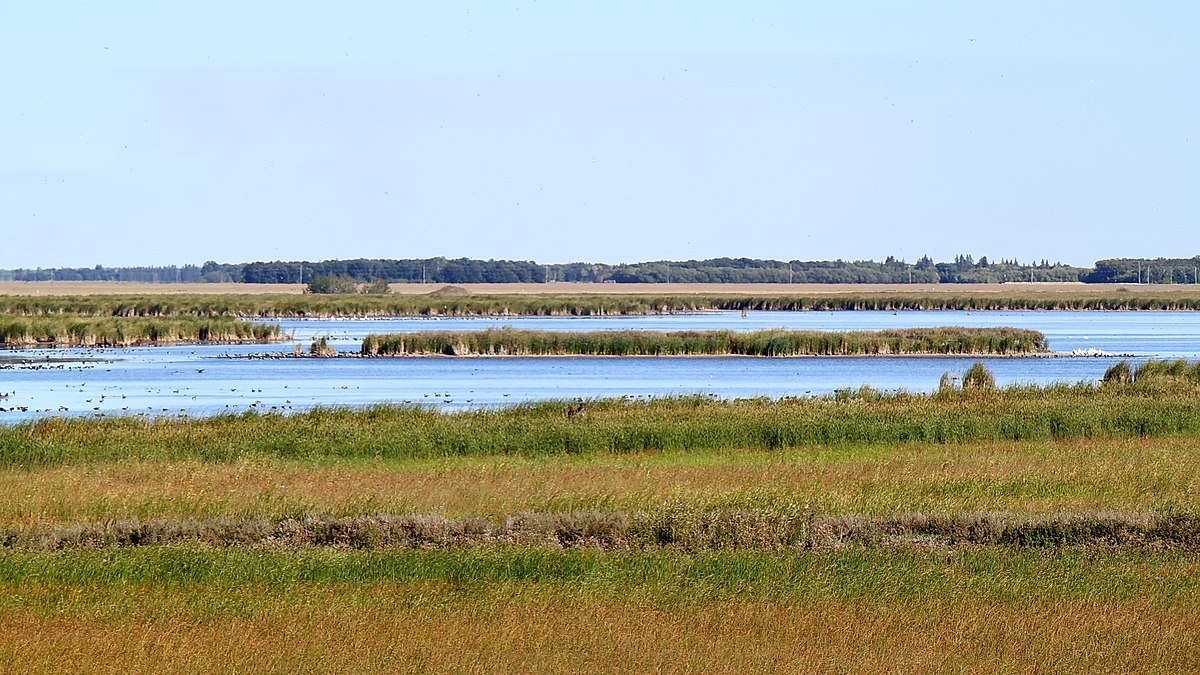
Below is an image of the Oak Hammock Marsh. This is a popular place every grade school kid from the city visits at least once on a field trip. The square shaped land masses are bird islands - specifically for the migratory birds to breed in safety and in dense numbers.

50.11'93 N
97.07'51 W

A Wiki page describing how it was built:


30735

I've been there and you would never know it has such an ordered geometric unity from the air.

Here's an even larger and more extensive project the province of Manitoba has undertaken in its reconstruction of the Little Saskatchewan River Delta.

53.39'15 N
100.58'25W
30736

Ducks Unlimited has an extensive report on it here:

Rebuilding the South Reader Outlet—Ducks Unlimited Canada/

Some of the other images on the "Water People of North America" page are less explainable.

I'll write a follow up post on this thread showing some confirmed pre-contact mounds on Google Earth and offer some tips to anyone who likes searching for them. Even the large ones are very difficult to find on Google Earth.
 
Back
Top Bottom