Watch the skies and land and oceans

Tropical Storm Melissa to strengthen into major hurricane: Latest forecast​


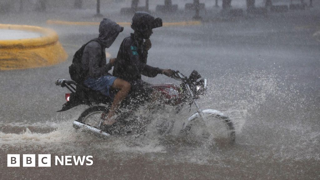
Tropical Storm Melissa is expected to intensify into a major hurricane over the weekend and bring catastrophic flash flooding and landslides to parts of the Dominican Republic, Haiti and Jamaica.

Here’s the latest forecast:

Melissa is expected to become a Category 4 hurricane by Sunday as it lashes the Caribbean with heavy rain and destructive winds

Hurricane conditions are expected to first hit southern Haiti on Saturday and then reach Jamaica on Saturday night or Sunday morning.

It could potentially be the strongest hurricane to impact Jamaica in more than 35 years and could potentially be a multi-day major hurricane event Sunday through Tuesday as Melissa strengthens and moves extremely slowly near or south of the island.

The storm has already led to the death of an elderly man in Haiti who was killed by a downed tree, according to The Associated Press.

On Friday evening, Tropical Storm Melissa continued to churn about 215 miles southeast of Kingston, Jamaica, moving at only 2mph. This extremely slow movement looks to be the trend for several more days, which gives it more opportunity to significantly intensify.


Hurricane Melissa strengthens as it barrels towards Jamaica​


Hurricane Melissa is forecast to become a rare category five storm as it turns towards Jamaica, bringing life-threatening flash flooding and landslides.

The cyclone, which had winds of up to 120 mph (195 km/h) as of 06:00 GMT, is currently turning north-west in the Caribbean and is expected to make landfall by Tuesday, according to the US National Hurricane Center (NHC).

It warns of power cuts and damage to infrastructure as Melissa brings up to 30 inches (76cm) of rain and sea level surges as high as 13ft (4m) above ground. "Seek shelter now," residents have been told.

Melissa is the 13th hurricane in this year's Atlantic season, which typically ends in November.

A category five hurricane is the strongest type, with winds of at least 157mph.

While Melissa is set to weaken to a category four before reaching Jamaica, the NHC said there was "very little practical difference in the overall impacts" upon landfall, and that the hurricane will be "at least that intensity" when it hits the island.

Landslides already being caused by the hurricane have already killed two in Haiti, the nation's Civil Protection agency has said.

Melissa is forecast to pass over Cuba by Wednesday before moving through the Antillas Mayores and out into the Atlantic.


Screenshot_20251026-180025_Maps.jpg


Comment: These types of events tend to intensify when they coincide with geomagnetic storms. Let's wait and see.​
GEOMAGNETIC STORM WATCH: Minor G1-class geomagnetic storms are possible on Oct. 27th when a CME is expected to hit Earth's magnetic field. This is a low confidence forecast because of busy and confusing CME activity on Oct. 23rd, when this minor CME left the sun. SpaceWeather
 
Comment: These types of events tend to intensify when they coincide with geomagnetic storms. Let's wait and see.
GEOMAGNETIC STORMS POSSIBLE THIS WEEK: A minor CME is heading for Earth, followed close behind by a high-speed stream of solar wind. Their combined impact could cause G1/G2-class geomagnetc storms on Oct. 28th, 29th and 30th. SpaceWeather.com

Melissa is now a category 5 hurricane. Jamaica is going to get hit very hard!

Hurricane Melissa is now the strongest storm on the planet this year​


Strongest storm this year: Melissa underwent extreme rapid intensification, strengthening to a rare Category 5 with winds of 175 mph and stronger gusts, making it the strongest storm on the planet this year.

• Jamaica’s worst hurricane: Melissa’s outer bands are lashing Jamaica with strong winds and heavy rain. Mandatory evacuation orders have been issued for vulnerable coastal areas of Jamaica ahead of the unprecedented storm’s expected landfall Tuesday morning.

• Catastrophic impact: Up to 40 inches of rain, 13 feet of storm surge and 160 mph sustained winds will cause “extensive infrastructure damage” that will cut off communities, the National Hurricane Center warned. Melissa has already killed three people in Haiti and Jamaica each and one person in the Dominican Republic.

Could Melissa be strengthening further?

From CNN Meteorologist Briana Waxman
Melissa remains a Category 5 hurricane with winds of 175 mph as of 2 a.m. ET, according to the National Hurricane Center. However, the minimum central pressure of the storm has decreased from 909 millibars Monday evening to 901 millibars early Tuesday.

In general, the lower the pressure, the stronger the storm, so this drop indicates that Melissa may be gaining strength in the coming hours. For reference, Hurricane Katrina’s lowest pressure was 902 mb, making Melissa even more intense than the 2005 storm that devastated Louisiana.

NOAA Hurricane Hunters continue to fly into the storm to collect valuable wind data, so we will stay tuned to see if they find stronger winds in Melissa’s eyewall this morning ahead of its projected landfall.


While this hurricane hangs off Jamaica, east-central Florida has been inundated with rain from a separate storm system, a 6.5M earthquake has struck off the Leeward Isles of the Caribbean, and US military build-up against Venezuela continues.


● Hurricane Melissa hits Cuba, bringing 115mph winds and heavy rain, after crossing Jamaica as the strongest storm to hit the country in modern history

● In Jamaica, Prime Minister Andrew Holness declares a "disaster area" and warns of "devastating impacts"

● The extent of the damage in Jamaica will not begin to become clear until daybreak - but Holness warns of damage to homes and hospitals

● The mayor of Montego Bay tells the BBC the first thing they will do is "check if everybody is alive"

● The normal soundtrack that accompanies Jamaican life is silent, writes the BBC's Nick Davis from Kingston

● After hitting Cuba, the hurricane will move north-east towards the Bahamas and Bermuda

Across the wider Atlantic Melissa was noteworthy for the following.

● Tied as the strongest hurricane to make landfall anywhere in the Atlantic basin with a sustained wind speed of 185mph

● With a central pressure of 892mb, Melissa also tied with the Labor Day hurricane in 1935 as most intense hurricane to make landfall


This is what 185 mph wind gusts are like.


Three Chinese astronauts stranded in space after debris hits their return capsule​


"Three Chinese taikonauts — Wang Jie, Chen Zhongrui and Chen Dong — will be extending their stay aboard China's Tiangong space station after their return capsule was struck by a presumed piece of orbital debris on Wednesday."

"The stated reason for the delay was that the crew's return capsule "is suspected of being impacted by small space debris,"

 
Although the explanation with the telescope does not sound very convincing to me, kind of similar to the bird, I suppose.

(Nienna) What was the “bird" above the sun pictured on May 24th by the LASCO telescope?

A: Expulsion of mass from sun's core due to temporary opening of channel.

Q: (L) Would that have anything to do with any of the current cosmic energies?

A: Yes

Q: (L) Should we expect other odd behaviors or phenomena in relation to the sun?

A: Definitely.


Omen. It's coming 🔥

This is a cosmic ray 🙂
Shot today — original shot.

They asked to write it in the language of physics
This is a galactic particle of very high energy, born unknown where and when (possibly in a supernova explosion) at a speed close to the speed of light, flying into infinity until suddenly a human space telescope appeared out of the darkness in its path. Thus, learning in the last nanosecond of its existence about the presence of intelligent life in the Universe, the particle collided at a sharp angle with the telescope's detector, broke apart, and turned into many secondary particles that scattered along the line of its motion.
1762458010440.png
 
I think they tried to keep this one quiet, but alas, it discharged and grew a tale:


2RtLabErpAfC6zXv6hZBE8-650-80.jpg.webp


New photos reveal that a recently discovered comet dubbed the "other ATLAS" has transformed into a spectacular golden ribbon after surviving a close approach to the sun — a journey that many experts believed would be the comet's doom.
C/2025 K1 reached its closest point to the sun, or perihelion, on Oct. 8, coming within a minimum distance of 31 million miles (50 million kilometers) of our home star — around four times closer than 3I/ATLAS managed during its own perihelion on Oct. 29. Due to the intense gravitational strain from this close encounter, many experts believed that C/2025 K1 would be ripped apart, according to Spaceweather.com.
They didn't count on electromagnetic forces.

"Three Chinese taikonauts — Wang Jie, Chen Zhongrui and Chen Dong — will be extending their stay aboard China's Tiangong space station after their return capsule was struck by a presumed piece of orbital debris on Wednesday."
Sounds like cometary debris.
 
An analyst predict a 2025/2026 cold winter :

Signs of an Upcoming Cold Winter.​

October 29 2025

ITCZ / ITF


The Intertropical Front (ITF)—the climatic equator—shifted northward this summer, averaging 2.4°C above the seasonal norm over Africa. This shift caused widespread rainfall across the Sahel but also indicates a more significant phenomenon: a change in energy transport within the hemisphere.
When the ITF moves northward, tropical and southern hemispheres retain more of Earth's heat and humidity. Less energy is transported across the equator toward the northern hemisphere. With less incoming energy, the north experiences an energy deficit as winter approaches—a configuration that makes colder seasons more likely. A wetter Sahel is a visible sign of this imbalance.

And this year, the ITF isn't acting alone.

World Meteorological Organization


Global oceans tend to be cooling, with vast areas below the WMO 1991-2020 baseline reference. Additionally, the development of a La Niña phenomenon in the Pacific reinforces this trend: La Niña winters often bring more blocking highs and increased snow cover over Eurasia and North America.
Moreover, both the North Atlantic Oscillation (NAO) and Arctic Oscillation (AO) are declining. When these indices are negative, they weaken westerly winds and allow Arctic air to spread southward into mid-latitudes. This type of configuration is precisely associated with some of the most severe winters ever recorded.

Early-season data already aligns. Snow rapidly expanded across northern Siberia in September, and forecasts predict the first snowflakes over Central Europe by month's end. If this layer of snow accumulates early, it will reinforce blocking anticyclones and cold accumulation across the continent. Taken together:
  • The ITF moving northward
  • Cooler oceans
  • La Niña
  • Declining NAO/AO indices
  • Early snowfall
these signals accumulate in favor of colder conditions. Traditional medium-term models will continue to predict mild weather, but physical factors suggest otherwise.

Global Ocean Cooling in September​

The NOAA reanalysis shows that global oceans cooled during the first half of September 2025. With the exception of a warm area in the northern North Pacific, most world oceans are dominated by below-average sea surface temperatures compared to the WMO's 1991-2020 climatic reference.

Oceans influence weather and climate. When such vast areas show below-average temperatures, the consequences can be significant: altered storm tracks, disrupted monsoon patterns, and slowed global temperature increases. Contrary to all headlines about "boiling seas," September 2025 is taking an opposite direction with cooling oceans—and thus a potential planetary cooling outlook.

Source (French)
 
Back
Top Bottom