The earth's magnetic field is weakening - letting in more solar energy, stimulating hurricanes electrically. There's potential for a very difficult hurricane year, including the first ever Category 6.
You are using an out of date browser. It may not display this or other websites correctly.
You should upgrade or use an alternative browser.
You should upgrade or use an alternative browser.
Crazy Storm Weather and Lightning - Global
- Thread starter mabar
- Start date
Dubai flooding amid atypical heavy rains snarls traffic on UAE roads and airport runways
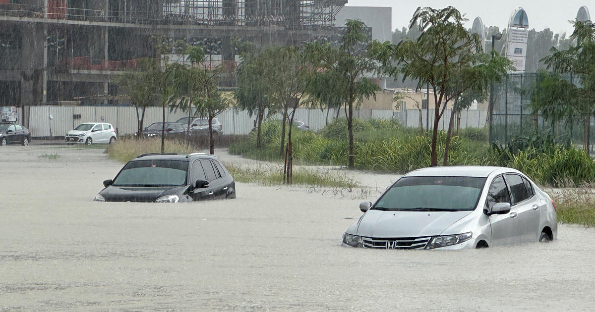
Heavy rains lashed the United Arab Emirates on Tuesday, flooding portions of major highways, leaving vehicles abandoned on roadways across Dubai and grinding traffic at the city-state's huge international airport briefly to a complete halt. Meanwhile, the death toll from separate heavy flooding in neighboring Oman rose to 18, with others still missing as the sultanate prepared for the storm.
The rains began overnight, leaving massive ponds on normally parched streets and airport tarmacs as whipping winds contributed to flight disruptions at Dubai International Airport, the world's busiest for international travel and the home of the long-haul carrier Emirates. The airport said in a series of social media posts that all operations were halted for about 25 minutes on Tuesday afternoon, and that all arrivals would be diverted after that "until the weather conditions improve."
Dubai flooding amid atypical heavy rains snarls traffic on UAE roads and airport runways
Normally parched roads and airport runways in the desert city-state of Dubai were left underwater by an incredibly rare rainstorm.
With its millions of petrodollars, the United Arab Emirates has enough money to play God
During a visit to the NCM, General Director Abdulla Al Mandous told CNBC that the technology is "based on scientific background."
Click here to view interactive content
Al Mandous added that Abu Dhabi's program does not use silver iodide, a common crystal-like material used as a seeding agent in other countries. This material has been widely criticized for potential harmful effects on the environment and the public, however, some cloud seeding studies show there has been no substantial evidence to prove that at current levels it poses any toxic effects.
The NCM said it does not use any harmful chemicals in its operations. "Our specialized aircrafts only use natural salts, and no harmful chemicals," the organization told CNBC.
United Arab Emirates is using cloud seeding tech to make it rain
- In the 1990s, the UAE introduced a rain enhancement methodology called cloud seeding.
- Cloud seeding is the process of increasing the amount of rain produced from the clouds above, which is designed to improve water shortage issues in arid regions around the emirate.
- By the early 2000s, Sheikh Mansour Bin Zayed Al Nahyan, the vice president of the UAE, allocated up to $20 million for research into cloud seeding.
- The UAE partnered with the National Center for Atmospheric Research in Colorado and NASA to set up the methodology for the cloud seeding program.
During a visit to the NCM, General Director Abdulla Al Mandous told CNBC that the technology is "based on scientific background."
Click here to view interactive content
Al Mandous added that Abu Dhabi's program does not use silver iodide, a common crystal-like material used as a seeding agent in other countries. This material has been widely criticized for potential harmful effects on the environment and the public, however, some cloud seeding studies show there has been no substantial evidence to prove that at current levels it poses any toxic effects.
The NCM said it does not use any harmful chemicals in its operations. "Our specialized aircrafts only use natural salts, and no harmful chemicals," the organization told CNBC.
Publié le 16 avril 2024
La ville de Dubaï a été le théâtre d’inondations meurtrières provoquées par des pluies torrentielles.
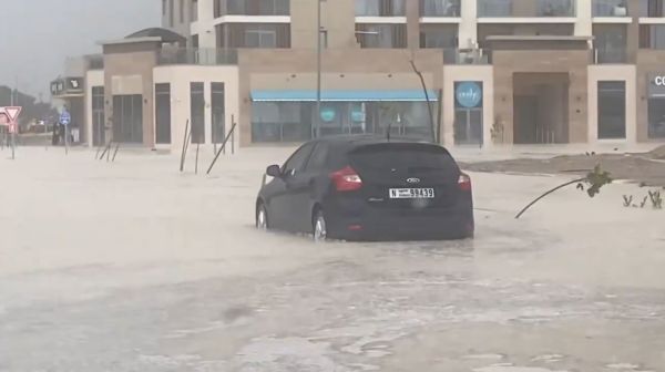
Près de 160 mm de pluie sont tombés sur Dubaï en moins de 24 heures. Cet épisode était si intense que la cité du Moyen-Orient a été submergée. L’orage exceptionnel a inondé les rues de la ville, mais aussi le tarmac de l’aéroport international, le deuxième plus achalandé du monde. L’établissement prévoyait que ce mauvais temps continue le lendemain. Plusieurs vols ont été suspendus temporairement.
Au total, selon les autorités, ce sont au moins 18 personnes qui ont péri en raison des crues subites à Oman. Parmi les victimes, on dénombre neuf enfants et le conducteur de l’autobus scolaire emporté par les eaux.
Selon le Royal Oman Police, au moins 75 habitants ont été secourus dans les dernières 24 heures.
La pluie tombée représente près de deux ans de précipitations pour Dubaï.
En moyenne, la région reçoit environ 70 mm de pluie annuellement.
-----------------
The city of Dubai was the scene of deadly floods caused by torrential rains.
Nearly 160 mm of rain fell in Dubai in less than 24 hours. This episode was so intense that the Middle Eastern city was submerged. The exceptional storm flooded the streets of the city, but also the tarmac of the international airport, the second busiest in the world. The establishment predicted that this bad weather would continue the next day. Several flights have been temporarily suspended.
In total, according to the authorities, at least 18 people died due to flash floods in Oman. Among the victims, there are nine children and the driver of the school bus swept away by the waters.
According to the Royal Oman Police, at least 75 residents have been rescued in the last 24 hours.
The rain that fell represents almost two years of precipitation for Dubai.
On average, the region receives around 70 mm of rain annually.
 www.meteomedia.com
La ville de Dubaï a été le théâtre d’inondations meurtrières provoquées par des pluies torrentielles.
Près de 160 mm de pluie sont tombés sur Dubaï en moins de 24 heures. Cet épisode était si intense que la cité du Moyen-Orient a été submergée. L’orage exceptionnel a inondé les rues de la ville, mais aussi le tarmac de l’aéroport international, le deuxième plus achalandé du monde. L’établissement prévoyait que ce mauvais temps continue le lendemain. Plusieurs vols ont été suspendus temporairement.
Au total, selon les autorités, ce sont au moins 18 personnes qui ont péri en raison des crues subites à Oman. Parmi les victimes, on dénombre neuf enfants et le conducteur de l’autobus scolaire emporté par les eaux.
Selon le Royal Oman Police, au moins 75 habitants ont été secourus dans les dernières 24 heures.
La pluie tombée représente près de deux ans de précipitations pour Dubaï.
En moyenne, la région reçoit environ 70 mm de pluie annuellement.
-----------------
The city of Dubai was the scene of deadly floods caused by torrential rains.
Nearly 160 mm of rain fell in Dubai in less than 24 hours. This episode was so intense that the Middle Eastern city was submerged. The exceptional storm flooded the streets of the city, but also the tarmac of the international airport, the second busiest in the world. The establishment predicted that this bad weather would continue the next day. Several flights have been temporarily suspended.
In total, according to the authorities, at least 18 people died due to flash floods in Oman. Among the victims, there are nine children and the driver of the school bus swept away by the waters.
According to the Royal Oman Police, at least 75 residents have been rescued in the last 24 hours.
The rain that fell represents almost two years of precipitation for Dubai.
On average, the region receives around 70 mm of rain annually.

Deux ans de pluie en 24 heures : déluge mortel dans cette région - MétéoMédia
La ville de Dubaï a été le théâtre d’inondations meurtrières provoquées par des pluies torrentielles. Détails.
Liliea
The Living Force
Extreme rains have been known to fall since Thursday 18 April, causing many points in the province to be flooded. By Monday, about 110,000 people had been evacuated across the province, while 25,800 people were in emergency shelters, according to Xinhua.
While on April 1 a new daily heat record was set in Moscow at 21.6 degrees Celsius according to Ria.ru and your telegram channel today a month's rain falls.

 ria.ru
China floods: four killed in Guangdong sparking concerns over extreme weather defences
While on April 1 a new daily heat record was set in Moscow at 21.6 degrees Celsius according to Ria.ru and your telegram channel today a month's rain falls.
Saturday in Moscow became the “wettest” April 27 since 1949
MOSCOW, April 27 - RIA Novosti. Saturday in Moscow became the “wettest” April 27 since 1949, but the daily record of this day, set in the distant 1880, held, said the leading employee of the weather center “Phobos” Mik hail Leus.“
“For the passing day in Moscow, according to the weather station VDNKh, fell 13.4 millimeters of precipitation - so this is the ‘wettest’ April 27 since the beginning of meteorological observations at this weather station in 1949”, - said Leus in his Telegram-channel.” said Leus in his Telegram-channel.
“About 290 teams and 300 brigades of Mosvodostok were on duty” due to the emergency situation.

Суббота в Москве стала самым "мокрым" 27 апреля с 1949 года
Суббота в Москве стала самым "мокрым" 27 апреля с 1949 года, однако суточный рекорд этого дня, установленный в далёком 1880 году, устоял, сообщил ведущий... РИА Новости, 27.04.2024
Tornadoes seem to be forming earlier in the season than usual. Mid-West got hit pretty bad.
Tornado sweeping across Nebraska


Tornado sweeping across Nebraska
Shocking video of several lightning strikes meters away from a family in the Chaco region, Argentina
Kenya's first-ever cyclone "could hit at any time."
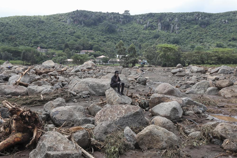
Kenyan President William Ruto warned that the situation due to devastating floods caused by torrential rains that have left at least 210 people dead will worsen, as the African country's first-ever cyclone "could hit at any time along the coast."
"Unfortunately, we have not seen the last of this dangerous period, as the situation is expected to worsen," he said. The Department of Ecology and the Climate Prediction Application Center (ICPAC) have issued a stark warning that Kenya could face its first ever cyclone," Ruto said in an address to the nation from the presidential headquarters.
The Council of Ministers was warned by experts on Thursday that Cyclone Hidaya could hit Kenya's coastal region in the coming days, according to local media.
Consequently, the president ordered the Ministry of Education to postpone until further notice the reopening of all schools after the vacations, which was scheduled for next Monday after having already been delayed once by the rains.
El primer ciclón de la historia de Kenia "podría golpear en cualquier momento" - EFEverde
El presidente de Kenia, William Ruto, alertó de que el primer ciclón de la historia del país africano "podría golpear en cualquier momento"
Forquetinha, Brésil - 30 avril 2024
Source: Corpo de bombeiros militar do RS via storyful
Des crues ont causé la mort d'au moins 13 personnes dans el sud du Brésil et une vingtaine manquent à l'appel.
C'es tmême la pire catastrophe climatique jamais vécue dans l'État du Rio Grande do Sul, selon son gouverneur.
Ce sont des pluie torrentielles qui inondent la région et font déborder les cours d'eau depuis plusieurs jours.
L'armée brésilienne a mené plusieurs opérations de srcours en lien avec ces inondations historiques.
On a mobilisé pas moins de 446 soldats et 27 véhicules pour venir en aide à la population, dont des chars d'assaut.
Floods have caused the death of at least 13 people in southern Brazil and around twenty are missing.
It is even the worst climatic disaster ever experienced in the state of Rio Grande do Sul, according to its governor.
Torrential rains have been flooding the region and causing rivers to overflow for several days.
The Brazilian army carried out several relief operations in connection with these historic floods.
No less than 446 soldiers and 27 vehicles were mobilized to help the population, including tanks.


Compté de Polk, Texas - 2 Mai 2024
L'est du Texas connaît des inondatins majeures après de fortes pluies, comme ici au bord de Houston.
Plusieurs opérations de recherche et de secours ont eu lieu. Des gens sont restés coincés sur le toit de leur maison.
DEs autoroutes ont été fermées à la circulation en raison des crues trop importantes. Un petit barrage a cédé dans le comté de Trinity.
Jusqu'à 228mm de pluie étaient tombés sur une partie de l'état le 2 mai en mi-journée.
East Texas experiences major flooding after heavy rains, like here on the edge of Houston.
Several search and rescue operations took place. People were stuck on the roofs of their homes.
Highways were closed to traffic due to excessive flooding. A small dam failed in Trinity County.
Up to 228mm of rain had fallen across parts of the state by midday on May 2.
The Woodlands, Texas - 3 Mai 2024
Après avoir reçu des pluies torrentielels durant 5 jours, de puissantes tempêtes continuaient de s'abattre sur le Sud-est du Texas le 3 mai.
Les intempéries incessantes avaient déversé jusqu'à 100 mm d'eau en quelques heures seulement, forçant les autorités à donner des ordres d'évacuation dans certaines zones à risque. Le NAtional Weather Service indiquait que d'autres inondations soudaines pourraient survenir le jour même avec des quantités supplémentaires atteignant jusqu'à 50 mm.
After receiving torrential rains for 5 days, powerful storms continued to hit Southeast Texas on May 3.
The incessant bad weather had dumped up to 100 mm of water in just a few hours, forcing the authorities to issue evacuation orders in certain risk areas. The National Weather Service indicated that additional flash flooding could occur today with additional amounts reaching up to 50 mm.


Source: Corpo de bombeiros militar do RS via storyful
Des crues ont causé la mort d'au moins 13 personnes dans el sud du Brésil et une vingtaine manquent à l'appel.
C'es tmême la pire catastrophe climatique jamais vécue dans l'État du Rio Grande do Sul, selon son gouverneur.
Ce sont des pluie torrentielles qui inondent la région et font déborder les cours d'eau depuis plusieurs jours.
L'armée brésilienne a mené plusieurs opérations de srcours en lien avec ces inondations historiques.
On a mobilisé pas moins de 446 soldats et 27 véhicules pour venir en aide à la population, dont des chars d'assaut.
Floods have caused the death of at least 13 people in southern Brazil and around twenty are missing.
It is even the worst climatic disaster ever experienced in the state of Rio Grande do Sul, according to its governor.
Torrential rains have been flooding the region and causing rivers to overflow for several days.
The Brazilian army carried out several relief operations in connection with these historic floods.
No less than 446 soldiers and 27 vehicles were mobilized to help the population, including tanks.
Compté de Polk, Texas - 2 Mai 2024
L'est du Texas connaît des inondatins majeures après de fortes pluies, comme ici au bord de Houston.
Plusieurs opérations de recherche et de secours ont eu lieu. Des gens sont restés coincés sur le toit de leur maison.
DEs autoroutes ont été fermées à la circulation en raison des crues trop importantes. Un petit barrage a cédé dans le comté de Trinity.
Jusqu'à 228mm de pluie étaient tombés sur une partie de l'état le 2 mai en mi-journée.
East Texas experiences major flooding after heavy rains, like here on the edge of Houston.
Several search and rescue operations took place. People were stuck on the roofs of their homes.
Highways were closed to traffic due to excessive flooding. A small dam failed in Trinity County.
Up to 228mm of rain had fallen across parts of the state by midday on May 2.
The Woodlands, Texas - 3 Mai 2024
Après avoir reçu des pluies torrentielels durant 5 jours, de puissantes tempêtes continuaient de s'abattre sur le Sud-est du Texas le 3 mai.
Les intempéries incessantes avaient déversé jusqu'à 100 mm d'eau en quelques heures seulement, forçant les autorités à donner des ordres d'évacuation dans certaines zones à risque. Le NAtional Weather Service indiquait que d'autres inondations soudaines pourraient survenir le jour même avec des quantités supplémentaires atteignant jusqu'à 50 mm.
After receiving torrential rains for 5 days, powerful storms continued to hit Southeast Texas on May 3.
The incessant bad weather had dumped up to 100 mm of water in just a few hours, forcing the authorities to issue evacuation orders in certain risk areas. The National Weather Service indicated that additional flash flooding could occur today with additional amounts reaching up to 50 mm.
Some really bad storms with tornadoes have been going across the US of late. This article about one in late April caught my eye.
Oklahoma storm had 3 extraordinary features, including a "wrong-way" tornado
Oklahoma storm had 3 extraordinary features, including a "wrong-way" tornado
Meteorologists stared at their radar screens in awe as a supercell thunderstorm performed several neat tricks.
By Jesse Ferrell, AccuWeather meteorologist and senior weather editor
Published May 6, 2024 2:31 PM EDT | Updated May 6, 2024 2:31 PM EDT
Hours after a tornado was documented in Tillman County, Oklahoma, on April 30, meteorologists and weather enthusiasts were enthralled by a severe thunderstorm in the same county because several rare meteorological phenomena, including double tornadoes, a tornado track that looped back on itself and an "anti-cyclonic" tornado, were documented. Because the storm occurred after dark, photos and videos are few and far between, but it left its evidence on the radar.
Twin tornadoes
The radar shows the Tillman storm appeared to have two tornadoes at the same time. Having two tornadoes in the same storm, especially as one is dying and another is forming, is not rare, as supercell thunderstorms cycle their energy; in fact, two concurrent tornadoes in one storm have been documented via video on occasion, such as the twin tornadoes at Pilger, Nebraska, of June 16, 2014.
The first tornado from the Tillman storm also appeared to have looped over on its own track, which is rare but not unheard of.
Wrong-way tornado
The second tornado spawned by the Tillman storm spun the wrong way, exhibiting clockwise or "anti-cyclonic" movement. This is because the Coriolis Effect, which dictates rotation at the size of a tornado, is never 100 percent effective. It is estimated that only 1 to 2 percent of tornadoes rotate clockwise.
The radar showed winds toward the radar on the south side of the storm, with winds away from the radar on the north side, meaning that the tornado was spinning clockwise. The two tornadoes from the Tillman storm may have even experienced the Fujiwhara effect, spinning around each other.
A towering, rotating storm
The Tillman thunderstorm also appeared to have a complete cyclonic structure as high as 18,000 feet, which is rarely seen in radar data. Typically, tornadoes twist below the storm's base, which is also rotating but far beneath the top of the storm.
Tornadoes are rated on the Fujita scale based on a post-storm estimate of damage, and tornadoes in rural areas can be underestimated because there are no structures to indicate damage. Very little damage was done by these rural storms. The NWS said "this [first] tornado produced EF1 damage, although it was likely much stronger." The second anti-cyclonic tornado was also rated EF1.
Severe storm at Huston and... other cities since is happening right now, I hope is no much damage.
There are many warnings to the coast areas as well.
Windy and Accuweather has the same form. It got my attention.
There are many warnings to the coast areas as well.
Windy and Accuweather has the same form. It got my attention.
Attachments
Sudden floods around the Iranian city of Mashhad have taken the lives of at least seven people, with three more missing.
The head of the Khorasan Razavi Province Reza Abbasisaid at least seven people have died in the floods and three more are missing in the flash floods hitting the provincial capital and its neighborhoods. Many people were injured.
Heavy downpours hit the province, mainly the capital Mashhad and clogged the streets. Many vehicles also got stuck in the floods.
Abbasi said Red Crescent Society rescue teams and military forces have been dispatched to the affected areas. Enqelab Square in Mashhad is the hardest hit area and it will take more time to return back to normal.
Other cities in the province, including Fariman and Torghabeh, were also flooded.
Areas close to the northern border with Turkmenistan have seen heavy rainfall and large hail with streets, homes and shops all under more than 90cm of water in some locations. At the same time, further rain is expected across central Asia, with more predicted close to the Afghan and Tajik border.
City fire brigade divers retrieved the bodies of a man and a woman, both approximately 50 years old, in the northern Iranian city, which has seen several recent days of floods and freak weather events in part due to the wetter regional climate this year.
Rescue operations have continued late in the evening to find other potential victims.
Jo Bugman
Jedi Master
Interesting with that video of how dark it got during that storm compared to the one recently in Houston.
Trending content
-
-
Thread 'Coronavirus Pandemic: Apocalypse Now! Or exaggerated scare story?'
- wanderingthomas
Replies: 30K -

