Crazy Storm Weather and Lightning - Global

Crazy storm weather in Croatia
Due to the approaching high-altitude cyclone and the influx of moist, unstable air, the State Hydrometeorological Institute (DHMZ) has issued a red warning for the Zagreb, Karlovac and Rijeka regions, while the rest of the country is under an orange warning.

Severe thunderstorms, heavy rain, possible hail and a sudden drop in temperature are expected during the evening and night, the DHMZ warns.

Rain in Karlobag

In Karlovac, 48.2 millimeters (1,9 inches) of rain fell on Sunday between 0:00 and 08:00. For comparison, the average amount of precipitation in that city during July is 92 millimeters (3,6 inches). If we add to that figure Saturday's precipitation - between 08:00 and 00:00, 16.6 millimeters fell - the total amount of rain in 24 hours is slightly less than 65 millimeters (2,5 inches).
Also hail in Karlovac:

Hail in Mali Lošinj:

Lightning strikes the Thermal Power Plant in Zagreb

And the memorable scene was filmed in Istria. During a storm in Jehnići near Poreč, residents could see an incredible palette of colors in the sky while lightning flashed.

In Zadar, on Saturday between 21:00 and 22:00, 20.3 millimeters of rain fell, which is more than half of the average July precipitation in that city, which is 35.4 millimeters.

Detailed article see here (in Croatian)
 

Megaflashes! New records set for longest lightning strikes, both in length and duration


Story Summary
  • The new record for longest lightning strike is now 477 miles, set on April 29, 2020.
  • The new record for longest-duration lightning strike is just over 17 seconds.
  • “These are extraordinary records from single lightning-flash events."
Scientists in Europe on Monday confirmed that a pair of lightning strikes in 2020 set new world records, for both length and duration.

Apparently there is a new megaflash event that happened in 2017 that beats this record. It apparently extended from eastern Texas to near Kansas City, Missouri on Oct. 22, 2017 reaching 515 miles (+/- 5 miles)!


Megaflash 2017.jpg
 
Over the weekend we had crazy weather on the Mid North Coast NSW, Hunter region and the Tablelands. Floods, wild winds and snow where it rarely snows:

1754302465127.png 1754302498591.png 1754302528682.png
 
Strong storm hits Mexico City, the International Airport (AICM) closed for several hours, floods at many places, the Zocalo flooded (first time I had seen that) several hisotrical buildings with water leaks. And the forecast is that heavy rain will continue in most of the country.
Mexico City International Airport (AICM) suspended landing and takeoff operations due to heavy rain. The rainfall affected safety and visibility on the runways, causing flooding. The AICM recommends that travelers contact their respective airlines to find out the status of their flights.
Rainfall on August 10 causes damage to La Merced Parish
The historic church located in Arcos de Belén, in the center of Mexico City, was flooded inside. Workers and parishioners joined forces to remove the water and move the parish furniture, trying to prevent further damage.
🗣️ The extremely heavy rain that hit Mexico City on Sunday caused severe flooding in the capital's Zócalo. The water level even reached the Metropolitan Cathedral and several businesses.


Is not the first time, though...
Today's rain reminded me of the worst flood that hit Mexico City in the 20th century; it was the afternoon of July 15, 1951. 🔺A brief THREAD🔺. That year, a storm caused two-thirds of Mexico City to be flooded, with the lowest areas covered by up to 2 meters of water!
1754937626434.png

And we should not be surprised much, though. Mexico City was built over a lagoon,
Why does Mexico City flood?
WATER HOLDS MEMORIES...
Work by Miguel Covarrubias
1754937734392.png

The song performed by Jorge Negrete in the film "I'm going to eat that prickly pear." famous for several decades, which is already ingrained in the collective memory of all Mexicans, especially those who live in Mexico City, is very fitting.

I'm going to eat that prickly pear.

The little tree where the peacock slept has fallen
Now it will sleep on the ground
like any other animal.

The eagle, being an animal, was depicted on money
to climb the prickly pear cactus
it asked permission first.

Guadalajara on a plain, Mexico on a lagoon
I'm going to eat that prickly pear
even if it pricks my hand.

They say I'm a bad man, bad and ill-fated )
because I ate a peach
with a red heart.
 
Weather chaos in Paris diverts flights and causes cancellations due to lightning and cyclonic wind activity.


Screenshot 2025-08-29 at 11-34-26 Statistics of electrical activity on France - Keraunos.png

Due to the significant turbulence due to the gusts of wind, the evening's flights to Calvi from Orly and Marseille were diverted to Nice and Bastia respectively. "The flight to Bastia from Orly scheduled for 8:00 p.m. was initially diverted to Nice and had to return to Paris this evening," according to a statement from the Corsican prefecture.


Impressive arrival of a #arcus over the #Paris #Orly airport as a corollary of the day's #orages ⛈️😍

For this last weekend of returning from vacation, 20% of the flights scheduled this Friday between 3:30 PM and 11:30 PM have been canceled at Orly airport, the DGAC announced, due to #orages.

Another anthology-worthy night chasing sprites above storms located in the north of Italy. Saint-Raphaël (Var) in the foreground. #orage #redsprites #StormHour @KeraunosObs @3BMeteo @infoclimat
 
Vancouver Island experienced some amazing lightening and thunder last night.
I live on the very southern peninsula, and the storm was mid island north of us, so didn’t get to see the show in person, but I managed to collect a few photos.
The bolts of lightening seemed to be very “plasma” looking on a couple of them. There were a few videos, and they showed the same thick, blob type bolts, so it possibly wasn't lens distortion.
IMG_1016.jpeg
IMG_1014.jpeg

IMG_1018.jpeg
IMG_1017.jpeg

The amount and intensity of recorded lightening bolts is incredibly high for the pacific coastal area.
IMG_1019.jpeg
 
Incredible counts of electrical activity from two continents are only separated by time zones.

Over 4,500 lightning strikes hit California overnight, sparking new wildfires.
By Gillian Mohney, News Editor, Sep 2, 2025

Thousands of lightning strikes were reported Tuesday in the East Bay and Central Valley as dry thunderstorms rolled through the area, increasing the risk of a major wildfire.

The National Weather Service reported more than 4,700 lightning strikes from midnight to 5:30 am Tuesday, with minimal precipitation, in an area stretching from Paso Robles to just north of Sacramento.

Cal Fire reported four new fires in the Central Valley on Tuesday morning but has not said if they were caused by lightning.
Roger Gass, a meteorologist at the National Weather Service, said the lightning strikes will continue as the storms head east into the Sierra Nevada.

“We have a greater potential … during the summer months to have these dry thunderstorms, as monsoon moisture works its way in from the desert southwest and generally just to our south,” Gass told SFGATE.

Dry thunderstorms can be particularly dangerous, as heat and arid weather leave plenty of fuel in the form of dried vegetation in California hills in the late summer and early fall months. In August 2020, two days of storms ignited 367 fires in California.

Parts of Southern California including Palm Springs and San Bernardino are also seeing stormy conditions. A social media post on X showed showers and lightning in the Palm Springs area Tuesday morning.


Gass said the Bay Area may avoid a major wildfire, as temperatures are expected to drop this week, helping mitigate the fire danger.

“We are expecting a cooling trend throughout the week,” Gass told SFGATE. “Temperatures will generally cool to around or just below seasonal averages, and as we head into the upcoming weekend, they basically hold steady.”

But the risk of wildfire remains high for parts of the state. The weather service has issued a red flag warning for regions of far Northern California along the Oregon border through Wednesday.


🌪️ It is highly likely that the windy phenomenon that struck Morbihan this Tuesday morning was a tornado. Several municipalities suffered damage along a narrow corridor. Here, roofs torn off in the Kerchevet hamlet in Guéhenno. (via @Gazettedu56

Line 1
A ridge regime largely dominated during the summer, with a fairly strong anomaly of high geopotentials over western Europe.Lower down in altitude, the air mass exhibited an anomaly of nearly 2°C at 850 hPa.

Over the summer, more than 4000 severe hailstorms were recorded, a value down compared to last summer. The south of the country was more exposed to these hailstorms. Find the detailed report for the summer of 2025 here: https://keraunos.org/actualites/fil
 
La Niña Is Expected To Form Soon. Here’s What That Could Mean.
NOAA’s Climate Prediction Center says La Niña will likely form in the coming months and may persist through the winter.
A transition from ENSO-neutral to La Niña is likely in the next couple of months, according to a monthly update released by NOAA’s Climate Prediction Center on Thursday. A La Niña watch continues to be in effect.

What Is A La Niña Watch?

A La Niña watch is issued when conditions are favorable for La Niña conditions to emerge within the next six months. La Niña occurs when the ocean’s surface temperatures in the central and east-central equatorial Pacific reach a specific level of cooler temperatures, which can impact weather patterns across the globe.

Neutral Conditions Remain For Now

ENSO-neutral conditions continued this past month, with near- to below-average sea-surface temperatures across the central and eastern equatorial Pacific Ocean. ENSO-neutral means that neither El Niño nor its counterpart La Niña are ongoing.

Current sea-surface temperatures in the equatorial Pacific Ocean are a mix of cooler and warmer waters, as seen in the map below, meaning ENSO-neutral conditions are still in place at this time. Temperatures will need to continue to trend colder in this region of the Pacific for La Niña to develop.

sstanomaliesenso.jpg

This image highlights the cool than average water temperatures in the equatorial Pacific Ocean.

(MORE: What Is La Niña? A Deeper Dive)


There's a 71% chance of La Niña during October through December, according to NOAA. This is based on model ensembles and recently observed trends across the surface and subsurface equatorial Pacific of cooling sea-surface temperatures.

However, the period of La Niña conditions could be brief. Chances decrease to 54% in December 2025 through February 2026, though La Niña is still favored. This could mean that typical La Niña-triggered winter impacts may not be as significant.


Screenshot 2025-09-14 at 09-41-09 La Niña Could Form Soon. Here’s What It Means. Weather.com.png

Why This Matters

La Niña’s cooling effect on the equatorial Pacific waters can affect weather patterns thousands of miles away, including near the U.S. While it isn’t nearly the only driver of weather patterns, here are some impacts you could see in this transition to La Niña:
  • A ramped-up hurricane season. As of now, we’ve seen six named storms this season, but only one was a hurricane, reaching major hurricane strength. Colorado State University's updated forecast released in early August still calls for an active season. Part of the reason for this active forecast is the cool sea-surface temperatures in the eastern equatorial Pacific, which usually favors an active Atlantic hurricane season due to low vertical wind shear, conducive for developing hurricanes.
Screenshot 2025-09-14 at 09-43-10 La Niña Could Form Soon. Here’s What It Means. Weather.com.png

Utah Homes Destroyed By Tornado

3 hours ago
Two homes were destroyed in southeast Utah after a tornado touched down in the state on Saturday. Survey crews are still assessing the damage.
From San Juan county as tornado reports indicted the western parts of Utah yesterday survey crews are still assessing the damage left behind including 2 homes that were sadly destroyed the threat for tornadoes intensifies this morning as potent storms linger in the plains our bounds if I recall the tornado tore con was even all that high yesterday but you know you can never rule out an isolated tornado just depends on where it forms where the destruction happens.
 
The San Francisco Chronicle selected a compelling headline highlighting the effects of the ongoing meteorological activities affecting the West Coast. 🧐☔🌩️

Session 19 October 2024
(L) Thing is, when it hit up in the mountains, it wasn't really a hurricane exactly. It was just freaking...

(Niall) A monsoon. A deluge.

(L) Yeah, a deluge. I mean, because by the time it crosses...

(Andromeda) Nobody expected it.

(L) ...crosses that much land, it loses its hurricane force. Well, I mean, they start to lose their hurricane force when they approach land.

(Joe) When they said that some 'seeding' was involved for that hurricane, was that a seeding of the hurricane in terms of the strength of the hurricane?

A: Not exactly. Both recent hurricanes were not as strong in terms of wind strength as reported.

Q: (Joe) Right. So, Hurricane Helene was a relatively normal or even low-grade hurricane that passed over Florida, but then dumped all this rain on North Carolina, which is to do with the loading of the atmosphere with a lot of water, which is for other reasons. But Hurricane Milton, what freaked everybody out was that it strengthened from a category 1 to category 5 in a day, more or less, and everyone's like, "Oh my God!" and meteorologists were crying and stuff. [laughter] But then as I watched it go across, it actually arrived on land actually as a category 1 storm. But anyway, what kind of technology was used there for seeding? Rain seeding?

A: Yes

q: (Joe) And that was involved in both of them?

A: Yes

Q: (Joe) So that kind of helped along the rainfall type thing?

A: Yes

Q: (L) So they really want floods. They want to destroy stuff and disrupt everything?

A: Yes

Thu, September 25, 2025 at 4:00 AM PDT
The upper-level low-pressure system that cooled the Bay Area and sparked showers Wednesday isn't done yet. Unlike most California weather systems that sweep through in a day or two, this one has been unusually persistent, lingering offshore before sliding inland toward the Sierra on Thursday. That slow drift keeps the low in charge of California's weather through the weekend.

A typical upper-level low latches onto the jet stream and races east. This one, by contrast, has acted like an anchor, cut off from the main flow and reluctant to budge. The result has been days of influence that cooled Bay Area highs by 15 to 20 degrees, stirred up Central Coast thunderstorms and are now driving weather farther south. On Thursday, Tahoe, Yosemite and Mammoth Lakes could all see strong afternoon thunderstorms with lightning and bursts of heavy rain.

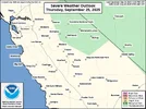
Parts of the Sierra Nevada are at risk for thunderstorm development on Thursday. (NOAA)

Parts of the Sierra Nevada are at risk for thunderstorm development on Thursday. (NOAA)

By Friday, the low slides down the Sierra Nevada into Southern California, gradually losing steam as its moisture source dries up. Isolated showers may linger through the weekend in the mountains near Los Angeles and across the high desert, and there is the risk of some flooding over the weekend. But the bigger story will be cooler temperatures. Normally hot spots like Barstow and Palm Springs will top out in the 80s under a blanket of clouds.


For the Bay Area, Thursday will feel like a middle ground. Most spots will land in the 70s and 80s, a noticeable shift from Wednesday's cool start but still far from Tuesday's spike into the 90s. By Friday, a narrow ridge of high pressure nudges in behind the low pressure system, tipping inland temperatures sharply upward again. The East Bay and South Bay valleys surge back into the 90s, while San Francisco, Oakland and bayside neighborhoods stay in the 70s and low 80s, moderated by the sea breeze.

And the low pressure system that's been parked over California? By the weekend it will finally drift east toward Arizona and New Mexico, nudged along by a stronger system moving in from the Pacific. That next system could bring a fresh round of unsettled weather to California early next week.

Thursday breakdown

San Francisco: Clouds are likely to be hovering around the city in the morning and will be slow to clear, potentially never clearing on the west side of the city. That will keep temperatures on the cool side, with highs in Ocean Beach, the Sunset and Richmond districts in the 60s while downtown and the Mission top out in the low 70s. Temperatures won't move much overnight as cloud cover moves back in, with lows in the low 60s.

North Bay: A cloudy morning across much of the North Bay will give way to mostly sunny skies by the early afternoon, with a few lingering puffy cumulus clouds in the valleys. Temperatures will struggle to break out of the 70s in most spots, with Santa Rosa, Napa and Fairfield standing the best chance at reaching the low 80s. The clouds return in the evening and overnight hours, with low temperatures ranging from the upper 50s to low 60s.

East Bay: The East Bay starts out cloudy in the morning, with sunshine breaking out east of the Berkeley hills first and eventually spreading to the bayside by the early afternoon. Temperatures will be held in check again, topping out in the mid-80s in Concord, Dublin and Livermore. Richmond, Oakland and Berkeley will see temperatures in the low to mid-70s, with upper 70s expected in Fremont. Low clouds return west of the Berkeley hills overnight and stay mostly clear across the interior. Low temperatures will stay in the 60s.

Pacific Coast and Peninsula: There won't be much sunshine to speak of along the Pacific Coast. Some rays of sunshine may slip through the clouds for a short time in the afternoon, but otherwise it stays overcast, with temperatures in the mid- to upper 60s in Half Moon Bay and Pacifica. Across the Peninsula, the clouds will hang on until the late morning, with partly sunny skies developing in the afternoon. Temperatures will range from the low 70s in South San Francisco to the mid-70s in San Mateo and the low 80s in Redwood City. Cloudy along the coast, but partly clear on the bayside of the Peninsula overnight with lows in the upper 50s at the coast and low 60s by the bay.

South Bay and Santa Cruz: Mostly cloudy skies in the South Bay and Santa Cruz will start to clear by midmorning, with the Santa Cruz mountains clearing first. Mostly sunny skies for the rest of the day with high temperatures in the mid-70s at the Santa Cruz coastline to the low 80s in the Santa Cruz Mountains and in San Jose and Santa Clara. Mostly clear overnight except for a few clouds at the coast with low temperatures in the low 60s.

Strong lightning strike destroys New Zealand radar

Published Sep 24, 2025 8:38 AM PDT
An unusually strong lightning strike disabled a radar in Westland, New Zealand, on Sept. 18. MetService New Zealand posted a photo of the destroyed radar dome on Facebook, saying that repairs will prove to be complex, and the radar is likely to be offline for an extended period.

The strike, a 156-kiloamp strike, was five times more powerful than the average lightning strike in the country. It overwhelmed the grounding system that would normally transport the electricity safely to the ground, and instead melted and burned the radar's protective dome, in addition to damaging equipment inside.

Radar domes are routinely struck by lightning worldwide. This particular radar was also struck by lightning in 2022, but the dome sustained only minor damage.

1758835071153.webp
A lightning strike damaged a radar in New Zealand this week. (MetService)

The strike, a 156-kiloamp strike, was five times more powerful than the average lightning strike in the country. It overwhelmed the grounding system that would normally transport the electricity safely to the ground, and instead melted and burned the radar's protective dome, in addition to damaging equipment inside.

Radar domes are routinely struck by lightning worldwide. This particular radar was also struck by lightning in 2022, but the dome sustained only minor damage.

Originally Published: September 25, 2025 at 12:33 PM PDT
Hundreds of lightning strikes sparked across the Bay Area as a low pressure system passed through the region this week, bringing a spattering of rain and a cooldown that is set to end as temperatures heat up again.

Over a 24-hour period from Wednesday to Thursday morning, about 5,000 lightning strikes touched down across the state, according to the National Weather Service.

Map of lightning strikes in the Bay Area and Central Coast


While it’s not unheard of to have lightning this time of year, “I would say that it doesn’t happen often,”
NWS meteorologist Roger Gass said. “We’ve actually had a similar situation last week that brought less in the way of showers and thunderstorms. They were more isolated in nature, but this one basically it outperformed itself.”

Lightning was reported all across California, from the Bay Area and Central Coast to Sacramento and Los Angeles, said Gass. There were 985 strikes recorded in the Bay Area and Central Coast region between late Tuesday night and early Thursday morning, according to a map shared by the weather service Thursday morning.

The map showed large amounts of lightning clustered in Contra Costa and Alameda counties. Strikes were recorded across the entirety of Contra Costa, with the highest concentration in the east side of the county, while strikes in Alameda County were centered almost entirely in the county’s east side.

In Brentwood, in eastern Contra Costa County, some residents found the influx of lightning unsettling, including Mayor Susannah Meyer.

“It’s been so muggy lately, and I saw there was a slight chance of rain, but I didn’t expect a full-on thunder and lightning show,” Meyer said, adding that she was woken up in the middle of the night by “booming” noises.

The storm caused brief blackouts in two Brentwood neighborhoods — Shadow Lakes and Brentwood Hills, said Brentwood Vice Mayor Pa’tanisha Pierson.

According to Brentwood Vice Mayor Pa'tanisha Pierson, the storm caused brief blackouts in two Brentwood neighborhoods: Shadow Lakes and Brentwood Hills
Brentwood football coach Jeff Weisinger, who was coaching an Oakley high school Wednesday evening, described the lightning as a “cool light show.”

“We don’t get a lot of (bad) weather out here,” he said. “Sometimes it’s a combination of cool and a little scary.”

Strikes were also recorded in southwestern Santa Clara County, passing up San Jose and with only a handful of strikes in the eastern part of the county.

The lightning skipped the Peninsula almost entirely – save for a single recorded flash in San Francisco, according to the map.

Lightning started four major fires in August 2020, including the August Complex fire — the largest in California history — as well as three other fires that sit in the top 10 of CalFire’s list of the state’s biggest fires ever. A CalFire information page did not indicate any new fire starts thought to be caused by lightning on Thursday.

Officials could not confirm whether a house fire that broke out in Brentwood shortly after midnight Thursday was started by lightning, but Lauren Ono, Contra Costa Fire Protection District public information officer, said lightning was reported in the area around the time the two-story structure caught fire.

The lighting came from a standalone low pressure system off the coast of Monterey, while a cluster of storms brought rain across the Bay Area, said NWS meteorologist Nicole Sarment. The low pressure system traveled up from Southern California and brought monsoon moisture from the sub-tropics, Gass said.

“That’s in part why we have the muggy conditions that really persist into (Thursday) and possibly into (Friday) as well,” Gass said.

South Bay cities such as Gilroy saw the highest concentrations of precipitation, with the area receiving just under an inch of rain Wednesday, Sarment said. Mt. Madonna, between Gilroy and Santa Cruz, received the highest recorded rain level, hitting 1.18 inches.

The low pressure system was still lingering south of the Bay Area on Thursday, bringing rain showers to Monterey County and other southern points, Sarment said.

The weather was expected to heat back up Friday and Saturday, with temperatures rising to the mid to upper 80s in San Jose and the mid 70s in Oakland. Some areas of Contra Costa County could hit the low to mid-90s. The Peninsula’s bayside will warm to the mid-80s while the coastside will hit only the mid-60s.

“The heat will be the notable thing,” Sarment said.

A cluster of rain systems will reach the Bay Area on Sunday and stay through Wednesday, bringing with them a cool down of temperatures as a system arrives from Alaska. The rain will reach the North Bay Sunday night and spread south beginning Monday, Gass added.

“There is rain expected, … but it’s not going to be non-stop rain,” Sarment said. “We’re not expecting any widespread flooding or anything.”

The rain is expected to bring higher precipitation totals to the North Bay and lower in the South Bay. The storm also is expected to bring cooler temperatures with the rain and cloud cover.

The storms will also bring the possibility of more lightning, but current forecasts only predict that in the North Bay Monday, Gass said.

“It will be cooler conditions, especially since it’s not coming from the south. It’s coming down from the Gulf of Alaska,” Gass said. “This will be a fall-like system.”

Chaos to Clarity: Will Tug-of-War Lead to Carolina Landfall?
We may have two hurricanes next week, and one could make landfall in the Carolinas. It's a complicated forecast with more chaos than clarity. Bernie Rayno looks at the models and the weather setup and says it's time to get ready. #hurricane #outerbanks #forecast #tropicalstorm
 

Attachments

  • 1758833711943.webp
    1758833711943.webp
    135.1 KB · Views: 0
Back
Top Bottom