Brazil | Sandstorm in Campo Grande this Friday in Mato Grosso do Sul ( via @Astronomiaum)
Line-2
Brazil | Strong winds as the sandstorm passed in Campo Grande yesterday in the Brazilian state of Mato Grosso do Sul ( via @mdsbruu)
 www.news.com.au
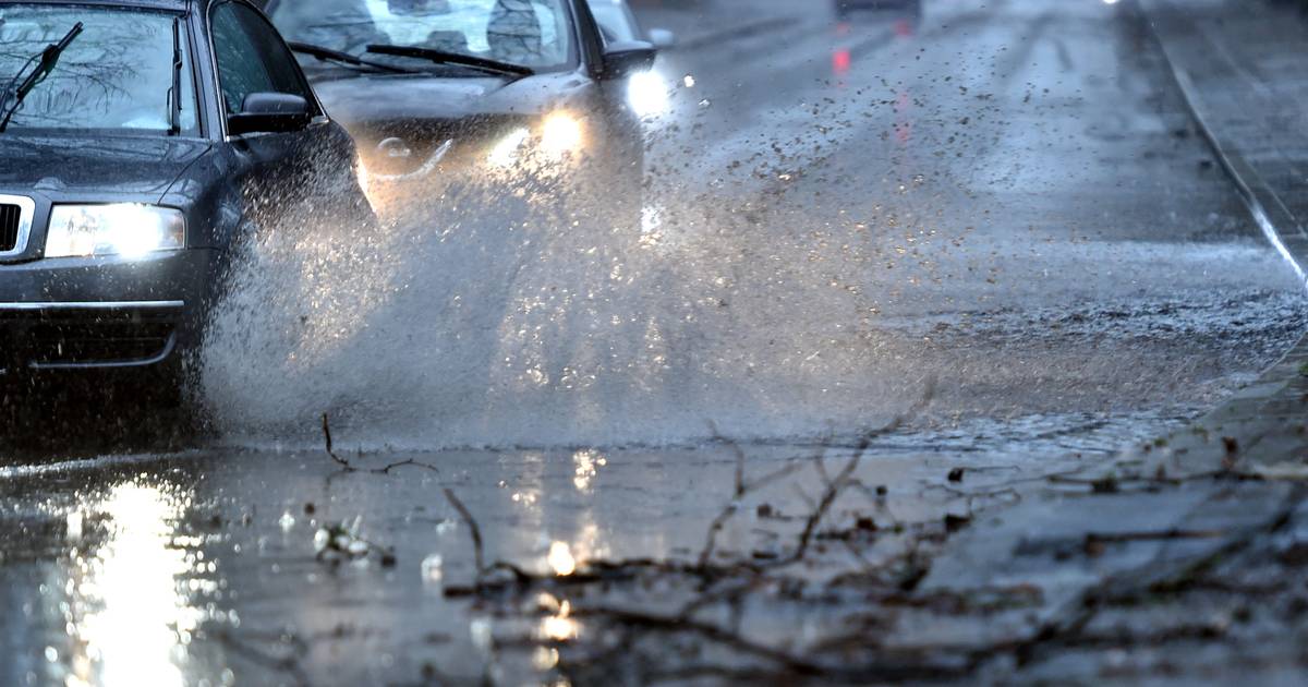
Storm Hendrik brings strong gusts and rain
The German Weather Service warns from Wednesday of some strong gusts of wind in North Rhine-Westphalia.
During the course of Wednesday, “Hendrik” will initially bring rain at temperatures between 17 and 19 degrees, the German Weather Service announced on its website. Especially in the Bergisch there can be stormy gusts during the day.
Thunderstorms are possible on Thursday night and temperatures drop to around 8 degrees.
In the second half of the night, Sturm Hendrik picked up again. The weather experts expect gusts of wind throughout the country, and even heavy gusts of wind are expected in the mountains.
Thunderstorms and squalls continue on Thursday during the day with maximum temperatures between 10 and 16 degrees. The storm slowly subsides in the evening.
 regionalheute.de
Warning against entering the woods: Autumn storm "Hendrik" is reaching the region
After an unusually warm October day, the low "Hendrik" brings cold, storms and rain to the region. Improvement is only in sight at the weekend.
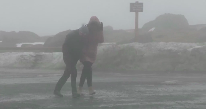
Region. With every hour that goes by, the prognoses intensify: The first real autumn storm is imminent on Thursday. Tomorrow, Wednesday, temperatures of up to 19 degrees will be reached again on the front of storm "Hendrik". The force with which Hendrik pumps Mediterranean air to Central Germany on Wednesday is felt on Thursday in the form of sometimes violent gusts of wind. As early as Wednesday, the state forests are warning in a press release against entering the forests in the Harz Mountains.
The first gusts of wind appear in the Upper Harz on Wednesday. In the higher altitudes these can turn out to be hurricane-like. The first real hurricane gusts appear on the Brocken during the day. "The first autumn storm hits heavily thinned forest stands thinned by bark beetle damage," explains Christian Schulz, Head of Operations at the Clausthal Forestry Office. Schulz continues: "They can collapse in the wind and endanger people." All workers and forest machines will be withdrawn from the forest - Visitors should behave in the same way.
Hurricane and snow potential
In the night of Thursday, the wind speeds continue to increase. In addition, a broad band of rain spreads over the region from the southwest, which, in addition to recurring rain showers , can also bring thunderstorms at certain points . The peak of the gusts of wind is reached between 8 a.m. and 3 p.m. Hurricane-like gusts then occur in Torfhaus at speeds of up to 110 km / h. On the Brocken, hurricanes of up to 120 km / h can even be achieved. Even if it is decreasing, stormy gusts make the Harz unsafe all day even on Friday. On the Brocken, the thermometer falls below freezing point for the first time - it could even snow.
Squalls also in the flatlands
While terms such as "hurricane" are easier to use in mountainous areas than in the plains, the rest of the region also gets to feel the power of Hendrik. With mild temperatures of up to 19 degrees , however, only wind speeds of up to 55 km / h are reached on Wednesday afternoon . Although this is noticeable, it usually does not cause any major damage to healthy trees. After a short period of calm in the night of Thursday, the wind speeds increase again sharply and reach their peak in the early Thursday afternoon . Squalls with speeds between 75 and 85 km / h cover the region over a large area.Individual peaks of up to 100 km / h and thunderstorms cannot be ruled out by the German Weather Service. Since the wind mainly comes from the west-southwest on Thursday, the Mediterranean heat pump also fails - only maximum values of up to 15 degrees are reached in the region.
Stormy weather also on Friday
After a temporary calm and low cloud cover on Friday night, the North Sea air now has the greatest influence on the weather in the region. The maximum values on Friday are only in the single-digit range with up to 9 degrees , in addition there is sometimes longer rain and further stormy gusts around 75 km / h in the afternoon . Only on Saturday will the storm finally come to an end. According to current forecasts, October will no longer reach temperatures above 15 degrees. After all - next weekend we will see the sun more often - despite the lower temperatures - and it will stay dry.


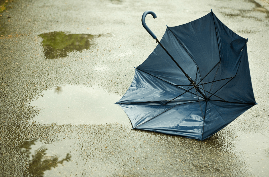
Here in Belgium as well. Since last night, there have been strong winds and a lot of rain.Things also heat up here in Germany:
 www.brusselstimes.com
Gusts of up to 100 km/h are expected across Belgium on Wednesday night, according to the Royal Meteorological Institute (RMI), which has issued a yellow warning for the whole country starting from midnight.
Winds are expected to reach 70 to 90 km/h in most areas, but speeds reaching 100 km/h cannot be ruled out, reports the Belga News Agency.
As a precautionary measure, Brussels Environment has announced the closure of regional green spaces and car parks in the Soignes forest. The City of Liège has also taken measures to restrict public access to parks and cemeteries.
The situation is expected to return to normal by the end of the morning on Thursday.
In the event of storm damage or water damage for which fire brigade assistance is required, the 1722 non-emergency number should be called. The FPS also recommends using the electronic hotline 1722.be, which is considered to be “the most direct way of requesting assistance from the fire brigade in situations where no life is in danger”.
If the situation is life-threatening, 112 should be called.
Very localized but destructive wind phenomena are identified and will be the subject of in-depth investigations to determine their natureWinds and warnings
Electrical something?Very localized but destructive wind phenomena are identified and will be the subject of in-depth investigations to determine their nature
:https://keraunos.org/actualites/fil

 cassiopaea.org
From Session 10 January 2015Q: (L) Okay, next question: When an F5 tornado can form in a matter of minutes, what is the connection with what is going on in 4D? How does it happen? What's the mechanism?
A: Once again you must think in terms of information and electrical charge. The charge on earth is building in several ways and a tornado is an electrical phenomenon similar to ball lightning.
The next is just a possibility, but considering how far the PTB have gone to exercise control, where is the limit to the technology some sectors would employ to achieve their targets? And of course different possibilities are not mutually exclusive; an event could be caused by some of this and a pinch of that. We also do not know if what is employed in one place necessarily creates a reaction in the place it is used. Perhaps the Earth lets go of steam where it is convenient.Q: (L) So, just out of curiosity: a long time ago, you said that 4D war is experienced by us as weather. I'm assuming it's not just weather, but also maybe cometary bombardment could also be a 3rd density manifestation of 4th density war. So my question is, is there any consciousness to these kinds of things... is any of it "directed"?
A: In some cases, yes. In others, just "collateral damage."
Q: (Perceval) For the Air Asia flight, did it involve a massive updraft and then a downdraft as some are claiming?
A: Yes
Q: (Perceval) And what causes that kind of a vortex?
A: Variations of temperature in layers of atmosphere enhanced by variations in charge potential difference.
Q: (Pierre) So it's powerful. You have the electrical factor and the mechanical or thermal factor sometimes working in conjunction.
(Chu) Like a tornado then.
(Chu) Do you want to ask about that weird thing you saw in the pool?
(L) Oh, yeah. What day was it? Was it Wednesday? It was the same day that this Charlie Hebdo thing happened, so that was Wednesday. So I was looking out the window at the guys who...
(Galatea) The mouse is crawling down.
(L) ...at the guys who were removing a stump out in the back yard. I noticed that the pool had swells, and they were big, slow, almost-entire-pool-sized swells. The water was going up and down, up and down, almost straight up and down, in a big way. It was BIG swells like you'd see on big open water long before a storm. I stood there and watched and watched and waited, because usually if the pool is doing something like that, it will calm down after 5 or 10 minutes. I watched it for at least 10 minutes or so, and I went back and looked at it again and it was still doing it 30 minutes later. Honey, you remember?
(Ark) Yes, yes.
(L) It was doing it for a long time, and it didn't stop.
(Ark) It was like, you know, being in resonance with something with frequency of 60 Hz or something like that.
(Perceval) But it didn't splash over the sides?
(L) No splashing, no wavelets. It was almost as if it had oil on top of it to keep it perfectly smooth, what mariners would call “oily swells” I think.
(Pierre) It was a very long wavelength, like 3 or 4 meters.
(L) Yeah, at least. We waited, and I was thinking maybe it was an earthquake or something like that.
(Pierre) Something in the ground?
(L) Yeah, so can you tell me what that was?
A: Activation of inner earth energies in response to events elsewhere. We have noted that your planet responds to activities on the surface. Often this is expressed as heat which results in earthquakes and/or volcanic eruptions. But it can also call forth other types of frequencies. There is another aspect that you should consider: the use of infrasound machines by secret projects to control human emotional states. Such instruments can evoke even more devastating responses from the planet and thereby the solar system.
 www.zerohedge.com
In higher elevations, wet snow across the Sierras could amount to 1-3 feet."An atmospheric river marked as a category 4 or a 5 is capable of producing remarkable rainfall totals over three or more days, likely to exceed 10% to 15% of a typical year's precipitation in some locations," said Marty Ralph, director of the Center for Western Weather and Water Extremes at the University of California San Diego.
 as a category 2 hurricane.