WORLDWIDE EARTHQUAKE REPORT AUGUST 30
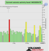
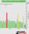
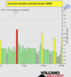
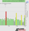
Based on the averages of all earthquakes during the last 24 hours we had a moderate seismic activity level.
See Global seismic activity level chart
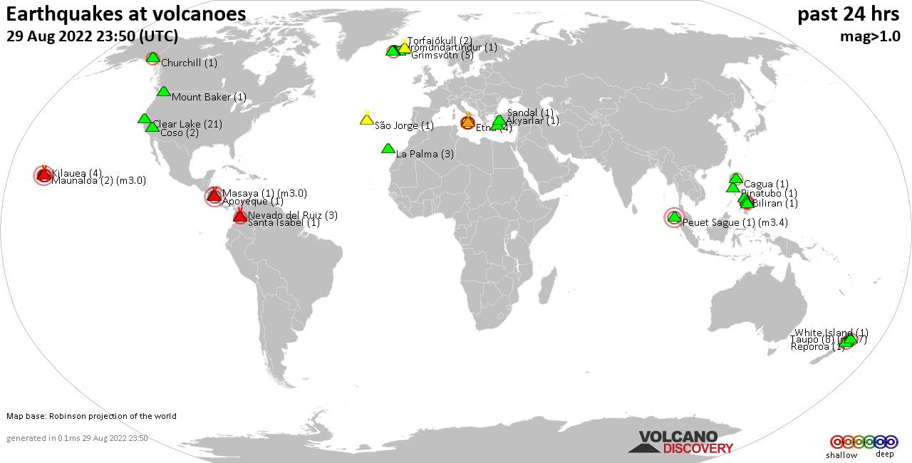
Earthquakes in the past 24 hours
~1 quake above magnitude 6
~ 2 quakes between magnitude 5 and 6
~ 33 quakes between magnitude 4 and 5
~ 95 quakes between magnitude 3 and 4
~ 227 quakes between magnitude 2 and 3
~ 449 quakes below magnitude 2 that people normally don't feel.
~807 quakes past 24 h..(831 earthquakes in the 24 hours prior to this report) Estimated combined seismic energy released: 2.1 x 10¹⁴ joules (57.6 gigawatt hours, equivalent to 49579 tons of TNT or 3.1 atomic bombs!)
Volcanodiscovery earthquake report 24h
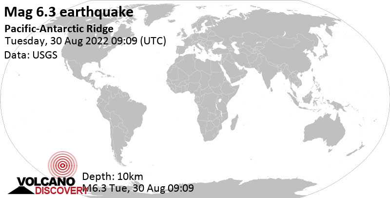
▪︎Strongest earthquake today M6.3 see post #3847
▪︎M 5.5 - Pacific-Antarctic Ridge
2022-08-30 08:00:00 (UTC)
54.484°S 136.205°W
10.0 km depth
USGS earthquake alert
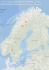
▪︎M 5.3 - Carlsberg Ridge
2022-08-30 13:58:20 (UTC)
4.378°N 62.598°E
10.0 km depth
USGS earthquake alert
When I saw this earthquake I started to compile data because there is a geologist in Mexico who assures that Mexico is the
antipode of Carlsberg Ridge, then he foresees an earthquake of great magnitude, greater than 6 degrees in fact, between September and October of this year.
▪︎Carlsberg Ridge (between the horn of Africa and India) recorded three M4 earthquakes (4.7, 4.6 and 4.8) on August 28.
▪︎On August 30 the precursors began at 00:47 with a 4.7 magnitude earthquake and followed: M4.7 at 05:28:06 UTC, M4.8 at 05:35:58 UTC, M4.9 at 08:36:11 UTC and the M5.3 at 13:58:20 UTC
▪︎A very strong
Carlsberg Ridge Earthquake occurred on Monday,
August 15, 1966 at 10:20 GMT and was magnitude 6.0.
▪︎Coincidentally, on
September 25, 1966 at 06:02 UTC (01:02 a.m. local time) a magnitude
6.0 earthquake was recorded 4.1 km south of San Jose del Pilon, Zirandaro, Guerrero, Mexico,

▪︎On January 21, 2003, the
Colima earthquake was recorded at 02:06:34 UTC in southwestern Mexico. The earthquake reached a magnitude of 7.6.
▪︎Months later, on July 15, 2003, an M7.6 earthquake was recorded at Carlsberg Ridge.
USGS earthquake report
▪︎The geologist mentions another example. On August 28, 1973 at 09:50 UTC the Orizaba Veracruz earthquake occurred with a magnitude of 7.5.
Orizaba Earthquake. There was extensive damage, leaving hundreds dead and widespread devastation, in several cities in Puebla. The death toll was at least 600, with as many as 1,200 dead, and 212 casualties alone in the small Ciudad Serdán. Major cities affected were Ciudad Serdán, Orizaba, Ixtaczoquitlán, Córdoba, Ciudad Mendoza, Zongolica, Rio Blanco, and Acutzingo.
Wikipedia
▪︎The geologist claims that there was an M5.5 earthquake at Carlsberg Ridge that year. Unfortunately I could not find a record of that earthquake on the internet due to the moderate magnitude.
So we will have to wait and see.

 )
) .
. 


 Earthquake and heavy rains in Pakistan