Earthquakes around the world

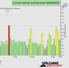
Last week saw 1 M6, a M6.2 in Indonesia.
In the usual area, there was 1 out of 61 earthquakes worldwide equal to or greater than 4.5 and 1548 out of 1908 quakes of all sizes.
Percentage: 81.1%
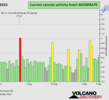
Last week saw 3 M6 earthquakes, with the largest being a M6.9 in the Mid Atlantic Ridge, between Brazil and West Africa.
In the usual area, there were 2 out of 97 earthquakes worldwide equal to or greater than 4.5 and 1705 out of 2102 quakes of all sizes.
Percentage: 81.1% (like last week)
Earthquakes 7 days to September 4th 2022.gif
 
WORLDWIDE EARTHQUAKE REPORT SEPTEMBER 01

Based on the averages of all earthquakes during the last 24 hours we had a high seismic activity level. See Global seismic activity level chart

~1 quake above magnitude 6
~5 quakes between magnitude 5 and 6
~28 quakes between magnitude 4 and 5
~79 quakes between magnitude 3 and 4
~188 quakes between magnitude 2 and 3
~422 quakes below magnitude 2 that people normally don't feel.
~723 quakes past 24 h. Estimated combined seismic energy released: 1.4 x 10¹⁵ joules (401 gigawatt hours, equivalent to 3.5 x 10⁵ tons of TNT or 21.6 atomic bombs!)
Volcanodiscovery earthquake report 24h

▪︎Strongest quake M6.9 - central Mid-Atlantic Ridge
2022-09-04 09:42:18 (UTC)
0.950°S 21.725°W. 10.0 km depth.

▪︎M 5.3 - Hindu Kush region, Afghanistan
2022-09-04 21:57:36 (UTC)
34.675°N 70.737°E. 10.0 km depth
USGS earthquake alert

▪︎M 5.3 - Loyalty Islands, New Caledonia
2022-09-04 20:15:04 (UTC)
21.248°S 168.537°E. 10.0 km depth
USGS earthquake alert

▪︎M 5.3 - Izu Islands, Japan region
2022-09-04 14:58:22 (UTC)
32.366°N 142.473°E. 10.0 km depth
USGS earthquake alert

▪︎ Planetary and lunar geometry preceding last week's strong seismic events.
 

Attachments

  • chrome_screenshot_1662331718040.png
    chrome_screenshot_1662331718040.png
    315.6 KB · Views: 0
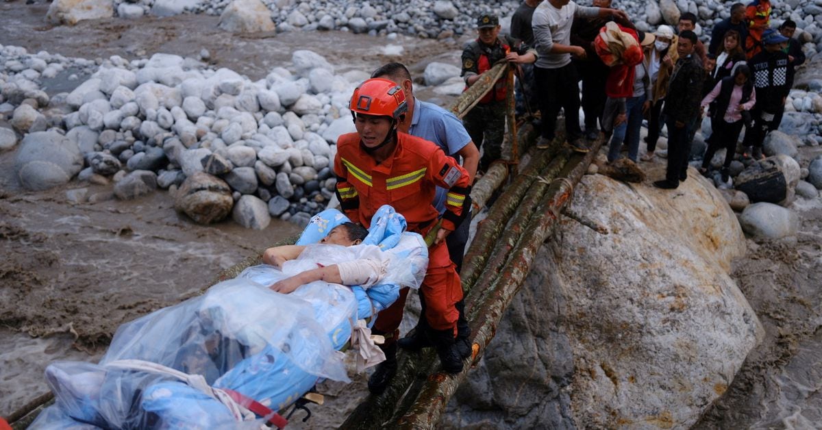
Strong earthquake in China

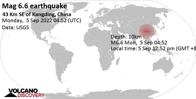
M 6.6 - 43 km SE of Kangding, China
2022-09-05 04:52:19 (UTC)
29.726°N 102.279°E
10.0 km depth
USGS earthquake alert

Estimated energy: 5 x 10¹⁴ joules (139 gigawatt hours, equivalent to 1.2 x 10⁵ tons of TNT or 7.5 atomic bombs!)

A very strong quake struck southwestern China's Sichuan province in Luding county on Monday afternoon at 12.52 p.m. this afternoon. The epicenter of the quake was 44 km (27 mi) SE of the town of Kandin (pop: 100,000), in a mountainous area. There is no clear information yet as to whether it caused fatalities, injuries or damage.

According to the U.S. Geological Survey, the quake had a magnitude of 6.6 and occurred at a shallow depth of 10 kilometers (6 miles), making it potentially a very dangerous quake. The region has been affected by severe heat waves and drought in the past months as well.

Sichuan is among China's most earthquake-prone regions, located at the edge of the Tibetan Plateau where the Indian and Asian tectonic plates meet. Large quakes are common in this area. Two earthquakes earlier this year in June in the same area killed at least four people.
China's deadliest earthquake in recent decades was was the 12 May 2008 mag. 7.9 quake in Sichuan that killed nearly 90,000 people. Its epicenter was at 174 km / 108 mi distance from today's quake.

Data for the same earthquake reported by different agencies​

Info: The more agencies report about the same quake and post similar data, the more confidence you can have in the data. It takes normally up to a few hours until earthquake parameters are calculated with near-optimum precision.
Mag.DepthLocationSource
6.610 km43 Km SE of Kangding, ChinaUSGS
6.510 km6.5 WESTERN SICHUAN, CHINAEMSC
6.610 kmSichuan, ChinaRaspberryShake
6.110 kmChina: Near ChengduRENASS
6.610 kmSichuan, ChinaGFZ
6.710 kmSichuan, ChinaGeoAu
6.420 kmSichuan, China [Land: China]INGV

 
WORLDWIDE EARTHQUAKE REPORT SEPTEMBER 05

Based on the averages of all earthquakes during the last 24 hours we had a high seismic activity level. See Global seismic activity level chart

~3 quakes above magnitude 6
~3 quakes between magnitude 5 and 6
~48 quakes between magnitude 4 and 5
~111 quakes between magnitude 3 and 4
~236 quakes between magnitude 2 and 3
~426 quakes below magnitude 2 that people normally don't feel.
~827 quakes past 24 h. (723 earthquakes in the 24 hours prior to this report) Estimated combined seismic energy released: 7.6 x 10¹⁴ joules (211 gigawatt hours, equivalent to 1.8 x 10⁵ tons of TNT or 11.4 atomic bombs!)

▪︎Strongest earthquake today Mag. 6.6 | 44 km SE of Kandin, Garzê Zangzu Zizhizhou, Sichuan, China - 18 hours ago

M 6.2 - southern East Pacific Rise
Time 2022-09-04 18:57:31 (UTC-05:00)
Location 56.022°S 124.515°W
Depth 10.0 km

▪︎M 5.4 - 53 km NNW of Bandar Abbas, Iran
2022-09-05 09:14:51 (UTC)
27.631°N 56.061°E. 10.0 km depth
USGS earthquake alert

M 5.3 - Kermadec Islands region
2022-09-05 11:19:35 (UTC)
31.834°S 179.177°W. 113.1 km depth
USGS earthquake alert

▪︎M 5.1 - northern Mid-Atlantic Ridge
2022-09-05 13:49:26 (UTC)
52.056°N 30.130°W. 10.0 km depth
USGS earthquake alert

▪︎Earthquake Forecast

Today's lunar peak, that follows on the critical planetary geometry on 3 September, could trigger additional larger seismic activity, potentially reaching magnitude 7.
 

Attachments

  • chrome_screenshot_1662416985880.png
    chrome_screenshot_1662416985880.png
    331.3 KB · Views: 0
Videos from the M6.6 earthquake in China.


China earthquake kills dozens as tremors shake locked-down Chengdu​


At least 46 people have been killed in a strong earthquake that struck south-western China and was felt by millions of people confined to their homes under a strict Covid lockdown in Chengdu.

The 6.6-magnitude quake hit about 26 miles (43km) south-east of the city of Kangding at a depth of about six miles, the US Geological Survey (USGS) said.

Chinese state broadcaster CCTV said that 17 people died in Ya’an city, while 29 deaths were reported in neighbouring Ganzi prefecture.

“Another 16 people were missing and 50 were injured,” CCTV said late on Monday.

Tremors also shook buildings in the Sichuan provincial capital of Chengdu and the nearby city of Chongqing.

 
Strong earthquakes

Very strong earthquake M 6.0 - South Sandwich Islands region
2022-09-06 08:32:40 (UTC)
56.565°S 25.790°W. 10.0 km depth
USGS earthquake alert
Estimated energy: 6.3 x 10¹³ joules (17.5 gigawatt hours, equivalent to 15080 tons of TNT or 0.9 atomic bombs!)

Data for the same earthquake reported by different agencies​

Info: The more agencies report about the same quake and post similar data, the more confidence you can have in the data. It takes normally up to a few hours until earthquake parameters are calculated with near-optimum precision.
Mag.DepthLocationSource
6.010 kmSouth Sandwich Islands RegionUSGS
6.040 kmSOUTH SANDWICH ISLANDS REGIONEMSC
6.010 kmSouth Sandwich Islands RegionRaspberryShake
5.610 kmNear Mar Del PlataRENASS
5.920 kmSouth Georgia & the South Sandwich Is. [Sea]INGV
5.910 kmSouth Sandwich Islands RegionGFZ
5.858 kmSouth Sandwich Islands RegionGeoAu
Volcanodiscovery

▪︎M 5.3 - South Sandwich Islands region
2022-09-06 09:04:53 (UTC)
56.604°S 25.965°W. 17.4 km depth
USGS earthquake alert

▪︎M 5.2 - 23 km WNW of Puerto Morazán, Nicaragua
2022-09-06 07:35:34 (UTC)
12.947°N 87.366°W. 10.0 km depth
USGS earthquake alert
 
WORLDWIDE EARTHQUAKE REPORT SEPTEMBER 06

Based on the averages of all earthquakes during the last 24 hours we had a moderate seismic activity level. See Global seismic activity level chart

~6 quakes above magnitude 5
~30 quakes between magnitude 4 and 5
~103 quakes between magnitude 3 and 4
~219 quakes between magnitude 2 and 3
~470 quakes below magnitude 2 that people normally don't feel.
~828 quakes past 24 h. (827 earthquakes in the 24 hours prior to this report) Estimated combined seismic energy released: 9.6 x 10¹³ joules (26.6 gigawatt hours, equivalent to 22894 tons of TNT or 1.4 atomic bombs!)
Volcanodiscovery earthquake report 24h

▪︎M 6.0 - South Sandwich Islands region was updated to M5.9 this morning.

▪︎M 5.7 - South Sandwich Islands region
2022-09-06 12:14:07 (UTC)
56.492°S 25.700°W. 8.9 km depth
USGS earthquake alert

▪︎M 5.0 - 71 km S of Calama, Chile
2022-09-06 13:14:36 (UTC)
23.097°S 68.955°W. 94.2 km depth
USGS earthquake alert

Update: Thousands evacuated in SW China as quake toll rises to 66​


Chinese firefighters worked in treacherous terrain on Tuesday to help evacuate more than 11,000 people after a magnitude-6.8 quake struck China's mountainous southwestern province of Sichuan.

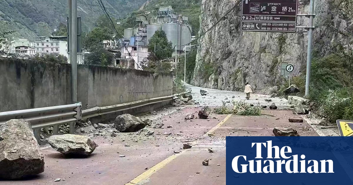
Authorities had identified around 500 potential geological hazards, according to the reports, referring to landslides and collapsed mountain roads.

The death toll from the strongest earthquake to hit China's southwestern Sichuan province since 2017 rose to 66 on Tuesday, though dozens of people were suffering heavy injuries.

On Tuesday, state television reported over 200 people were still stranded in Hailuogou, a popular tourist spot known for its glaciers, verdant forests and soaring peaks. Rescuers were working to reopen roads to reach them.

It also reported that 243 houses had collapsed and 13,010 had been damaged. Four hotels and hundreds of tourist lodgings were also affected.

The quake cut power to several towns, while various highways collapsed and seven small-to-mid-sized hydropower stations suffered damage.

With heavy rains expected over the next three days, experts on Tuesday flagged risks posed by a number of dammed lakes that have formed after the quake.


Attachments

  • chrome_screenshot_1662510437499.png
    chrome_screenshot_1662510437499.png
    348.8 KB · Views: 0
WORLDWIDE EARTHQUAKE REPORT SEPTEMBER 07

Based on the averages of all earthquakes during the last 24 hours we had a moderate seismic activity level. See Global seismic activity level chart

~4 quakes above magnitude 5
~41 quakes between magnitude 4 and 5
~96 quakes between magnitude 3 and 4
~228 quakes between magnitude 2 and 3
~517quakes below magnitude 2 that people normally don't feel.
~886 quakes past 24 h. (828 earthquakes in the 24 hours prior to this report) Estimated combined seismic energy released: 9 x 10¹³ joules (24.9 gigawatt hours, equivalent to 21422 tons of TNT or 1.3 atomic bombs!)
Earthquake report past 24h


▪︎Strongest earthquake today M5.9 - southern East Pacific Rise
2022-09-07 06:07:51 (UTC)
54.418°S 119.414°W. 22.2 km depth
USGS earthquake alert

▪︎M 5.6 - 110 km NW of Bengkulu, Indonesia
2022-09-07 18:09:37 (UTC)
3.196°S 101.471°E. 48.8 km depth
USGS earthquake alert
▪︎M 5.1 - 100 km SE of Gorontalo, Indonesia
2022-09-07 18:11:39 (UTC)
0.015°N 123.798°E. 141.1 km depth
USGS earthquake alert

▪︎It is 5 years since the powerful #earthquake M8.2 in the Gulf of #Tehuantepec, (Mexico) 137 km SW of Pijijiapan #Chiapas at 23:49h on September 7, 2017.
This is how that tragic day dawned that tragic day #Juchitán #Oaxaca.
Credits 🎥 @EberthMunoz
Via @NoeDoroteo

▪︎ Earthquake Forecast: Large seismic activity is less likely to occur. Solar System Geometry Survey

▪︎Strongest earthquakes in the first five days of September
 

Attachments

  • chrome_screenshot_1662593774800.png
    chrome_screenshot_1662593774800.png
    360.5 KB · Views: 0

Update: Thousands evacuated in SW China as quake toll rises to 66​


Chinese firefighters worked in treacherous terrain on Tuesday to help evacuate more than 11,000 people after a magnitude-6.8 quake struck China's mountainous southwestern province of Sichuan.

Authorities had identified around 500 potential geological hazards, according to the reports, referring to landslides and collapsed mountain roads.

The death toll from the strongest earthquake to hit China's southwestern Sichuan province since 2017 rose to 66 on Tuesday, though dozens of people were suffering heavy injuries.

On Tuesday, state television reported over 200 people were still stranded in Hailuogou, a popular tourist spot known for its glaciers, verdant forests and soaring peaks. Rescuers were working to reopen roads to reach them.

It also reported that 243 houses had collapsed and 13,010 had been damaged. Four hotels and hundreds of tourist lodgings were also affected.

The quake cut power to several towns, while various highways collapsed and seven small-to-mid-sized hydropower stations suffered damage.

With heavy rains expected over the next three days, experts on Tuesday flagged risks posed by a number of dammed lakes that have formed after the quake.

8 SEP, 2022
 
Iceland
8 Sep 2022

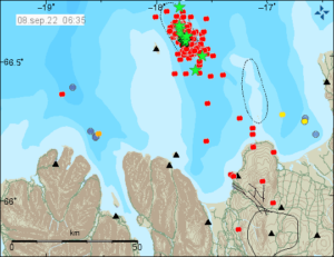
Here i refer to an article via in german language written Vulkane.net, which reported about an earthquake swarm just north of the north coast in Iceland

220908_0635.jpg


Iceland: Earthquake M 4.9
by Marc Szeglat


Date: 08 September 2022 | Time: 04:01:01 UTC | Location: 66.56 ; -17.75 | Depth: 10 km | Mb 4.9

This morning an earthquake of space wave magnitude 4.9 manifested off the north coast of Iceland. The hypocentre was 10 km deep. The epicentre was located 11.7 km east of Grimsey Island. The data comes from IMO. The EMSC calculated the magnitude as 5.0. More than 240 further earthquakes followed, 2 of which were only slightly weaker than the strongest earthquake: they reached Mb 4.8 and Mb 4.3. The earthquakes occurred along the Tjörnes Fracture Zone, which is known for its strong swarm earthquakes. The zone is also home to a submarine volcanic field and previous episodes of strong swarm earthquakes have shown dyke intrusion due to ground uplift. However, the current swarm could also be purely tectonic in nature.

The Tjörnes Fracture Zone is a foliation fault, and connects part of the Mid-Atlantic Ridge to the Kolbeinsey Strain Zone. The Mid-Atlantic Ridge runs through Iceland and is the junction between North America and Europe. Several volcanic systems lie on it, including one in the north of Iceland. This volcanic system is the 30 km long Þeistareykjabunga system. It flows into the Öxarfjörður Fjord. The last eruptions of Þeistareykjabunga occurred a good 2400 years ago.

The current earthquakes could be clearly felt in the north of Iceland. Interestingly, there is a perception report at the EMSC that comes from a ship. They claim to have felt the earthquake strongly on board. It was 49 km from the epicentre. The swarm quake is not over yet and as I write these lines, more tremors are coming. I will keep you informed of further developments. By the way, under Reykjanes there have only been isolated earthquakes since yesterday. IMO detected 82 tremors there in the last 2 days.


END OF ARTICLE
 
WORLDWIDE EARTHQUAKE REPORT SEPTEMBER 08

Based on the averages of all earthquakes during the last 24 hours we had a moderate seismic activity level. See Global seismic activity level chart

~7 quakes above magnitude 5
~37 quakes between magnitude 4 and 5
~142 quakes between magnitude 3 and 4
~546 quakes between magnitude 2 and 3
~1218 quakes below magnitude 2 that people normally don't feel.
~1950 quakes past 24 h. (886 earthquakes in the 24 hours prior to this report) Estimated combined seismic energy released: 6.9 x 10¹³ joules (19.1 gigawatt hours, equivalent to 16398 tons of TNT or 1 atomic bombs!)
Earthquake report past 24h

M 5.5 - 46 km SW of Lixoúri, Greece
2022-09-08 07:36:24 (UTC)
37.903°N 20.066°E. 13.2 km depth
USGS earthquake alert

M 5.4 - 24 km ENE of Atico, Peru
2022-09-08 21:59:41 (UTC)
16.142°S 73.406°W. 49.1 km depth
USGS earthquake alert

M 5.4 - south of the Fiji Islands
2022-09-08 15:05:34 (UTC)
25.258°S 179.702°E. 495.2 km depth
USGS earthquake alert

M 5.1 - Nias region, Indonesia
2022-09-08 07:58:52 (UTC)
1.322°N 96.790°E. 10.0 km depth
USGS earthquake alert

▪︎ Earthquake Forecast: A lunar peak on 8 September could result in some seismic increase in the next two days, potentially reaching low to mid 6 magnitude.

MAGNITUDE PROBABILITY

updated 8 September, 11:50 UTC

M 6.0-6.4M 6.5-6.9M 7.0+
60%50%40%
 

Attachments

  • chrome_screenshot_1662676895304.png
    chrome_screenshot_1662676895304.png
    363.1 KB · Views: 1
WORLDWIDE EARTHQUAKE REPORT SEPTEMBER 09

Based on the averages of all earthquakes during the last 24 hours we had a moderate seismic activity level. See Global seismic activity level chart

~2 quake above magnitude 6
~8 quakes between magnitude 5 and 6
~38 quakes between magnitude 4 and 5
~153 quakes between magnitude 3 and 4
~609 quakes between magnitude 2 and
~1445 quakes below magnitude 2 that people normally don't feel.
~2255 quakes past 24 h. (1950 earthquakes in the 24 hours prior to this report) Estimated combined seismic energy released: 2.5 x 10¹⁴ joules (69.2 gigawatt hours, equivalent to 59520 tons of TNT or 3.7 atomic bombs!)
Earthquake report past 24h

▪︎Biak, Indonesia has been hit by 3 strong earthquakes.

M 6.2 - 263 km ESE of Biak, Indonesia
2022-09-09 23:31:47 (UTC)
2.246°S 138.201°E. 18.0 km depth
USGS earthquake alert

M 5.9 - 263 km ESE of Biak, Indonesia
2022-09-09 23:44:10 (UTC)
2.240°S 138.200°E. 19.1 km depth
USGS earthquake alert

M 6.2 - 261 km ESE of Biak, Indonesia
2022-09-10 00:05:12 (UTC)
2.221°S 138.196°E. 15.7 km depth
USGS earthquake alert

▪︎M 5.2 - 142 km NNW of Okha, Russia
2022-09-09 09:01:53 (UTC)
54.836°N 142.435°E. 10.0 km depth
USGS earthquake alert

M 5.2 - 27 km SW of Tari, Papua New Guinea
2022-09-09 13:12:05 (UTC)
6.034°S 142.786°E. 1.6 km depth
USGS earthquake alert
 

Attachments

  • chrome_screenshot_1662771492375.png
    chrome_screenshot_1662771492375.png
    358.9 KB · Views: 0
M 4.8 Earthquake near Mulhouse. It is not so powerful in absolute value but for French standards it's noteworthy. Interesting coincidence this quake happened the same day (September 10th) as the new demonstrations of Yellow Vests.

"ALERT - Earthquake of magnitude 4.8 near Mulhouse , strongly felt a few minutes ago in Alsace and Switzerland (French Seismological Central Office)."


M 6.0 - 175 km WSW of Pariaman, Indonesia​

Estimated energy: 1.8 x 10¹⁴ joules (49.4 gigawatt hours, equivalent to 42502 tons of TNT or 2.7 atomic bombs!

Data for the same earthquake reported by different agencies​

Info: The more agencies report about the same quake and post similar data, the more confidence you can have in the data. It takes normally up to a few hours until earthquake parameters are calculated with near-optimum precision.
Mag.DepthLocationSource
6.310 kmSouthern Sumatra, IndonesiaGFZ
6.120 kmKEP. MENTAWAI REGION, INDONESIAEMSC
6.210 kmSouthern Sumatra, IndonesiaRaspberryShake
 
Back
Top Bottom