angelburst29
The Living Force
A strong earthquake has hit a region of the densely-populated Lombok island in Indonesia, home to over 3 million. At least 10 people died as a result of the quake.
29.07.2018 - Strong 6.4 Magnitude Quake Rocks Tourist Island in Indonesia - USGS (Photos)
Strong 6.4 Magnitude Quake Rocks Tourist Island in Indonesia - USGS
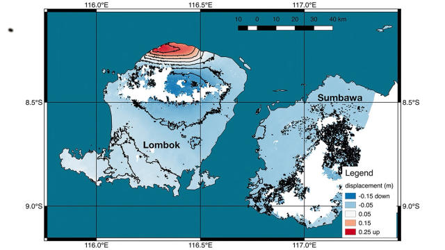
A strong 6.4-magnitude earthquake has hit the Lombok region in Indonesia, according to the United States Geological Survey (USGS).
Indonesian authority reported that at least three people died as a result of the earthquake. The death toll was updated to 10 nearly an hour later. There were also several reports on social media about structures damaged by the quake.
The epicenter of the quake was reportedly some 80 miles (128.75 km) northeast of the island's main city of Mataram at a depth of some 360 miles.
The earthquakes above 6.0 magnitude are considered strong and can be felt hundreds of miles/kilometers from the epicenter and cause damage to structures in populated areas.
29.07.2018 - Strong 6.4 Magnitude Quake Rocks Tourist Island in Indonesia - USGS (Photos)
Strong 6.4 Magnitude Quake Rocks Tourist Island in Indonesia - USGS
A strong 6.4-magnitude earthquake has hit the Lombok region in Indonesia, according to the United States Geological Survey (USGS).
Indonesian authority reported that at least three people died as a result of the earthquake. The death toll was updated to 10 nearly an hour later. There were also several reports on social media about structures damaged by the quake.
The epicenter of the quake was reportedly some 80 miles (128.75 km) northeast of the island's main city of Mataram at a depth of some 360 miles.
The earthquakes above 6.0 magnitude are considered strong and can be felt hundreds of miles/kilometers from the epicenter and cause damage to structures in populated areas.
 the
the  not activate the seismic alert?
  Read the explanation: