Earthquakes around the world

Very strong mag. 6.0 Earthquake - Coral Sea, 143 km southeast of Uki Ni Massi Island, Solomon Islands

Feb 21, 2026 16:42:07 UTC - 54 minutes ago
Sunday, Feb 22, 2026, at 03:42 am (GMT +11)
confirmed (manually revised)
6.0
10 km
11.3339°S / 162.3952°E
sb.png
Solomon Islands
11.3339°N / 17.605°W
gw.png
Guinea-Bissau
150 seismic stations
VI Strong shaking near epicenter
0 reports
USGS (United States Geological Survey)
Overcast Clouds
04n.png
28.1°C (83 F), humidity: 78%, wind: 3 m/s (6 kts) from NNE
6.3 x 10¹³ joules (17.5 gigawatt hours, equivalent to 15080 tons of TNT or 0.9 atomic bombs!) | equivalent to ONE quake of magnitude
6.0​
| about seismic energy
[td]Date & time[/td] [td]Local time at epicenter[/td] [td]Status[/td] [td]Magnitude[/td] [td]Depth[/td] [td]Epicenter latitude / longitude[/td] [td]Seismic antipode[/td] [td]Quality[/td] [td]Shaking intensity[/td] [td]Felt[/td] [td]Primary data source[/td] [td]Weather at epicenter at time of quake[/td] [td]Estimated seismic energy released[/td]
 
WORLDWIDE EARTHQUAKE REPORT FEBRUARY 21, 2026

A very strong magnitude 6.0 earthquake occurred in the Coral Sea near the coast of Solomon Islands.​

M 6.0 - 110 km SSE of Kirakira, Solomon Islands
2026-02-21 16:42:07 (UTC)
11.334°S 162.395°E. 10.0 km depth
USGS earthquake alert
chrome_screenshot_21 feb. 2026 11_34_27 a. m. CST.png


Before this earthquake, seismic activity was at low levels with one strong earthquake in Papua New Guinea (M5.7)

The M6.0 earthquake occurred after lunar geometries involving Jupiter, Uranus, and Neptune.
2026-02-14-overview.png
 

Very strong mag. 6.0 Earthquake - South Pacific Ocean, 295 km south of Matuku Island, Eastern, Fiji

Feb 22, 2026 07:43:26 UTC - 1 hour 9 minutes ago
Sunday, Feb 22, 2026, at 07:43 pm (GMT +12)
confirmed (manually revised)
6.0
654 km
21.7999°S / 179.5487°E
fj.png
Fiji
21.7999°N / 0.451°W
ml.png
Mali
68 seismic stations
II Very weak shaking
1 report
USGS (United States Geological Survey)
Broken Clouds
04n.png
27.1°C (81 F), humidity: 75%, wind: 7 m/s (13 kts) from SE
6.3 x 10¹³ joules (17.5 gigawatt hours, equivalent to 15080 tons of TNT or 0.9 atomic bombs!) | equivalent to ONE quake of magnitude
6.0​
| about seismic energy
[td]Date & time[/td] [td]Local time at epicenter[/td] [td]Status[/td] [td]Magnitude[/td] [td]Depth[/td] [td]Epicenter latitude / longitude[/td] [td]Seismic antipode[/td] [td]Quality[/td] [td]Shaking intensity[/td] [td]Felt[/td] [td]Primary data source[/td] [td]Weather at epicenter at time of quake[/td] [td]Estimated seismic energy released[/td]
 
WORLDWIDE EARTHQUAKE REPORT FEBRUARY 22, 2026

A very strong magnitude 6.0 earthquake occurred in the South Pacific Ocean 290 km (180 mi) from Fiji. Second M6.0 earthquake in less than 24 hours​

M 6.0 - south of the Fiji Islands
2026-02-22 07:43:26 (UTC)
21.800°S 179.549°E. 653.8 km depth
USGS earthquake alert
chrome_screenshot_22 feb. 2026 5_51_16 a. m. CST.png

While earthquakes in the Fiji region often occur deep (~500km), this event occurred at a noteworthy depth of ~654km. They don't occur much deeper than this. Frank Hoogerbeets
The clustering of stronger tremors is still ongoing with two additional events (M 5.8, M 6.0) in the last hour. Frank Hoogerbeets

In the last 24 hours. (Note that the majority of M≥5.0 earthquakes have occurred in the southwestern Pacific)​

Balleny Islands region (M5.6)
Vanuatu (M5.1)
Barranca Perú (M5.0)
Kuril Islands (M5.8)
South of Fiji Islands (Aftershock M5.3)
Houma Tonga (M5.4)
Namuac Philippines (M5.1)

Tomorrow (Feb 23) a critical planetary geometry involving Venus and Neptune will occur, along with two lunar geometries involving Uranus and Mars.

2026-02-14-overview.png


As of now, the SSGEOS forecast calling for an 80% chance of M5.5 to M6.4 events has been met. Since January 2, there has not been an earthquake exceeding magnitude 6.5 (the M6.5 quake in Mexico on January 2).
 

Very strong mag. 6.5 Earthquake - 58 km southeast of Loei, Changwat Loei, Thailand

Feb 22, 2026 17:07:41 UTC - 59 minutes ago
Monday, Feb 23, 2026, at 12:07 am (Asia/Bangkok GMT +7)
unconfirmed (uncertain whether an earthquake with these data happened)
6.5
10 km
17.03°N / 101.98°E
th.png
Amphoe Pha Khao, Changwat Loei, Thailand
Also near:
la.png
Lao People's Democratic Republic 94 km (58 mi) away
17.03°S / 78.02°W
VII Very strong shaking near epicenter
1 report
GFZ (German Research Centre for Geosciences)
Scattered Clouds
03n.png
26°C (79 F), humidity: 61%, wind: 1 m/s (2 kts) from WSW
3.5 x 10¹⁴ joules (98.6 gigawatt hours, equivalent to 84802 tons of TNT or 5.3 atomic bombs!) | equivalent to ONE quake of magnitude
6.5​
| about seismic energy
[td]Date & time[/td] [td]Local time at epicenter[/td] [td]Status[/td] [td]Magnitude[/td] [td]Depth[/td] [td]Epicenter latitude / longitude[/td] [td]Seismic antipode[/td] [td]Shaking intensity[/td] [td]Felt[/td] [td]Primary data source[/td] [td]Weather at epicenter at time of quake[/td] [td]Estimated seismic energy released[/td]
 
Wa this a ghost earthquake ?

M6.5... unconfirmed (uncertain whether an earthquake with these data happened)
A very strong magnitude 6.5 earthquake hit 58 km (36 mi) away from Loei, Changwat Loei, Thailand Volcanodiscovery

The USGS does not recognize this earthquake in Thailand, and the only seismological agency that had reported it was the German Research Centre for Geosciences (GFZ), but it later stated that it was an error.​
A GFZ spokesperson confirmed that the agency was no longer reporting a quake in Thailand and was checking whether the initial report was "a glitch". The Thai meteorological service said there was no quake with an epicenter inside Thailand. Reuters

● New earthquake in Iran

A moderate magnitude 4.2 earthquake hit 56 km (35 mi) away from Mohr, Fars, Iran. This adds to the series of earthquakes that have occurred recently in the region of Iran. Likely it is an aftershock of the N5.2 earthquake on February 02.

M 4.2 - 55 km SE of Mohr, Iran
2026-02-22 19:11:25 (UTC)
27.176°N 53.253°E. 10.0 km depth
USGS earthquake alert
Screenshot_20260214-012354_Chrome.jpg

 
WORLDWIDE EARTHQUAKE REPORT FEBRUARY 23, 2026

Low levels of seismic activity in the last 24 hours. Only two M≥5.0 earthquakes, one in Tonga (M5.0) and an Aftershock M5.5 of the M6.1 earthquake in Alaska.

During the observation period (February 14 to 23), five M6+ earthquakes were recorded (representing an above-average number of two per month) and one M7.1 earthquake,

Frank Hoogerbeets points out in this video that it would be very easy to say that the Earth-Saturn-Neptune alignment on February 20 was the main cause of this M7.1, but there is something more interesting.​
Statistically, if we look at all the Earth-Saturn-Neptune alignments that occurred since 1900, we see, from 1917 to 2026, we see these events here, 1952, 1953, 1989 and 2026. What stands out here is 1917 with three magnitude 7 earthquakes. Very interesting, a major cluster of large earthquakes. But overall if we look at all the other cases we see that seismic activity really did not reach, almost didn't reach 6.5. Only in 1989 a 6.5, but all the other cases most of the time it stayed below 6.5, which is statistically not really significant. So 1917 stands out with three magnitude 7 earthquakes and 2026 now with a magnitude 7.1 also stands out​

What characterized the Earth, Saturn, Neptune alignment of 1917 was the presence of three alignments converging over a period of two days: Venus, Mars, Jupiter in one, Venus, Mercury, Sun in another, and Mercury, Earth, Uranus in the third.​
Several alignments converging on the 28th, 29th, very tight, very unique, very rare. And it resulted in rare seismic activity. Three magnitude 7 earthquakes within three days, that is pretty rare, that is quite exceptional.​

If we take a look at the graph, we can see significant seismic activity between February 19 and 23. We had several planetary geometries involving Venus, Mercury, Uranus in one, the aforementioned Earth, Saturn, Neptune, and the Sun, Venus, Neptune. On the other hand, there were also lunar geometries involving the outer planets: Saturn, Neptune, Jupiter, and Uranus.​
So quite a seismic increase. It reached 7.1, but not just because of Earth in alignment with Saturn and Neptune. There was more going on. It was Venus in a right angle with Mercury and Uranus converging with a lunar peak, because we see that peak right there within the green peak, which is the moon in alignment with Saturn and Neptune at the same time​

2026-02-14-overview.png


The magnitude 7.1 earthquake was the first of that magnitude this year. It was also the first event of such magnitude to occur in Malaysia.
M 7.1 - 55 km NNW of Kota Belud, Malaysia
2026-02-22 16:57:46 (UTC)
6.829°N 116.264°E. 619.8 km depth
USGS earthquake alert
Strongest in 126 years

The earthquake was the strongest to hit this part of Malaysia since at least the beginning of the previous century (our records start in 1900). No other quake of equal or greater strength had occurred near the present epicenter since then. Volcanodiscovery

Until this M7.1 earthquake, there had only been one M6.1, and that was 75 years ago.

M 6.1 - 10 km W of Kudat, Malaysia
1951-06-02 06:47:56 (UTC)
6.878°N 116.727°E. 15.0 km depth
USGS earthquake alert

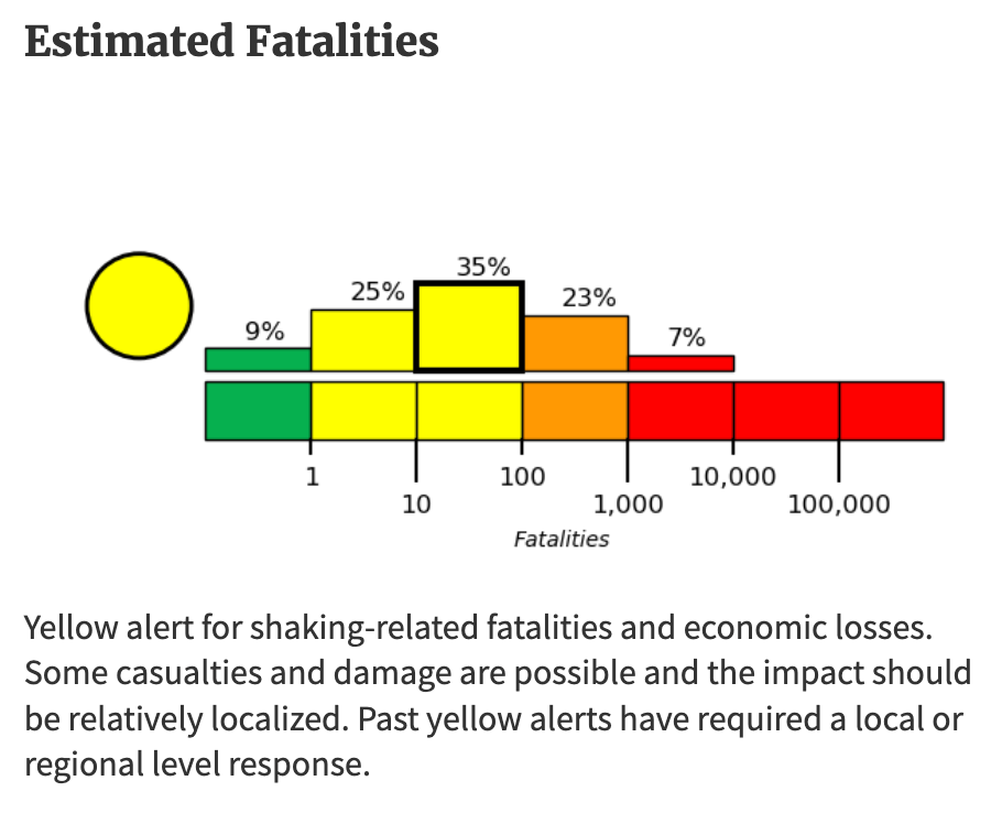
It should be noted that this M7.1 did not cause significant damage or casualties for one main reason: its extreme depth, almost 620 km (385 miles) Deep earthquakes (generally >300 km) release a lot of energy (which is why the magnitude is high), but the seismic waves attenuate and disperse much more as they travel toward the surface.

● SSGEOS Earthquake forecast updated February 23, 15:22 UTC
EARTHQUAKE WARNING

A convergence of planetary and lunar geometry on 23-24 February will likely trigger a burst of stronger (M≥5.5) earthquakes around the 24th, potentially peaking high 6 to 7 magnitude.

The positions of Mars, Jupiter and Uranus combined will probably cause stronger seismic activity above average until at least 4 March.​

Observation period from February 23 to March 4
2026-02-23-overview.png


Seven planetary geometries/alignments and several lunar geometries involving Jupiter, Uranus, and Mars will occur during this period.
We're probably going to see a seismic response, the grouping of stronger earthquakes on the 27th, later on the 27th into the 28th. We usually see that burst of stronger earthquakes following the lunar peak or the geometric peak, like within 24 hours following that peak. So be on extra alert there as well in this time-frame. later on 27th, 28th. The Venus, Mercury, Earth alignment, that's really a critical one, especially with the convergence with lunar geometry on the 27th. And there is a slight possibility of a larger seismic event around the 1st of March, 28th or 1st, near the time of that convergence. And in a really worst case scenario that could really go into the eight magnitude range, but that's a really worst case scenario.​

The full moon (March 2-4) in alignment with Jupiter, Uranus, and Mars will be a critical aspect.
So it's going to be pretty crowded here from the second to the fourth. A huge convergence. We can basically see this as one convergence of planetary and lunar geometry. Really, really critical because this all happens around the time of the full Moon.​
So if we consider this convergence from the 2nd to the 4th, we're probably going to see the burst of stronger earthquakes on the 2nd already. And around the time of full Moon and those days following the full Moon, we can see an obvious seismic response well into the 6 magnitude range. There could be a magnitude 7 in there. And in a worst case scenario, there could be a magnitude 8 around the fifth.​

 
Back
Top Bottom