Earthquakes around the world

Magnitude 6.1 Earthquake Rocks Indonesia's Bali - EMSC
16.07.2019

A powerful magnitude 6.1 earthquake hit the southern part of the Indonesian island of Bali, the European Mediterranean Seismological Center (EMSC) reported.

The quake was registered at 8:18 a.m. local time on Tuesday. No casualties or damages have been reported.

The quake's epicentre was 102 km southwest of Denpasar in Bali and was 100 km deep, according to the EMSC.

According to BNO News, citing Indonesia’s seismological agency BMKG, there was no threat of a tsunami.


Indonesia is part of the so-called Ring of Fire, defining most the Pacific Ocean coastline in the Earth's northern hemisphere, where many of the most active tectonic plates are located.
 
4.3 magnitude earthquake centered near Blackhawk felt throughout Bay Area
Jul 16 2019 02:25PM PDT
BLACKHAWK, Calif. (KTVU) - A 4.3 magnitude earthquake shook Contra Costa County at 1:11 p.m. on Tuesday afternoon.
The earthquake's epicenter was about 7.5 miles east of Blackhawk near the Los Vaqueros Reservoir according to the USGS.
https://www.google.fr/maps/place/Bl...00eee0b55c70c!8m2!3d37.8182488!4d-121.9074859
The earthquake was initially reported as a 4.4 magnitude, but was then downgraded to a 4.2. A few minutes later the USGS said it was a 4.3 magnitude.

Many people reported feeling a strong jolt throughout the East Bay and as far as San Francisco and San Mateo County.
https://www.google.fr/maps/place/Bl...00eee0b55c70c!8m2!3d37.8182488!4d-121.9074859
"Felt it in San Mateo. On the 10th floor of a 12-story building," Dana Zuccarello wrote on KTVU's Facebook page. "We swayed for quite a few seconds. Was wondering if it was going to stop or get worse."
https://www.google.fr/maps/place/Bl...00eee0b55c70c!8m2!3d37.8182488!4d-121.9074859
"I felt a little sway in SF, but initially thought it was the construction going on next door," wrote Julie Tran Vong.
https://www.google.fr/maps/place/Bl...00eee0b55c70c!8m2!3d37.8182488!4d-121.9074859
The USGS reported a second earthquake with a preliminary magnitude of 3.5 struck at 1:28 p.m.
https://www.google.fr/maps/place/Bl...00eee0b55c70c!8m2!3d37.8182488!4d-121.9074859
"San Ramon just over the hill from Blackhawk felt a nice roll and the aftershock was a tad softer," said Dana Fisher.
There have been no reports of injuries or damage.
https://www.google.fr/maps/place/Bl...00eee0b55c70c!8m2!3d37.8182488!4d-121.9074859
3.5 magnitude earthquake shakes Morgan Hill

Posted Jul 15 2019 01:57PM PDT
MORGAN HILL, Calif. - An earthquake with a preliminary magnitude of 3.5 shook the South Bay Monday afternoon.
The earthquake was reported by the USGS at 1:46 p.m. centered about 10 miles north of Morgan Hill.
https://www.google.fr/maps/place/Bl...00eee0b55c70c!8m2!3d37.8182488!4d-121.9074859
People in the San Jose area reported that they felt the shaking.
https://www.google.fr/maps/place/Bl...00eee0b55c70c!8m2!3d37.8182488!4d-121.9074859
So far there have been no reports of injuries or damage.[/QUOTE]
https://www.google.fr/maps/place/Bl...00eee0b55c70c!8m2!3d37.8182488!4d-121.9074859

https://www.google.fr/maps/place/Bl...00eee0b55c70c!8m2!3d37.8182488!4d-121.9074859
 

07de8d13ff1d0b0fa452ce43a8743e25.png

cf7b0d80f190d7f929ce73cace155774.png


Testimonies
 
Dutchsinse has a theory about what causes the cluster of EQs at Ridgecrest. See for yourself between 36 and 41 min into this: dutch 15-7-2019

Essentially the theory is that there is a correlation between historic oil pumping operations (which have caused pressure in the form of subsidence to spread south east) and the 6.4M, 7.1M and 10,000 smaller earthquakes experienced in the Searles Valley area earlier this month.

Excessive oil pumping may have TRIPLED the risk of earthquakes in Los Angeles during the early 1900s, report reveals
It’s no secret that Los Angeles sits upon a seismically active stretch of land.

But, new research suggests human activity in the region may have made things much, much worse.

A new investigation into LA’s oil pumping history suggests the activity may have been responsible for as many as half of the mid-sized earthquakes that hit the region in the early 20th century, according to the LA Times.

‘The LA Basin could be a generally safer place for natural earthquakes than what we’ve estimated,’ lead author Susan Hough, a geophysicist at the US Geological Survey in Pasadena, told the LA Times.

While earthquake activity for moderate tremors spiked between 1935 and 1944, with about one magnitude 4.4 to 5.1 quake every two years, this rate dropped significantly after 1945.

In a report published in the American Geophysical Union’s Journal of Geophysical Research: Solid Earth at the end of last year, researchers re-examined historical data on earthquake damage in the LA Basin.

Building off of this information, they were able to refine earthquake locations identified by early sensors that began monitoring the region in 1932.

According to the researchers, many of the quakes during the time took place near active oil fields.

‘All these little earthquakes happened in the 1930s,’ said Roger Bilham, a geologist at the University of Colorado Boulder and an author of the study, said when at the time it was published.

‘It looked like the LA region was very active seismically, and of course it is quite active, but if you throw away those earthquakes induced by oil you come up with a lower rate of seismicity.’

Prior to the 1950s, oil companies were readily sinking wells and drilling deep into active faults to pull oil from the ground, the researchers say.

And, earthquakes often followed within a few months of well expansion below 1.9 miles.

In the late 1950s, oil companies began using water-flooding wells to recover oil, which balanced out the volume and reduced quake activity.

As the researchers explain, though, oil pumping didn’t necessarily make earthquakes come out of thin air.

Instead, they simply sped up a process that was already underway.

‘These earthquakes that we modelled probably would have happened in the next few hundred years anyway.

‘If an earthquake’s about to go, it doesn’t take much to make it happen sooner.’

Between 1935 and 1944, LA experienced six earthquakes and two aftershocks measuring between magnitude 4.4 and 5.1.

After 1945, the rate dropped to just one every seven years.

‘It turns out it would be almost impossible for the things they were doing in the 1930s not to produce earthquakes,’ Bilham said.

‘In California, they were sucking out the oil so fast they were setting up these giant stresses near the oil fields, forces enough to break rock.

‘And we know that they did break the rock because they produced earthquakes in the oil fields that severed the pipes.’


In more recent times there has been a link between fracking and earthquakes:


When we add the slowdown of Earth's rotation into the mix there is going to be a whole lot more shaking going on!


4.3 Earthquake Bay area of California... Moderate quakes continue near Ridgecrest, Ca
TheEarthMaster Published on Jul 17, 2019 / 23:16

Run Time: / 23:03 Mason Exploring
Published on Jul 6, 2019
(HD)-This is a tutorial Map of the area and birds eye view from someone who has explored out there.

This is a map explanation of the surrounding land marks,and other earthquakes in same general area. I'll show you Lockheed Northrop Edwards , Airforce base, Charles Manson Barker Ranch , Trona, Randsburg Acton, 1872 Earthquake,

China Lake
I wanted to show a view from google earth along with my videos of the Ridgecrest, Trona, Los angeles area of earthquakes to give you a better understanding of the citys and towns.

Conspiracy ? Map? Tutorial? Follow thru as I guide you thru the air to show locations and birds eye view of southern California Earthquakes... and forgotten history
 
Last edited:
https://actualidad.rt.com/actualidad/321517-razon-microsismos-ciudad-mexico said:
Why micro-sisms in Mexico City are only perceptible in certain areas

Two new earthquakes, magnitude 2.2 and 1.8, were recorded this Thursday afternoon in the mayor's office Alvaro Obregon, west of Mexico City. With them, there are 
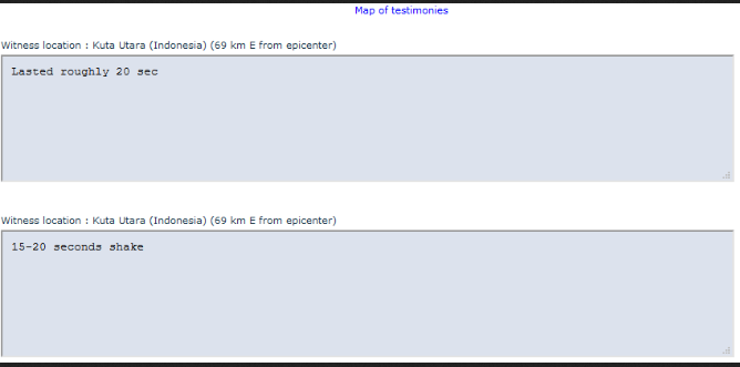
19 microsisms that since last July 12 have been perceived in some parts of the Mexican capital, with emphasis on the aforementioned demarcation, in addition to that of Miguel Hidalgo.

Until this Wednesday, there was still speculation as to whether the causes of the microsisms were geological faults, the sinking of the Valley of Mexico or earthquakes on the coast.

This Thursday, Guillermo Ayala, director of early warnings of the Secretariat of Integrated Risk Management and Civil Protection (SGIRPC) of Mexico City, clarified that they are due to a bordering geological fault. "It is in the middle of the two mayor's municipalities, which is why it is perceived indistinctly from one side and the other. They are very brief shakes, but they have strength and are perceptible," he concluded in a televised interview.

In the Mexico Basin, where the State of Mexico, Mexico City, Hidalgo, Tlaxcala and Puebla, there are at least six faults: those of Chiquihuite, Santa Catarina, Santa Fe, Ayotuzco, Tenango and La Pera.

The Santa Fe fault is located in the west of Mexico City and is the closest to that of the earthquakes that have been recorded since July 12. "It is a displacement of a geological fault and with it can present something known as a '
swarm'," Ayala said.

The 'swarms' are seismic sequences and in Mexico City -referred the expert- have been presented in different moments of the years 1974, 1981 and 1984. For this reason, he warned, more micro-sysms could be appearing in the Mexican capital.


Since last Friday, the head of Analysis of the National Seismological Service (SSN), Victor Hugo Espindola Castro, had advanced that the earthquakes could be associated "with the great complex system of faults that exist in Mexico City," he said in an interview with Notimex, the news agency of the Mexican state.

The Local Government's Explanation
After a meeting with experts, the head of government of Mexico City, Claudia Sheibaum, explained that the microsisms, with epicenter in Álvaro Obregón and to a lesser extent Miguel Hidalgo, are the product of an active geological fault that is located along a volcanic strip between the states of Jalisco, 500 kilometers from the Mexican capital, and Veracruz, 400 kilometers.

Also, these movements of failures, he said, could have been generated as a result of heavy rains in recent weeks in the area.

Sheinbaum responded in passing to accusations from neighbours that the seismicity had been the result of works to extend Line 12 of the capital's Metro, or the extraction of water from aquifers. "These microsisms have occurred previously in the city, which does not mean that something will not be done, but it is important to clarify that they are not due to the work of Line 12, to the increase in construction in the city that occurred in previous years, nor to the extraction of water from the aquifer, but to geological faults," he said.


Why the seismic alert is not activated
According to a special report issued by the SSN, although the magnitudes of the earthquakes recorded are low, they are perceptible in some areas due to the proximity of the epicenter and its shallow depth of two to three kilometers.

The report points out that seismic activity in the Mexico Basin is usually few in number and of low magnitude; however, several earthquakes are recorded each year as a result of the activation of geological faults that already exist in the subsoil.

Delfino Hernández, a specialist in geological risks at the Autonomous Metropolitan University (UAM), explained to local media that the faults in Álvaro Obregón and Miguel Hidalgo are apparently hidden, but there comes a time when they give way and the blocks move, either forwards, backwards, downwards or upwards.

Seismic alerts, placed at various points in Mexico City, are not useful in these cases, because the micro-systems are immediate and there is no margin for reaction, said Hernandez.

A 45-year phenomenon
According to data from the National Seismological Service, the incidence of earthquakes with epicenter in the Mexican capital is a phenomenon that has occurred for 45 years, so that to date 243 low-intensity tremors have been recorded, the largest with intensity of 4.4.

In its report, the SSN points out that between 1998 and 2013 the municipalities with the most records were Tláhuac, Iztacalco and Milpa Alta; from 2014 and to date, more have been detected in Coyoacán, Benito Juárez, Miguel Hidalgo and Álvaro Obregón, the latter being the municipality with the most epicenters so far this year.

Translated with www.DeepL.com/Translator
 
Panic as strong quake shakes Athens

Athens (AFP) July 19, 2019 - A strong 5.1-magnitude earthquake jolted Athens on Friday, knocking out phone connections, damaging buildings and causing power outages, as panicked residents rushed into the streets.

The epicentre of the shallow quake was northwest of Athens, close to where a 5.9-magnitude quake in September 1999 left 143 people dead in and around the capital.

Friday's emergency was the second in just over a week for the new conservative administration of Prime Minister Kyriakos Mitsotakis, who took office after a July 7 election.

In the city centre, the marble cupola cross of a historic 19th century church came loose and shattered onto the street below.

Another Athens church had its cupola cross snapped by the tremor, and a disused cargo conveyor belt at the port of Piraeus collapsed, TV footage showed.

News channels broadcast images sent in by viewers which also showed parked cars in central Athens damaged by fallen masonry.

Cracks also appeared in some walls in Greece's 170-year-old parliament building. "It was more like an explosion," another woman told ERT on the city's central Syntagma Square.

The US geological institute said Friday's quake had a magnitude of 5.3. "For the time being we cannot be sure whether this was the main earthquake," seismologist Gerassimos Papadopoulos told ERT.

"There have been at least three (smaller) aftershocks already, which is a positive sign," he said, adding that the quake was felt as far as the Peloponnese peninsula.

"People in the capital must remain calm... they must be psychologically ready for more aftershocks," he said.

Greece lies on major fault lines and is regularly hit by earthquakes, but they rarely cause casualties.


By Rong-Gong Lin IIStaff Writer July 23, 2019 3 AM
More than 80,000 earthquakes have been recorded in the Ridgecrest area since July 4 — the aftermath from two of the biggest temblors to hit California in nearly a decade.

Experts said the two major quakes — the first measuring magnitude 6.4, the second 7.1 — led to a particularly energetic aftershock sequence before slowing down.

The calculation, conducted by Zachary Ross, Caltech assistant professor of geophysics, comes as the earthquake sequence has continued to lessen rapidly.

The U.S. Geological Survey says the chance of an earthquake of magnitude 7 or higher resulting from the Ridgecrest quakes is 1 in 300 — possible, but with a low probability.

This activity is common in areas where there’s a high heat flow in the earth, Ross said.

Caltech seismologist Egill Hauksson said earlier this month that aftershock sequences in areas of Earth’s crust that is relatively warm can be initially quite intense but also fade more quickly, as has been seen in relatively hotter rock in the Imperial Valley.

The Ridgecrest earthquakes are relatively close to the Coso Volcanic Field of Inyo County, which is mainly within the borders of Naval Air Weapons Station China Lake, the sprawling military installation where much of the earthquake rupture occurred underneath. It’s one of the nation’s largest producers of geothermal power.

Scientists have been urging the public to use heightened concern over quakes to get prepared, including planning for a home or apartment retrofit and furniture and heavy appliances to walls.

In any given week, there is a 1-in-10,000 chance that a magnitude 7.8 or greater earthquake can strike the southern San Andreas fault.
The quakes caused damage in Ridgecrest, Trona and local military installations. But there were no major injuries.

Last week, officials said the aftershocks have been creeping into areas close to two major earthquake faults. Some aftershocks have rumbled northwest of the Searles Valley earthquake, approaching the Owens Valley fault. That fault triggered an earthquake of perhaps magnitude 7.8 or 7.9 in 1872, one of the largest in California’s modern record. The Ridgecrest aftershocks have also headed southeast toward the Garlock fault, a lesser-known fissure capable of producing an earthquake of magnitude 8 or higher.

New satellite images offer a dramatic and instructive view of the immense power of the magnitude 7.1 quake. The animated slides show how the temblor permanently jolted a huge block of earth northwest while the other side of the fault moved southeast.

Some of the clearest images show long scars on the surface of the Mojave Desert, indicating precisely the 30 miles of earthquake fault — oriented in a northwest-southeast direction — that moved within moments on July 5.

STRONGEST EARTHQUAKE HITS KOREA
Published on Jul 22, 2019

Tremor Greece 5.1 (Athens) July 19, 2019 (Compiled)

4.2 Earthquake Twentynine Palms, CA 7/22/2019
 
At Least 8 People Killed, 12 Injured Due to Twin Earthquakes in North Philippines- Reports
27.07.2019

MOSCOW (Sputnik) - Earlier on Saturday, media reported that at least five people had been killed and 12 injured in the two earthquakes that occurred near the northern islands of the Philippines during the night.

The death toll in the twin earthquakes that shook the Philippines has risen to eight, the Malaysian Insight news outlet reported, citing officials.

On Friday, the US Geological Survey reported that a 5.4 earthquake was registered east of the island of Itbayat in the northernmost part of the Philippines on 20:16 GMT. Soon after, a 5.9 magnitude earthquake was registered at 23:37 GMT around that same area.

Another earthquake, of 5.7 magnitude, was registered on Saturday at 01:24 GMT.


According to local authorities, as cited by the Xinhua news outlet, a historic church and other houses were damaged in the quake.

A tsunami warning has not been issued.
 

Eight killed in quake, aftershocks in Philippines, 60 injured: agency
An initial quake of magnitude 5.4 that struck the Batanes islands was followed shortly by an aftershock of magnitude 5.9, according to Philippine government data. Another big aftershock struck a little later.

The first quake killed five people while three people were killed in aftershocks, Ricardo Jalad, executive director of the disaster agency stated.

The national disaster agency said it was sending medical and rescue teams to the islands, about half way between the main Philippine island of Luzon and Taiwan. The military was also deploying an aircraft to send supplies and bring out injured, he said.

The Philippines is on the geologically active Pacific Ring of Fire and experiences frequent earthquakes.


Earthquake of magnitude 6.3 strikes near south coast of Japan's Honshu: EMSC
July 27, 2019 - An earthquake of magnitude 6.3 struck near the south coast of Japan's island of Honshu early on Sunday, the European earthquake monitoring service EMSC reported bit.ly/32WdwKM.

The estimated population of the area where the earthquake was felt is 30 million inhabitants, EMSC said. There were no immediate reports of damage or injuries.
 
Earthquake of magnitude 6.3 strikes near south coast of Japan's Honshu: EMSC
British guy droning volcanoes, chasing storms and flogging footage. Work often seen on CNN, TWC, Nat Geo, Hollywood movies etc. Video only available via license: James Reynolds

Published on Jul 25, 2019

Related:


Here is a little video about how Japanese prepare themselves for disasters, specially earthquakes that's why I posted it here but maybe it is the wrong section? Very interesting to learn with Japanese.

 
Back
Top Bottom