The Great Serpent Mound of Ohio

Debra

The Living Force
This article was in my news feed this morning. It looks somewhat like the Earth's wavy jet stream. The scale is large, 1,300-foot long and 3-foot high, so it is something that was built to be seen.
From the article: "Thousands of years ago, Native American peoples populated the Ohioan landscape with mounds and massive earthworks. Initial research attributed the effigy to the Adena culture, which flourished from 1000 BC to 100 AD. The Adena culture are well-known for building burial and effigy mounds, many of which are located near the Great Serpent Mound."

The Great Serpent Mound of Ohio, the Largest Earthen Effigy in the World

306533065430655
 
I'm not sure if this is the best place to post this, but I couldn't find any other thread that was closer.

Some general background that ties in with Debra's post on the Serpent Mound above:

A quote from Jim Viera and Hugh Newman's "Giants on Record" relates that in 1882 Cyrus Thomas was named as the Smithsonian's "Director of the Division of Mound Exploration" - the largest division of field work for the Smithsonian at the time. For many of the settlers moving into areas recently cleared of indigenous people, digging into mounds and treasure hunting was a popular pastime.

Digging up, speculating and reporting on pre-contact mounds in North America was an integral part of nascent "archaeology" from the 17th century until 1950. In our local area, modern anthropology at the university level doesn't begin until 1960. All the excavations before this time are mostly "pot hunters".

To get an idea of the extent of mound building around our area of the northern plains - here's a report the State of Minnesota funded to the tune of $9 million. They used LIDAR and old historical records to try and locate the more than 12000 mounds reported in Minnesota. As the report states, thousands have been ploughed over and removed since the mid-19th century.

Mapping Pre-Contact Burial Mounds

If you look at the plotting on the maps in the report, a majority of the mounds are on the current major waterways of the Minnesota - primarily on the Rainy and Mississippi Rivers.

For many of the 200 reported mounds here in Manitoba, the same pattern is formed for the most part along the Assiniboine, Souris and Red Rivers. These being major trade and travel routes for at least 2000 years.

But the two mounds I'm most interested in, don't follow any major water route (still in existence). They are both very large and non-conical unlike the majority of the mounds on the river routes are. To get an idea of the scale of these two mounds, I'll compare them to the largest mound still in existence in North America - Monk's Mound at Cahokia.

Monk's Mound

Dimensions: 951 Ft. in height/836 Ft. width and 100 Ft high.

The two mounds I'm trying to study in Hilton, Manitoba are known as The Sykes Mound and The Mc Kay Mound - named after the homesteaders that first arrived to farm the land in the area probably in the mid-1880's. The Sykes family is still farming the land adjacent to the Sykes mound.

The most easily approachable is the Sykes Mound - conveniently located at the of Indian Hill road :-)

Here's a pic I took a couple of weeks ago:

31481


49'28'40.88 N
99'33"28.19 W

35 Feet in Height
905 Ft in Width
1266 Length (1.39 factor)

Google Earth Image:

31482

As you can see from Google earth it would be impossible to locate it from above. All I had was a hand-drawn Manitoba Historical Society Map from the 1940's which only showed the rail line and the obsolete road grid system from that era. So I basically had to go drive around the area for a couple of hours before I could locate it.

Two miles east of the Sykes mound is the Mc Kay Mound. It's on private property and not accessible, but I got this shot of it from a gravel road:

31483

49'28"59.46 N
99'35"48.85 W

80 Ft. in Height
1033 Ft. in Width
1460 Ft Length (1.39 factor)

These dimensions show Mc Kay being quite a bit larger than Monk's Mound at Cahokia. Originally it was thought that only the top of this mound was artificial as the mass of it was too large for "primitive people" to construct.

But the last major Manitoba "mound" paper commissioned by Parks Canada in 1978 (cryptically entitled "323") did not state anything about to what extent it was artificial or natural - just that it was confirmed mound. Both the Sykes and Mc Kay sites have artificial lakes on their edges where large amounts of clay were dug out to use stabilizing their bases.

Link to the "323" paper that documents all Manitoba mound excavations between 1820-1978.

323 - Survey of Manitoba Mounds

Beyond its massive size, Mckay's shape is very unusual. 31484:


It looks almost exactly like the arrow/spear points uncovered in abundance in SW Manitoba.

Projectile Point

With the massive size and unusual location of these mounds, I'm going to try and tie this information with the Younger Dryas Impact Event, glacial lake/river outflows and some information from the C's sessions to try and put an age and possible purpose together in a future couple of posts. Any input or suggestions would be greatly appreciated.

A shorter overview of the area for anyone interested:

Hilton Mounds
 
Link to the "323" paper that documents all Manitoba mound excavations between 1820-1978.

This article might be of interest - for it goes into a little bit more back history of the Manitoba region, including the Linear Mounds in Canada and how the Dakota First Nation figures in some of the historic decisions of placing many of these mounds under protection.

Sep 2013: Linear Mounds one of Manitoba's best-kept archeological secrets

In my younger years, I had a fascination with historic archaeology and "sacred places". It led to the study of indigenous cultures, including American Native Indians, their sacred traditions and folklore. At one time, before the Europeans "discovered America" - it was a great Indian Nation made up of various Indian tribal clans, who had worked out trade and hunting agreements ... and Peace Agreements. There were some warring fractions and occasional massacres but Elders involved in Tribal councils would organize "a Welcoming Committee" to contact the renegades.

Even now, there is still a vibrant Indian Nation, made up from the various indigenous cultures that span the continent, including the Amazon and as far North as Alaska. They have been kept in the shadows - by those who have stolen their lands and decimated their cultures but they have formed a close-knit society within their ranks and their traditions are very much alive.

Just my personal opinion, if President Trump wants to make America Great Again, he should reach out to some of the indigenous Tribal Elders and allow them to be elected on local city and State Councils? They may not understand Politics, as has become the practice but they are great organizers and environmentalist. They know "the lay of the land" and instinctively know how to solve many of the problems facing us today.

Getting back to the history of the mounds and native culture, I once had a College professor instruct me - to explore the historical records of the Franciscan Monks and Spanish explorers who mapped out the continents and gave dated descriptions of the lifestyles and customs of the natives in any given location. Along with mapping, descriptions would be noted to sacred grounds or landmarks and a brief summary of it's history or native significance.

Here's one such site - "Franciscans in the Americas" that give some mythology but Canada also has a history of early Franciscan visits.


Franciscans in the Americas

Canadian Indians: Excavation of Manitoba Burial Mounds

From studying Mounds and historic and sometimes "sacred" locations and tribal customs, folklore and medicinal herbs and plants - it eventually led me into the study of various religions. One thing - generally leads into another. "Have fun!"
 
Thanks Angleburst29 for adding even more detail to the mounds.

The Linear mounds near Melita are protected and the only moounds in Manitoba recognized as archaeologically significant. I haven't visited them, but hope to next summer. Despite the fact it looks pretty close to Hilton, it's a lot of driving when you're out on vacation. So I stuck with where I had some knowledge and didn't bore my spouse too much :-) When I first came across the linear mounds , they reminded me of the "tracks" Laura asked the C's about in the Azores. Bodies are found at each end - but the structures like a capacitor or circuit to me.

I'm thinking that there are riverine and burial mounds form the past 2000 years and then there are mounds/earthworks etc, that might be much older and closer to the Younger Dryas. As the C's said, "Ancient people were connected". The Linear Mounds look like a "connection" to me. Originally, the dating on these Manitoba mounds went back only to about 1100 AD. With Clovis points being found in the area - the dating is going back much more. But the mounds can't be excavated anymore because of Federal Law.

As you mentioned, the Franciscans and Jesuit Relations are among the best early references available for initial contact cultural with indigenous people before the 1730's. Unfortunately for us in Manitoba, most of the earliest contacts were couer de bois/fur traders that didn't take a lot of notes. The land was too treacherous and distant from Montreal or New Spain to make it here (as far as we know). But there are a number of correlations between their records and our area in regards to migrating indigenous people and their culture.

From what I've been able to dig out - the particular area of SW Manitoba where these mounds are, doesn't have any European notes until La Verendreye in the 1730's. I'm still going through those, but mounds don't seem to be mentioned here until the 1820-30's. Although there are some interesting histories regarding giant skulls causing plagues after the French and Indian War in the late 1770's related back from the Mandan and Saulteux.

I'll definitely try and include some perspectives from the Dakota/Nakota and Anishinabe from the area around the mounds. Without having the access to visit 1st nation reserves and know some people from there, The sparse settler records don't give enough of a full picture. The indigenous oral histories actually tipped off the 19th century geologists as to how the land was formed through glaciation. In the vein of Cremo's Forbidden Archaeology, Dakota Vine Deloria took a shot at re-writing evolution and North American archaeology with "Red Earth, White Lies" an excellent book that Jim and Hugh quote in their "Giants on Record".

Red Earth, White Lies

And I think you're right - these aren't just burial mounds. They have a much larger significance and other purposes. Living in the city, no one has any idea about these when I bring them up. Once you're out in the area and start asking questions - everyone has a story. Some of them the are really bizarre and I think - important. It's a huge puzzle to try and figure out.
 
And I think you're right - these aren't just burial mounds. They have a much larger significance and other purposes.

Some of these areas are indeed, sacred - not only in our 3D but are surrounded by Ancestral energy forms that can be sense or seen by true practicing Shamans. There is much about our World, that we are not aware of, because many of us have lost our "sensitivity" to read the environment we are in and the subtle signs and vibrations that animals can easily pick up on. Many of these mounds are located on ley lines and/or magnetic points that produce anomalies.

Like many of the early Churches and prominent medieval Cathedrals are located on Power Points on the earth's natural grid, mounds were built in the same way - all representing a certain energy and symbolism - native to the culture building them. Repetition of certain ceremonial incantations or rituals, guided by celestial movements, have anchored strong energy imprints at some of these sites. The same could be claimed of certain landmarks that served a specific purpose.

Another subject that intersects with the mounds placement is the Pyramids that circle the Globe - all connected through an Earth grid.
There is so much to explore and discover, with the mysteries in plain sight - yet we are oblivious to their nature and purpose because our ancestral "histories" have been altered or destroyed - to keep the sacred knowledge hidden.

I briefly read about a project that used satellite tracking to penetrate the earth's surface. The project mainly focused on finding and locating large mineral deposits. In one case, the satellite focused on the Amazon forests and a rough image appeared denoting solid structures beneath the canopy of thick foliage. It took two professional guides about a year to hack their way through the dense brush and locate the structures. It's a very large complex. I would imagine, if the same technology was applied to the mounds, if it hasn't already, could provide valuable information on what might be within the mounds themselves? Maybe, there are tunnels or other artifacts?

I don't play around with Google Earth, too much but you might be able to view the areas of interest and maybe get a closer look at the mounds. There might even be some drone footage on UTube? Happy hunting!
 
I briefly read about a project that used satellite tracking to penetrate the earth's surface. The project mainly focused on finding and locating large mineral deposits. In one case, the satellite focused on the Amazon forests and a rough image appeared denoting solid structures beneath the canopy of thick foliage. It took two professional guides about a year to hack their way through the dense brush and locate the structures. It's a very large complex. I would imagine, if the same technology was applied to the mounds, if it hasn't already, could provide valuable information on what might be within the mounds themselves? Maybe, there are tunnels or other artifacts?

This is a good point, angelburst29. In Manitoba - there is no interest in uncovering the past beyond old pictures of buildings in cities and towns. One of the reasons is that the city of Winnipeg dominates the cultural and economic aspects so heavily within the political sphere of the province. The area where these mounds are is "un-developing" if anything.

We've spent quite a bit of time in the Yucatan exploring Mayan areas well off the beaten path and as you mentioned above, the work to excavate pyramids and cities from the jungles is a huge undertaking. Calakmul is spectacular and difficult to access, but has hundreds of visitors every day.

Nothing like the thousands of hours of excavation in Yucatan is even necessary here. It would be really easy to to just identify the mounds and ask the local indigenous people to get involved preserving or reclaiming them in a respectful way. Potentially it could be be a big educational and tourist draw to an area without much expense. It would only be beneficial. Although the mounds are on private land, they're not farmed on because of their steepness and any road or interpretative center would have almost no effect on the farm land. I've never had an unwelcome feeling from anyone in the area. White or native - almost everyone wants to talk about them. There's just such a small population.

Many of these mounds are located on ley lines and/or magnetic points that produce anomalies.

In the archaeological records I've read, the "magnetic anomaly" never came up. But as nothing has been scientifically done since 1949, that's not surprising. Last week I asked my Dad if he had ever heard any stories. He's 76 and hasn't lived in Manitoba for decades, but he did have an unusual anecdote that relates.

He got heavily into HAM radio in the early 70's. We had towers and giant radios since I was a little kid. I really didn't know or care what they were about, but remember lifting and climbing a lot. He told me that him and one of his buddies were recruited by a Hutterite Colony (Hutterites are basically like Amish Anabaptists in religion, but strangely embrace technology heavily) to create a HAM radio jamming signal at a 70cm wavelength to prevent the local AM station in Brandon from transmitting to the colonies near Hilton. Apparently there was a midnight Bible show that was way too liberal for the younger colony members to hear. They kept asking questions and elders didn't like it.

My dad and his friend built a jammer to scramble the signals from Brandon, so it wouldn't come through clearly. As they were using harmonics and triangulation to "contain the area" - but my dad and his friend couldn't get the jam to work in a certain area.

When they drove out there to figure out what was going on, they pinpointed the problem to the mounds. According to him it wasn't a "signal" per se, but rather a warp that pushed their jamming signal way out from where it should be. He speculated that there were large ore deposits in the mounds creating this effect. Which is entirely possible. But everything in that area is folded shale. The larger natural hills are just west and far more massive then the mounds - yet they have no magnetic signature.

There's no archaeology or indigenous oral history that puts these mounds after 1300ish, so how these two specific locations have the only magnetic signature for 200 square miles is bizarre.

There is a Youtube video from a local guy who climbed Sykes Mound if you want to get an idea of the surrounding land and the exceptional viewpoint from it. The Crocus is our provincial flower :-)

 
There's no archaeology or indigenous oral history that puts these mounds after 1300ish, so how these two specific locations have the only magnetic signature for 200 square miles is bizarre.
I'm really interested in what you are sharing about the mounds.
During my younger years I spent a LOT of time on the banks of the Peace River, Northern Alberta, and there are supposedly some mounds there too.
Our farm had a lot of artifacts on it. I remember holding a quart sealer jar that was over half full of arrow heads that my older brothers had found while clearing land and picking rocks in fields. There were trees that were permanently bent and growing in dome shapes.
My Mom told me that the Native Hunting groups would use the sites while on hunting trips to the river.They would just throw the hides over the bent trees, and ta da, a tent shelter!

I wonder if the Uni in Winnipeg would be interested in the mounds there? I have an Archaeologist friend in AB, I will see if he has any info, contacts and stuff, and I will post it here.

Watching the video and seeing the crocuses invoked such a sweet, intense feeling of "Homesick" for the land that I grew up on....took me completely by surprise!
Thanks for that. :flowers:
 
When they drove out there to figure out what was going on, they pinpointed the problem to the mounds. According to him it wasn't a "signal" per se, but rather a warp that pushed their jamming signal way out from where it should be. He speculated that there were large ore deposits in the mounds creating this effect. Which is entirely possible. But everything in that area is folded shale. The larger natural hills are just west and far more massive then the mounds - yet they have no magnetic signature.

I have an idea of what your Father might have experienced in detecting "a warp" near the mound. The best time to experience that sensation would be early in the morning, after the dew has evaporated from the foliage. The sensation could feel like a mild dizzy spell and heavier in some other spots. I generally associate a warping sensation where there's quartz deposits. If there is any ore deposits like iron or nickel, you can generally pick of traces of it - walking in the vicinity of the mound with a metal detector. Arrow heads can be detected the same way.
Like I said, one thing can lead to another and metal detectors are fun.


There were trees that were permanently bent and growing in dome shapes.
My Mom told me that the Native Hunting groups would use the sites while on hunting trips to the river. They would just throw the hides over the bent trees, and ta da, a tent shelter!

Bent trees are markers. The "elbow" marks the direction. Some hunters mark trails that way, too. Sometimes, you will find a pile of rocks, a few feet from one of these bent trees. I never did discovered what the significance was?
 
@angelburst29
Bent trees are markers. The "elbow" marks the direction. Some hunters mark trails that way, too. Sometimes, you will find a pile of rocks, a few feet from one of these bent trees. I never did discovered what the significance was?

Yes, there were several Bent Tree /marker trees on our farm as well.
A few times, My Dad and Grandfather found pemican bundles, wrapped in leather and bark, buried 3 to 4 feet deep in the permafrost. These bundles would be frozen and once thawed, still eatable.

The Dome bent trees I was referring to, were the remnants of a circle that had been used for temporary wigwams.
The trees in Northern Alberta, Canada grow slowly, due to the long winter seasons, so saplings stay thin and bendable for several seasons.
The people that were in my area are the Woodland Cree.
The live bent trees interspersed with cut saplings, similar to the picture below made fast and sturdy shelters:

31622
 
These dimensions show Mc Kay being quite a bit larger than Monk's Mound at Cahokia. Originally it was thought that only the top of this mound was artificial as the mass of it was too large for "primitive people" to construct.

In studying History and some of the landscapes around me, starting in Pennsylvania and then expanding to the New Jersey/New York State borders (Tri-state), you begin to get a sense, that many of the cultures that prospered in these areas were well organized and highly functional for the necessaries of life. We tend to label these cultures "as primitive" because they flourished in a different time span - to ours.
It can be a real "cultural shock" to discover - in many ways - these cultures and people might have been more "advanced" in some areas of life, then we are now. Our society has adapted to high tech gadgets - they invented tools. Most of us having working schedules (9-5) or any of the 8-hour variations - work for them started at Sunrise and ended at dusk. They were more attuned to nature because interacting with it was a way of life. For the most part, many of us now, live in a structured concrete jungle and rely on innovations and artificial intelligence, to help manage our lifestyles. We consider ourselves, as an advanced civilized culture, who now have space flight and can travel to the Moon ... but hasn't "all that" been already accomplished in our "distant past"? Not so "primitive" were they - unless we place ourselves on the same scale?

Originally it was thought that only the top of this mound was artificial as the mass of it was too large for "primitive people" to construct.

Back in the late 1950's, a neighbor next to my Grandparent's, who's farm pastures shared a boundary line, celebrated the marriage of their oldest Son. He married a girl from upstate New York and purchased a 55 acre parcel of undeveloped land, with the intent of starting his own dairy farm. The area they selected to build their home had to be cleared of trees. Once the trees were logged, heavy equipment was brought in to clear the tree stumps, so a foundation could be dug. Near a meadow and clearing, another foundation needed to be dug for the barn.

Everything was proceeding as planned. While the heavy equipment was on site, they decided to connect to a small stream on the property and excavate a deep trench for a pond, that could be stocked with Trout and serve as a watering hole (eventually) for cattle. Two days into digging the trench, they thought they hit bedrock or shale, so got out the shovels to see what sentiment they were dealing with. They started digging around - what looked like - large bones. They were so mystified by what they discovered, they set up kerosene lanterns, so they could dig through the night. At first, they thought they had found Dinosaur bones? But as morning approached, both went into shock! They had partially uncovered what appeared to be an enormous human-like-head, upper torso and part of an arm and right leg. It would take a few more days to uncover more. The one arm bone was longer than the height of either of them standing (over six feet long). They panicked and one of them left to contact the Sheriff. When the guy came back with the Sheriff, there were several Deputy's behind them.

After the Sheriff surveyed the trench, he instructed the two guys (owner and the machine operator) to go get some rest, the Deputies would secure the area and they could come back later.

Hours later, the owner shows up, along with his new Father-in-Law and several other men and denied entry to the property. Lining the long dirt road - up to the clearing where the work was being done to dig foundations, were assorted cars and trucks with logo's. Some were the Deputy's vehicles, other's were from a "Conservatory Agency", along with several white trucks with a "Smithsonian" logo.

During a heated argument between the men and two deputes, the Sheriff drives up with three men in the vehicle. One is from the County extension Office of the fish and gaming commission, another, a representative of the County and State Conservation Board and the third, a legal representative from the Governors Office for the State of New York. They were "commaderring the property" on grounds of "National Security" ... (say WHAT?) It was one shock - after another. The property was to become "under the Conservatory - ship of the Smithsonian."

That last statement - says "volume's" if you know how to interpret it - correctly! Wonder where your "History is" - under lock and key! The Smithsonian also works hand-in-hand with the UNESCO World Heritage Foundation. UNESCO World Heritage Centre

The machine operator was allowed to retrieve his heavy equipment and a deal was made with the property owner via the Governor's Office and the Conservatory representing the Smithsonian - to reimburse the purchase price paid for the property and an undisclosed amount in incidental costs. The guy eventually purchased a large track of land in Bush Hill Fall's, near the Pocono's. To play it safe, established fruit tree groves. We had an apple orchard on the farm but my Father and his Brother would take a ride up to Bush Hill Fall's in late September and purchase bushels of pears and peaches, for home canning. (I miss those day's!)

There use to be a magazine published once a month, like The Reader's Digest, called Fate Magazine that contained story's about Indian lore, treasure or archeological discoveries and odd/strange happenings. Often, there would be a story of someone accidentally discovering old silver or copper mine's or digging up "giant size bones" in Ohio, Boston, New York, Pennsylvania and even in Canada.

I would reason, there's some evident pointing "to Giant's" once inhabiting the lands, we now call Home. I don't think, it would be unreasonable to suspect that McKay mound was artificially constructed - by someone with a larger body build and big hands. There had to be some "intelligence" and purpose for the mounds? It's up to us - to rediscover - what has been hidden.
 
Sep 2013: Linear Mounds one of Manitoba's best-kept archeological secrets

In my younger years, I had a fascination with historic archaeology and "sacred places". It led to the study of indigenous cultures, including American Native Indians, their sacred traditions and folklore. At one time, before the Europeans "discovered America" - it was a great Indian Nation made up of various Indian tribal clans, who had worked out trade and hunting agreements ... and Peace Agreements. There were some warring fractions and occasional massacres but Elders involved in Tribal councils would organize "a Welcoming Committee" to contact the renegades.

Even now, there is still a vibrant Indian Nation, made up from the various indigenous cultures that span the continent, including the Amazon and as far North as Alaska. They have been kept in the shadows - by those who have stolen their lands and decimated their cultures but they have formed a close-knit society within their ranks and their traditions are very much alive.

Much of what is highlighted is a bit overstated. Obviously, this person has never gotten their hands dirty in the archives of the USA, records of the VA company, records of explorations, etc, to actually read about the populations of the Americas. Yes, there were some tribal "agreements" here and there, but of a very primitive sort, and mostly based on agreeing to get together and go massacre some other tribe and take their stuff.

The lives of most NA were mostly stone age primitive, and only with the arrival of Europeans did they begin to note other ways of doing things modeled on what they learned from the Europeans and suddenly started having different kinds of agreements with each other; this was probably due as much to seeing the Europeans as invaders that threatened all of them as anything else, but the bottom line is, before this time, things were way primitive, in contrast to earlier groups that were more complex.


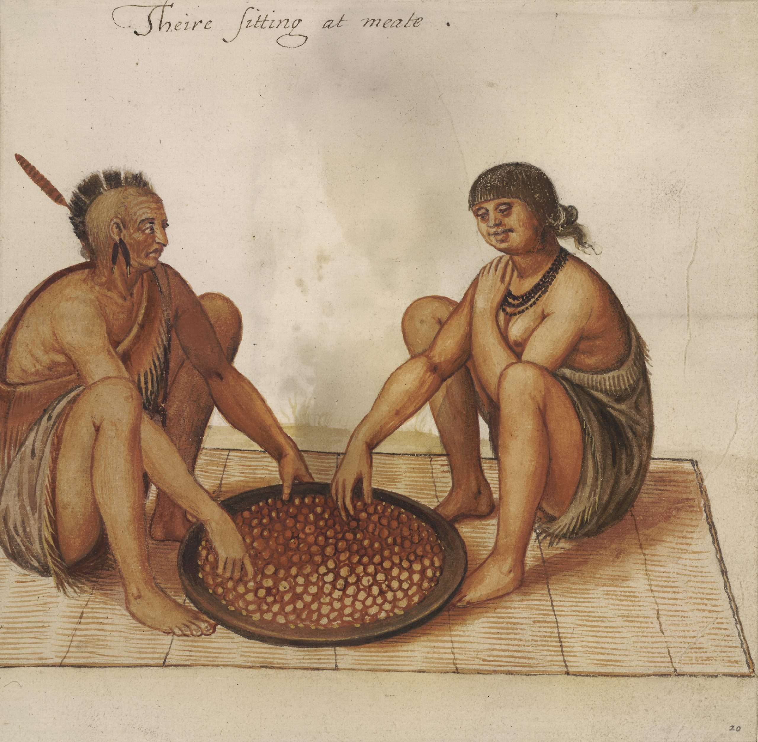
John White was an English artist who in 1585 accompanied a failed colonizing expedition to Roanoke Island in present-day North Carolina and who, in 1587, served as governor of a second failed expedition, which came to be known as the Lost Colony. As an artist attached to the first group of colonists, White produced watercolor portraits of Virginia Indians and scenes of their lives and activities. He rendered the local flora and fauna and, using the English polymath Thomas Hariot as a surveyor, created detailed maps of the North American coastline. He also joined Hariot and others on an exploration of the Chesapeake Bay and made contact there with the Chesapeake Indians. Many of White's paintings were published, sometimes in altered form, by Theodor de Bry as etchings in Hariot's illustrated edition of A briefe and true report of the new found land of Virginia (1590). They are the most accurate visual record of the New World by an artist of his generation. After the first colony failed, White led a second, which was intended for the Chesapeake but which settled again at Roanoke. The colonists included White's daughter, Elinor White Dare, who gave birth to Virginia Dare, the first English child born in America. A poor and unpopular leader, White agreed to be a messenger back to England to inform the colony's backers of the location change and a need for new supplies. Waylaid by the Spanish Armada, he did not return until 1590; the colonists had disappeared. White died three years later.

A perusal of White's watercolors is very educational.


In my younger years, I had a fascination with historic archaeology and "sacred places". It led to the study of indigenous cultures, including American Native Indians, their sacred traditions and folklore. At one time, before the Europeans "discovered America" - it was a great Indian Nation made up of various Indian tribal clans, who had worked out trade and hunting agreements ... and Peace Agreements. There were some warring fractions and occasional massacres but Elders involved in Tribal councils would organize "a Welcoming Committee" to contact the renegades.

Much of what is highlighted is a bit overstated. Obviously, this person has never gotten their hands dirty in the archives of the USA, records of the VA company, records of explorations, etc. to actually read about the populations of the Americas. Yes, there were some tribal "agreements" here and there, but of a very primitive sort, and mostly based on agreeing to get together and go massacre some other tribe and take their stuff.

The lives of most NA were mostly stone age primitive, and only with the arrival of Europeans did they begin to note other ways of doing things modeled on what they learned from the Europeans and suddenly started having different kinds of agreements with each other; this was probably due as much to seeing the Europeans as invaders that threatened all of them as anything else, but the bottom line is, before this time, things were way primitive, in contrast to earlier groups that were more complex.

My statements and references center around the life and activities of an American Indian warrior and chief, Tecumseh, who was born in 1768, around the present region of South Central Ohio (The Great Serpent Mound of Ohio) and died October 5, 1813 in the battle of Moraviantown, outside of what is now Thamesville, Ontario (McKay Mounds, Canada).


https://www.historynet.com/native-american-indian-chiefs
Tecumseh: Tecumseh was the chief of the Shawnee Tribe and responsible for forming Tecumseh’s Confederacy. This was a vision to unite the tribes East of the Mississippi as an independent nation.

Many brave and wise Indian leaders appeared and gained respect and fame in the late 18th and early 19th century. Only a few of them, however, had the diplomatic skills and charisma to go beyond leading their own bands and their own tribes to form and lead intertribal alliances. Tecumseh - the Shawnee, Red Cloud - the Oglala Sioux and Sitting Bull - the Hunkpapa Sioux all had the right stuff to become legends.

Born around 1768 somewhere near present-day Springfield, Ohio, Tecumseh developed an early hatred for the white man’s steady encroachment into Indian homelands. When he was 6 years old, after invading Virginia, frontiersmen killed his father, his mother took him to the spot and cried out to him: ‘Avenge! Avenge!’ At age 12, too young to be a warrior, Tecumseh watched George Rogers Clark and some 1,000 men defeat his people and burn his town. Filled with bitterness, he swore vengeance on the Long Knives.

By the early 1790s, white Americans were traveling down the Ohio River, turning north and settling on Shawnee hunting grounds. Tecumseh led raiding parties on white settlements and helped defeat two armies sent out to subdue the Indians. Officials in George Washington’s administration feared a great and powerful alliance of the tribes, and the president sent Maj. Gen. Anthony Wayne out to ‘tame’ the Indians. At the Battle of Fallen Timbers, Tecumseh was the greatest rallying force for the Indians, many times stopping retreats and inspiring them to stand and fight, but he could not prevent a crushing defeat.

Nor could he prevent chiefs of other tribes from signing the Treaty of Greensville, thus ceding all of what is now the State of Ohio and part of Indiana to the whites. After that there was a period of relative peace between 1795 and 1809. But during those years, William Henry Harrison, a military man who became Governor of Indiana Territory, used liquor, oratory and ceremonial pomp to persuade various chiefs to surrender 50 million acres.

By 1805, Tecumseh was traveling between the Appalachians and the Mississippi persuading other tribes to join his confederacy. He told Harrison: ‘The Indians were once a happy race, but now are made miserable by the white people, who are never contented, but always encroaching. They have driven us from the great salt water, forced us over the mountains and would shortly push us into the lakes. But we are determined to go no farther.’ His oratory, of course, did not stop the white invasion, and Tecumseh decided to make use of the religious fervor being spread by his younger brother Tenskwatawa, called "the Shawnee Prophet". He planned to reform bad Indian habits, to abandon everything the white man had brought into the Indians’ lives, and try to form a huge confederacy that would include every tribe in the U.S. territory.

Within three years, the brothers had built Prophetsville, a very large town where the Tippecanoe River flows into the Wabash,

and had persuaded many chiefs that this was the last chance to stop the white encroachment. But in 1809, some Ohio Valley chiefs signed the Treaty of Fort Wayne, ceding many square miles of land. Tecumseh decided it was time for action and told Harrison he must give back the land. The governor, of course, refused. Tecumseh thought the confederacy was not quite ready for military action and withdrew. He went south to get the final agreement from a number of tribes to join the alliance. British Indian agents were encouraging an Indian uprising against the Americans.

In 1811, Harrison decided to take action while Tecumseh was away, visiting the southern tribes Tecumseh had instructed Tenskwatawa not to fight Harrison, but the strong-arm governor provoked a battle at Prophetstown by moving troops to within 600 yards of the town. Insulted, the young warriors fought on November 7, 1811. Harrison's troops won the Battle of Tippecanoe, and the next day they burned the great town, center of the confederacy. The Americans had destroyed the great alliance.

Tecumseh rallied many Indians to the British cause and helped capture Detroit during the War of 1812, but he fell on October 5, 1813, at the Battle of the Thames (near present day Thamesville, Ontario, Canada),
while shouting encouragement to his warriors. The leading proponent of Indian unity was gone, and there was no one to replace him to oppose white settlement east of the Mississippi River.

Half a century passed, and whites began to appear in droves west of the Mississippi. Red Cloud, was born about a decade after Tecumseh's death, and his Oglala Sioux followers were willing to talk with the whites. There could be peace if the white man stayed out of Sioux hunting grounds and stopped using the Bozeman Trail.

The government called a council for the spring of 1866 at Fort Laramie, on the Platte River not far from the Wyoming-Nebraska border.
Negotiations seemed to be going well until Red Cloud and his chiefs found out that Colonel Henry B. Carrington had arrived with 700 soldiers to build forts on the Bozeman Trail. The Federal peace commission learned that there could be no peace unless a treaty had the support of Red Cloud, who was respected not only by the Oglalas but also by the Bruls and other Sioux and by their Cheyenne allies. ‘The Great Father sends us presents and wants us to sell him the road, but the white chief goes with soldiers to steal the road before Indians say Yes or No,’ said Red Cloud. He then stormed out of the Laramie meeting.

A real war began with Red Cloud, the head soldier. Red Cloud was the only Plains Indian who could gather so many confederates and keep them together long enough to wage a successful campaign against the white man’s incursions. He gathered 250 lodges of Sioux and Cheyennes in the cause, which provided him with about 500 warriors, and carried on continuous guerrilla warfare along the length of the Bozeman Trail. Seventy white people were killed, 20 wounded, and 700 horses, mules and cattle were taken. The soldiers stuck close to their forts.

The Great White Father had to do something, so in 1868 he sent out a peace commission. Whites, according to the Fort Laramie Treaty, were to be banned from Sioux hunting grounds, and their forts were to be abandoned. After the soldiers left, the Indians had the satisfaction of burning the hated forts. The so-called Red Cloud War had been a victory for the Indians. There was relative peace until gold was discovered in the Black Hills in the mid-1870s and the government failed to keep out the white prospectors. Red Cloud, who had come to recognize the hopelessness of challenging the overwhelming numbers of the white man, did not ‘go shooting,’ and that angered many of his people. Although he came to believe in compromise rather than war, Red Cloud never stopped fighting to protect the Sioux culture. Unlike Tecumseh, he did not go out in a blaze of glory. Red Cloud lived until 1909. But like Tecumseh, he had effectively resisted the white invasion…for a while.

The Hunkpapa leader and holy man Sitting Bull replaced Red Cloud as the chief symbol of resistance on the northern Plains.
Born in March 1831 near the Grand River (in today’s South Dakota), Sitting Bull tried to avoid whites until the situation became intolerable. Then he called for action, and many Sioux, Cheyennes and Arapahos were happy to follow his lead.

In 1868 many divisions of the Sioux rejected Red Cloud’s peace with the United States and did something they had never done before — choosing one man to be the leader of all the Teton Sioux. His name was Sitting Bull. Crazy Horse, a leading warrior, was essentially second in command. The Fort Laramie Treaty, however, largely kept an uneasy peace until all Indians were ordered to go to reservations by January 31, 1876, or be deemed "hostiles". (Today's enemy combatants or anti-Semitic's?)

That March, one of the columns of Brig. Gen. George Crook attacked a Cheyenne village not even on the list of hostiles. The survivors made their way to Sitting Bull up in Powder River country, and he gave them food and shelter. He decided the time for patience was gone. Sitting Bull sent messages to all Sioux, Cheyenne and Arapaho bands. He wanted them to join him.

In the spring of 1876, he sent out small raiding parties to steal good horses, guns and ammunition, while the U.S. Army mounted a campaign to subdue all Plains Indians who were off their reservation. In June, Sitting Bull danced the Sun Dance until he fell unconscious and had a vision of soldiers falling like rain. Not only did he believe in his vision, but so, too, did most of the warriors around him. The Indians would fight the soldiers and be victorious!

On June 17, Crazy Horse fought Crook to a standstill at the Rosebud. Sitting Bull’s vision had not yet come true, but one of the leading white fighting men had been knocked out of the picture. Sitting Bull moved his great allied camp to find more plentiful food for his people and horses. (see ‘Sitting Bull’s Movable Village’ in the December 2000 Wild West). He eventually chose a place along the Little Bighorn River where the grass was good and there was game nearby. That is where Lt. Co. George Custer and the 7th Cavalry found them.

Although Sitting Bull and his allies won a great battle, on June 25-26 at the Little Boghorn, they could not win the war.
Most of the Indians, hungry and desperate, returned to the reservations the next year. Sitting Bull instead went to Canada, where he found peace for a while. On July 19, 1881, he, along with 187 followers, turned himself in at Fort Buford, Dakota Territory.

Sitting Bull mostly stayed at the Standing Rock Agency beginning in 1883 and continued to have much influence. When the Ghost Dance movement stirred up the Sioux in 1890, he became — at least in some eyes — a feared figure once more. On December 15, 1890, Sitting Bull died in a fight near his cabin on the Grand River when Indian police attempted to arrest him.

Of Tecumseh, Red Cloud and Sitting Bull, which one was the greatest? Tecumseh’s widespread and powerful alliance was betrayed by his brother. Sitting Bull put together the most complete and famous single Indian victory. Red Cloud, however, actually defeated the U.S. Army over a long campaign and temporarily shamed it. The nod probably must go to Red Cloud.

In the link above, there are references to other Native American tribes and leaders. Another such example that focuses on Canada:
Chief Pontiac: Pontiac was chief of the Ottawa Indian tribe. The tribe was allies to the French during the French and Indian war. Later they were involved in Pontiac’s Rebellion. Read more about Chief Pontiac.

At the time I was exploring Indian culture and lore, I was in my late 20's- early 30's and then "life" suddenly took a different turn and there wasn't time to further explore the subject and visit libraries (prior to computers being publically accessible). It got placed on the back-burner, so to speak, so never ventured further back in History, on the subject.


Roanoke Colony deserted
John White, the governor of the Roanoke Island colony in present-day North Carolina, returns from a supply-trip to England to find the settlement deserted. White and his men found no trace of the 100 or so colonists he left behind, and there was no sign of violence. Among the missing were Ellinor Dare, Whites daughter; and Virginia Dare, Whites granddaughter and the first English child born in America. August 18 was to have been Virginias third birthday. The only clue to their mysterious disappearance was the word “CROATOAN” carved into the palisade that had been built around the settlement. White took the letters to mean that the colonists had moved to Croatoan Island, some 50 miles away, but a later search of the island found none of the settlers.

Roanoke the Lost Colony - The Truth Revealed
 
Last edited:
I thought I'd update this topic a little bit, as Michael B-C's excellent work on the the thread, "The Once and Future Sky God", has pointed me in the direction of some fascinating interesting parallels between North American Mounds and what he's researched on that topic. (I'll outline that on a second post).

The first new piece of the puzzle I found was the striking similarities between The Sykes Mound in Hilton, Manitoba and the Spirit Mound in South Dakota 900km to the south.

Both face the north and are located on the prairie away from historical waterways. Neither are claimed as being built by any local native group. Both have a very similar shape/topography (more on that later). Both dates of construction are unknown. As I mentioned before the vast majority of mounds in Minnesota and Manitoba are much smaller, circular and along historic river "highways". The Spirit Mound and Sykes mound clearly are not.

As I mentioned in an earlier post, the colloquial term for the mounds in Hilton are "The Cursed Mounds", though I haven't been able to confirm where the term came from. Most likely it originated from the former RCAF air base in Shiloh that reported the spinning compasses flying over the mounds and a crash of one of its NATO trainer fighter T-33's nearby.

The Spirit Mound in South Dakota has an interesting history dating back to a report from the renowned explorers, Lewis & Clark:

On August 25, 1804 Meriwether Lewis, William Clark, and 10 other men traveled about 9 miles (14 km) north of the river's junction with the Missouri River to see the "mountain of the Little People".[7] Lewis wrote in his journal that the Little People were "deavals" (devils) with very large heads, about 18 inches (46 cm) high, and very alert to any intrusions into their territory.[8] The Sioux said that the devils carried sharp arrows which could strike at a very long distance, and that they killed anyone who approached their mound.[8][9] The Little People so terrified the local population, Lewis reported, that the Maha (Omaha), Ottoes (Otoe), and Sioux would not go near the place.[8] The Lakota people who came to live near the "Spirit Mound" after the Wičhíyena Sioux have a story no more than 250 years old which describes how a band of 350 warriors came near the mound late at night and were nearly wiped out by the ferocious Little People (the survivors were crippled for life).[10]

The Lakota people of South Dakota are closely related to the Assiniboine (Nakota) who were the main inhabitants in the Hilton area at the time of La Verendreye's first exploration/contact in the 1730's along the Pembina Valley. La Verendreye, however, didn't report the mounds in Hilton at all.

When I came across Lewis & Clark's recounting of the Lakota account, I found it odd that the little people were described as coming out of the hill. Not defending the summit or living near it - but coming out of it. There's no reports of people living in mounds (as in caves or burrows) that I've ever found, so then what's going in this story?

Little people "emerging" from a mound - only to defend it. A possible portal?
Devils with large round heads eighteen inches high. Definitely not human - or known kind of human?
Sharp Arrows that can strike at a long distance. Some advanced weaponry (At least for the 1600's when the last battle occurred)?
Survivors crippled for life.

If we're to take the Lakota at their word, what it looks like is the Spirit Mound in South Dakota exhibits the characteristics of what might be a portal being used by some species of 4D STS and defended with extreme violence. Obviously proving that hypothesis is a completely different story. I might add that Paulides' book "Bigfoot, Wild Men and Giants", has numerous newspaper articles from pre-1930 associating mounds with giants and Sasquatch.

Spirit Mound and Sykes Mound photos attached below.
 

Attachments

  • spiritmound1.jpg
    spiritmound1.jpg
    19.2 KB · Views: 8
  • Sykes Editedjpeg.jpg
    Sykes Editedjpeg.jpg
    347.8 KB · Views: 8
After reading Michael B-C's thread on "The Once and Future Sky God", I was more convinced that many of these ancient sites were used as magico-religious centres by the secret society elites to control the population. Not only must there have been a socioeconomic control system applied, but I think also some electromagnetic "field" may have come into play.

The Good ole "frequency fence" per se.

So after a little digging, I came across a huge mound in Northern Syria referred to as the, "White Monument". It was located on the upper Euphrates, 200km north Tell Abu Hureyra - one of the cradles of the Natufian cultural horizons mentioned by Michael - and only 150km south of Gobekli Tepe.

It's dated at about 4500 years old. But dating mounds means dating whatever organic material is found in them. Those remains could have no correlation to the original mound, but may have been placed later or shifted to a lower level from seismic or weather activity.

A brief description of the mound:

The White Monument at Tell Banat contains the bones of what are believed to be around 30 dead soldiers, posed as if they fell in battle. A more than 4,500-year-old artificial mound in Syria may be the world's earliest known war memorial.

The White Monument is 22 meters in height and 100 meters in diameter. The white sheen over it is caused by erosion washing down the sides of the monument, which were constructed using gypsum and marl, both calcium and carbon rich materials.


I'm not sure if this mound still stands as I believe the site was flooded by a hydroelectric project and later had many of its artifacts destroyed by the ISIS invasion (surprise surprise).

More on the "posed" 30 dead soldiers from the Jerusalem Post:

The dead appear to have been buried in a specific pattern and according to ritual, research suggests. Each of the dead was buried alongside his military gear, jewelry, and sometimes with the skins of a kunga, a donkey-like animal often depicted pulling chariots. Some of the corpses were buried in pairs and some alone. According to Porter, the pairs buried with kunga skins may have been chariot teams.

What? Posed as if they fell in battle. With weapons and jewelry? So they died in some battle 4500 years ago, their bodies were then moved from the battle field and then re-positioned in a giant mound as if they were in battle? That seems like an enormous amount of gruesome work. Why not just bury them flat like so many other military graves?

Is there a possibility that these warriors were emerging from the mound like the little warriors of Spirit Mound, but these guys got "stuck"? Like some TDARM military transfer went wrong? Upright and standing skeletons have been found in our Manitoba mounds, and Jim Vieira has mentioned in "Giants on Record" that this was the case with many giant skeletons as well.

So possibly these mounds (or at least some of them) may have been utilized as a trans-dimensional or trans-density transfer point. Possibly energizing a portal at a natural window point.

In terms of magnetic lines, Gobekli Tepe and the White Monument are on almost the exact same meridian. The Sykes Mound is on the same Meridian as Cuernavaca in Mexico.

From the Nov.15.1997 Session:

Q: (T) If you go in the pool at the hotel, don't float on your back looking up at the objects in the sky... Mexico City is filled with UFOs... (L) We'll take pictures...

A: Yes, Many UFOs in Mexico. Cuernavaca is Earth's most intense window area.

Q: Why is that?

A: Complicated, but magnetic/volcanic influences contribute to the presence of a supervortex...


Then I found a really fascinating paper, "The Magnetic Anomaly of a Mound" from 2002 by Tateyana Smekalova and Bruce Bevan.

The paper itself is very technical, but from what I can gather is that the topography of the mound plays a role in its electromagnetic signature. They also located some sort of "Dipole" signature from a possible spherical object inside the mound. Like many of the Old Kingdom pyramids and structures in Egypt, these mounds have a very specific construction with certain types of stone built up in layers to produce a so far unknown effect beyond its EM signature.

Some mounds may be built on or near ancient impact zones (the drumlins near Sykes may also have been made by cometary fragments like the Carolina Bays), contain complex geology or soil components that are conductive what the C's regularly reference as "unstable gravity waves" that are warped/focused/manipulated by the topography of the mound, its materials/mass and structure as well as the possible specific dipole creating object buried within.

Possibly some mounds (very large ones with critical mass) - although referred to as ceremonial or graves - are able to be utilized as portals. Digging through old sessions all I could find were the following that might add some backing to my theory:

A: Gravity binds all that is physical with all that is ethereal through
unstable gravity waves!!!

Q: (L) There is no emanation point?

A: Yes.

Q: (L) So, through unstable gravity waves, you can access other
densities?

A:
Everything.

Session 23-AUG-2001:

Q: Okay, last time we were talking about the "M" mound in Wisconsin. You said that it was not a natural structure but that it was built for "F 353535." Could you say more about this? Was this used somehow to genetically manipulate the surrounding population?

A: Best so called lie in town.

Q: That doesn't make any sense.

A: Lay. [As in "ley" lines?]

Q: (TB) It looks like a big man laying. Is something laying there? (L) Or was it used for some kind of fertility rites? Is something buried inside it?

A: Force field generator.

Q: (L) Is it a force field generator by virtue of the kinds of rocks that are in there? Is it like rocks under a mound? {To TB} Have they ever x-rayed it to see what's under it? (TB) The whole area is a lead and zinc mining area. There's a lot of lead deposits around. Maybe they shield it, but it's supposed to be a natural formation, but the C's have said it's not a natural formation. (L) {chuckling} So maybe it's that everybody around there who "gets laid" is having some force field generator affecting them? Is that correct? Does it do something to the people in the area when they conceive children? Or do you mean ley line?

A: Close.

Q: (TB) There is an incredibly high rate of cancer in the area. Is it related to this high rate of cancer?

A: Yes. Lies are lays.

Q: (A) The cancer could be due to the lead which leaches into the water. (TB) That's true. (L) Genetically manipulate the surrounding population. Does this force field... well, yeah. Lies are lays. Ley lines, lies are lays... (TB) STS control field.

(L) Is that what you are saying?

A: Close.


So maybe not the clearest answer on the "M" mound in Wisconsin from the C's, but their hints come close to the White Monument Mound's EM signature and the Spirit Mound info that it may be possible to draw out some preliminary hypothesis to go forward.

The 3-5-3-5 comment, I think was answered in later session that basically means an induced or imposed obsession with cycling between 3rd and 5th densities for the purposes of getting locked into "earthbound" obsession.

My interpretation would be that the "M" mound (and possibly others) could generate some field that would act as a frequency fence to prevent higher frequencies "getting in" to inspire the local population to increase awareness. Obsessing over "lays" (play in the dirt and get dirty) and "lies" trapped the population controlled by the secret society/elites. The mounds have the magic-religious ability to not only affect "frequency" but also provide grand pageantry and magical emergences from other densities or dimensions that properly keeps the populace entrapped in fear, desire and awe. Possibly they might be used to bring in "reinforcements" when necessary - from another dimension or density.

The left over EM signature could also lead to some blocking or altering of proper cell growth and cause the cancer mentioned by the C's still lingering in that part of Wisconsin - like the Lakota that survived the battle at Spirit Mound but were crippled for life.

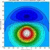
I attached a photo of the White Monument. The other image is the LIDAR image from the paper depicting its electromagnetic profile. There are a number of "Magnetic Signature of a Mound" papers out there from Crimea, Romania, The Serpent Mound in Ohio and the White Monument if anyone wants to look at them. But they are not fun reading at all. It'll take me few years to probably grasp that info ;-)

On a personal note, by a complete fluke, my wife and I were able to purchase a trailer on a lake less than 15km from the Hilton mounds (practically on the same road). We were only able to spend a few weekends out there in Sept. this year as its seasonal, but were lucky enough to meet many of our neighbours.

No one had heard of the mounds, but the owner of the land knows Alfred Sykes whom she wants to introduce me to. His family were the first homesteaders in the area who arrived in the 1870's. They still own the land with mounds on it. So hopefully I'll get to meet him next summer and get some first hand info.

The strange thing about the area is that its population hit its highest point in 1931 and has been declining ever since, despite it being absolutely beautiful and unique. This is probably due to the whole area being very agricultural with mechanization and corporate farming lessening the need for labour. We live only 250km away and almost no one we know has even visited the lake.
 

Attachments

  • White Monument.png
    White Monument.png
    451.7 KB · Views: 4
  • 0.jpg
    0.jpg
    25.1 KB · Views: 4
Back
Top Bottom