The Ice Age Cometh! Forget Global Warming!

It has been mentioned on this thread about the changes to weather graphics used by forecasters, and mostly to imply extreme warm temperatures are occurring; i came across these tweets today that seems to illustrate that point rather well:

Yes, in your face thermographic-like landmass imagery that always shows up any heat in red by contrast. Very blatant manipulations examples. Good catch.
 
ThanksIt has been mentioned on this thread about the changes to weather graphics used by forecasters, and mostly to imply extreme warm temperatures are occurring; i came across these tweets today that seems to illustrate that point rather well:
Thanks!
 

'It's a good thing': Climate scientists rejoice at western Washington's chilly, snowy spring

Published: 1:26 PM PDT May 13, 2022
The statewide snowpack is at 128% of normal. On April 1, the state was only at 80% of normal.
1652650365900.png

Arctic ice just won't melt...several ships can confirm that (Nov-2021) ...they were trapped in the ice. luckily rescued icebreaker powered by nuclear power


Opinion:

Wrong, CNN, AP, NYT, etc., Climate Change Did Not Cause South Africa’s Tragic Floods
A Google news search for the term “climate change,” over the past few days turns up dozens of stories in corporate media outlets blaming climate change for recent deadly floods in South Africa. Although many of the stories accurately captured the pathos of the human tragedy resulting from South Africa’s floods, they all mispresented the facts: human caused climate change did not cause the recent floods. History shows, because of its topography and regional ocean circulation patterns, floods regularly occur in South Africa. No data support the claim South Africa’s floods are increasing in number or intensity. The death and damage caused by the April 2022 flooding is due to rising populations in flood zones, poverty, and poor infrastructure.

The Associated Press (AP), CNN, the New York Times among other mainstream media outlets have all jumped on the claims of a single study attributing the fatal flooding in South Africa’s Eastern Cape and Kwa-Zulu Natal, particularly in the fast growing city of Durban, to human caused climate change. The widely carried AP story, “Climate change a major factor in fatal South Africa floods,” is typical of the media’s coverage of the flawed, unverified, research.

“The fatal floods that wreaked havoc in South Africa in mid-April this year have been attributed to human-caused climate change, a rapid analysis published Friday by … the World Weather Attribution [WWA] group,” writes the AP. “‘Human-induced climate change contributed largely to this extreme weather event,’ Izidine Pinto, a climate analyst at the University of Cape Town and part of the group that conducted the analysis, said.”

Commenting on the study, the AP writes, “[t]he analysis used long-established and peer-reviewed climate models to account for various levels of sea surface temperatures and global wind circulation among other factors … [to produce a] rapid assessment analysis.”

Climate Realism has previously discussed WWA’s past flawed efforts to rapidly link particular weather events to human caused climate change, here and here, for example.

It has long been recognized in the scientific community that the climate models relied upon by WWA to make its attributions and praised by the AP are seriously flawed, a fact covered in Climate Realism, most recently here and here, and in Climate Change Weekly, here and here. Among the greatest weaknesses acknowledged by the U.N. Intergovernmental Panel on Climate Change (IPCC) about climate models is that they only display a poor understanding of ocean circulation patterns and clouds, two factors fundamental to storm patterns. Compounding error upon error, WWA then uses these flawed models in ways they were never intended to be used, to “attribute” odds that particular events or degrees of intensities of events, would not have occurred absent climate change. Climate models were not designed to make such attribution claims.

Floods are a natural, relatively regular occurrence in certain regions of South Africa, particularly along the streams, rivers, and steep ravines common along the mountainous Eastern Cape and coast, where Durbin is located.

“Floods are the most frequently recorded disasters in southern Africa,” said one recent report, Floods: Current state and implications of climate change.. “South Africa is no exception and experienced 77 major floods between 1980 and 2010, costing the lives of at least 1,068 people,” continuing “[e]ven though the exact place, time and date of the next flood cannot be predicted, we know floods will happen.”

Topography, mountainous regions containing numerous steep ravines rapidly funneling rainfall into rivers and streams is one reason areas in South Africa are prone to periodic flooding. Another factor is prevailing winds and ocean circulation patterns. First Post listed factors which contributed to the deadly flooding:

[T]he rains were part of a normal South African weather system called a “cut-off low” which can bring heavy rain and cold weather.

Cut-off low pressure systems are common. Their frequency becomes high during autumn and spring seasons, and they are differing in strength,” said Puseletso Mofokeng with the South African Weather Service.

Some of these systems are very intense, causing heavy rain, hail, strong and potentially damaging winds and heavy snowfall.

A cut-off low in April 2019 killed 85 people in Eastern Cape and KwaZulu-Natal provinces.

In addition, First Post reports:

Durban experiences floods every year, but not as severe as these.

The city is built on a hilly area with many gorges and ravines — a topography that University of KwaZulu-Natal urban planner Hope Magidimisha-Chipungu says is conducive to floods.

Durban is one of South Africa’s fastest-growing cities, with economic growth outpacing the national average by 2015.

Massive, unplanned migration created housing shortages, which resulted in the mushrooming of shack dwellings, locally called informal settlements.

“The ways in which South African cities were designed were very exclusionary in nature,” said planner Magidimisha-Chipungu. “The spatial planning and the apartheid legacy (placed) the urban poor in the periphery and in the low-lying areas” along riverbanks, she said.

Around a quarter of the metro’s 3.9 million people live in 550 informal settlements around the city. At least 164 of them were built on floodplains, according to Galvin.

To sum up, floods in recent years have all occurred in South African regions known to flood with some regularity. This combined with population increases, with large numbers of people erecting or moving into unplanned shanty towns in known flood zones account for the deadly nature of the floods in recent years. Climate change need not apply.

Indeed the IPCC’s 6th Assessment Report (AR6) report indicates climate change it is not a factor. As Roger Pielke, Jr., said in his summary and analysis of AR6:

Heavy precipitation: “the frequency and intensity of heavy precipitation have likely increased at the global scale over a majority of land regions with good observational coverage … [yet] “heavier rainfall does not always lead to greater flooding.”

To make claims about trends in flooding, one should look at trends in flooding and not precipitation. The conflation of the two is a common error.

Concerning flooding AR6 says:

Flooding (detection): “Confidence about peak flow trends over past decades on the global scale is low, but there are regions experiencing increases, including parts of Asia, southern South America, the northeast USA, northwestern Europe, and the Amazon, and regions experiencing decreases, including parts of the Mediterranean, Australia, Africa, and the southwestern USA.”

So while the IPCC has only low confidence it can detect any general increases in flooding during the recent period of modest warming, what data it does have suggests Africa is likely one of the regions experiencing declines in flooding, not increases as suggested by WWA—a suggestion uncritically parroted by the AP and other corporate media outlets.

Noted astronomer Carl Sagan once said, “extraordinary claims require extraordinary evidence.” Neither WWA nor any of the mass media print and broadcast outlets publicizing WWA’s rapid attribution analysis provided any extraordinary evidence indicating climate change was behind South Africa’s recent floods.

The general public would likely benefit from WWA aiming less for a rapid assessment, and more for accuracy in whatever analysis they do produce. Speed should not count for more than the truth in either climate research or reporting.

Why do the media outlets promote the extraordinary alarming results from researchers associated with WWA and their ilk, while ignoring countervailing evidence? Perhaps because disasters and crises sell papers, magazines, and ad time, but also perhaps because they are being directly paid to do so by institutions focused on promoting fighting climate change as a crisis in order to bring about a change in global governance. As I noted in Climate Change Weekly 427, in February the AP proudly announced they had accepted an $8 million grant from five prominent foundations known for promoting and backing organizations that promote climate alarm. This funding went to support the hiring of more than two dozen journalists to report on climate issues primarily from Africa, Brazil, India, and the United States.

In its press release announcing the grant, the AP said, “[t]his far-reaching initiative will transform how we cover the climate story.” Based on recent AP climate coverage, there is little doubt the foundations are getting their money’s worth.


Adapt 2020
 

-------------------------------------------------------------------------------------------
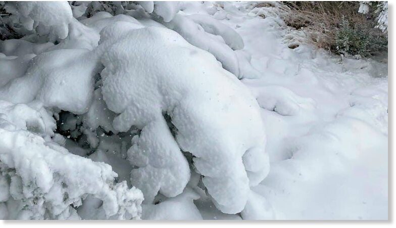
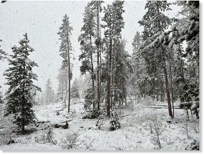
Exactly one month until the summer solstice, Colorado is waking up to a winter wonderland.

Here is a look at the latest snow totals:

Top 5:

Near HWY 9 at Fremont/Park County Line - 20"
Black Forest - 16"
Woodland Park - 16"
Cascade - 14"
Colorado Springs - Gleneagle - 13"

An update on the snowstorm mention above, total over 3 day storm reached 30 inches:


Snippet -

The late May snowstorm that dumped as much as 30 inches of snow in the high country of the Arkansas River watershed basin last weekend brought welcome moisture to the region, but drought conditions are expected to persist.

On Monday, the basin's snowpack reading came in at just 66% of normal. Although below average, that reading was more than double last week's figure, according to Natural Resource Conservation Service data compiled by the Arkansas River Watershed Collaborative.

Three-day snowfall amounts from last weekend's storm totaled 30 inches in Buena Vista, nearly 25 inches in the Twin Lakes and Leadville areas, 20.8 inches in Salida, 17 inches in Canon City and 10.7 inches in Westcliffe, according to the National Weather Service.

 
Heavy snowfall of up to 3 FEET over the past weekend for parts of USA. Not much coverage in media about this or so it seems. Those reports available about it prattle on about how this precipitation is much needed because drought conditions - rather than concentrating on the extremely late nature of the event and the exceptional amounts that have accumulated.


Extract-

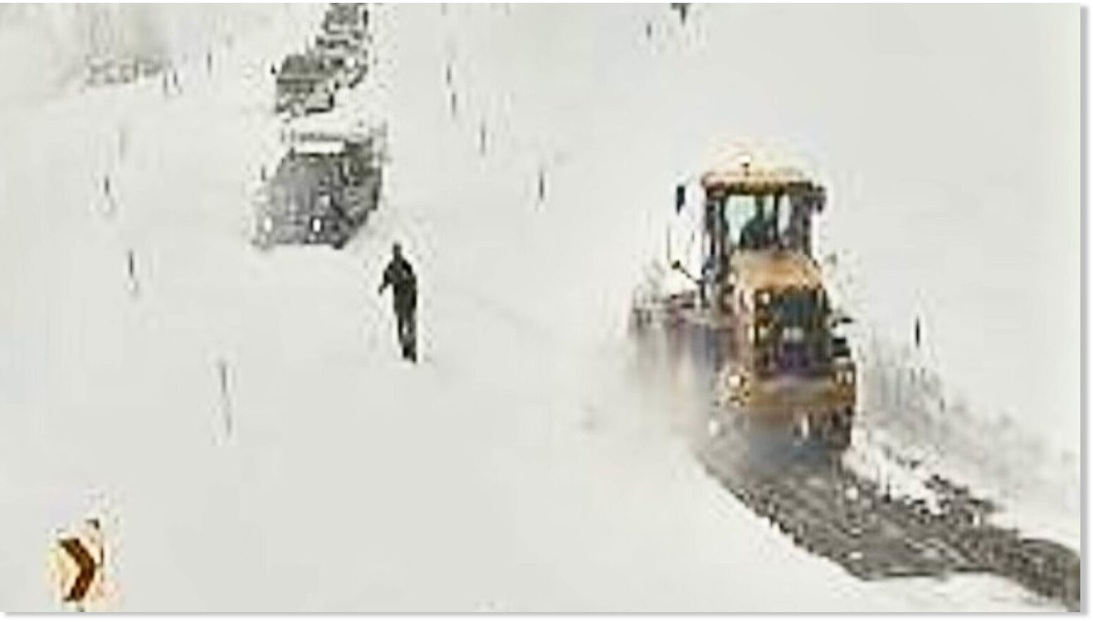
A major spring snow storm dumped more than 3 feet of snow on northwest Wyoming over the Memorial Day weekend, stranding dozens of travelers on the Chief Joseph Highway.

Dozens of people caught in the storm that closed Wyoming Highway 296, which connects Cody to Cooke City, Montana, and the Beartooth Highway, had to be rescued by Department of Transportation personnel, according to Cody Beers, a department public relations specialist.

"There were vehicles blocked there last night and spun out on the road," Beers told Cowboy State Daily midday Monday. "There's at least two feet of snow up on (Dead Indian Pass) and there was a pretty good line of cars, 10 to 12 cars backed up."


Extract -

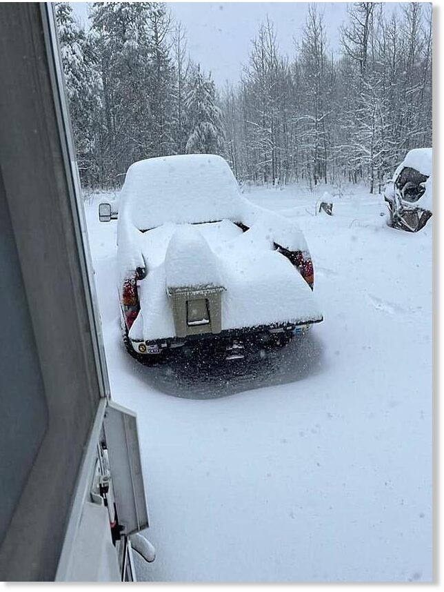
Ah, you have to love Idaho. The South Hills south of Twin Falls kicked off the unofficial start of summer with a good ol' fashioned snowstorm. Camping season may have to wait a little longer in this area.

Memorial Day weekend is considered the unofficial start of summer. You know, time to start camping, barbecues, outdoor activities, water activities, etc. Looks like Mother Nature had her own plans. Hopefully not too many people got stuck in the South Hills over the weekend because over 2 feet of snow came down.

Photos shared by the Twin Falls Sheriff's Department show just how crazy it got up there. The 5th Fork area definitely got hit hard. 2 and a half feet of snow fell there. But the snow isn't the only concern right now in the area. Trees were downed over the roadways and the trails. It is best to avoid the area as much as possible.


Extract -

Bailey Holland and her siblings figured they'd spend Memorial Day weekend at a water park.

However, a storm system that pushed through Utah over the long weekend resulted in a change of plans. They traded a day at the water park with one last sledding trip in the Cottonwood Canyons.

"It's actually really fun," she told KSL-TV.

The Memorial Day weekend storm ultimately lived up to the hype, producing at least 16 inches of new snow near Alta (equating to over 2 inches of water), according to the National Weather Service. It even produced over 4 inches of precipitation in other parts of the Wasatch Mountains since Saturday — all of which matters as Utah heads into its historically driest season.

"It was phenomenal, and you could not ask for a better way to end the month of May," said KSL meteorologist Kevin Eubank.
 
This is not exactly the IceAge topic, very much related nonetheless. Ben from Suspicious Observers released a video which deals which changes to their projects mostly but at the end he brings on a sobering wake up call for those who still don't take seriously the changes in environment as well as in society and what is about to happen. He's spot on and in accord with findings of this Forum. I put the time mark at the beginning of that part (22:09) so you can listen just to those last 5 minutes.


#Météo | These next 48 hours will mark the installation of often mixed weather, especially on Wednesday with the arrival of a disturbance from the West which will cross the country. It will be cooler, except near the Mediterranean where summer will continue!

As the climate narrative crumbles Metro60 compares apples to oranges in a futile attempt at disinformation.
1977: how to survive the next ice age 2008: How to Win the Global Warming War. It is true that in the 70s the thermometer was not very upward oriented. The one thing in the print media that we're sure is true: the date.

Flashback: Published online: 04 Aug 2020

Modern Grand Solar Minimum will lead to terrestrial cooling

Valentina Zharkova
Snip:
In this editorial I will demonstrate with newly discovered solar activity proxy-magnetic field that the Sun has entered into the modern Grand Solar Minimum (2020–2053) that will lead to a significant reduction of solar magnetic field and activity like during Maunder minimum leading to noticeable reduction of terrestrial temperature.

Sun is the main source of energy for all planets of the solar system. This energy is delivered to Earth in a form of solar radiation in different wavelengths, called total solar irradiance. Variations of solar irradiance lead to heating of upper planetary atmosphere and complex processes of solar energy transport toward a planetary surface.

The signs of solar activity are seen in cyclic 11-year variations of a number of sunspots on the solar surface using averaged monthly sunspot numbers as a proxy of solar activity for the past 150 years. Solar cycles were described by the action of solar dynamo mechanism in the solar interior generating magnetic ropes at the bottom of solar convective zone.

These magnetic ropes travel through the solar interior appearing on the solar surface, or photosphere, as sunspots indicating the footpoints where these magnetic ropes are embedded into the photosphere.

Magnetic field of sunspots forms toroidal field while solar background magnetic field forms poloidal field. Solar dynamo cyclically converts poloidal field into toroidal one reaching its maximum at a solar cycle maximum and then the toroidal field back to the poloidal one toward a solar minimum. It is evident that for the same leading polarity of the magnetic field in sunspots in the same hemisphere the solar cycle length should be extended to 22 years.

Despite understanding the general picture of a solar cycle, it was rather difficult to match the observed sunspot numbers with the modeled ones unless the cycle is well progressed. This difficulty is a clear indication of some missing points in the definition of solar activity by sunspot numbers that turned our attention to the research of solar (poloidal) background magnetic field (SBMF) [1].

 
It is a pity that information via telegram channels often lack any further references, if one would like to check up things closer…

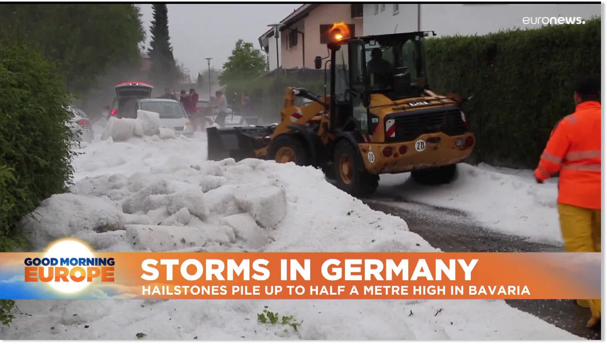
If those amounts of (what looks to me like hail)… well, those are mighty impressive amounts !!

According to this report the hail was about half a meter deep -

 
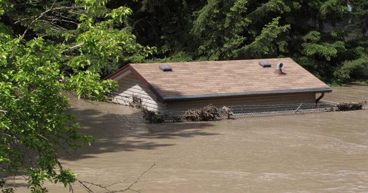
The below is a look back into the great flood of June 19/20 2013 that took out Calgary, Alberta.


At that time in the BC/Alberta Rockies, there was still significant snowpack, and if remembered, a cell came up from Denver Colorado and sat/stalled over the mountains releasing sheets of rain, taking down the snowpack and channeling water into the tributaries right to Calgary.

Today, the snowpack is still significant, and the rains started in the last few days and seem to be strong/continuous - remaining for a few more days. Not saying this is going to happen again, however there are similar conditions.

Overnight on these passes, it is suppose to snow 15 cm - had heard 2 ft. from someone else.

 
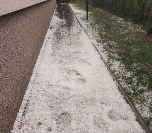
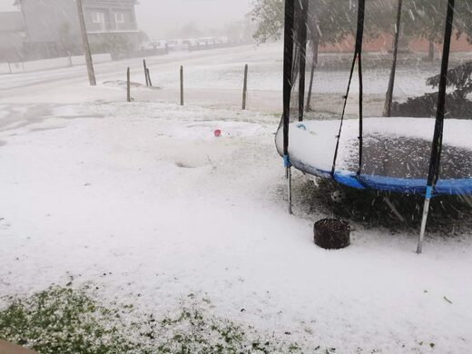
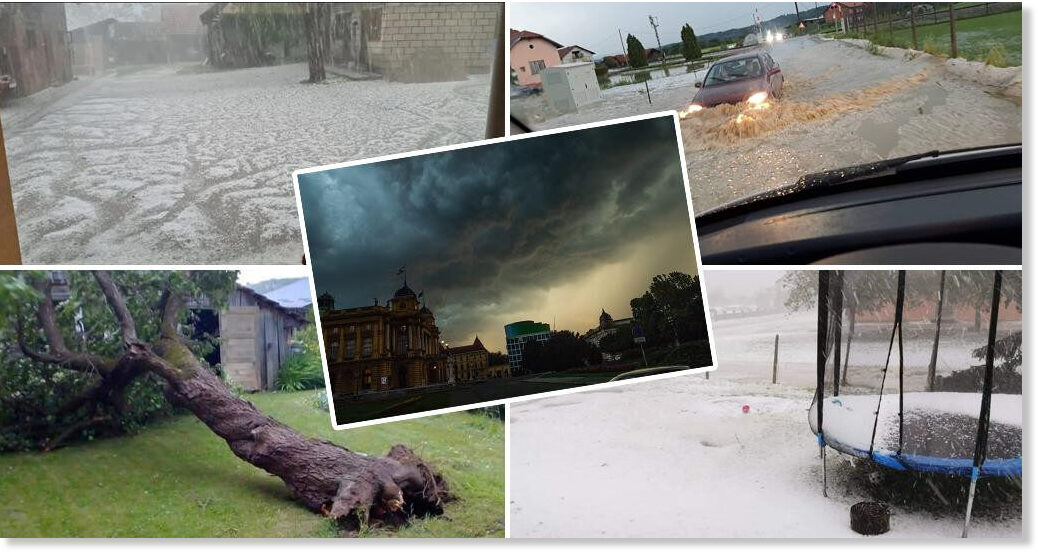
A third major hail storm in 20 days, this time with the flood, happened in Croatia.


Storm followed by rain, hail and wind hit parts of Krapina-Zagorje, Zagreb and Koprivnica-Križevci counties today, June 13 in the evening

hail

hail

10 minutes after the fierce storm in Pozanovac


Stormy storm followed by strong wind and hail hit Hrvatsko Zagorje again, this time hail the size of a hazelnut hit the municipality of Bedekovčina on Monday night

The mayor of Bedekovčina, Darko Ban, told Hina that catastrophic scenes were visible in the Poznanovec settlement, where 20 centimeters of ice were recorded on the road .

This is the third in a series of fights that has hit Krapina-Zagorje County in the last 20 days.

Mayor Željko Kolar declared a natural disaster for the area of Hum na Sutli Municipality caused by heavy hail on May 25, and on June 2 the hail caused great damage to agricultural land in the towns of Klanjec and Oroslavje and the municipalities of Kumrovec, Zagorska Sela and Veliko Trgovišće.

After that storm, the Minister of Agriculture, Marija Vučković, visited the affected areas to make sure of the extent of the damage.

Edited: SOTT URL and FB URL not correctly displayed
 

Trending content

Back
Top Bottom