The Ice Age Cometh! Forget Global Warming!

I recall one session where the Cs said something like (and I am paraphrasing) "Ice ages come on much much much faster than scientists think". The current "scientific consensus" is that the transition into an ice age takes "thousands of years". I always interpreted the use of the word "much" by the Cs to mean a factor of 10. So "much much much" is 1,000 times faster... This means that the transition into an ice age takes "years" and not "thousands of years".

Session 22 February 1997

A: Climate is being influenced by three factors, and soon a fourth.

Q: (L) All right, I'll take the bait; give me the three factors, and also the fourth!.

A: 1) Wave approach. 2) Chlorofluorocarbon increase in atmosphere, thus affecting ozone layer. 3) Change in the planet's axis rotation orientation. 4) Artificial tampering by 3rd and 4th density STS forces in a number of different ways. Be vigilant. Be observant. Be cautious in your planning and be aware. Do not let emotional anomalies cloud your knowledge base. This is not a "time" to let one's guard down. Be especially careful of travel to unfamiliar locators, as well as sleeping in unfamiliar surroundings!!! You are being watched. Or, at least, it is best to assume you are, and act, think, and prepare accordingly. Remember what you have been warned about concerning attack. As you learn more and know more, you become more interesting... and, when your ranks swell, you are more vulnerable unless you are more aware!!

Q: (L) All right, were those given in the order in which they are occurring? The fourth being the one that's coming later?

A: Maybe, but remember this: a change in the speed of the rotation may not be reported while it is imperceptible except by instrumentation. Equator is slightly "wider" than the polar zones. But, this discrepancy is decreasing slowly currently. One change to occur in 21st Century is sudden glacial rebound, over Eurasia first, then North America. Ice ages develop much, much, much faster than thought. [Discussion of new scientific theory recently presented that the earth is expanding.]

Session 26 July 2014

(Turgonl) About the weather here in Canada... It's been fluctuating between hot and cold this summer, and in the winter time. And we were just wondering, is the way the ice age is going to occur, will the summers just start to get cooler and cooler with the precipitation as time goes on over the next few years?

A: No, glacial rebound will fall within months when the tipping point is reached.
 
It is rather worrying that preparations for possible/probable ice age conditions are not being made. I predict that things are going to get very serious and very chaotic rather quickly. But then, about anybody with two firing neurons can see that, so no cigar!

I have heard anecdotally the climate change research funding is decreasing or ceasing and is being redirected to 'other areas'. This is a vague statement but unfortunately I don't wish to provide specific details at this time.

As a thought experiment, if this were the case, it would make a lot of sense that it's not announced publicly. It would make even more sense to deny and distract - those in the know have a head start: "Yes we are fairly confident climate change is occurring and has probably always been occurring, but we need more data to be positive that man made contributions are accelerating the change. We are throwing (xyz) at it. We are investing in this, and that. We are looking to renewable energy as a future solution, blah blah blah" - is a pretty good message to portray. If things do get serious and very chaotic quickly, it's advantageous (perceived by them, or so they think) to keep the masses in the dark.

-> edited addition: The point is, I think preparations are probably being made at the highly privileged and private levels of society. I don't believe it is in their interest to advertise their preparations, but it is 100% in their interest to discredit the conspiracy-theorist-preppers who do.
 
Last edited by a moderator:
Spring snowfall in Magadan, Russia - March 31 (and from the look of it more than just a dusting).


Super-chilled thunderstorm unlike any other ever detected​


By Brian Lada, AccuWeather meteorologist and staff writer
Updated Apr. 1, 2021 5:28 PM CEST

thunderstorm-satellite.jpg


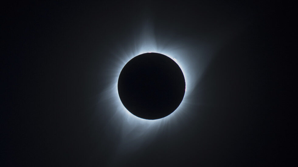
The cluster of particularly cold brightness temperatures is slightly to the left of the image center. (Image/NOAA/VIIRS/S.Proud/UniOxford)

When people think of a thunderstorm, towering clouds on a warm and humid summer day may come to mind, but one thunderstorm tracked by forecasters over the Pacific Ocean several years ago set a record for the extremely cold conditions that it generated.

A new study published in American Geophysical Union examined a particularly strong thunderstorm that rumbled over the Pacific Ocean well northeast of Australia on Dec. 29, 2018, a storm that has now gone down in the record books.

The record-setting storm was spotted by the NOAA-20 satellite, one of the most advanced weather satellites in NOAA’s fleet that launched just one year prior to the storm’s development.

The lowest temperature detected in the clouds above the strongest part of the storm was so low that it was almost literally off the charts -- coming in at around minus 111.2 degrees Celsius, or a bitterly cold 168.1 degrees below zero Fahrenheit.

This “extremely cold temperature that is, to our knowledge, the coldest recorded by satellite,” the authors of the study said. Previously, the lowest temperatures recorded in the cloud tops of storms anywhere around the globe ranged between 162 and 157 degrees below zero F.

The astonishingly low temperature was measured from space with the use of infrared sensors on the NOAA-20 satellite, a system that can accurately tell what the temperature is inside the clouds within Earth's atmosphere.

The driving feature behind every thunderstorm is the updraft, the column of rising air that gradually gets colder as it climbs higher and higher in the atmosphere.

When the rising column of air reaches the tropopause, the top of the lowest section of the atmosphere, the clouds typically fan out and spread outward. This is called an anvil cloud due to its resemblance to the tool used by blacksmiths.

In a stronger storm, like the one that was observed on Dec. 29, 2018, part of the storm clouds can poke through the tropopause and break into the next layer of the atmosphere, the stratosphere. This feature is called an ‘overshooting top’ and is the part of the storm where the record-breaking temperature was detected.


overshooting-top-photo.jpg


This image of a typical cumulonimbus cloud "anvil" was taken by the Expedition 16 crew on the International Space Station. The signature cauliflower shape of an overshooting top can be seen on the right region of the anvil cloud top. (Image/NASA)

The incredibly low temperature was not only due to the storm, but the overall state of the atmosphere that day.

On Dec. 29, 2018, the atmosphere around the tropopause was abnormally cold before the thunderstorm started to brew.

“Storm activity on this day was typical for the time of year, implying that the cold cloud top temperatures were primarily driven by the exceptionally cold tropopause rather than the unique properties of a given convective storm,“ the authors of the study explained.

What makes this thunderstorm even more impressive is the fact that when the NOAA-20 satellite passed over the storm, it was not at its peak strength.

The weather satellite is in polar orbit around the Earth, a type of orbit that allows the satellite to gather data about any given point on the planet two times a day. This is different than the GOES-East weather satellite which is in geosynchronous orbit, a type of orbit that allows a satellite to consistently take observations of the same region of the globe around the clock.

Because of this, the NOAA-20 satellite did not record the temperature of the cloud tops when they were at their coldest.

This new record, while impressive, may not stand for long, the researchers said.

“We found that these really cold temperatures seem to be becoming more common – with the same number of extremely cold temperatures in the last three years as in the 13 years before that,” said Dr. Simon Proud of the U.K.’s National Centre for Earth Observation.

Scientists think that the next record will likely happen over the same area of the Pacific Ocean where this record-setting storm took shape near the tail end of 2018. That is due in part to increasing sea-surface temperatures creating a more favorable environment for storm development along with changing conditions higher in the atmosphere.
 
Frost warnings have been issued to fruit growers in France, and it seems that the meandering jet stream is partly to blame.

The graphic on the left shows that last winter's jet stream was more uniform and so temperatures for many should have been less erratic (although not necessarily less extreme), meanwhile to the right it shows that this year's jet stream is weaker and meandering and is resulting in a greater temperature fluctuation. The next two graphics show the warm temperatures that Europe has been experiencing and the sudden drop in temperature that is expected.

Growers in France note that it's not unusual to expect frosts late into April but that due to a 'false spring' their crops are already 'in advance' - and we've seen that all over the world for years now that plants are blossoming earlier - and they're saying that hard frosts following such warm spells threaten to seriously damage their crops.

The warnings issued in France:

[Thread] [Update] Tonight, the meteorological models are still converging towards an event of major destruction of tree production (start from the north tomorrow evening) Tuesday, Wednesday, Thursday will be 3 difficult days for French agriculture. #FrAgTw

"Do we have traces of precedents in archaeo-meteorology or even in the history of meteorology? Apparently, these false premature springs should multiply with strong risks of catastrophic variations as here. The vegetation did not need that ..."


Last edited:
We had a feathering of snow in the south-east of England this morning. The temps have plumeted and it is supposed to be -3 tonight. Yesterday morning I was out walking in a balmy 14 C with strong sunshine. The day before (Saturday) there was a bitter chill to the air. The weather is all combobulated...love that word....:wow:
 
Here in SW France today temps forecast above freezing for the rest of the week with overnight dips down to near freezing, 1C. A hard freeze would be devastating to the fruit growers, who dominate this region, as the trees are just now flowering. Hopefully the dire forecasts for the region will not be as harsh as predicted. The locals have a rule of thumb; don't plant until April 21st. This has been learned from experience. I will resist the urge to get a head start with the tomatoes for a couple of weeks.

We might dodge the bullet this year but the trend will eventually catch up with us.
 
We had cold windy weather yesterday, and even snow later in the day and night. There are still some snowflakes flying around (in the occasional sunlight, that's weird), temperaures around 0°C (-1 to +3 or so). We had some nice and warm weather days prior as well, but now some cold icy stream coming from north straight into Germany.
[ventusky]
Screenshot_2021-04-06_08-52-41.png
 
Cold here in the south west of England today, with hail showers for much of the morning...only a few days ago I was in the garden in single layers, looking for shade from the sun!
Here in SW France today temps forecast above freezing for the rest of the week with overnight dips down to near freezing, 1C. A hard freeze would be devastating to the fruit growers, who dominate this region, as the trees are just now flowering. Hopefully the dire forecasts for the region will not be as harsh as predicted. The locals have a rule of thumb; don't plant until April 21st. This has been learned from experience. I will resist the urge to get a head start with the tomatoes for a couple of weeks.

We might dodge the bullet this year but the trend will eventually catch up with us.
When I lived in Scotland, the rule of thumb was "Ne'ar cast a cloot til May is oot." Keep ya vest on, in other words, until the beginning of June! Cloot being the shortened version of "clootie", a rag. But cloot is also a cloven hoofed creature, so could also refer to turning livestock into the fields only when the threat of bad weather has passed? I was speaking with my Mum last week, discussing the forecast for this cold spell and she told me of the time she was in hospital, 53 or so years ago. It was June, the south east of England and it was snowing! All the ladies in the ward were huddled up under the covers...a week later, it was so hot they were all lying above the covers, not sleeping at night because of the heat!
 
Another thing they could do is fill his pockets with chalk and release him into the stratosphere to see how much of the sun's energy he blocks out.
I'd be happy with that!

Apparently, the plan is on hold until they can get more support, via lobbying...
 
Some recent images from southern Europe of the severe cold wave hitting the region:


Comprehensive coverage of the record-breaking situation in most of Europe here -


-----------------------------------------------------------

Many areas in Slovenia reached their coldest April morning over the last 100 years! The official meteorological station Nova vas na Blokah peaked at -20.6 °C which has set a new all-time national record for the month of April since the records began. Numerous extreme cold records also across other parts of central and western Europe, deep freeze and morning frosts have been destructive.

As we expected, the weather models were not wrong this time. An unpreceded extreme cold has verified across many parts of Europe this Wednesday morning, following the significant and historic snow a day before. Snowfall with some accumulation was reported even at the seaside in Slovenia and Croatia islands (Kvarner area).

In Slovenia, the weather station Nova vas na Blokah hit -20.6 °C and set the new official lowest temperature for April (the previous record at the station Nova vas was -18.0 °C set on April 4th, 1970). There was another record of -26.1 °C recorded with an unofficial weather station in the village Retje near Loški Potok.

The previous official record for Slovenia was held by station Pokljuka (elevation approx 1350 m ASL), with -20.4 °C set back on Apr 9th, 1956.

Many areas across the northern Balkans have seen even lower temperatures than they were during the last winter 2020/21. In the case of the Notranjska region in Slovenia (e.g. stations Nova vas na Blokah, Postojna, and Babno Polje) this was the colder morning of the winter.

2021 set a new record having temperatures lower in April than January. Even if it happens in March, it is extremely rare. This is just a plain example of how extremely cold and historic event this event and this morning was for April.

The main reason for these extreme cold records is the Arctic cold air mass that spread across a large part of Europe this week. Clear (no clouds) nights with barely any winds and fresh snow on the ground with dry air mass in the mid-levels are an ideal recipe for extremely cooling in the nighttime hours.

Unfortunately, these temperatures were so extremely low that the ongoing blossoming fruit trees and early growing states of the vegetation were simply burned and destroyed.

Very low temperatures with record-breaking cold and damaging frost ware also reported from parts of England, France, Germany, around the Alps, Italy, and Croatia...

(Snipped)
 
Back
Top Bottom