You are using an out of date browser. It may not display this or other websites correctly.
You should upgrade or use an alternative browser.
You should upgrade or use an alternative browser.
Volcanoes Erupting All Over
- Thread starter Laura
- Start date
Pacaya volcano has erupted, spewing ash 4.3 kilometers into the sky.
By: VN - 22 Mar 2021
Published on 21.3.2021 (5:10)
Pacaya Volcano Volcanic Ash Advisory: VA EM LIKELY to 14000 ft (4300 m)
Pacaya Volcano (Guatemala) eruption news and activity updates
www.volcanodiscovery.com
Published on 21.3.2021 (5:10)
XPan
The Living Force
She came back - Etna's 16th Paroxysm
since 16 Feb 2021 [corrected date]
In this very moment of 24 March 2021, at 05.00 - Etna is having it's 16th Paroxysm. The webcam I am watching right now (Guidetna.it), shows a clear view towards the SE crater. At this stage however, no photos have yet appeared, so i'll have to fall back onto a few screen shots from various webcams.
The Tremor "Heartbeat" chart
is a mix of two sources of data. After the heavy snowfall, one instrument (ECPN) stopped sending data, so I had to fall back onto a different station, called EMFS. In the tremor chart below I merged them - but they are not authentic.


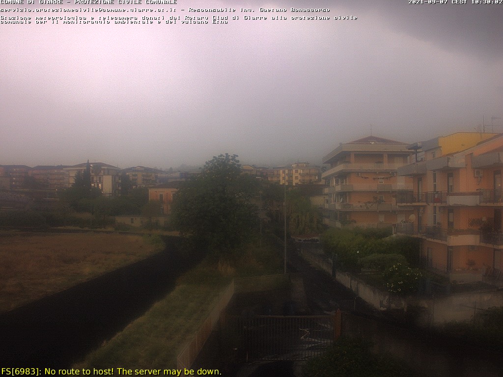
Last three images - seen from the East Coast of Sicily, City of Giarre (UTC time)
If you ever wondered
What an Infrasonic (seismic) chart looks like when Etna is having an eruption... ? Well, the waves are then all over the place. A site on which you can see the all three charts live; thermographic, infrasonic and Tremor - is available here via Marc Szeglat's german homepage "Vulkane.net" [ The times are given in UTC, not local time]

since 16 Feb 2021 [corrected date]
In this very moment of 24 March 2021, at 05.00 - Etna is having it's 16th Paroxysm. The webcam I am watching right now (Guidetna.it), shows a clear view towards the SE crater. At this stage however, no photos have yet appeared, so i'll have to fall back onto a few screen shots from various webcams.
The Tremor "Heartbeat" chart
is a mix of two sources of data. After the heavy snowfall, one instrument (ECPN) stopped sending data, so I had to fall back onto a different station, called EMFS. In the tremor chart below I merged them - but they are not authentic.
Last three images - seen from the East Coast of Sicily, City of Giarre (UTC time)
If you ever wondered
What an Infrasonic (seismic) chart looks like when Etna is having an eruption... ? Well, the waves are then all over the place. A site on which you can see the all three charts live; thermographic, infrasonic and Tremor - is available here via Marc Szeglat's german homepage "Vulkane.net" [ The times are given in UTC, not local time]
XPan
The Living Force
Additions (Etna's 16th Paroxysm)
Boris Behncke, the german-italian INGV vulcanologist who lives afoot of Etna Volcano to the south, in Tremestieri Etneo, had two photos posted, showing 1) how the volcano (SE Crater) started to wake up (23 March) after several days sleep and 2) the startup prior the paroxysm (morning of 24 March)
The ash clouds looks moving straight to the south, e.g. over the City of Catania and airport.


Now that the sun is rising
over east of Sicily, the webcam images of the ongoing eruption are stunning, in a golden glow everywhere.


Boris Behncke, the german-italian INGV vulcanologist who lives afoot of Etna Volcano to the south, in Tremestieri Etneo, had two photos posted, showing 1) how the volcano (SE Crater) started to wake up (23 March) after several days sleep and 2) the startup prior the paroxysm (morning of 24 March)
The ash clouds looks moving straight to the south, e.g. over the City of Catania and airport.
Now that the sun is rising
over east of Sicily, the webcam images of the ongoing eruption are stunning, in a golden glow everywhere.
XPan
The Living Force
Remarkably beautiful
video clip from the Icelandic eruption. [1 min 13 sec]
video clip from the Icelandic eruption. [1 min 13 sec]
XPan
The Living Force
Volcanic Info snippets (I)
ETNA. Sicily
(24 Mar 2021)
Already yesterday evening, the volcano showed signs of awakening around 19.00 - when then went into higher gear at around 21.30. Apparently it was the most longlasting Paroxysm ( = short, violent eruption) of all 16 since 16 Feb 2021. Lots of ash has been ejected and a lava stream is flowing into the "Valle Del Bove", a depression to the east of the volcano.
Oh, speaking about the "Valle del Bove" depression. I have once been there at the rim of it (at 2000 meter) It is truly an impressive view... I will dig out a couple images to show you how vast it really is. (shown below the web cam image).
Apparently, it is said that the depression was created by a massive landslide and mega tsunami that hit the east Mediterranean Costal Areas. (I do not know when this was supposed to have happened). Etna you see today, is the newest part - in chain of long development (half million years when it all begun) of which the original ancient Etna (pre-Etnean) doesn't even exist anymore (!) - nor the others that followed. There is a huge cliff at Acicastello at the east coast, on which a castle is built on. As well the "Ciclopi" steep cliffs right in the water - at Acitrezza - are the remnants of the oldest part of the volcano in existence.

Webcam image from this morning 24 March 2021
ETNA. VALLE DEL BOVE (2016)


ETNA. Sicily
(24 Mar 2021)
Already yesterday evening, the volcano showed signs of awakening around 19.00 - when then went into higher gear at around 21.30. Apparently it was the most longlasting Paroxysm ( = short, violent eruption) of all 16 since 16 Feb 2021. Lots of ash has been ejected and a lava stream is flowing into the "Valle Del Bove", a depression to the east of the volcano.
Oh, speaking about the "Valle del Bove" depression. I have once been there at the rim of it (at 2000 meter) It is truly an impressive view... I will dig out a couple images to show you how vast it really is. (shown below the web cam image).
Apparently, it is said that the depression was created by a massive landslide and mega tsunami that hit the east Mediterranean Costal Areas. (I do not know when this was supposed to have happened). Etna you see today, is the newest part - in chain of long development (half million years when it all begun) of which the original ancient Etna (pre-Etnean) doesn't even exist anymore (!) - nor the others that followed. There is a huge cliff at Acicastello at the east coast, on which a castle is built on. As well the "Ciclopi" steep cliffs right in the water - at Acitrezza - are the remnants of the oldest part of the volcano in existence.
Webcam image from this morning 24 March 2021
ETNA. VALLE DEL BOVE (2016)
Last edited:
XPan
The Living Force
Volcanic Info snippets (II)
"In Iceland, Fagradalsfjall continues to be active, with various names circulating for the local volcano, in the local media. The rate of lava production fluctuates in the range around 5 cubic meters per second. The interesting thing is that volcanologists analyzed lava samples and found that it is a primitive (poorly differentiated) tholeiitic basalt magma that rose rapidly from about 20 km depth.
Tholeiite
is typical of volcanic rocks at mid-ocean ridges and often caused shield volcanoes to grow on Iceland. On Reykjanes this last happened more than 14000 years ago. At that time Iceland was still completely covered by ice. Now there are speculations that the eruption could last for years, when magma continuously flows in from great depths"

Fagradalsfjall, Iceland
An interesting aspect has emerged from the ongoing eruption at the Fagradalsfjall"In Iceland, Fagradalsfjall continues to be active, with various names circulating for the local volcano, in the local media. The rate of lava production fluctuates in the range around 5 cubic meters per second. The interesting thing is that volcanologists analyzed lava samples and found that it is a primitive (poorly differentiated) tholeiitic basalt magma that rose rapidly from about 20 km depth.
Tholeiite
is typical of volcanic rocks at mid-ocean ridges and often caused shield volcanoes to grow on Iceland. On Reykjanes this last happened more than 14000 years ago. At that time Iceland was still completely covered by ice. Now there are speculations that the eruption could last for years, when magma continuously flows in from great depths"
Some years back I read that 80% of active volcanos are under the sea at great depths. I thought that by the time we arrived "here" with so many volcanos going off, basically continually, (I believe we presently have 29 active volcanos) that the oceans would be seriously changing e.g. gassing off, and creating more rain in a colder environment. Colder environment partly created by the land volcanos spreading dust into the upper atmosphere. Is there a site that covers the under sea volcanos? Is this still good info? I am posting a site with short video of, and speaks of, the 80% under sea volcanos.

 oceantoday.noaa.gov
Deep Ocean Volcanoes | Ocean Today
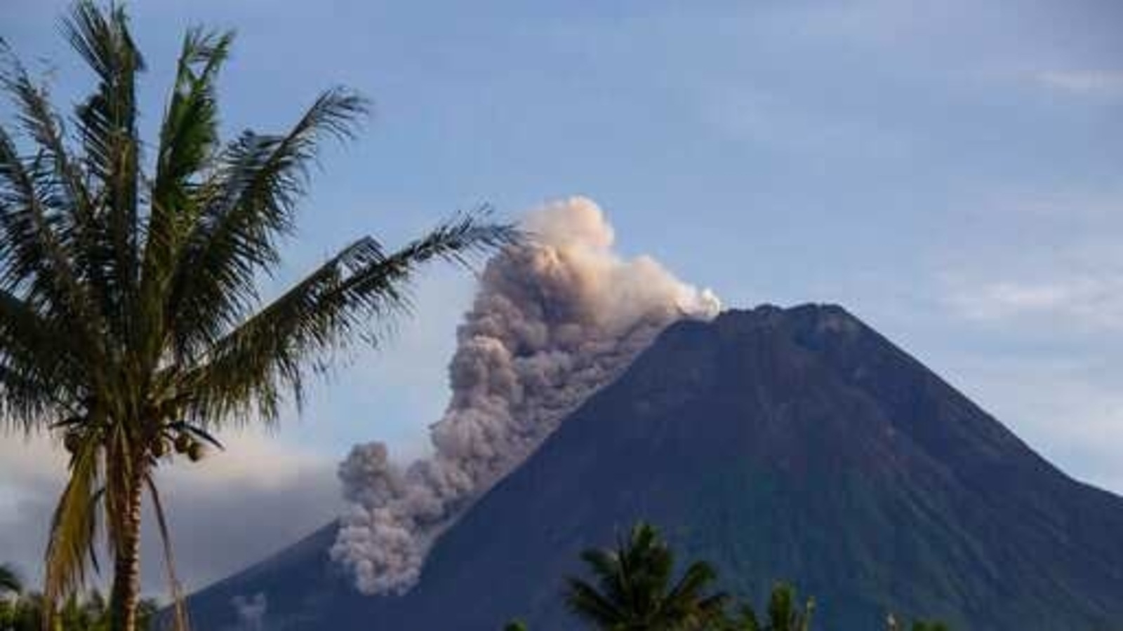
Merapi volcano has erupted, spewing ash 200 meters into the sky.
 By: VN - 27 Mar 2021, 11:45 AM
 www.hindustantimes.com
PUBLISHED ON MAR 27, 2021 02:38 PM IST
www.hindustantimes.com
PUBLISHED ON MAR 27, 2021 02:38 PM IST
Published on 27.3.2021 (1:53)
Merapi Volcano Volcanic Ash Advisory: GROUND REPORT OF VA TO FL120 OBS VA DTG: 27/1133Z
Merapi volcano news & eruption updates (Indonesia, Central Java)
www.volcanodiscovery.com
Indonesia's Merapi volcano spews ash, debris in new eruption
An avalanche of rocks spilled down Mount Merapi's slopes before dawn and clouds of hot ash shot 200 meters (656 feet) into the air as the mountain groaned and rumbled, said Hanik Humaida, the head of Yogyakarta’s Volcanology and Geological Hazard Mitigation Center.
Published on 27.3.2021 (1:53)
Pacaya volcano has erupted, spewing ash 2.7 kilometers into the sky.
By: VN - 30 Mar 2021, 09:30 AM
Published on Mar 30, 2021 (4:54)
Pacaya Volcano Volcanic Ash Advisory: PSBL VA SEEN IN STLT. to 9000 ft (2700 m)
Pacaya Volcano (Guatemala) eruption news and activity updates
www.volcanodiscovery.com
Published on Mar 30, 2021 (4:54)
Alert level raised as volcano erupts in southwestern Japan
Is it rare that BS news material is posted on NHK NEWS WEB?
Explosive eruption at Suwanosejima Eruption alert level 3 Kagoshima Toshimamura 諏訪之瀬島で爆発的な噴火 噴火警戒レベル3に 鹿児島 十島村 | NHKニュース https://t.co/Rvsi5hBLbA
A volcano on a southwestern Japan island erupted late Tuesday, sending large rocks nearly 1 kilometer from the crater, prompting the weather agency to raise its alert level.
The eruption occurred at the crater of Mt. Otake on Suwanose Island of Kagoshima Prefecture at 10:05 p.m. There were no immediate reports of injuries, according to local authorities.
The Japan Meteorological Agency said early Wednesday that it has raised the volcanic activity alert level by one notch to 3 on a scale of 5, meaning that people should not approach the crater.
Following the eruption on Tuesday night, the volcano erupted again at 2:57 a.m. Wednesday, with large rocks projected nearly 1 km from the crater as before.
The agency warned of the potential for big rocks to be hurled into the air within about a 2-km radius of the crater.
Late last year amid intensifying volcanic activity, the agency raised its alert level to 3 on Dec. 28. It was lowered to level 2 on Jan. 14 in the absence of any major changes in volcanic activity data.
Is it rare that BS news material is posted on NHK NEWS WEB?
Explosive eruption at Suwanosejima Eruption alert level 3 Kagoshima Toshimamura 諏訪之瀬島で爆発的な噴火 噴火警戒レベル3に 鹿児島 十島村 | NHKニュース https://t.co/Rvsi5hBLbA
Last edited:
NOTICE:
Seventeenth #eruption of the year of Mt. #Etna in #Sicily #Italy

April 1, 2021.
High, spectacular lava fountains, Strombolian time eruption.
Live:
Seventeenth #eruption of the year of Mt. #Etna in #Sicily #Italy
April 1, 2021.
High, spectacular lava fountains, Strombolian time eruption.
Live:
New hazard map for Mount Fuji doubles estimate of lava flow
Mount Fuji is one of the iconic symbols of Japan, a source of inspiration for artists for centuries and a can't-miss destination for modern-day tourists. It is also an active volcano.
Last week, the Japanese government revised its volcanic hazard map for Mount Fuji for the first time in 17 years. This comes as new data shows that lava flows from a major eruption could spread as far as 40 kilometers from the summit.
The map was presented at an online meeting of the Mount Fuji disaster management council last Friday.
The council is made up of officials from the central government and the prefectural governments of Shizuoka and Yamanashi prefectures, whose border the mountain straddles, and neighboring Kanagawa Prefecture.
The council updated the map based on the latest studies and geographical data. The major change was the amount of lava anticipated in the event of a large-scale eruption. Recent estimates show that an eruption could release 1.3 billion cubic meters of lava, about twice as much as previously thought. The new map includes far more craters from which this lava could flow than previous editions.
According to these estimates, lava flows could reach an additional 12 towns and cities in the three prefectures, including Uenohara City in Yamanashi Prefecture, located more than 40 kilometers from the summit.
Previously, Uenohara had been asked to provide shelter for evacuees from municipalities at the foot of Mount Fuji. Now the city will have to find shelters for its own residents.
The new map also shows that an eruption would affect wider parts of Fujinomiya City, Shizuoka Prefecture. Previous estimates indicated that lava would reach the city, located on the southwest side of Mount Fuji, within two hours. The new data suggests it would also reach the area north of the city center.
An eruption could also affect transportation and the distribution of goods, with the new calculations showing that lava flows could reach the Chuo Expressway and the JR Chuo line, which connects Tokyo with Nagoya.
Mount Fuji's last eruption began on December 16, 1707. It was centered on the southeastern slope and lasted until the following January. Records from the period show that a village about 10 kilometers from the crater was destroyed.
First confirmation by excavation of a house buried by Mt. Fuji eruption over 300 years ago ShizuokaHoei eruption
The Hoei eruption began on December 16, 1707, during Japan's Edo period.
Shizuoka Governor Kawakatsu Heita, who chairs the council, says the group will use the new map to revise evacuation plans for areas that could be affected. And though the overwhelming majority of Mount Fuji's recent eruptions have been minor or medium-sized, he had some words of warning for those who might underestimate the risk:
"These areas should feel a good amount of fear about the situation based on the revised data."
[NHK] It is a new discovery about the Hoei eruption that occurred on Mt. Fuji about 300 years ago. Oyama, Shizuoka Prefecture, which is said to have filled the entire village with volcanic ash from the eruption...
First confirmation by excavation of a house buried by Mt. Fuji eruption over 300 years ago Shizuoka July 5, 19:35
This is a new discovery about the Hoei eruption that occurred on Mt. Fuji about 300 years ago. For the first time, a part of the house at that time was found in the Subashiri district of Oyama Town, Shizuoka Prefecture, which is said to have been filled with volcanic ash from the eruption. It is highly likely that it was burned by high-temperature pumice due to the fact that it was burnt black, and experts say that it is an important discovery when considering measures for eruption of Mt. Fuji.
At the foot of Mt. Fuji, there was a village of Subashiri Village in the Subashiri district of Oyama Town, Shizuoka Prefecture during the Edo period, but it is said that volcanic ash accumulated about 3 m and was buried by the Hoei eruption in 1707
Furthermore, since the city is built on it, the records of the settlement in Subashiri Village are only left in old documents, and no home was actually found.
In June of last year, Oyama Town and a research team made up of archaeological and volcanic experts conducted an excavation for the first time to find out how the village of Subashiri Village near the crater was damaged.
...
This is the first time we have found a house in Subashiri Village that was buried by the Hoei eruption.
In addition, the wood was burnt black, and pumice stone with a reddish interior was also found, so the research team believes that the hot pumice stones from the eruption probably burned the house.
In the future, the research team will proceed with the verification of the stage of the eruption and how the house burned.
Setsuro Kaneko, a member of the Koyama Town Board of Education, who participated in the survey said, "I was so excited that when a burning pillar came out, I was really able to confirm the history of the village, which was only an old document. It is a result. In addition to applying what we learned from the excavation to future disaster prevention, we will continue to make diligent surveys and carefully preserve the ruins."
The research team leader, Kohei Sugiyama, a research fellow at the University of Tokyo, said, "It was demonstrated that the house was burned by the eruption of Mt. Fuji, which is an important clue when considering eruption countermeasures."
Subashiri area covered with thick volcanic ash
The Hoei eruption started in the middle of the Edo era, about 300 years ago, on December 16, 1707, on the eastern flank of Mt. Fuji, and continued until January 1 of the following year.
It is said that the oldest documents were the most damaged in the subashiri village at the foot of the Hoei crater, which is about 10 kilometers away, and it is located in the current Subashiri district of Oyama Town, Shizuoka Prefecture.
Subashiri Village was a village that spreads in front of the "Fuji Sengen Shrine" at the entrance of the mountain trail to Mt. Fuji.
According to the records of ancient documents, 37 houses were burned down by the fire caused by the hot ejecta, although there were no deaths, and the remaining 39 buildings that were not destroyed due to the weight of the ejecta over 3m and frequent earthquakes. It is said to have collapsed.
Since the entire village was covered with thick volcanic ash, it was hardly removed, and a new town was rebuilt on top of it, and the buried houses were a tradition without being found.
It is highly likely that Mt.Fuji will erupt in the future due to past occurrence cycles, etc.It is important to consider the damage caused by the last Hoei eruption in order to consider future disaster prevention. The discovery will be noticed.
Yoshihiro Ishibashi, the head priest of Fuji Sengen Shrine in the Odori District of Oyama Town, said, ``I heard from ancient times that there was a town buried under the ground due to an eruption, and I was wondering if this was true. It is scientifically verified by the research conducted by the University of Japan, and I'm glad that we faced the threat of Mt. Fuji's eruption by creating a new town on the volcanic ash that filled the village, so it is a wisdom of old people that we should cherish it I was talking."
Radar survey started excavation of a complex uneven house in the ground
The excavation was carried out by Oyama-cho, Shizuoka Prefecture, a research team of Kohei Sugiyama, a researcher at the University of Tokyo, who specializes in archeology, and Toshitsugu Fujii, an emeritus professor at the University of Tokyo, who specializes in volcanology.
Since 3 years ago, the research team has been conducting radar surveys using radio waves to explore the ground in the Subashiri area, where it is said that there are settlements buried in ancient documents.
As a result, it was confirmed that there were complex irregularities in several vacant lots, and the research team presumed that there was a structure like a house here.
Then, excavation and investigation by heavy equipment and manual work started in this vacant lot. I dug a hole that is 12m long and 3m wide.
After digging about 20 cm from the surface of the earth, eruptive products such as volcanic ash and scoria, which had cooled and solidified as magma foamed, were deposited under a thickness of about 2 m.
In the lowermost layer, about 15 cm of whitish pumice, which seems to have fallen immediately after the eruption, is deposited, and from that, two pieces of wood, which are black and scorched and have a diameter of about 10 cm, are considered to be "pillars", It came out upright.
In the surrounding area, debris like a part of the "wall" or "thatched roof" of the house was found.
Furthermore, from the south side, a field ridge about 50 cm in length and 1 m in width and 10 cm in width was found, and when the soil sampled was examined, it was found that barley was included.
In the past, some of the houses buried by the Hoei eruption were excavated at the Nagasaka Ruins in Gotemba City, Shizuoka Prefecture, but this is the first time that such houses have been confirmed in the Subashiri area where the entire village has been buried. ..
"It was only a legend that Subashiri was buried by an eruption, but it was a great archaeological achievement to prove its existence for the first time," said Sugiyama, a research fellow at the University of Tokyo.
Source: nhk
XPan
The Living Force
Etna Paroxysm No 17 (31 Mar - 1 Apr 2021)
Since 16 Feb 2021
My husband and I have been discussing this several times... the sounds of Etna... how are they sounding, really ? I only heard them (perhaps) as very faint rolling sounds from 15 km away a few times, I've been there. But then, I have never been really sure.
The following video clip gives you are direct source of how that actually sounds like when Etna does her thing (from a distance of 3 km)
Few photos
from the 17th Paroxysm on 1 April 2021 (but started already in the evening before midnight of 31 March 2021)
Trending content
-

-

-
Thread 'Coronavirus Pandemic: Apocalypse Now! Or exaggerated scare story?'
- wanderingthomas
Replies: 30K -
