What's the weather where you are?

Mid North Coast NSW, Australia

Mild 22*C today, still lots of smoke around from local bushfires, one very close to home yesterday :scared: Tomorrow is predicted to drop to 19*C with some (very much needed) rain, and then 26 & 29*C the following two days. It’s only spring, and bushfires are burning along the NSW coast, because everything is so dry.
 
Intense rain over the last 2 days. Expecting cooler temps and snow to reach this floor (@ 611 meters), in the next 48 hrs.
Preparing :-) for light amounts and changing conditions.

8bcfa98b17a7309c99b149e491bb9cf0.gif
 
S Wisconsin/USA: Got our 4th snowfall of Fall today. Enough to delay/close schools a bit north of here. Wisconsin's October snowfall totals set new record by 5". We thought last year Winter weather came early (second week of November), but this is hitting a lot of businesses hard, especially ones like ours that need some half-way decent (dry/above freezing) weather to get work done. Trickle down affect is going to make it a long tough Winter for everyone. Before last year, we were working into late November/first week of December.

Temps dropping into upper teens(F) tonight. I'm glad I got the crawlspace under the kitchen insulated better, yesterday.
Winter temps look like they're going to continue for the next 6-10 days.
 
Tonight in the Laurentians, Québec
80% Precip. / 2 cm
Snow showers early, with a steadier snow developing late. Low -2C. Winds SW at 10 to 15 km/h. Chance of snow 80%. Snowfall of 2-3cm.

10 day outlook:

We have pulled out our gloves, hats, woolies, snowclothes and the whole bazaar!
It's going to come on fast and strong: at least that is the general feeling around here.
Thank you for sharing your present, that way we can better prepare for the future!
 
Last edited by a moderator:
The Croatian Hydrographic Institute has reported on November 13, that record high waves have been measured in the Adriatic, with maximum wave height of 10.87m. The record height wave is not photographed, but there is an interesting picture of Dubrovnik during same time with the waves crashing against the walls (1st photo). BTW, Dubrovnik walls are as tall as eight-story building. During historic storm, winds exceeded 140 km / h in the Dubrovnik area, and 134.28 km / h was recorded at the official DHMZ weather station on Marjan in Split, Dalmacija Danas reported. This was the third highest Jugo wind speed in Split officially recorded in the last 60 years. Second photo is form Split with main avenue turned into a river.
 

Attachments

  • 1 valovi u Dubrovniku.jpg
    1 valovi u Dubrovniku.jpg
    437.9 KB · Views: 12
  • split 13-11-19.jpg
    split 13-11-19.jpg
    49.1 KB · Views: 12
All I can say from Down Under, is we need rain. The past two weeks have been hot dry and windy, with numerous bushfires from Sydney all the way up the coast to parts of Queesland. Thank goodness for the Rural Fire Service, who are all volunteers.

Tomorrow is predicted to be 28*C here on the mid North Coast of NSW Australia, with no decent rain for some weeks yet.
 
Last edited:
December Heat Record Broken 🇮🇸


December heat records were broken or equalled by at least 53 remote weather-monitoring stations and three manned stations in the first days of the month. The cause was a mass of warm air that moved across the country. The data comes from Meteorologist Trausti Jónsson.

The highest temperature previously measured in Iceland in December was 18.4°C (65.1°F), recorded on December 14, 2001 near Siglufjörður. That record was broken at three separate locations on December 2, 2019 when temperatures reached 19.7°C at Kvísker, Southeast Iceland, 19.0°C (66.2°F) at Bakkagerði and 18.7°C (65.7°F) at Vestdalur (both in East Iceland).

Daily temperature records (as opposed to monthly) were broken at over 200 locations, though some of them had only been operation for a few years. When only those operating for ten years or longer were considered, then daily temperature records were broken at 178 stations on December 2 and 111 station on December 3.

Iceland Review

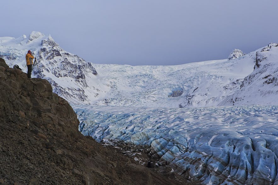
Will all the jökulls (glaciers) be melting? :whistle:

glaciers-in-iceland-4
 
Saint-Hippolyte, Quebec, Canada (lower Laurentians)
Today 12/09
100% / 0 mm
Light freezing rain this morning...later changing to rain. High 2C. Winds ESE at 10 to 15 km/h. Chance of precip 100%.

Tonight 12/09
100% / 7.37 mm
Rain likely. Low 1C. Winds S at 15 to 25 km/h. Chance of rain 100%. Rainfall near 6mm.

Source: www.wunderground.com
 
December Heat Record Broken 🇮🇸


December heat records were broken or equalled by at least 53 remote weather-monitoring stations and three manned stations in the first days of the month. The cause was a mass of warm air that moved across the country. The data comes from Meteorologist Trausti Jónsson.

The highest temperature previously measured in Iceland in December was 18.4°C (65.1°F), recorded on December 14, 2001 near Siglufjörður. That record was broken at three separate locations on December 2, 2019 when temperatures reached 19.7°C at Kvísker, Southeast Iceland, 19.0°C (66.2°F) at Bakkagerði and 18.7°C (65.7°F) at Vestdalur (both in East Iceland).


That didn't take long. A week later Iceland seems to be back to its normal self.

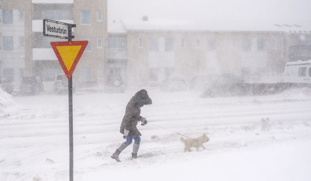
All Roads Out of Reykjavík Likely Closed Tomorrow

Extreme weather will likely close all roads in and out of Reykjavík tomorrow starting at noon. Most of the proposed closures in the capital area are expected to last until Wednesday afternoon. Road closures due to violent winds and heavy snowfall are expected throughout the country on Tuesday and Wednesday.

The Road and Coastal Administration has published a list of roads that may be closed tomorrow due to weather. The road closures include Route 1 (the Ring Road), both toward South Iceland and West Iceland. Route 41, which connects the capital region to Keflavík Airport (the country's international airport), is also expected to be closed from noon tomorrow until 1.00pm on Wednesday.

Residents and tourists alike are advised against travelling in Iceland tomorrow.

DSF9667-ohx1ryt83ws505i8jhk2yqwu72435jo46qfsp82yjc.jpg


Extreme Weather Across Iceland Into Wednesday

In West Iceland, north of Reykjavík, winds of 20-28m/s are expected, while further north in Breiðafjörður fjord, wind speeds could reach 23-30m/s, with blowing snow limiting visibility. The Westfjords and Northwest Iceland are expected to receive heavy snowfall and winds of 23-33m/s, with snowstorms limiting visibility and transport disturbances expected.

Iceland Review
 
Major turnaround up here, on the 49th parallel: yesterday it was seriously raining, like 6C today at 5 in the morn' -minus -12'ish!

TimeConditionsTemp.Feels LikePrecipAmountCloud CoverDew PointHumidityWindPressure
10:00 am
Partly Cloudy
Partly Cloudy
-10 C-16 C

Today 12/11
50% / 0.9 mm
A mix of clouds and sun this morning, then some snow showers this afternoon. High near -5C. Winds S at 10 to 15 km/h. Chance of snow 50%.
Source: www.wunderground.com
 
Rain, with changing conditions, with snow possible at this local.

When such a powerful jet of altitude west blowing at more than 300 km / h sinks into France, you know that the wind is likely to blow in #tempête . #jetstream

A lot of #neige to come on #Pyrénées . In 48h, the meter should be well past the chain (except the east of the PO). Locally equivalent rain, it should fall 150/200 mm of rain on the Upper Bigorre in particular.
 
After showers since the morning and a late afternoon and night windy enough to shake century-old oaks like tufts of grass and drop a few tiles, and also scatter the garden furniture, despite precautions, as if giants had come to fight and to finish a power cut for 24 hours.
Finally for this Saturday, December 14, the calm has once again settled in Southern Corsica shared between clouds and rays of sunshine comforting enough to leave the windows open.
Until the next battle.
 
Back
Top Bottom