WORLDWIDE EARTHQUAKE REPORT SEPTEMBER 06
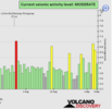
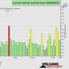
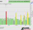
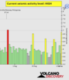
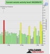
Based on the averages of all earthquakes during the last 24 hours we had a moderate seismic activity level.
See Global seismic activity level chart
~6 quakes above magnitude 5
~30 quakes between magnitude 4 and 5
~103 quakes between magnitude 3 and 4
~219 quakes between magnitude 2 and 3
~470 quakes below magnitude 2 that people normally don't feel.
~828 quakes past 24 h. (827 earthquakes in the 24 hours prior to this report) Estimated combined seismic energy released: 9.6 x 10¹³ joules (26.6 gigawatt hours, equivalent to 22894 tons of TNT or 1.4 atomic bombs!)
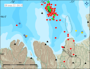
Volcanodiscovery earthquake report 24h
▪︎M 6.0 - South Sandwich Islands region was updated to M5.9 this morning.
▪︎M 5.7 - South Sandwich Islands region
2022-09-06 12:14:07 (UTC)
56.492°S 25.700°W. 8.9 km depth
USGS earthquake alert
▪︎M 5.0 - 71 km S of Calama, Chile
2022-09-06 13:14:36 (UTC)
23.097°S 68.955°W. 94.2 km depth
USGS earthquake alert
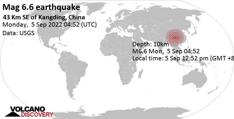
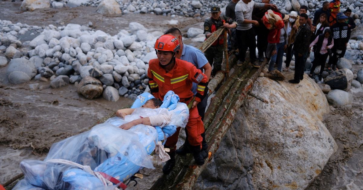
Update: Thousands evacuated in SW China as quake toll rises to 66
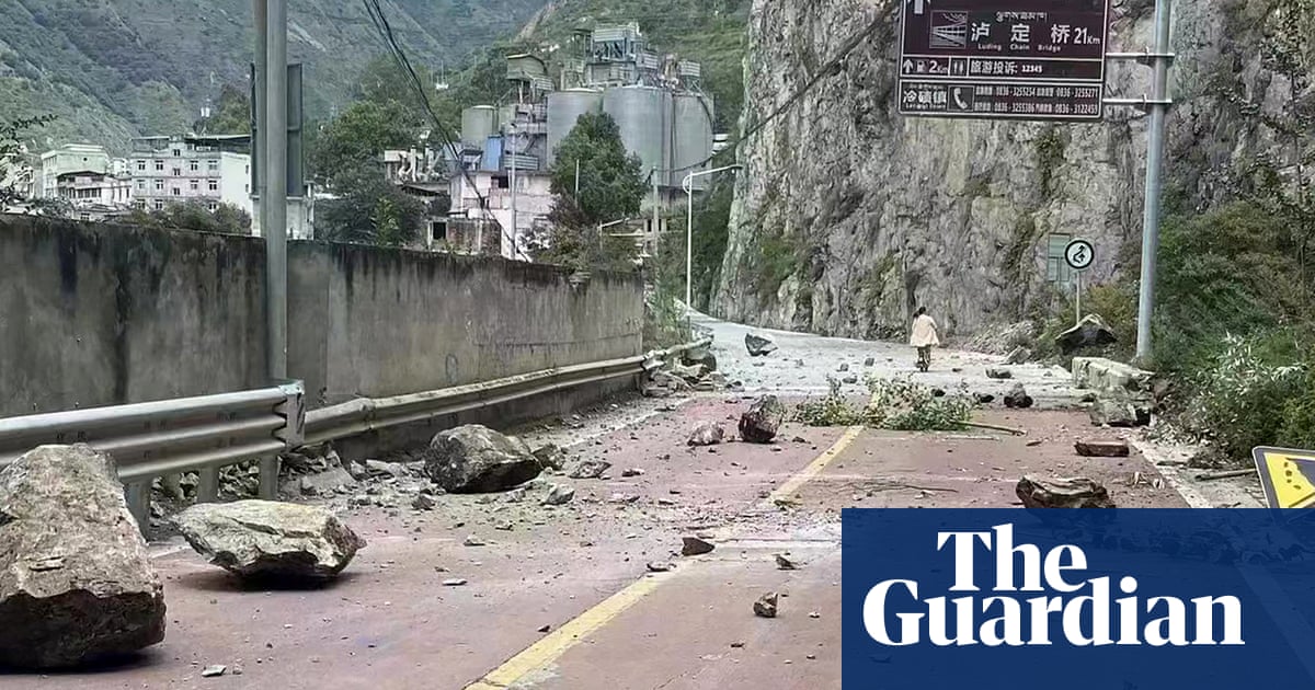
Chinese firefighters worked in treacherous terrain on Tuesday to help evacuate more than 11,000 people after a magnitude-6.8 quake struck China's mountainous southwestern province of Sichuan.
Authorities had identified around 500 potential geological hazards, according to the reports, referring to landslides and collapsed mountain roads.
The death toll from the strongest earthquake to hit China's southwestern Sichuan province since 2017 rose to 66 on Tuesday, though dozens of people were suffering heavy injuries.
On Tuesday, state television reported over 200 people were still stranded in Hailuogou, a popular tourist spot known for its glaciers, verdant forests and soaring peaks. Rescuers were working to reopen roads to reach them.
It also reported that
243 houses had collapsed and 13,010 had been damaged. Four hotels and hundreds of tourist lodgings were also affected.
The quake cut power to several towns, while various highways collapsed and seven small-to-mid-sized hydropower stations suffered damage.
With heavy rains expected over the next three days, experts on Tuesday flagged risks posed by a number of dammed lakes that have formed after the quake.
Chinese firefighters worked in treacherous terrain on Tuesday to help evacuate more than 11,000 people after a magnitude-6.8 quake struck China's mountainous southwestern province of Sichuan a day earlier, killing at least 66 people.

www.reuters.com
 @EberthMunoz