The Ice Age Cometh! Forget Global Warming!

Here is the begging tag that the Guardian appends to all their online articles. And oh wow, any press related to human-caused boiling seas and such will never have to hide behind a paywall thanks to donors like us! :thdown:
I'm thinking maybe they wouldn't need to beg if they trimmed some of the fat (like their 'huge global team of climate writers').
IMG_3169.PNG
 
A harbinger of things to come.

Major Storm Brings Snow To The West - Seismic Swarm Iceland - Geomagnetic Storm Watch - Green Mining
Magnetic Reversal News
A major storm is bringing early-snow to the western US this weekend https://tinyurl.com/yj8e9tua PG&E warning customers across state for potential shutoffs https://tinyurl.com/42zb5sv5 First major snow system of the season arrives in Colorado https://tinyurl.com/5fczpmmu First measurable snow of the season likely tonight https://tinyurl.com/mr3szwx3 Snow likely in Casper this afternoon https://tinyurl.com/2p8sec3h Northern Hemisphere Snowmass https://tinyurl.com/3v9642zf Powerful Storm to Affect the West and Plains https://www.weather.gov/ GFS Model US https://www.tropicaltidbits.com/analy... Magnitude 4.4 - 10 miles S of Skwentna Alaska https://tinyurl.com/yckwe7sv Earthquake swarm north of Herðubreið mountain https://icelandgeology.net/ Iceland Earthquake Map https://en.vedur.is/earthquakes-and-v... Space Weather https://solarham.net/ X-ray view of wreckage from a star-killing cosmic explosion reveals magnetic surprise https://www.space.com/cassiopeia-a-st...


1666570215551.png

1666570036292.png

1666570404135.png

Dated:

 
For what its worth Farmers' Almanac's winter prediction and also NOAA's - perhaps not surprisingly at odds with each other.
-------------------------------------------------------------------------------------------------------------------------

Farmers' Almanac declares parts of US 'hibernation zone' with predicted 'glacial, snow-filled' winter

Farmers-Almanac-Winter-Weather-Forecast-US-2023-media-1-copy[1].jpg

Many Americans have been broiling through an above-average summer, but if the Farmers' Almanac winter forecast is right, some parts of the nation are heading for a polar opposite experience this winter.

Their annual whimsical forecast is hinting at a particularly harsh winter across much of the North with "real shivers" that "might send people in the Great Lakes areas, Northeast and North Central regions hibernating."

In fact, their forecast map declares much of the upper Midwest a "Hibernation Zone" with a "glacial, snow-filled" winter head with temperatures forecast to drop as cold as -40 in the North Central states in mid-January which would be near record territory for some cities (such as Fargo, North Dakota) if such forecasts came to pass.

While temperatures wouldn't be that cold in the Northeast, the Almanac is predicting "significant shivers" there. Even in the Southeast, whose forecast isn't particularly snowy, is still looking at a "shivery, wet and slushy" winter, according to the Almanac.

As for the Southern Plains, expect the brunt of winter to come in January, with heavy snow predicted in the first week of 2023 in Texas and Oklahoma.

If shivering is not your thing, head west. The Almanac forecasts continued drier than normal conditions across the parched Southwest and Intermountain West while the Pacific Northwest is tabbed as "brisk" but with normal precipitation. That would make for a wet winter as "normal" winter is the wettest time of the year up there.

NOAA: Agree to disagree on winter forecast

Which is predicting a greater-than-average chance of a warm winter across the Southwest, Southern Plains and the entire Eastern Seaboard.

On the other hand, it's the Pacific Northwest leaning toward another chilly winter.

The Farmers' Almanac's shiver-fest forecast is in conflict with NOAA's current winter forecast.

You are a couple of months ahead, so just adding the North 49th latitude for same:

Canada’s Extended Winter Weather Forecast 2022-2023​

2022-2023 Canadian Extended Weather Forecast

A Potpourri Of Precipitation And Unreasonably Cold Conditions Ahead!

The first day of winter (the shortest day of the year) is Wednesday, December 21, 2022. But that doesn’t mean that the cold, snowy weather will wait until then. When will the temperatures start to drop? Are there any big snowstorms predicted to hit before the winter solstice? What is the extended winter weather forecast for 2022-2023?

Got flannel? Hot chocolate? Snowshoes? If not, you may want to go get some. According to our extended forecasts, 2022-2023 will be remembered as a time to shake, shiver, and 
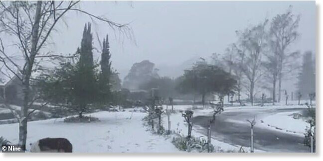
shovel—a winter season filled with plenty of snow, rain, and mush as well as some record-breaking cold temperatures!

To Shovel Or Not To Shovel?

Based on our extended weather forecasts, the winter season will be quite stormy for most areas. An active storm track will travel across eastern North America, running from the western Gulf of Mexico to the northeast—across the New England region of the US and up into the Maritime Provinces.

This means that places to the south and east of the storm track (the Maritimes) will see a good number of cold rains and storms filled with snow, sleet, ice, and rain. Areas north and west of this active track—Labrador, Newfoundland, Quebec, Ontario, and the Great Lakes—will more often-than-not will see winter’s precipitation fall as snow, and sometimes a lot of it.

The Prairie Provinces will be hit the hardest this year with tons of snow in both January and February.

British Columbia should see about average amount of winter precipitation, but with brisk temperatures, skiing should be decent this upcoming season.

1666678118085.png

Snow Days Ahead!

The last half of January looks quite stormy. A decent amount of snow is expected in Ontario, Quebec (January 20-23) and the Prairie Provinces (January 24-27). In February, especially for Eastern areas, there’s a possible Nor’easter that may drop as much as 30-60 centimeters (12-24 inches) of snow in some areas just after Groundhog’s Day.

Shake & Shiver​

The big shake-up this winter season will be frigid temperatures that will flow into many areas—especially across the Rockies and Prairies. During the month of January, Canadians may see one of the coldest arctic outbreaks in recent years.

More Winter Storm Warnings

There will be many significant weather disturbances that will cross the nation, but we are raising “red flags” for the first week of January across the Rockies and Prairies, with the potential of heavy snows, followed by a sweep of bitter cold air.

We’ll raise another red flag for January 16-23, 2023, across the eastern two-thirds of the country where our extended forecast points to bouts of heavy snow and rain, followed by what might be one of the coldest outbreaks of arctic air we have seen in many years. How cold? Try 40° below zero (a number that’s the same in Fahrenheit and Celsius).

Finally – after the vernal equinox on March 20, 2023 – when we’re supposedly into spring, expect a lion-like end to March with a wide-variety of weather ranging from heavy snows to torrents of rain to gusty thunderstorms and stormy weather across much of the nation.

As always, wait and see, and be prepared...
 
Glacier Route 1-West Glacier Park to 5 miles west of Marias Pass are scattered snow and ice, and from 5 miles west of Marias Pass to Junction Montana 49 North-East Glacier Park are snow covered in Montana. They've also already closed the Road to the Sun in Glacier National Park.
 
When I thought of a new Ice Age, I must admit I wasn't thinking in terms of the Geographical Poles being in a completely different spot from where they were in the last Ice Age.... (30 degs off?) One tends to think of the Poles staying in the one position and not moving.... :scared:

I'm reading Pierre's book "Cometary Encounters" and if the Poles were in a different location, it would explain why ice sheets were where they were....

I'm still trying to get my head around the forces necessary to do that Pole shift!
 
The following is a post from a popular meteorologist (who pushes global warming) noting the cold anomalies recorded today in South America and Australia:
Very impressive and widespread cool weather in South America and Australia right now.
These anomaly maps show how much warmer or cooler it is compared to average.
🔵
= cooler than average
🔴
= warmer than average

1667329917943.png1667329926496.png
- post can be found here: Bei Facebook anmelden
 
Last edited:
The following is a post from a popular meteorologist (who pushes global warming) noting the cold recorded today anomalies in South America and Australia:
Here is the situation in the Northern Hemisphere:
Screenshot 2022-11-01 204824.jpg
And from a different map projection:
1667333174933.png

Because of map distortions, that makes the area of the equator look smaller than it really is, it is not straightforward to say what the overall balance is of heat vs cold. A guess is that it looks like the anomaly is on the warm side, at least in the Northern Hemisphere. If that is so, the air can hold more humidity. When the air then is carried north, it cools down, the relative humidity goes up and water vapour condenses to give rise to precipitation in the form of mostly rain or snow. Is that the reason why:

Greenland keeps adding
One location, where the precipitation has been on the plus side since September 1st, is Greenland, as seen in the latest map of the surface mass balance: Surface Conditions: Polar Portal
1667333809172.png
For Antarctica, I could not find a similar model. The advantage of Greenland is its smaller size, which facilitates surveys. There was however a study, published in 2017 by Elizabeth R. Thomas et al, that based on a number of ice cores modelled the development of the surface mass balance of the Antarctic ice sheet over the last 1000 years. It may have been mentioned already, but I could not find it, so here is the abstract:
Regional Antarctic snow accumulation over the past 1000 years
DOI:10.5194/cp-13-1491-2017

Here we present Antarctic snow accumulation variability at the regional scale over the past 1000 years. A total of 79 ice core snow accumulation records were gathered and assigned to seven geographical regions, separating the high-accumulation coastal zones below 2000 m of elevation from the dry central Antarctic Plateau. The regional composites of annual snow accumulation were evaluated against modelled surface mass balance (SMB) from RACMO2.3p2 and precipitation from ERA-Interim reanalysis. With the exception of the Weddell Sea coast, the low-elevation composites capture the regional precipitation and SMB variability as defined by the models. The central Antarctic sites lack coherency and either do not represent regional precipitation or indicate the model inability to capture relevant precipitation processes in the cold, dry central plateau. Our results show that SMB for the total Antarctic Ice Sheet (including ice shelves) has increased at a rate of 7 ± 0.13 Gt decade⁻¹ since 1800 AD, representing a net reduction in sea level of ∼ 0.02 mm decade⁻¹ since 1800 and ∼ 0.04 mm decade⁻¹ since 1900 AD. The largest contribution is from the Antarctic Peninsula (∼ 75 %) where the annual average SMB during the most recent decade (2001–2010) is 123 ± 44 Gt yr⁻¹ higher than the annual average during the first decade of the 19th century. Only four ice core records cover the full 1000 years, and they suggest a decrease in snow accumulation during this period. However, our study emphasizes the importance of low-elevation coastal zones, which have been under-represented in previous investigations of temporal snow accumulation.
Coming back to the Northern Hemisphere, the Sea Ice is still there
1667336148165.png
1667336200886.png
Checking up on the Northern Sea Route, there has been little news since May, after trade between Russia and the West became more difficult. But judging from the map, if there is 1,5-2 meter ice in the eastern area above Siberia, already now, it might not have been as easy a year as many of the previous years.
 

----------------------------------------------------------------------------------------------------------------------------------

Big freeze strikes Australia: Antarctic blast lashes east coast, SNOW dumps near Sydney as temperatures plunge to single digits in Melbourne - just 4 weeks out from summer


64087339_11379009_Icy_gusts_ha[1].jpg

Australians have woken up to an icy morning as the country is lashed by two jet streams that have pooled cold air over the eastern seaboard.

The cold Antarctic air has been dragged north by a pend in the polar jetstream - a band of wind that continuously flows about 8 to 15km above sea level.

Icy gusts are lashing the east coast and snow is dumping just outside of Sydney and in south-eastern alpine region as the polar jetstream clashes with the separate subtropical jetstream.

It comes as residents of Melbourne and Canberra experience temperatures in the single digits - with the nation's capital hitting just six degrees on Wednesday morning and Melbourne nine degrees, with the mercury set to rise throughout the day.


Inland parts of NSW have also experienced widespread showers and scattered thunderstorms.

The state's central west is expected to bear the brunt of conditions with snow possible above 800 metres around Lithgow, Orange and Bathurst and more rain will flood already swollen creeks and catchments.

Lighter snowfall will extend further west, while many areas in NSW will have a maximum temperature 10 to 15 below normal.


NSW Minister for Regional Transport and Roads Sam Farraway warned motorists in the region to take care with wet and icy roads.

'The recent extreme weather has badly damaged roads right across the state's network and the forecast of more rain and possible snow only adds to our concerns,' he said.

'The potential for snow and black ice on roads across the Central West will create additional road hazards.

'Some areas across the state's west have received no rainfall for days but we are not yet seeing floodwaters recede.'

A dangerous mix of weather was created by the two jet streams clashing over the country due to the contrast in air mass density and temperature.

The polar stream is bringing cold air from the Antarctic while the subtropical sends through warmer air.

64085773_11379009_image_a_8_16[1].jpg

Severe weather warnings for damaging winds have now been issued for parts of Queensland, NSW and South Australia.

Flood warnings are also in place across regions in east and south-east Australia as the wild weather produces heavy rain.

Major flooding is expected at Coonamble and Nanami in NSW on Wednesday, and on Friday at Forbes which copped a deluge last month. The Bureau of Meteorology also expects major flooding on the Bogan River.

More than 90 SES hazard warnings are current for NSW with 48 flood rescues carried out and nearly 760 requests for assistance.

Evacuation orders are in place for residents in Moama, Mathoura, Cowra and Tumut.

Weatherzone meteorologist Yoska Hernandez told Daily Mail Australia that conditions should ease in the coming days.

'The worst of the weather should be today and tomorrow with damaging winds, snowfall and showers.'

'The high pressure system will settle the weather over the following days in the south-east.'

She added that the jet stream was already moving past the east towards the Tasman Sea.
 
It's dammed cold I tell ya. 🥶

With both sides of the puddle feeling an early November breakout, with #snow accumulations mounting for skiers.


Fg_pIZhUUAAqnAM.png


Line-1
No snow today in Mérens les Vals
Line-2
11/11/2004 1350m #ariege l'Hospitalet et Mérens

The anticyclone will not last very long towards #Europe West. From Monday, the disturbed Icelandic dynamic will increasingly influence the #France . On the program, generous rains (good news) and temperatures that remain fairly mild!

1668293387108.png
 
Some predictions age not so well!

View attachment 66859

And, to be sure, I checked pictures of the Kilimanjaro in 2022 and, surprise suprise, there is still snow!

View attachment 66860
Here in Montana, there were signs put up by the National Park Service in Glacier National Park in 2010 darkly proclaiming that the glaciers would by gone by 2020. Welp, this year they were ordered by the USGS (US Geological Service) to take the signs down, as there has been no indication that the glaciers in the park are shrinking. :-P

Indeed, teams from Lysander Spooner University visit GNP each September and have noted that GNP’s most famous glaciers such as the Grinnell Glacier and the Jackson Glacier appear to have been growing. The Jackson Glacier has grown as much as 25% or more over the past decade. :rotfl:
jacksonglacierGNPMontana.jpg
 
Back
Top Bottom