Earthquakes around the world

New Volcano Notice: Earthquakes Increase After Pu'u O'o Collapse
May 1, 2018
PUNA, Hawaii - The new activity means an outbreak of lava in a new location could occur, and officials say that "while it is not possible to predict where an outbreak could occur, the area east of Pu’u O’o is a possible location."

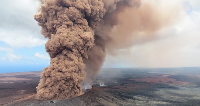
A series of earthquakes, the largest measured at a Magnitude 4.0, began rattling the Puna district below Kilauea volcano in the area between Pu’u O’o and Highway 130 last night, following the collapse of the Puʻu ʻŌʻō crater floor Monday afternoon.

The USGS Hawaiian Volcano Observatory issued the following Volcanic Activity Notice Tuesday morning:

Summary:
A collapse of the Puʻu ʻŌʻō crater floor Monday afternoon on Kīlauea Volcano’s East Rift Zone has prompted increases in seismicity and deformation along a large section of the rift zone, with seismicity currently occurring as far east as Hwy 130. A outbreak of lava in a new location is one possible outcome. At this time it is not possible to say with certainty if or where such an outbreak may occur, but the area downrift (east) of Puʻu ʻŌʻō is the most likely location, as this is where seismicity and deformation have been concentrated overnight.

Residents of lower Puna should remain alert and watch for further information about the status of the volcano; watch for Hawaii County Civil Defense messages.

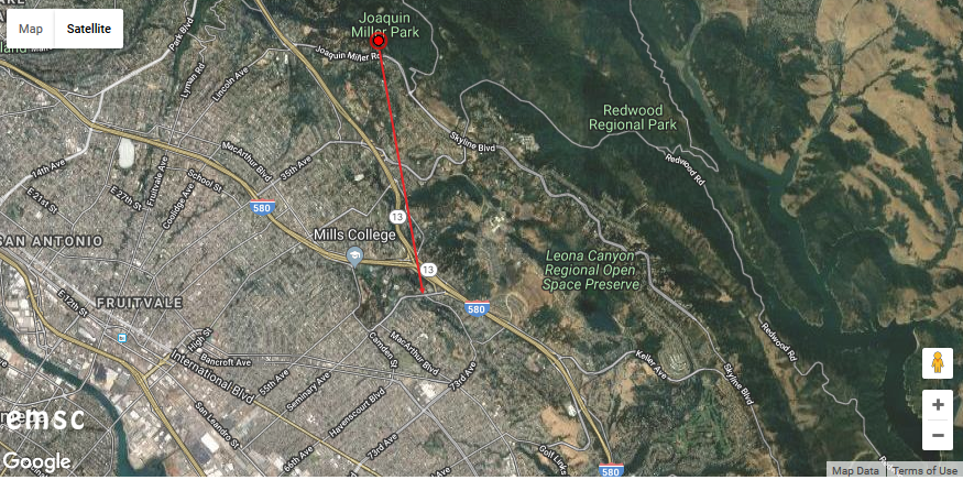
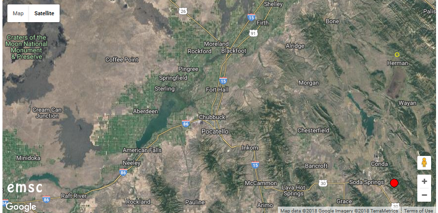
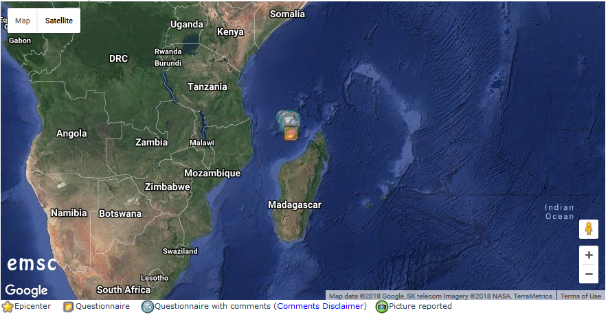
Recent Observations: (Hawaii 4.2 earthquake 1 of 82 in the past 24 hours)

Between about 2:00 and 4:30 pm on Monday, April 30, following weeks of uplift and increasing lava levels within the cone, the crater floor at Pu’u ‘Ō’ō on Kīlauea Volcano’s East Rift Zone collapsed.

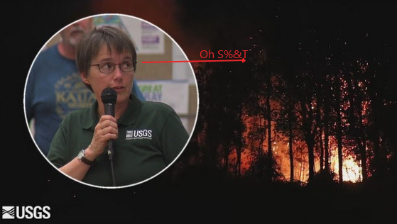
Poor weather prevented HVO from flying over the activity or seeing details of the activity in our web cameras on site.

Following the collapse, HVO seismometers and tiltmeters recorded an increase in seismic activity and deformation from Kīlauea Volcano’s summit to an area about 6-10 miles downrift (east) of Puʻu ʻŌʻō. Overnight, this activity localized downrift of Puʻu ʻŌʻō and continued to propagate eastward along the rift zone.

The largest earthquake of this sequence so far was a magnitude 4.0 earthquake just offshore south of Pu’u ‘Ō’ō at 02:39 this morning,

Kīlauea’s summit eruption has thus far not been affected by the change at Pu’u ‘Ō’ō.

Hazard Analysis:
The migration of seismicity
and deformation downrift (east) of Puʻu ʻŌʻō cone following Monday’s collapse indicates that a large area along the East Rift Zone is potentially at risk for a new outbreak.

The location of any future outbreak will determine what areas are in the path of new lava flows.

The situation is rapidly evolving and USGS Hawaiian Volcano Observatory scientists continue to closely monitor Kīlauea’s East Rift Zone and summit. More updates will follow as information becomes available.

Hawaii County Civil Defense issued an alert Tuesday morning, saying the activity this “means an outbreak of lava in a new location could occur. While it is not possible to predict where an outbreak could occur, the area east of Pu’u O’o is a possible location.”

“Due to the increased seismic activity, lower Puna area residents are advised to stay informed by listening to the radio; this station will be updated,” the civil defense message stated. “Hawaiian Volcanoes Observatories and your Hawaii County Civil Defense are continuing to monitor the situation. You will be informed as conditions change.

Earthquake, Magnitude 5.8 - PACIFIC-ANTARCTIC RIDGE - 2018 May 01, 17:15:37 UTC

Earthquake, Magnitude 5.7 - FIJI REGION - 2018 May 01, 12:45:33 UTC
 
02.05.2018 - Magnitude 5.1 Earthquake hits Southwest Iran, injuring over 70 people - Reports
Magnitude 5.1 Earthquake Hit Southwest Iran, Injuring Over 70 People – Reports

An earthquake with a magnitude of 5.1 has occurred in Iran’s southwestern province of Kohgiluyeh and Boyer-Ahmad, injuring 76 people, the IRNA news agency reported, citing Iran's emergency services spokesman.

The quake hit the city of Sisakht at 08:38 local time (04:08 GMT), making people rush out to the streets, the IRNA news agency reported, citing the Seismological Center of the Geophysics Institute of Tehran University.

The earthquake's epicenter was located at a depth of 8 kilometers underground. There is no information on the damage to infrastructure yet.

"The number of victims of the earthquake in Iran increased to 76," representative of the Iranian emergency situations organization Mujtaba Khalidi said.
 
BIVN :
The earthquake was not large enough to cause a tsunami for the island of Hawai’i, civil defense reported
Magnitude 6.9 Earthquake Hits Hawaii, Frequent Tremors

IntensityMapThumbnails.png

Earthquake, Magnitude 6.9 - ISLAND OF HAWAII, HAWAII - 2018 May 04, 22:32:55 UTC
 

05.05.2018 - Two Quakes Rock Hawaii's Big Island as Volcano is Erupting
Two Quakes Rock Hawaii's Big Island as Volcano is Erupting

According to the US Geological Survey, a second earthquake measured at a magnitude of 5.8 struck Hawaii Friday, roughly 30 minutes after a 5.7 magnitude quake hit the island. Both quakes were centered very near the Kilauea volcano, which has been intermittently spewing ash and lava, threatening residential areas, since yesterday.

Officials previously marked the earthquake at a magnitude of 6.9 before downgrading it to a 5.8.

The latest shake, which happened at 12:32 p.m. local time, stuck some 11 miles southwest of the Leilani Estates, near Kilauea. The National Weather Service has stated that there is no tsunami threat at this time. However, it did indicate that "some areas may experience small sea level fluctuations."

Since the quake struck, residents have taken to social media to share commentary and images of the surrounding areas.

Prior to the earthquake, netizens reported seeing lava from Kilauea being shot up in the air in the Leilani Estates area, which is under mandatory evacuations after reports of lava streams and emissions were spotted coming from the ground. The area, which populated by some 1,700 residents, has seen more than 1,500 people fleeing from their homes, the Chicago Tribune reported. Officials monitoring the area have detected high levels of sulfur, threatening people with breathing difficulties and the elderly.

There have been several tremors registered throughout the day, measured at magnitudes from 4.8 to 6.9. The latest quake first registered at a 6.0 before being upgraded to a 6.9, then downgraded to a 5.8.

Authorities confirmed early Friday that at least two homes were "touched by the lava flow" after evacuations were initiated, according to a report from NBC News. Roughly 770 buildings are under threat as they are located near the volcano.


05.05.2018 - Strong 6.4 Magnitude Earthquake Strikes Off Philippines - USGS (Photo - Video)
Strong 6.4 Magnitude Earthquake Strikes Off Philippines - USGS (PHOTO, VIDEO)

According to the latest reports by the USGS, US Geological Survey, an earthquake measuring 6.4 has struck off the coast of the Philippines.

The tremor was registered at 06:19 UTC (9:19 Moscow time). There are no immediate reports of casualties or damage from the quake, which hit at a depth of 30 km (18 miles), about 50 km north-northwest of Pandan, on the island of Catanduanes, according to the USGS.

No tsunami warnings were issued.

Seismological centers have posted the information about the earthquake on Twitter. Social media users are tweeting alleged photos/videos of the earthquake.
 
  • Like
Reactions: Ca.
May 5, 2018

Police, Fire Chiefs Talk Eruption Response (May 4, 2018)

Big Island Video News Published on May 5, 2018


Earthquake Warning 7-11 May 2018
Ditrianum Published on May 5, 2018 / 5:46
Early on May 8, the Moon will square both the Sun and Jupiter. Similar geometry in the past triggered earthquakes up to and even over 8 magnitude. This of course very much depends on the state of Earth's crust.

With the Mercury-Sun-Venus alignment on the 7th and the Sun-Earth-Jupiter alignment on the 9th, a warning is issued for this time-frame from the 7th to the 11th with the possibility of a large earthquake, perhaps over magnitude 8.
 
What may be a game changer for Hawaii is the fact that there is a Geomagnetic storm in progress as we speak:

GEOMAGNETIC STORM:
A minor G1-class geomagnetic storm is in progress on May 5th as Earth enters a stream of fast-moving solar wind. The gaseous material is flowing from a wide hole in the sun's atmosphere. It is, in fact, so wide that Earth could be inside the stream for days to come. NOAA forecasters estimate a 55% chance of continued storms on May 6th and 7th. High-latitude sky watchers should be alert for auroras. Visit Spaceweather.com for updates.
 
  • Like
Reactions: Ca.
427

6.9-magnitude earthquake hits Hawaii, prompts fresh volcano eruptions

Adapt 2030 Published on May 5, 2018
With the strongest quake and volcanic eruption in on Hawaii Island, you need to ask yourself it is correlated to solar activity or has something to do with the intensifying grand solar minimum.
A 6.9 earthquake and explosive eruption at the Pu O'o vent is rare, but looking at the intensity ramp up of the magnetic wave cancelling on our Sun, well the we get into some interesting similarities. I provide a timeline for the grand solar minimum intensification and incredible images of the lava events on the island.

Local Media sources are attempting to down play the significance of this event and what is yet to come, imho. :whistle:

8de771686b7157e74907b793a4b1300b.png


New York overdue for earthquake that could destroy 6,000 buildings | Daily Mail Online
17:26 BST, 4 April 2018
4AD180AA00000578-5577117-image-a-15_1522844331767.jpg

New York City is not thought of as a tremor hot spot, but the five boroughs are riddled with fault lines that could bring dozens of buildings down

4ACFA85100000578-5577117-image-a-1_1522843776370.jpg

Earrthquake hot spots around the U.S. with New York rated a moderate risk
 
Last edited:
06.05.2018 - Quake Hits Polish Coalmine: One dead, Four missing - Reports
Quake Hits Polish Coalmine: One Dead, Four Missing - Reports

A 3.42 magnitude earthquake that struck the Borynia-Zofiowka-Jastrzebie coal mine in Poland killed at least one miner; four others are currently missing, the chief executive of mine owner JSW, Daniel Ozon, as quoted by Reuters.

A total of 250 miners were underground, with 11 people working in the quake zone. Immediately after the quake, rescue services launched an operation; however, they've only managed to evacuate two miners from the epicenter on Saturday.

As Reuters reported, the rescuers have found another trapped miner, but his evacuation will take several hours.

Eight rescue teams are reportedly working on site, but haven't been able to get any nearer to the epicenter of the quake because of high levels of methane. According to them, it is very important that the trapped miners have enough air to breath.

This week a number of powerful earthquakes shook the world, injuring 130 people in Iran and prompting a mass evacuation in Hawaii.


May 5, 2018 - Polish rescuers battle to reach four Miners Trapped after quake
Polish rescuers battle to reach four miners trapped after quake

WARSAW (Reuters) - Rescuers battled in the early hours of Sunday to reach four coal miners who remained trapped nearly one kilometer (0.6 mile) underground in southern Poland after an earthquake.

The 3.4 magnitude quake hit the Borynia-Zofiowka-Jastrzebie mine on Saturday morning, initially trapping seven miners at a depth of about 900 meters (2,950 feet), state mining office WUG said.

Two had been rescued by mid-afternoon, and one was found late on Saturday but showed no signs of life, the deputy chief executive of the mine owner JSW, Tomasz Sledz, told reporters.

He said the third miner was buried and that it was not yet possible for rescuers to confirm he was dead. He said there had been no contact with the remaining four miners.


The two rescued miners were taken to a hospital in Jastrzebie-Zdroj city in “relatively good condition” and could walk unaided, JSW Chief Executive Daniel Ozon told reporters.

“We are doing all we can to save the miners,” Ozon said.

There were about 250 people working in the mine at the time of the quake, JSW said. The missing miners were from a team of 11 that was drilling a new tunnel. Four escaped by themselves.

The 200-person rescue operation was earlier hampered by high levels of methane, which reached a concentration of up to 58 percent.

A spokeswoman for JSW, the European Union’s largest coking coal producer, said earlier that the quake had damaged communications lines in the area.

Prime Minister Mateusz Morawiecki, who reached the mine on Saturday evening, said the rescue operation was very difficult and that he hoped the remaining miners would be saved.

He also visited the two rescued miners at the Jastrzebie-Zdroj hospital.

WUG said the quake was of a type that can occur in coal mines after the removal of deposits builds up tensions in the rocks.

Polish news agency PAP said family members of the missing miners had gathered at the mine and were being counseled by psychologists.
 
08.05.2018 - Fears Over Eruption grow as Major Tourist Spot Shaken with Hundreds of Quakes
Fears Over Eruption Grow as Major Tourist Spot Shaken With Hundreds of Quakes

Stepped-up tremors of unascertained reasons has scared one of the most popular holiday destination, the Canary islands, ahead of summer high season, raising fears devastating natural disasters. The local government holds an urgent meeting to discuss why might happen.

Almost 300 earthquakes have shaken the territory of the biggest islands of the Canary archipelago, Tenerife and Gran Canaria, over the last ten days. According to the Spanish National Geographic Institute, the biggest one, with a 3.2 magnitude of on the Richter scale, happened 35 km away from the Port of Las Palmas de Gran Canaria.

The area is the home to the world's third-tallest volcano, Mount Teide and the National Park of the same name, which is incidentally one of the most visited tourist destinations, with lots of volcanos.

The research cited by the Daily Star, suggested that seismic activity has been caused by a submarine fault between the two major Canary Islands, which could lead to an eruption, similar to the recent Hawaiian disaster. Kilauea volcano there sent spit lava flows to the neighboring houses, forcing thousands to evacuate.

Fears that the Canary’s Teide volcano may be reactivated and fears of a mega-eruption forced the government to appoint an urgent meeting.

However, the director of the National Seismic Network from Spain's National Geographic Institute, Emilio Carreño, speaking to Canary News, suggested, that these minor quakes were of tectonic origin and are “not usually associated with volcanology."

“It is not unusual. Right now in the Peninsula there are quite a few places at which these series are being observed, it is common during any single month to register between 100 and 600 earthquakes in areas like in the Jódar area, or in Jaén, which can experience between 400 and 500 at the same time,” he told the media.
 
This may not seem significant. But some of the Testimonies show a severity on areas built on land fill. Possibly showing signs of liquefaction. Lets get ready for the Rumble!
ce3e322890eaae9549692c573095732d.png

-eHg8Gp2VGssV8Qu8E4QPT9wzBZTR68TBGVWwbUQ4rdMOCurJgLrTshOebr5D3ELTRgH2kK4WCktcMAGY-wKDG3iVtG3d0kMMIxdYSGlJtCa0TWwmK4nuG04OUf3baK7m1iMc_XWYPCGbT80hoRI0hnCvIXOR-nf8___uesqzes62b3qhWG4EvHUXO9JOWt0ZonrtfHMZwNVBq2gK2lmKcpEqy4QyAvABbT22jbv-B4X_H6xvW4dbzRO7fOr2VZ0cgT4c6L_rGTBIlKcXqF7qhSkjb17XGOaWX9CAl7Bm7sgW9Pbd3InWFtrJrpLuyUaRrsXS6FRxXryklchJK4oC9jqSHaUYlA6B_n_IBjUA6XZx6q5qSmipEthySXU1y3DLlzSYWrGczpWpv_JlsZA4IKJ9REueemX8y64cFIGF8FBVuOW3DV28VyjUCjkJyb4WrGWpPJgZIfryWr3iae2lP9VlLCqtT37nS2CUlCWXakZTLwVJBdJ_fAibW1rd17xEIVEzZsoW53oGvIjn3Fkw9KVBanTTRtOeAaPdQZUnNCgSQzj7RafT06SMDhaSylWScKDvRlEerNOoQMclnH0jAEmyhx6DxHpyVjILXyy9XNMFzFpiDXXI6T78eb1aaWPsUXcOpDAi-_nDoFbI66dOoaHDv1lI7-DRONg_1iL6ukkdqH341UQgTz20Up1=w942-h470-l75-ft

Magnitude 3.5 earthquake shakes San Francisco Bay Area, centered near Oakland
SFGATE Updated 9:11 pm, Monday, May 14, 2018 Video (An overview of the San Andreas and Hayward faults.)
An earthquake with a magnitude of 3.5 struck the Oakland area Monday evening.

An earthquake with preliminary magnitude of 3.8 rattled the San Francisco Bay Area Monday night. The quake was later downgraded to a 3.5.

The rolling quake was centered about 2 miles east of Oakland, according to the United States Geological Survey (USGS). It struck at 7:18 p.m. There were no reports of damage or injuries.

ALSO READ: Quake shakes Giants game, fans go to bat with jokes

People from San Jose to Santa Rosa said they felt the East Bay-centered quake, according to the USGS Community Internet Intensity Map.

Those near the epicenter described the shaking as "light" to "weak." (Area on know land fill in the Grand Lake neighborhood )

An earthquake with preliminary magnitude of 3.8 rattled the San Francisco Bay Area Monday night. The quake was later downgraded to a 3.5.

The rolling quake was centered about 2 miles east of Oakland, according to the United States Geological Survey (USGS). It struck at 7:18 p.m. There were no reports of damage or injuries.

ALSO READ: Quake shakes Giants game, fans go to bat with jokes

People from San Jose to Santa Rosa said they felt the East Bay-centered quake, according to the USGS Community Internet Intensity Map. Those near the epicenter described the shaking as "light" to "weak."
"Our house shook," said Madeline Edwards, a longtime resident of San Francisco's Sunset District.

"I'm so excited," said Zachariah Costas from his home in Corona Heights. The Google engineer, originally from Philadelphia, said he slept through the last minor quake to rock the region — a 4.5-magnitude quake centered in Berkeley — in January.

That quake struck on Jan. 4 in the middle of the night, and it shook with enough force to jolt some locals from their slumbers.

The earthquake briefly interrupted the San Francisco Giants game Monday night. NBC cameras picked up the shaking moments before the Giants' Chris Stratton threw a pitch.

Glen Park resident Roberta Guise was watching the Golden State Warriors play the Houston Rockets in Game 1 of the NBA Finals when she felt a "single thumb".

"I thought the sofa had settled," she said. "Apparently not."

BAY AREA QUAKE: Will there be aftershocks and how big will they be?

Anh Le, of San Francisco, said she was using the restroom in her North Beach apartment when "the entire bathroom floor shook and rumbled," and her home filled with sounds of "shaking vibrations."

"Ah, the experience and pleasures of feeling the kinetic movements and vibrations of living near the Hayward and San Andreas Faults," Le mused.

Just before 7:30 p.m., BART reported a 10-minute systemwide delay due to the earthquake.

The City of Oakland issued an AC Alert more than an hour after the earthquake subsided. No damage or injuries were reported to the city. Officials warned residents to remain alert to possible aftershocks.

Aftershocks can occur following a quake of magnitude 3.5. They are generally considered to be within a "fault length" of the original quake, meaning aftershocks could occur within 20 miles for a 20-mile-long fault. The Hayward Fault is more than 70 miles long.

Click through the above slideshow for social media reactions to the earthquake.

They Lie you die!

81c0b356da48a21ab53d288f3de8fa95.png

Earthquake, Magnitude 3.5 - SAN FRANCISCO BAY AREA, CALIF. - 2018 May 15, 02:18:34 UTC
 
Last edited:
Ditrianum Published on May 22, 2018 / 9:21
On the 20th the Sun, Mercury and Neptune lined up. A seismic increase may occur as a result when the Moon lines up with Neptune early on the 23rd. Around the same time Earth will be aligned with Mercury and Jupiter possibly adding to an electromagnetic amplification. On the 26th Earth will be aligned with Venus and Saturn which adds a quake watch from the 26th to the 28th. Current Seismic Indicator: Global Earthquake Forecast | Ditrianum
 
100s of DEEP tremors being monitored not far from Cascadia Subduction Zone
[SIZE=4]https://www.youtube.com/watch?v=vcc93a_2ODM[/SIZE]
Published on May 29, 2018
May 29, 2018: Scientists are monitoring a "swarm" of 100s of deep tremors near the Cascadia Subduction Zone in Western Washington.

Earthquake, Magnitude 3.3 - SOUTHERN IDAHO - 2018 May 30, 03:28:11 UTC
88c0a542b6cfae894fa5db92ffb79a13.png

M5.3 2017 Soda Springs, Idaho Sequence
Last updated September 27, 2017 1:40 PST

Earthquake, Magnitude 4.6 - MAYOTTE REGION - 2018 May 30, 05:52:43 UTC
Earthquake, Magnitude 5.0 - MAYOTTE REGION - 2018 May 30, 05:54:02 UTC
7c8d4b0cbb17f9c457801881bad33267.png

M 5.0 - MAYOTTE REGION - 2018-05-30 05:54:02 UTC

10 000 homes damaged after M5.7 earthquake strikes Jilin Province, China
May 29, 2018

TheEarthMaster Published on May 28, 2018
Current World Earthquake Map https://earthquake.usgs.gov/earthquak... Recent California and Nevada Earthquakes http://scedc.caltech.edu/recent/ Current Space Weather info http://www.spaceweather.com/

fb68615a799912d59c2392193b005456.png

https://www.youtube.com/watch?time_continue=38&v=wzOlBXPNPAk
Published on May 30, 2018 / 17:16
Western Washington experiencing deep tremor event you can't feel https://www.king5.com/article/news/lo...
 
While it’s common for Britons to find fault with London, geologists at Imperial College have done one better and found faults underneath the great city. A pair of tectonic lines were recently discovered underneath the United Kingdom’s largest metropolitan area.

01.06.2018 - London's Fault: Geologists Find UK Capital at Risk of Serious Earthquake
London’s Fault: Geologists Find UK Capital at Risk of Serious Earthquake

The two faults are located underneath Central London and Canary Wharf and are moving at a rate of 1 to 2 mm per year, the Telegraph reported. They are capable of causing a magnitude 5 or 6 earthquake.

A 5.0 magnitude earthquake would feel like standing on a platform between two trains, the Mirror noted. That's enough to cause some annoyances and some broken wall-mounted objects, but not enough to bring down buildings — probably. But the slight chance of a magnitude 6.0 tremor could seriously damage structures.

That's big news, because although Britain is crisscrossed by several small fault lines, geologists had previously believed the city was built on geologically stable ground. Now the city will have to draw up new guidelines for buildings to survive an earthquake of an intensity up to 6.5 on the Richter scale.

The strongest quake ever recorded in the region was only a magnitude 6.1 beneath the Dogger Bank in 1931, far from any inhabited land.

However, Richard Ghail, a specialist in civil and environmental engineering at Imperial College in London, said that the threat of a quake is "enough to be scary but not fundamentally a problem," noting that the faults could probably only cause such a shaker once in 1,000 years, the Mirror reported.

The Richter scale, which is used to rate the intensity of an earthquake, is logarithmic, not linear. "That just means that if you add 1 to an earthquake's magnitude, you multiply the shaking by 10. An earthquake of magnitude 5 shakes 10 times as violently as an earthquake of magnitude 4; a magnitude 6 quake shakes 10 times as hard as a magnitude 5 quake; and so on," Science magazine noted.

Neither the British Isles nor London are strangers to quakes of 4 to 6 magnitude. The UK is hit by 20 to 30 earthquakes each year, The Telegraph noted. In 2008 the northern town of Market Rasen experienced a 5.2 magnitude tremor that was felt across the island, the biggest in 25 years.

And London itself has been shaken by quakes in the past, too, with a 5.5 magnitude earthquake in April 1580 that originated underneath northern France killing two people. A previous quake rocked the city in 1382 from the same location, the Guardian reported. A quake hasn't been felt in London since the 1770s, though.

However, London is about 50 times larger than it was back in 1580, the Guardian notes. The buildings most at risk are the historic ones, not modern structures. "What's tended to get damaged most was buildings of the Victorian period that are in bad repair. You'll remember there was a small earthquake in Folkestone in 2007. What was damaged most was old chimneys — they came down. Newer houses were not damaged at all… It may not sound very dramatic compared to buildings collapsing but if people are walking in the street and a chimney falls on you, that's bad news," said Roger Musson of the British Geological Survey.
 
Back
Top Bottom