Australia
Sydney has wettest year on record with 2.2 metres of rain in 279 days
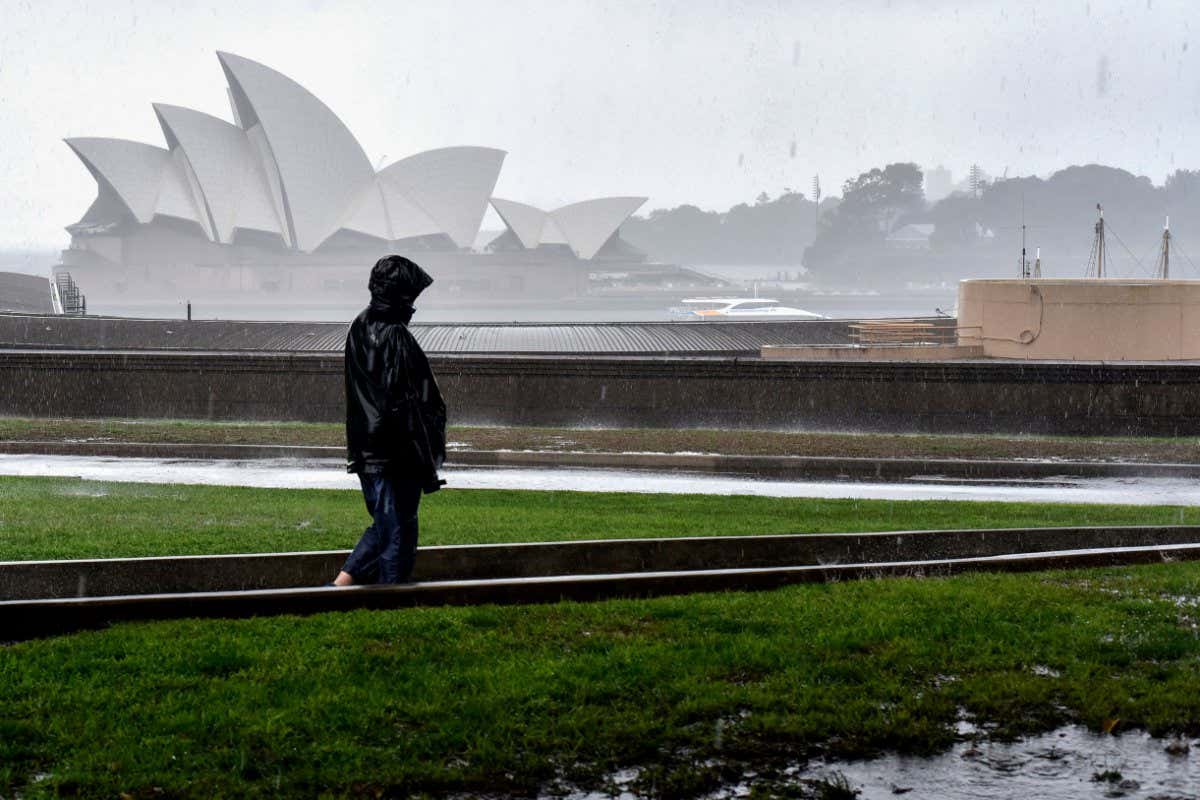
This year is already Sydney’s wettest year on record, with more than 2.2 metres of rain having fallen since January.
Previously, Sydney’s wettest year was 1950, when the total annual rainfall was 2.194 metres. This year’s rainfall topped that figure at around 1pm on 6 October.
In an average year, Sydney only gets about 1.2 metres of rain.
With almost a quarter of the year left to go and wet conditions predicted to continue, 2022 is likely to be the wettest year on record in Sydney by a long margin, says Milton Speer at the University of Technology Sydney.
There are several reasons why it has been so wet, he says.
One is that for the third year in a row, the east coast of Australia is experiencing a La Niña weather cycle, which attracts moist onshore winds from the Pacific Ocean.
Another is that there have been a series of low-pressure troughs associated with low-pressure systems that have “focused the rain for extended periods on Sydney and other parts of the coast”, says Speer.
A combination of moist ocean weather cycles, low-pressure systems and climate change have combined to make 2022 the wettest year ever recorded in Sydney

www.newscientist.com
Sydney, Australia records its wettest day since 1858, more than 60 cities in New South Wales under flood warning.
▪︎Colombia and Nicaragua
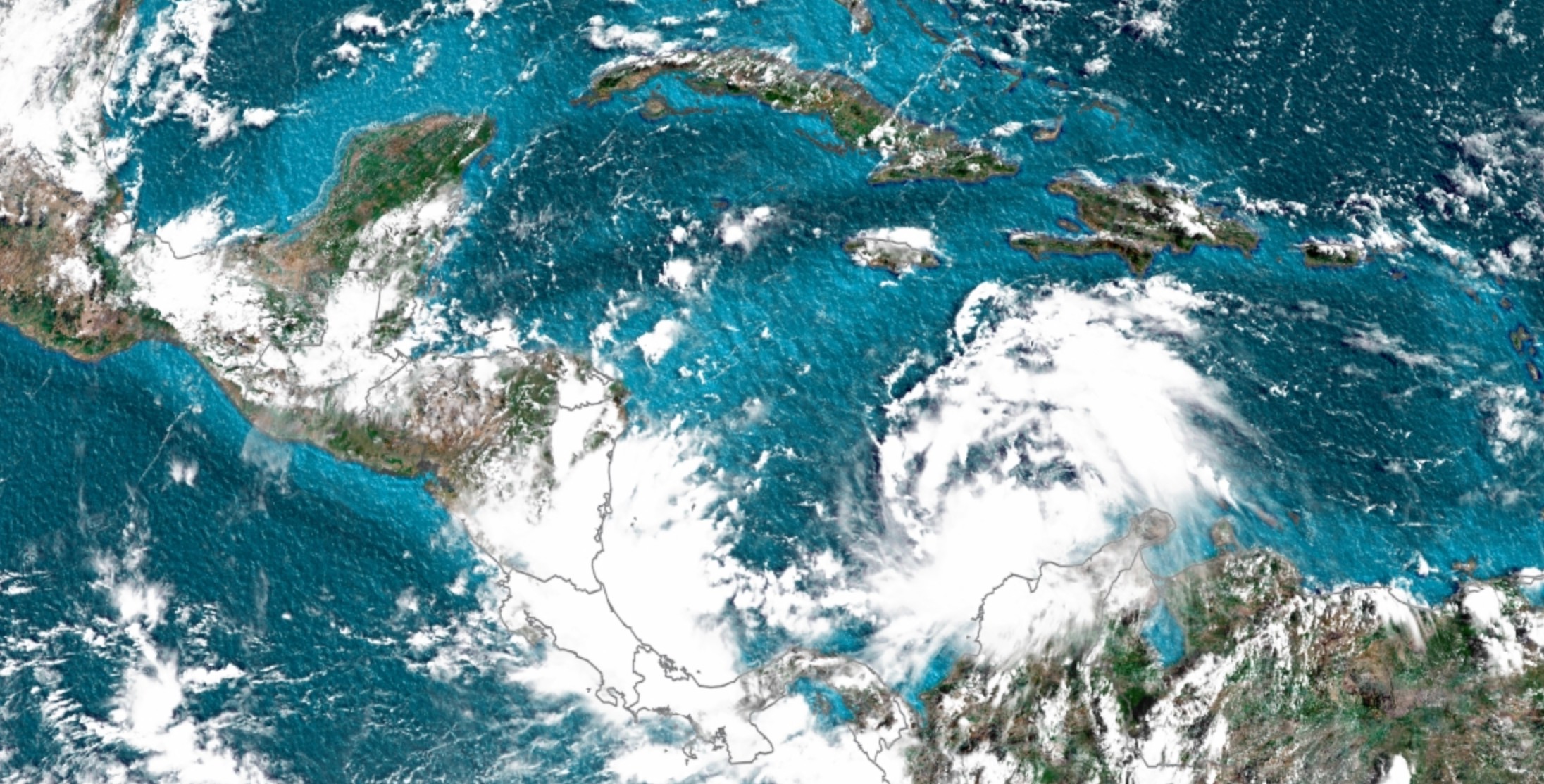
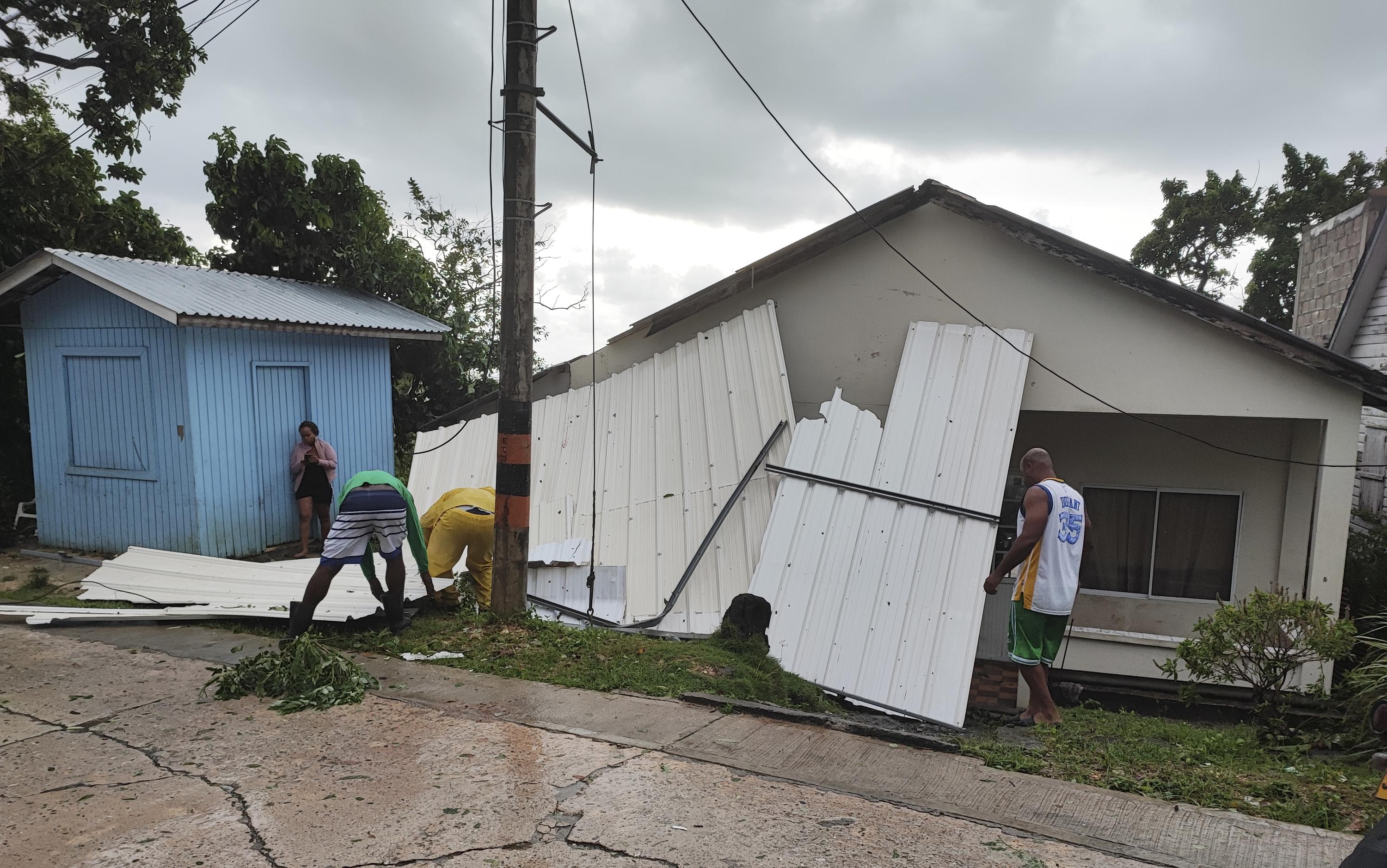
Julia is now a category 1 hurricane
Julia is now a hurricane with maximum sustained winds of 75 mph (120 km/h), according to a 7 p.m. (Miami time) special update from the National Hurricane Center.
Hurricane Julia is expected to strengthen slightly before hitting the coast of Nicaragua early Sunday.
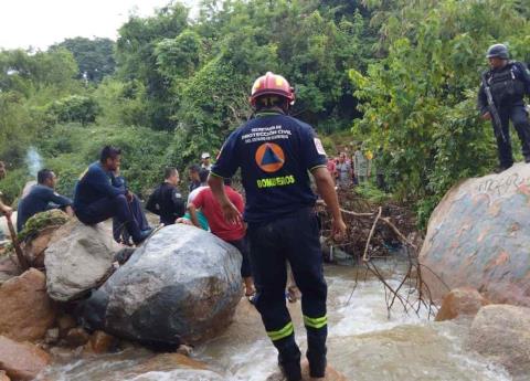
Along with hurricane force winds, potentially life-threatening rainfall amounts of 6 to 10 inches (150-250 mm) are possible in Nicaragua, with isolated amounts up to 15 inches (350 mm).
Such rainfall amounts could trigger landslides and flash flooding.
Julia es ahora un huracán con vientos máximos sostenidos de 120 km/h, según una actualización especial de las 7 pm ET del Centro Nacional de Huracanes.

cnnespanol.cnn.com
Colombia declares "maximum alert" in San Andres Island due to storm Julia.
Tropical #TropicalStorm #Julia about to reach hurricane strength on approach to the coast of Nicaragua

.
-Winds 110km/h
-280km ENE of Bluefields #Nicaragua.
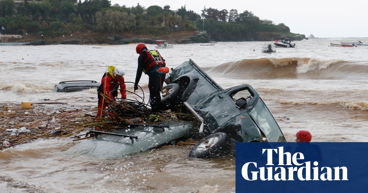
▪︎Spain
Torrential rains hit the region of Mallorca in Spain.


 A 205 km southwest of Playa Pérula and 230 km south-southwest of Cabo Corrientes, #Jalisco.
 #Maximum sustained winds of 185 km/h and gusts of 225 km.
 Displacement to the north at 7 km/h
 (05h).
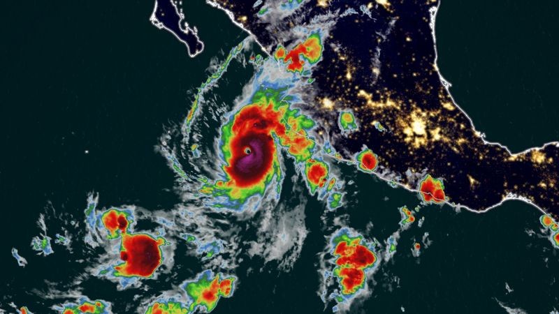
 maybe so maybe not..?
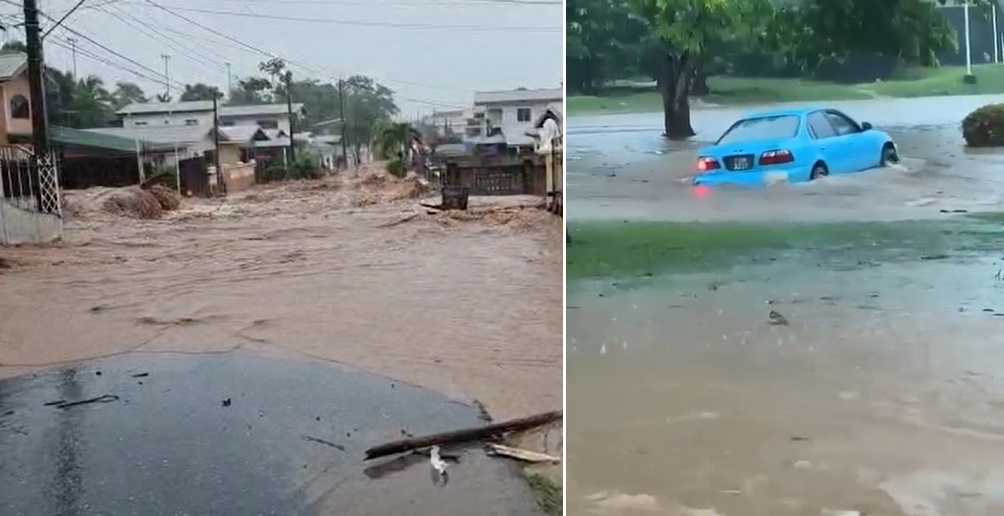


 into the Pacific Ocean as a Tropical Storm.
 ️
️ .
. .
.


 .
.