Earthquakes around the world

WORLDWIDE EARTHQUAKE REPORT MARCH 01/2023

● M 5.4 - 165 km SE of San Jose Village, Northern Mariana Islands
2023-03-01 19:28:09 (UTC)
14.121°N 146.881°E. 29.5 km depth
USGS earthquake alert

● M 5.1 - South Sandwich Islands region
2023-03-01 12:54:52 (UTC)
60.285°S 27.111°W. 62.7 km depth
USGS earthquake alert

● M 5.0 - Bonin Islands, Japan region
2023-03-01 13:59:22 (UTC)
27.419°N 142.744°E. 17.5 km depth
USGS earthquake alert

● M 5.0 - southern Sumatra, Indonesia
2023-03-01 23:05:23 (UTC)
1.581°S 100.836°E. 92.0 km depth
USGS earthquake alert
5.7 magnitude earthquake shakes Sumatra, Indonesia.
This earthquake was reported as M5.0 by USGS and M5.2 by GeoAu, only BMKG reported as M5.6, so I think M5.7 was a preliminary report. Volcanodiscovery recorded the earthquake as M5.6

● M 5.0 - 149 km ESE of Kuril’sk, Russia
2023-03-01 19:29:50 (UTC)
44.535°N 149.505°E. 35.0 km depth
USGS earthquake alert

● M 5.0 - 66 km ENE of Kainantu, Papua New Guinea
2023-03-02 01:30:28 (UTC)
5.987°S 146.381°E. 92.9 km depth
USGS earthquake alert

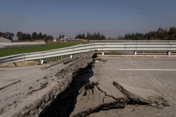
● M 4.7 - 7 km NW of Günyazı, Turkey
2023-03-01 07:20:23 (UTC)
36.281°N 36.055°E. 11.4 km depth
USGS earthquake alert
Let's pray for Turkey

● Summary

Seismic activity level has been at high levels in the last 24 hours. This is the last chart posted by Volcanodiscovery at 00:50 UTC on March 02 Global seismic activity chart
~1 quake above magnitude 6
~7 quakes between magnitude 5 and 6
~37 quakes between magnitude 4 and 5
~99 quakes between magnitude 3 and 4
~362 quakes between magnitude 2 and 3
~647 quakes below magnitude 2 that people normally don't feel.
~1153 earthquakes in the past 24h (1135 earthquakes in the 24 hours prior to this report) Estimated combined seismic energy release: 95903 tons of TNT or 6 atomic bombs
Volcanodiscovery earthquake report 24h
 
Strong earthquake Oaxaca México

M 5.7 - 8 km WSW of San Pedro Tapanatepec, Mexico
2023-03-02 04:40:43 (UTC)
16.354°N 94.269°W. 87.7 km depth
USGS earthquake alert

Data for the same earthquake reported by different agencies

5.898 kmMexico: 47 Km Al SURESTE De UNION HIDALGO, OAXSSN
5.788 kmOaxaca, MexicoRaspberry
Shake
5.7100 kmOAXACA, MEXICOEMSC
6.368 kmMexico: 66 Km Al Noroeste De Puerto Arista, MéxicoINETER
5.810 kmMexico: Near Tuxtla GutiérrezRENASS
5.9105 kmOaxaca, Mexico [Land: Mexico]INGV
6.010 kmOaxaca, MexicoGFZ
5.710 kmOaxaca, MexicoIRIS
5.788 kmOaxaca, MexicoUSGS
Volcanodiscovery
 
Geophysicist: Japan is threatened by an earthquake that will cause a tsunami dangerous for Tokyo

Within three months, a strong earthquake may occur off the southern coast of Japan, which may affect the Kuriles and Kamchatka. About this "Gazeta.Ru" said Alexey Lyubushin, chief researcher of the Laboratory of Physics of Sample Mass Fluctuations of the IFZ RAS, Doctor of Physical and Mathematical Sciences.

"Japan is in a dangerous situation. Somewhere within three months from March to May 2023, there may be a very strong earthquake in the ocean off the southern part of Japan. The main danger here is a tsunami. If we proceed from the expected location of the seismic event, the tsunami may affect Tokyo. Therefore, great sacrifices are possible," Lyubushin said.

According to him, the forecast is based on the analysis of seismic noise throughout the planet, and Japan in particular. Japan has an extensive, open database — 78 seismic stations register fluctuations of the Earth's surface. These data formed the basis of the calculation. These fluctuations are in a certain way connected with the preparation of earthquakes.

"I used such a geophysical parameter as the length of the day (the Earth rotates sometimes slower, sometimes faster). The parameters of seismic noise vary depending on the length of the day. It turned out that there is a correlation: a surge in the response of the properties of seismic noise for the length of the day is associated with seismic energy emissions. First there is a spike in correlation, then after 430 days there is a release of seismic energy. It's March of this year," Lyubushin explained.

The peak recorded by the scientist was formed at the end of 2022 and the beginning of this year both for Japan and for the whole world. Therefore, strong earthquakes are also possible in other parts of the world.

"Of course, if there is an earthquake in Japan, it will be very strong. This may affect the Kuril Islands. Kamchatka, too, but still it is a little far away," said Lyubushin.

 
I see that a magnitude 8+ earthquake is overdue for the Alpine Fault in New Zealand. It occurs approximately every 300 years and last happened in 1717.


Major magnitude 6.6 earthquake - Coral Sea, 89 km west of Santo, Luganville, Sanma Province, Vanuatu

Date & timeMar 2, 2023 18:04:30 UTC - 41 minutes ago
Local time at epicenterFriday, Mar 3, 2023 at 5:04 am (GMT +11)
StatusConfirmed
Magnitude6.6
Depth10.0 km
Epicenter latitude / longitude15.2929°S / 166.3657°E
VU.png
(Coral Sea, Vanuatu)
Antipode15.293°N / 13.634°W
Shaking intensityVery strong shaking near epicenter
Felt0 reports
Primary data sourceUSGS (United States Geological Survey)
Nearest volcanoAoba (158 km / 98 mi)
 
M 6.6 - 80 km WSW of Port-Olry, Vanuatu
2023-03-02 18:04:30 (UTC)
15.293°S 166.366°E10.0 km depth
USGS earthquake alert

Data for the same earthquake reported by different agencies
Mag.DepthLocationSource
6.610 km92 Km W of Luganville, VanuatuUSGS
6.410 kmVanuatu IslandsGFZ
6.610 kmVanuatu IslandsRaspberry
Shake
6.624 kmVanuatu IslandsGeoAu
5.710 kmVanuatu: Near NouméaRENASS
6.510 kmVanuatu IslandsIRIS
6.410 kmVANUATUEMSC
6.615 kmVanuatu Islands [Sea: Vanuatu]INGV
Volcanodiscovery

One hour ago SSGEOS recorded the atmospheric fluctuation

 
WORLDWIDE EARTHQUAKE REPORT MARCH 02/2023

We continue with high levels of seismic activity.

Two strong aftershocks have followed the M6.5 earthquake in Vanuatu. The M5.4 aftershock occurred 5 minutes after tha major earthquake.
M 6.6 - 80 km WSW of Port-Olry, Vanuatu
2023-03-02 18:04:30 (UTC)
15.293°S 166.366°E10.0 km depth
USGS earthquake alert

●M 5.4 - 48 km WNW of Port-Olry, Vanuatu
2023-03-02 18:11:07 (UTC)
14.911°S 166.642°E. 10.0 km depth
USGS earthquake alert

● M 5.0 - 36 km WNW of Port-Olry, Vanuatu
2023-03-02 20:55:32 (UTC)
14.956°S 166.743°E. 41.9 km depth
USGS earthquake alert

●M 5.2 - South Georgia Island region
2023-03-02 05:42:02 (UTC)
55.098°S 31.496°W. 10.0 km depth
USGS earthquake alert

●M 5.2 - 59 km SE of Shikotan, Russia
2023-03-02 06:14:51 (UTC)
43.406°N 147.217°E. 40.1 km depth
USGS earthquake alert

●M 5.1 - 157 km SSE of Shimoda, Japan
2023-03-02 06:47:39 (UTC)
33.332°N 139.494°E. 9.9 km depth
USGS earthquake alert

●M 5.1 - 50 km W of Bengkulu, Indonesia
2023-03-03 00:36:47 (UTC)
3.867°S 101.816°E. 62.2 km depth
USGS earthquake alert

●M 5.0 - 66 km ENE of Kainantu, Papua New Guinea
2023-03-02 01:30:28 (UTC)
5.987°S 146.381°E. 92.9 km depth
USGS earthquake alert

● Summary

Seismic activity level has been at high levels in the last 24 hours. This is the last chart posted by Volcanodiscovery at 00:50 UTC on March 03 Global seismic activity chart
~1 quake above magnitude 6
~10 quakes between magnitude 5 and 6
~32 quakes between magnitude 4 and 5
~101 quakes between magnitude 3 and 4
~310 quakes between magnitude 2 and 3
~631 quakes below magnitude 2 that people normally don't feel.
~1085 earthquakes in the past 24h (1135 earthquakes in the 24 hours prior to this report) Estimated combined seismic energy release: 119 gigawatt hours, equivalent to 1 x 10⁵ tons of TNT or 6.4 atomic bombs
Volcanodiscovery earthquake report 24h
 
WORLDWIDE EARTHQUAKE REPORT MARCH 03/2023

Three strong earthquakes shook the region of Sandwich Islands and Mid Atlantic Ocean

●M 5.6 - east of the South Sandwich Islands
2023-03-03 04:53:55 (UTC)
59.411°S 18.080°W. 10.0 km depth
USGS earthquake alert

●M 5.2 - east of the South Sandwich Islands
2023-03-03 00:31:53 (UTC)
59.327°S 18.069°W. 10.0 km depth
USGS earthquake alert

●M 5.6 - southern Mid-Atlantic Ridge
2023-03-03 19:00:26 (UTC)
30.862°S 13.448°W. 10.0 km depth
USGS earthquake alert
chrome_screenshot_1677893184560.png

● M 5.3 - 63 km WNW of Port-Olry, Vanuatu
2023-03-03 00:54:27 (UTC)
14.776°S 166.555°E. 10.0 km depth
USGS earthquake alert

●M 5.2 - 119 km WNW of Panguna, Papua New Guinea
2023-03-03 09:41:17 (UTC)
5.908°S 154.486°E. 51.0 km depth
USGS earthquake alert

●M 5.1 - 50 km W of Bengkulu, Indonesia
2023-03-03 00:36:47 (UTC)
3.867°S 101.816°E. 62.2 km depth
USGS earthquake alert

●M 5.0 - 23 km SE of Göksun, Turkey
2023-03-03 02:53:42 (UTC)
37.854°N 36.664°E. 6.1 km depth
USGS earthquake alert

●M 4.3 - 37 km NW of Raudales Malpaso, Mexico
2023-03-03 15:04:07 (UTC)
17.394°N 93.884°W. 180.0 km depth
USGS earthquake alert
Earthquakes in Chiapas, Mexico commonly occur offshore. This earthquake occurred inland. El Chichon volcano is located 83 km from epicenter. El Chichón became famous for its large eruption in 1982 that affected the world's climate for the following years with a measurable cooling effect caused by the large amounts of SO2 aerosols ejected into the atmosphere. Currently the volcano is dormant

● Summary

Seismic activity level has been at moderate levels in the last 24 hours. This is the last chart posted by Volcanodiscovery at 01:10 UTC on March 04 Global seismic activity chart
~7 quakes above magnitude 5
~35 quakes between magnitude 4 and 5
~114 quakes between magnitude 3 and 4
~337 quakes between magnitude 2 and 3
~632 quakes below magnitude 2 that people normally don't feel.
~1125 earthquakes in the past 24h (1085 earthquakes in the 24 hours prior to this report) Estimated combined seismic energy release: 12355 tons of TNT or 0.8 atomic bombs
Volcanodiscovery earthquake report 24h
 
Watch Africa: Earthquake in Uganda March 04/2023

We were told by the Cs to watch Africa. Uganda records at least a couple of light to moderate earthquakes per year. According to Volcanodiscovery data:

"the last earthquake in Uganda occurred six months ago: Moderate mag. 4.2 earthquake - 34 km north of Jinja, Eastern Region, Uganda, on Wednesday, Aug 31, 2022 at 11:04 am

Since 1900 (123 years ago), Uganda had 195 quakes. The strongest earthquake occurred near Uganda 95 years ago:

Major magnitude 7.0 earthquake - 21 km southeast of Kabarnet, Baringo, Kenya, on Friday, January 6, 1928 at 19:31 GMT.

chrome_screenshot_1677938293196.png

The Great Rift Valley of Africa includes the following countries: Eritrea, Ethiopia, Djibouti, South Sudan, Kenya, Uganda, Democratic Republic of Congo, Rwanda, Burundi, Tanzania, Malawi, Mozambique, Zambia and Zimbabwe. The Red Sea and the Jordan Valley are also part of the rift system.

800px-Great_Rift_Valley_map-es.svg.png

The constant earth tremors and lava emersions contribute to the growth of the fracture and if it continues at this rate, according to science, the valley floor will be completely flooded by seawater within 10 million years.

This reminds me of something the Pleiadians said to Barbara Marciniak (documented in the book Family of Light).

"The land masses have changed their configuration and moved over time. You believe that these movements happened gradually but nowadays this theory is losing supporters as the Earth is constantly transforming in the geophysical and energetic realm. No one knows quite what to make of all this, because in most cases you choose to believe the official version of the 'truth'. Your perceptual experience tells you that gradual change is the rule and you cannot even imagine the knowledge your ancestors had. They were perfectly aware that sudden, traumatic and surprising changes could occur in an instant and that therefore you cannot plan for the unforeseen."


M 4.6 - Lake Edward region, Uganda
2023-03-04 05:34:09 (UTC)
0.618°N 30.083°E. 10.0 km depth
USGS earthquake alert
 
WORLDWIDE EARTHQUAKE REPORT MARCH 04/2023

Almost a month after the M7.8 earthquake in Turkey the number of earthquakes recorded in 24 hours was less than 1000. Turkey had an M4.2 aftershock at a very shallow depth.(EMSC recorded the quake as M4.7)

●M 4.2 - 2 km NNE of Çelikhan, Turkey
2023-03-04 05:27:34 (UTC)
38.046°N 38.246°E. 1.9 km depth
USGS earthquake alert

●M 5.2 - 137 km SE of Hihifo, Tonga
2023-03-04 20:18:07 (UTC)
16.789°S 172.838°W. 46.5 km depth
USGS earthquake alert

●M 5.0 - south of the Kermadec Islands
2023-03-04 01:19:32 (UTC)
32.281°S 178.695°W. 18.7 km depth
USGS earthquake alert

● Atmospheric fluctuations were recorded in Asia (China, Nepal, India, Pakistán) and West Pacific.


● Summary

Seismic activity level has been at moderate levels in the last 24 hours. This is the last chart posted by Volcanodiscovery at 01:10 UTC on March 05 Global seismic activity chart
~1 quake above magnitude 6
~2 quakes between magnitude 5 and 6
~37 quakes between magnitude 4 and 5
~120 quakes between magnitude 3 and 4
~338 quakes between magnitude 2 and 3
~439 quakes below magnitude 2 that people normally don't feel.
~937 earthquakes in the past 24h (1125 earthquakes in the 24 hours prior to this report) Estimated combined seismic energy release: 12355 tons of TNT or 0.8 atomic bombs
Volcanodiscovery earthquake report 24h
 
Last week saw 5 M6 earthquakes with the highest being a M6.8 in Tajikistan.
In the usual area, there were 6 out of 109 earthquakes worldwide equal to or greater than 4.5 and 1618 out of 1851 quakes of all sizes.
Percentage: 87.4%
Last week saw three M6 earthquakes, of which 2 were M6.5 and a M6.9, in the Kermadec islands, New Zealand.
In the usual area, there was 1 out of 101 earthquakes worldwide equal to or greater than 4.5 and 1690 out of 2006 quakes of all sizes.
Percentage: 84.2%
Earthquakes 7 days to March 5th  2023.gif
 
Watch Africa: Earthquake in Uganda March 04/2023

We were told by the Cs to watch Africa. Uganda records at least a couple of light to moderate earthquakes per year. According to Volcanodiscovery data:

Since 1900 (123 years ago), Uganda had 195 quakes. The strongest earthquake occurred near Uganda 95 years ago:

The Great Rift Valley of Africa includes the following countries: Eritrea, Ethiopia, Djibouti, South Sudan, Kenya, Uganda, Democratic Republic of Congo, Rwanda, Burundi, Tanzania, Malawi, Mozambique, Zambia and Zimbabwe. The Red Sea and the Jordan Valley are also part of the rift system.

View attachment 71957

The constant earth tremors and lava emersions contribute to the growth of the fracture and if it continues at this rate, according to science, the valley floor will be completely flooded by seawater within 10 million years.

This reminds me of something the Pleiadians said to Barbara Marciniak (documented in the book Family of Light).

"The land masses have changed their configuration and moved over time. You believe that these movements happened gradually but nowadays this theory is losing supporters as the Earth is constantly transforming in the geophysical and energetic realm. No one knows quite what to make of all this, because in most cases you choose to believe the official version of the 'truth'. Your perceptual experience tells you that gradual change is the rule and you cannot even imagine the knowledge your ancestors had. They were perfectly aware that sudden, traumatic and surprising changes could occur in an instant and that therefore you cannot plan for the unforeseen."
I was thinking some days ago, that IF something happens in this part of Africa, as a split of the continent, the Lake Victoria could well be part of the section that would be separated from the African continent and thus remove the White Nile from its major source. In this scenario, only the Blue Nile, which has its source in Eritrea, could remain, if Eritrea is not affected by this possible split. And even then, we don't know how things might turn out. But, as @Puma shared above, Eritrea is a part of the Great Rift Valley of Africa.

Or the Lake Victoria could be too flooded with salty sea water to keep its waters fresh. Therefore, the Nil might be no more conducive to the usual aquatic life and water resources necessary to the flora, fauna ... and the villages and towns that depend on it.

In fact, given the location of the rifts in the Horn of Africa in the pictures @Puma shared above and before in this thread, AND the list of countries that are included in the Great Rift Valley of Africa, that's the entire Great Lakes region up to North Africa -and who knows, maybe up to the all the middle-eastern part- that may well be affected by a lack of fresh water. A lack of fresh water that would occur in a context of geological chaos: starvation, diseases, and deaths for those people and Life at large who would come out of the primary disaster.

My My, this could be huge!

I guess we have to Wait and See.
 
WORLDWIDE EARTHQUAKE REPORT MARCH 05/2023

M 5.8 - west of Macquarie Island
2023-03-05 22:21:34 (UTC)
55.734°S 147.343°E. 10.0 km depth
USGS earthquake alert

M 5.4 - Mindanao, Philippines
2023-03-05 20:43:02 (UTC)
7.529°N 126.172°E. 10.0 km depth
USGS earthquake alert

M 5.1 - 19 km ENE of Atico, Peru
2023-03-05 19:25:43 (UTC)
16.155°S 73.445°W. 57.2 km depth
USGS earthquake alert

M 5.1 - Nicobar Islands, India region
2023-03-05 23:37:12 (UTC)
7.625°N 91.767°E. 10.0 km depth
USGS earthquake alert


● Summary

Seismic activity level has been at moderate levels in the last 24 hours. This is the last chart posted by Volcanodiscovery at 01:10 UTC on March 06 Global seismic activity chart
~4 quakes above magnitude 5
~30 quakes between magnitude 4 and 5
~108 quakes between magnitude 3 and 4
~302 quakes between magnitude 2 and 3
~560 quakes below magnitude 2 that people normally don't feel.
~1004 earthquakes in the past 24h (937 earthquakes in the 24 hours prior to this report) Estimated combined seismic energy release: 12355 tons of TNT or 0.8 atomic bombs
Volcanodiscovery earthquake report 24h
 
Back
Top Bottom