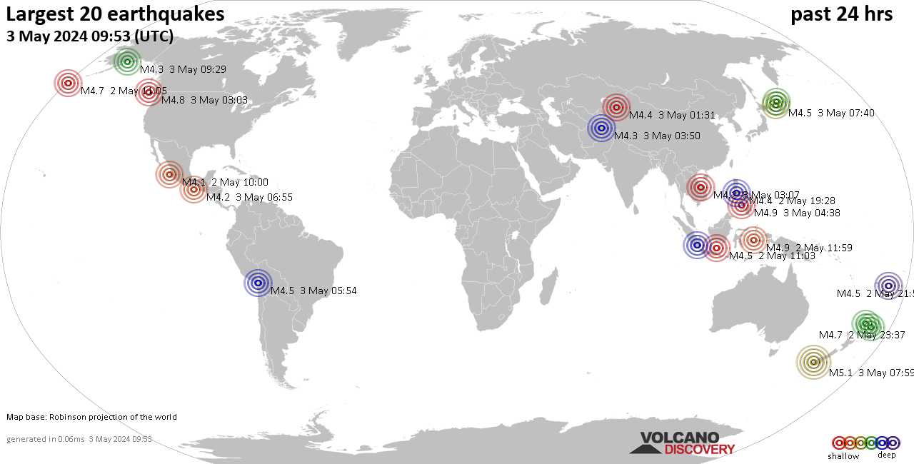
Earthquakes around the world

The theory of planetary geometries as causes of earthquakes has more to do with the theory of the electric universe than with astrology.
The theory was that the energy bursts from the Sun was triggering earthquakes, the 'planetary geometry' is merely incidental and another one of his interests.
 
The theory was that the energy bursts from the Sun was triggering earthquakes..

Even this is not accurate. SSGEOS demonstrated this with statistical observations to conclude that solar flares do not cause earthquakes. Take, for example, the M8.8 earthquake in Russia.​

M 8.8 - 2025 Kamchatka Peninsula, Russia Earthquake
2025-07-29 23:24:52 (UTC)
52.498°N 160.264°E. 35.0 km depth
USGS earthquake alert

According to data from Spaceweatherlive, solar activity remained at low levels on the day before and on the day of the M8.8 earthquake. ( here is the data July 28 & July 29)

●On July 28, the maximum solar flare registered C1.5 from solar region 4153.

●On July 29, the maximum solar flare registered C3.1 from solar region 4155.

At that time, AR4153 and AR4155, along with others, were facing the Earth, but none had a magnetic field strong enough to generate the danger of an M-class or X-class flare.
SpaceWeather
hmi200.gif

So where did the burst of solar energy come from to generate an M8.8 earthquake? From a solar wind stream coming from a coronal hole? No. According to SpaceWeather on July 28 & July 29​
There are no significant coronal holes facing Earth. Credit: NASA/SDO​

We would have to go back to July 24 to see something interesting happening, as the Earth was in a solar wind stream from a coronal hole, but this commonly occurs without a significant seismic activity reflection on Earth.​
The geomagnetic field has been at unsettled to active levels for the past 24 hours. Solar wind speed reached a peak of 818 km/s at 24/0738Z. Total IMF reached 7 nT at 23/2128Z. SpaceWeatherlive

Let's take the example of the M6.0 earthquake in Afghanistan.
M 6.0 - 27 km ENE of Jalālābād, Afghanistan
2025-08-31 19:17:34 (UTC)
34.519°N 70.734°E. 8.0 km depth
USGS earthquake alert

On August 30, region 4199 produced an M2.7-class solar flare at 20:02 UTC with an associated CME.


The "impact" occurred on September 1st at 21:00 UTC
CME IMPACT SPARKS WIDESPREAD AURORAS: As predicted, a CME struck Earth's magnetic field on Sept. 1st (2100 UTC). The impact was abrupt and strong, bringing solar winds faster than 600 km/s (1.3 million mph), and a G2-class geomagnetic storm. SpaceWeather

Strongest earthquakes from September 1 to 3

● M 5.0 - 130 km SE of Old Harbor, Alaska
2025-09-01 11:02:10 (UTC)
56.279°N 151.984°W. 18.5 km depth
USGS earthquake alert

● M 5.3 - Izu Islands, Japan region
2025-09-02 03:32:31 (UTC)
30.634°N 140.171°E. 10.0 km depth
USGS earthquake alert

● M 5.3 - 15 km SSW of Puyo, Ecuador
2025-09-03 14:56:44 (UTC)
1.606°S 78.070°W. 163.3 km depth
USGS earthquake alert

Solar wind flowing from a southern coronal hole could graze Earth on Sept. 6-9.
coronalhole_sdo_200.gif

So, can an M-class flare produce an M6+ earthquake, but a C-class flare produce an M8+ earthquake, if we only take into account "solar energy burst" close to significant seismic events? I don't think so.
 
WORLDWIDE EARTHQUAKE REPORT SEPTEMBER 04, 2025

A strong magnitude 5.9 earthquake hit 186 km (116 mi) away from Salta, Salta Province, Argentina,

M 5.9 - 91 km WSW of San Antonio de los Cobres, Argentina
2025-09-04 04:10:18 (UTC)
24.383°S 67.201°W. 176.5 km depth.
USGS earthquake alert

Screenshot_20250904-084524_Chrome.jpg

Earthquake in Argentina could have been caused by the geometry of the Moon, Earth, and Saturn, whose magnetic impact was detected by the Easter Island magnetometer station according with Richard Cordaro data:​
Tomorrow's planetary energy impacts. Not very strong teams assaulting the Mid-Pacific region. Seismic influence, of course, will be at the Ring of Fire following travel time of 2 to 3 hours from the leading edge magnetic anomaly. Some weakening after traveling. One-day probability of an M6+ earthquake ~ 40%, based on 30 previous M6+ earthquakes.
20250904_090109.png

A seismic cluster has been recorded following the M6.0 earthquake in Alaska. Mainly concentrated in the Mid-Pacific region​

●M 5.0 - 37 km ESE of Union, Philippines
2025-09-03 22:45:48 (UTC)
●M 5.0 - 246 km SSW of ‘Ohonua, Tonga
2025-09-03 22:56:12 (UTC)
●M 5.1 - 86 km W of San Antonio de los Cobres, Argentina 2025-09-04 04:10:08 (UTC)
●M 5.1 - 258 km NE of Fais, Micronesia
2025-09-04 04:37:49 (UTC)
●M 5.3 - 149 km ESE of Kokopo, Papua New Guinea 2025-09-04 09:38:40 (UTC)
●M 5.1 - 57 km E of Isangel, Vanuatu
2025-09-04 11:10:14 (UTC)

Could this cluster indicate another significant seismic event?
Magnetic alerts are coming in due to our quartet of planetary impacts in the Mid-Pacific this morning. The green alert at 09:21 (from HON) was probably the warning ahead of the M 5.3 at Papua New Guinea. I'm concerned about the blue alert (from TUC) at 10:13 which may be coming from a fault along the coast of South/Central America. The red alert (from IPM) earlier at 09:09 could be from Chile, however it is the most difficult alert to guess.Richard Cordaro
20250904_092147.png
 
An uptick in seismic activity on the West Coast and in California

3.2 Earthquake San Francisco Bay Area. Noticeable uptick in movement across the West Coast. Sunday

An analysis by the USGS of the M8.8 Russian Kamchatka earthquake

Snip: July 31, 2025
Aftershock Forecasts
Following the M8.8 Russian Kamchatka Peninsula Earthquake, the USGS has released new aftershock forecasts that detail the likelihood and magnitude of future earthquakes expected in the region.

Within the first week following the magnitude 8.8 event, scientists calculated:
  • 2% chance of additional magnitude 8 or larger aftershocks
  • 24% chance of additional magnitude 7 or larger aftershocks
  • 96% chance of additional magnitude 6 or larger aftershocks
  • greater than 99% chance of more magnitude 5 or larger aftershocks
  • greater than 99% chance of more magnitude 4 or larger aftershocks
  • greater than 99% chance of more magnitude 3 or larger aftershocks
These forecasts prove vital for residents and responders who must remain vigilant and prepared for subsequent tremors that can continue for weeks, months, or even years after a major earthquake. Forecasts will be updated as more information becomes available.

These forecasts prove vital for residents and responders who must remain vigilant and prepared for subsequent tremors that can continue for weeks, months, or even years after a major earthquake. Forecasts will be updated as more information becomes available.

Event Summary

On July 29, 2025, at 7:25pm EDT (July 30, 2025, 11:25am local time), a magnitude 8.8 earthquake struck offshore the Kamchatka Peninsula, Russia, tying it for the sixth-largest earthquake ever recorded by modern seismic instruments. The massive earthquake triggered Pacific-wide tsunami watches and warnings.

This historic earthquake was not an isolated event. It followed a 10-day sequence that began with 50 magnitude 5.0 or larger earthquakes, including a magnitude 7.4 earthquake on July 20 and three magnitude 6.6 earthquakes. The sequence remains active as scientists monitor ongoing aftershocks, including M6.9 and M6.2 quakes.

To learn more about the seismotectonics of the Kuril-Kamchatka subduction zone, check out our new geonarrative.
1757347205894.png
 
A very strong magnitude 6.4 earthquake occurred in the South Pacific Ocean

M 6.4 - Vanuatu region
2025-09-08 21:47:48 (UTC)
20.981°S 173.758°E. 10.0 km depth
USGS earthquake alert
Screenshot_20250908-173432_Chrome.jpg

Earthquake season begins in Mexico 😂

A strong magnitude 5.1 earthquake hit 126 km (78 mi) away from Ayutla de los Libres, Estado de Guerrero, Mexico

M 5.1 - 8 km NE of Corralero, Mexico
2025-09-08 22:33:20 (UTC)
16.295°N 98.139°W. 10.0 km depth
USGS earthquake alert
chrome_screenshot_8 sep. 2025 5_40_14 p. m. CST.png
 
A strong magnitude 5.8 earthquake occurred in the North Pacific Ocean 165 km (103 mi) from United States.

M 5.8 - 165 km WSW of Port Orford, Oregon
2025-09-09 04:08:01 (UTC)
42.370°N 126.441°W. 13.8 km depth
USGS earthquake alert
chrome_screenshot_9 sep. 2025 9_30_02 a. m. CST.png

Aftershocks

●M 4.9 - 167 km WSW of Port Orford, Oregon
2025-09-09 05:59:03 (UTC)
●M 3.1 - 173 km WSW of Port Orford, Oregon
2025-09-09 08:05:20 (UTC)
●M 4.3 - 184 km WSW of Port Orford, Oregon
2025-09-09 11:47:09 (UTC)
 
I follow a page on facebook by this guy, Mark C. Honig.
This morning he posted about his theories regarding the quakes in the Pacific, and I’m copying the info here.

Update 9/9/25 11am (PST): Hawaii just got struck with it's largest quake in 30 days, an M 3.6. This starts our countdown until it hits California (Sept 12-14). https://earthquake.usgs.gov/earthquakes/eventpage/hv74771322/executive#general

Update 9/9/25 9am (PST): Hours after posting my forecast an M 5.8 struck offshore on the southern end of the Juan de Fuca. It has so far been accompanied by M 4.4, M 2.7, M 3.3, M 4.9, & M 3.1. This is energy from the far northern Canadian M 4.0 quake I referenced below in my original forecast. This changes my forecast range from M 5.0 to M 6.0 to M 5.5 to M 6.5, and this now becomes a much more serous situation. Now we have M 5.5 energy coming across the Pacific and M 5.8 energy coming from the north. If they both combine onshore, then a larger and perhaps two or three quakes will occur. The geysers have been in normal range and if they drop to under 10 quakes in a 24hr window, then we will need to watch for an M 6.0+ offshore. If the Pacific energy arrives late (after Sept 16), then the two waves will not merge and we could see several M 5.0 to M 6.0 quakes onshore. I added a new photo to the bottom showing the M 5.8 offshore event.

Original forecast:
We have an incoming wave from across the Pacific that could hit California from September 11 to September 22, 2025, and will be bringing with it a quake/s with a magnitude from M 5.0 to M 6.0!

This hypothesis of mine that shows deep quakes that strike in the ocean and offshore on the Mariana Ridge can send a seismic wave across the Pacific and strike California.
I have successfully seen this occur three times, and likely this will be the fourth time. Also Hawaii will occasionally be perturbed and exhibit the largest quake in a two week window, or exhibit an increase in a lava plum, or a quake far from the big Island of Hawaii will occur. This perturbance is usually a good mid-time point of the wave and will provide me the ability to set the first day the seismic energy could strike California.

Also, this seismic wave will often strike the southern end of the Juan de Fuca Plate along the Mendocino Fracture Zone aka the Mendocino Trench first, and occasionally it will continue onshore and strike Northern California. Often then seismic wave strikes and finishes off shore at the southern end of the Juan de Fuca.

What concerns me is we have a second seismic wave that has already struck offshore Canada and onshore in Oregon USA and Utah USA with M 4.0 energy. Should these two waves combine, we could be looking at a larger quake then M 6.0. My problem is I have not seen such an event before, so it is guess work on my part as to the maximum magnitude strength that it could achieve AND where this could quake/s could occur.

On the map from Google Earth, I have plotted all the strongest quakes in the last ten days. Then I connected them using the circle tool from Google Earth. At the center of this circle, all with in 35 miles of each other, is a pit mine, a power substation, and the scary Mount Rainier Volcano. The chances that these quakes align together and have a center point with three significant locations, leaves me wondering...

Now we sit, watch, and wait, for the incoming seismic wave. Based on my methodology, I must stay with the maximum quake magnitude of M 6.0. Please remember, all my posts and pics and data are free to use and re-post.

This is the quake that started this new seismic wave. Note that I take the magnitude and add strength to it using depth of the quake. I add M 0.1 for every 50klm depth. Thus 393Klm depth adds M 0.8 to M 4.7 and we arrive at M 5.5 then we subtract M 0.5 and add M 0.5 and we arrive at a range of M 5.0 to M 6.0: [https://earthquake.usgs.gov/earthqu...uakes/eventpage/us7000qtr4/executive#general)

Below are the quakes I have listed on the Google Earth map:

[https://earthquake.usgs.gov/earthqu...uakes/eventpage/us7000qukk/executive#general)

[https://earthquake.usgs.gov/earthqu...uakes/eventpage/us7000qup7/executive#general)

[https://earthquake.usgs.gov/earthqu...uakes/eventpage/nn00903673/executive#general)

[https://earthquake.usgs.gov/earthqu...uakes/eventpage/nc75232127/executive#general)

And this Google Earth location is the Pit Mine: 47°19'6.57"N 121°52'35.81"W

This is the Power Substation location: 47°20'6.79"N 121°56'1.77"W

And this is the location of Mount Rainier Volcano: 47°20'6.79"N 121°56'1.77"W
IMG_1132.jpeg
IMG_1133.jpeg
 
After I made my post above, I remembered another “earth opening up” player out here in close proximity to where these recent quakes are happening.

Mile-deep underwater volcano off West Coast could erupt soon, scientists say​

More than 2,000 earthquakes were recorded in one day.
ByJulia Jacobo
August 19, 2025, 2:57 PM
[…]
The Axial Seamount -- an underwater volcano located about 300 miles off the coast of Oregon and 4,900 feet below the surface -- has been displaying behavior that indicates an eruption is imminent, researchers at Oregon State University say.
https://abcnews.go.com/US/iliamna-v...-despite-dormant-100-years/story?id=123675989
Since the beginning of the year, the volcano has been inflating "like a balloon" as molten rock accumulates within, William Chadwick, research associate at Oregon State University, told ABC News in January.

Now, seismic activity near the volcano is ramping up as well. In June, more than 2,000 earthquakes were recorded in a single day, according to Oregon State University.[…]

1757447565049.png

1757447616196.png

Lots more photos and info in the article. Here’s the link:
 

Attachments

  • 1757447743561.gif
    1757447743561.gif
    35 bytes · Views: 0
  • Like
Reactions: Pat
Back
Top Bottom