Earthquake= Magnitude 5.3 - SOUTHERN IRAN - 2019-02-10 10:54:48.0 UTC
Earthquake information= Magnitude: 5.3, Region: SOUTHERN IRAN, Date time: 2019-02-10 10:54:48.0 UTC, Location: 27.0281 ; 55.6596, Depth: 10 km.
 www.emsc-csem.org
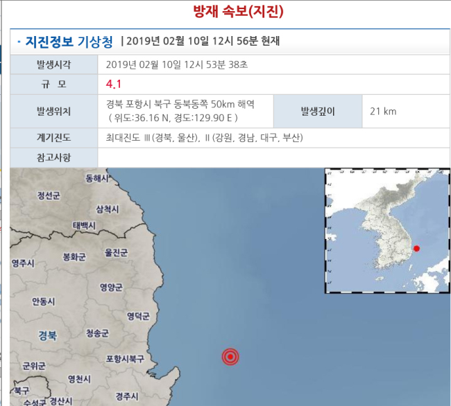
[Newsmaker] No damage reported from 4.1 magnitude earthquake off Pohang
A 4.1 magnitude earthquake struck off the southeastern city of Pohang on Sunday, but there have been no reports of damage, meteorological officials said.The quake happened at 12:53 p.m. in waters 50 kilometers northeast of the port city at a depth of 21 km, officials at the Korea Meteorological...
www.koreaherald.com