Fires around the world


1627231998799.png
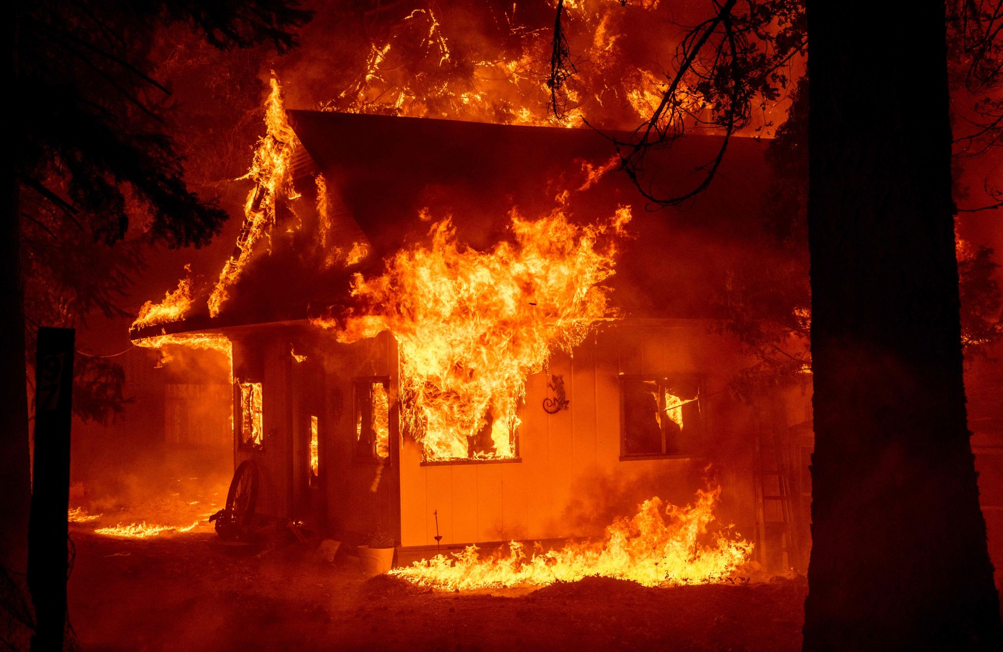
LATimes.com Photo


July 25, 2021 Updated: July 25, 2021 9:07 p.m.
1627293323428.png


Researchers link ‘heavy wildfire smoke’ in Reno to increased risk of contracting COVID-19

By CNEWS with AFP - Updated 07/26/2021 at 9:41 AM Published on 07/25/2021 at 7:54 AM
Mid Snip: 🤔🥱

Kiser is hoping that his research results will motivate people to get vaccinated and to wear masks to reduce their exposure to the virus and to tiny wildfire particulate matter that measures 2.5 micrometers or less.

That’s about 1/30th the size of a human hair at its largest. Scientists refer to it as PM 2.5 for short.

To analyze the relationship between this fine wildfire ash and COVID-19 positivity rates, Kiser and his team collected data from the Washoe County Health District and the region’s big hospital system, Renown Health.

He said they discovered that the PM 2.5 was responsible for a 17.7% increase in the number of COVID-19 cases that occurred during a period of prolonged smoke that took place between Aug. 16, 2020, and Oct. 10, 2020.

Washoe County’s 450,000 residents, many of whom live in Reno, experienced 43 days of elevated PM 2.5 during that period, researchers said, compared with 26 days for residents of the San Francisco Bay Area.

“We had a unique situation here in Reno last year where we were exposed to wildfire smoke more often than many other areas, including the Bay Area,” said Dr. Gai Elhanan, co-lead author of the study and an associate research scientist of computer science at the institute. “We are located in an intermountain valley that restricts the dispersion of pollutants and possibly increases the magnitude of exposure, which makes it even more important for us to understand smoke impacts on human health.”

The relationship between COVID-19 positivity rates and air pollution in general has gained interest among scientists around the world, and Kiser and Elhanan cite research papers from Europe and Asia that explore the phenomenon as well.

Kent Pinkerton, an expert on air pollution on the faculty at the University of California, Davis, said there’s concern among physicians and scientists about the impact of climate change on cardiopulmonary health, a topic he’s currently addressing in an article he’s submitting to a medical journal.

“Hotter temperatures, climate change, wildfires, air pollution, all seem to have some association with a greater risk of COVID-19 cases,” Pinkerton said. “If you’re susceptible to air pollution, such as particulate matter, it could be that you just have a situation where you’ll be also much more susceptible to viral particles that might be in the air that you’re breathing. It’s not that the air pollution makes the COVID-19 cases more likely to happen, but it may simply be a reflection of just the fact that, where areas of high pollution are, ... the risk for COVID-19 cases may be greater. “
 
Last edited:
Thousands of hectares have been devastated by forest fires over the weekend in Spain.

In the region of Catalonia, the situation is critical. Dozens of people have had to be evicted due to the advance of the fire.

In the provinces of Barcelona and Tarragona, a fire is progressing uncontrollably leaving in its wake about 1,300 burned hectares, including part of a protected natural area, and crops, emergency services reported.

 
A massive forest fire in southern Turkey spread to the town of Manavgat as the flames were fanned by strong winds on Wednesday, according to the local mayor, and TV footage showed residents running for their cars as streets were engulfed in smoke.

 
Visual light satellite charts from Turkey
29 July 2021

with screen caps from this morning vs this evening (after sunrise, and before sunset, smoke but also other haze or dust clouds, becomes more pronounced visible in visual satellite images) It also appears that a new fire broke out near Rhodes, on the Turkish mainland.

(oops, i spelled Manavgat wrong in the images, I am sorry)

2.jpg

_-2021-07-29-at-18.44.08.jpg
 
Fri 30 Jul 2021 // 04:47 UTC
Tesla's battery technology is extremely hot in Australia right now – but not in a good way. A 300-megawatt lithium-ion battery built in the state of Victoria using Tesla tech is literally on fire.


The "Victorian Big Battery" – an installation due to come online later this year – was commisisioned by authorities "to boost the state's energy reliability, drive down electricity prices and support Victoria's transition to renewable energy – as well as creating local jobs as we take steps towards a COVID normal."

The battery is currently succeeding on the jobs front: The Register understands that over 20 fire brigade units have scrambled to extinguish the blaze.

Fire and Rescue Victoria stated the fire is burning in just one shipping container and that emergency crews are "working to contain the fire and stop it spreading to nearby batteries".

The blaze has sparked an air quality warning that suggests residents of nearby suburbs should move indoors, close doors and windows, and even turn off heating and cooling systems that suck air from outside homes or offices. The stay-at-home warnings came just after a COVID-19 lockdown ended in Victoria.

While the battery uses Tesla hardware, French renewable energy outfit Neoen is responsible for its construction, ongoing operation and maintenance.

Three weeks ago, Neoen touted the swift progress of the construction project.


Victoria's government commissioned the battery to create storage capacity that would offset the closure of coal-fired electricity plants. The battery was due to come online ahead of the southern summer.

The Register has approached Tesla and Neoen for comment on the cause of the fire. ®
 
Many fires broke out within Sicily

Apparently the temperatures reached 45°C / 113°F in Syracusa, a town located at the east coast of Sicily south of Catania. The latter reported 42°C /107.6°F. In the southern Catania region 700 people (or houses) were evacuated, and the airport was closed, my husband tells me through whatever media he is looking (Catania today, local news - he said). Other places in Sicily reported fires, like the Palermo area, and well in the center of Sicily. Usually everything is bone dry this time of the year...

Mountain fires were also reported from mainland Italy (southern most tip) in the Reggio Calabria area.

On (visual light) satellite images I could spot some smoke yesterday evening, but looks pale in comparison to the vast Turkish fires, whose smoke is affecting the entire Easter Mediterranean Sea, going into Egypt, Jordan, Syria and Israel.


incendi-catania-2-768x432.jpg
incendi-catania.jpg
Catania city, 30 July 2021

_-2021-07-31-at-08.26.37.jpg
_-2021-07-31-at-08.27.11.jpg
 
Firefighters in Dallas Co. are battling a major fire on Sunday night.

The fire happened at the National Salvage & Service Corporation on River Road in Burnsville, just a few miles east of Selma.

The company is a leader in the railroad tie industry.

Flames and smoke from the fire could be seen from miles away on Sunday night.

Oil-treated railroad ties are stored on the property.

At this time there is no information on any injures.

Valley Grand Volunteer Fire Chief Billy Barrett says lightning apparently started the fire. He says fire crews eventually had to get away because it got so big and hot. Barrett says the fire could burn for days.

Alabama News Network will update this story as information becomes available.
(Copyright 2021 The Associated Press contributed to this report. All rights reserved. This material may not be published, broadcast, rewritten or redistributed without permission.)
 
Unfortunately NorCal is being hit really hard atm. There are numerous fires burning in our county, many 0% contained. Towns a few miles away are being evacuated.

It would take extraordinary circumstances to bring them to our doorsteps but the smoke is certainly becoming a potential health threat.

We were wondering if this is truly a "natural" event, caused by "lightning" or part of the bigger plan. Agenda 2030 and all... Lots of folks in these parts excersise their Second Amemndment rights. And generally don't buy into the current scheme.

Fwiw, we did have a lightning storm roll through but is that creatable? Maybe it is just another signs-of-the-times?

Even near Sacramento there was a huge fire (3rd photo). From yesterday. The others from today. (First is from McFarland Fire, noon, second from our back porch, Monument Fire, 6pm).
 

Attachments

  • IMG_1251.jpg
    IMG_1251.jpg
    1.7 MB · Views: 11
  • IMG_1258 2.jpg
    IMG_1258 2.jpg
    2.3 MB · Views: 11
  • IMG_1257.jpg
    IMG_1257.jpg
    2.3 MB · Views: 11
Last edited:
Fwiw, we did have a lightning storm roll through but is that creatable? Maybe it is just another signs-of-the-times?
A sign of the times, IMO. Do you remember what day the lighting storm rolled through where you live in Northern California? I'm in Oregon and we had a lightning storm roll through here last Sunday evening (I remember earlier in the day before the storm seeing thunderheads in the distance). It eventually brought rain where I live. Next day Monday was hazier than usual and off and on I'd see planes and helicopters with firefighting buckets fly by. Checked the news and sure enough the thunderstorm from the previous evening ignited a lot of new fires. Noticed just now there's an article on the topic on SOTT:

 
A sign of the times, IMO. Do you remember what day the lighting storm rolled through where you live in Northern California? I'm in Oregon and we had a lightning storm roll through here last Sunday evening (I remember earlier in the day before the storm seeing thunderheads in the distance). It eventually brought rain where I live. Next day Monday was hazier than usual and off and on I'd see planes and helicopters with firefighting buckets fly by. Checked the news and sure enough the thunderstorm from the previous evening ignited a lot of new fires. Noticed just now there's an article on the topic on SOTT:

Hi Cleo. The Lightning rolled through, heading north into Oregon, on Thursday the 29th I believe. Some of the fires were not discovered until the 30th. Looks like the Cascades east of Roseburg has a few that started at about the same time.


Cope, I think you are correct. Looks like a back-fire/counter-fire to me.
 
Unfortunately NorCal is being hit really hard atm. There are numerous fires burning in our county, many 0% contained. Towns a few miles away are being evacuated.
Current data base of fires in the USA (In Scope and Containment)

Dixie Fire Nears 500K Acres, Now Second-Largest In California History
BUTTE COUNTY (AP/CBS13) — The latest on the Dixie Fire impacting Butte, Plumas and Lassen counties:
August 8, 2021 9:10 p.m. Snip:
The Dixie Fire’s rapid growth continued through Sunday night with more than 489,000 acres now scorched, according to Cal Fire. The fire was still only 21% contained.

The number of structures completely destroyed has now grown to 627, while 42 more were damaged. Cal Fire has more than 5,800 personnel assisting in the firefight.

The Dixie Fire—now the second-largest blaze in California history and largest single-fire blaze in state history—has been burning for 25 days.

The largest fire in recorded California history remains the 2020 August Complex Fire, which was comprised of multiple smaller fires and burned across seven counties, destroying 935 structures. It was a total of 1,032,648 acres.
Three more mandatory evacuation orders were issued in Plumas County Sunday afternoon.
Those areas are:
  • P Zone 20: Hearth Ranch Includes Taylor Diggins Mine, north to Engel Mine, east to Lower Lone Rock, south to the border to Zone 28, west to the Taylor Diggins Mine.
  • P Zone 29: Long Rock includes Moonlight Valley, Engel Mine, Lone Rock Valley, and a portion of Growers Blvd. USFS Rd. 28N32 intersection of Plumas/Lassen line, and east to Diamond Mountain area, south to Lone Rock.
  • P Zone 30: includes the area surrounding Antelope Lake, North to the Plumas/Lassen Line as well as East to the Plumas Lassen Line, including Fruit Growers Blvd USFS Road 28N32, Indian Creek Road, Diamond Mountain Way the area of Thompson Creek and Boulder Creek.
8:25 a.m.

The Dixie Fire is now 463,477 acres, making it the second-largest wildfire in California’s history and the largest single wildfire in state history. According to Cal Fire, the blaze was still just 21% contained Sunday morning.

A total of 589 structures have been destroyed to date, with another 13,871 still threatened.

On Sunday morning, the Lassen County Sheriff’s Office issued new evacuation warnings issued for the Janesville area, west of Highway 395 from Bass Hill to Janesville Grade west to the Lassen County line including the area south of Bass Hill and the dirt portion of Wingfield Rd on the Janesville Side.

Mandatory evacuation orders remain in place for:
  • Clear Creek, Westwood, and Pine Town area south of Highway 36 from the Lassen County line east to Moonlight Ranch Rd – Zones LAS-E020 and LAS-E023
  • Lassen National Forest south of Highway 36 to the Lassen County line including Hamilton Mtn., Coyote Peak, and Indicator Peak – Zone LAS-E017
  • Walker Lake area south of Moonlight Rd. – Zone LAS-E018-19
  • Area east of Mtn. Meadows Reservoir and south of Highway 36 to Coppervale – LAS-E026
  • North of Highway 36 from the Lassen County Line to A21 – Zone LAS-EO27
  • South of Highway 44 from A21 to McCoy Flat – Zone LAS-E028
  • North of Highway 36 east of A21 – Zone LAS-EO29
  • The area south of Highway 44 from the Lassen County line east to A21 including Silver Lake, Juniper Lake, and the Caribou Wilderness Area – Zone LAS-E031

Evacuation Warnings remain in place for the area south of Highway 44, north of Highway 36, west to Hog Flat Reservoir.
Additionally, County Road A21 is closed to southbound traffic from Highway 44, and Highway 36 is closed west of the intersection of Hwy 44 and 36


9 Aug, 2021 12:12 Video /
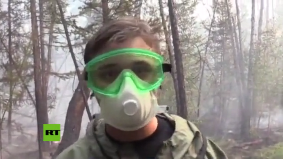
Russia is among the nations facing increasingly harsh natural disasters, such as the massive wildfires in the eastern Siberian region of Yakutia. An RT crew joined a group of firefighters doing their best to contain the blazes.

Yakutia is a sparsely populated part of Russia, prone to experiencing long periods of dry weather in summertime. This creates the conditions for massive and difficult-to-control wildfires. This year the threat emerged in mid-spring and, over the months, became quite devastating.

Despite all efforts to contain and douse the flames, some 37,000 square kilometers are affected at the moment. Several villages had to be evacuated before being obliterated. Many people living in parts of Yakutia and neighboring regions have also suffered from smoke inhalation and other hazards affecting their communities.

RT's Dmitry Pauk teamed up with a crew of firefighters in Yakutia, who said their resources have been stretched thin by the sheer size of the disaster. The larger fires, which pose a greater threat, get the priority allocations of manpower and equipment. Brigades dealing with smaller ones have to make the best of what they have.

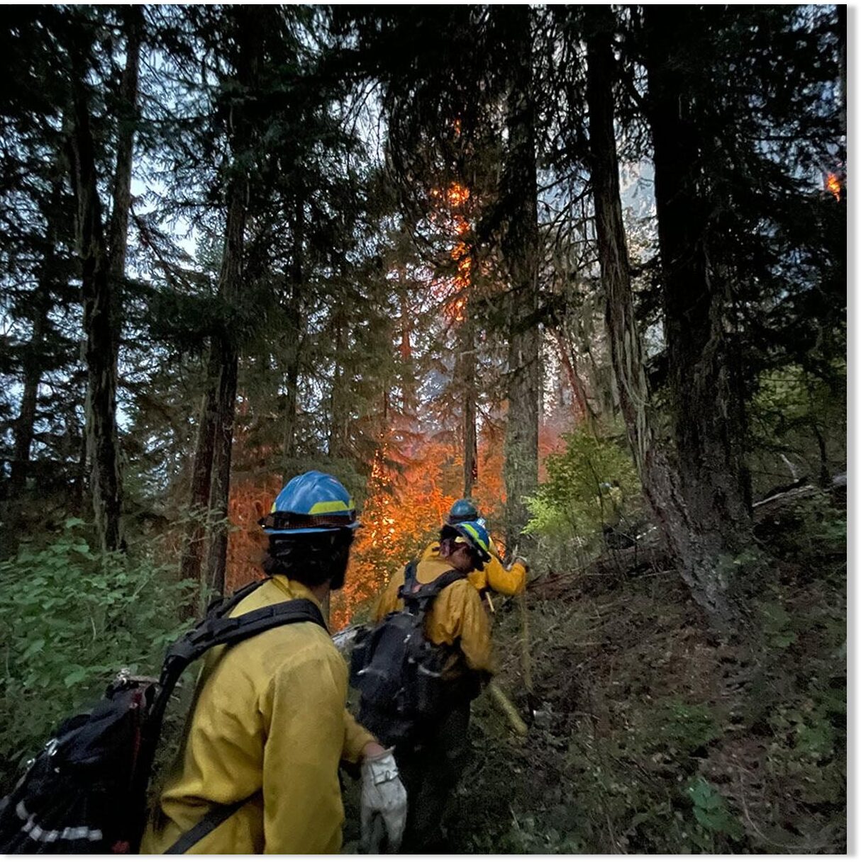
The crew that welcomed the RT crew is really low-tech, walking on foot in search of smoke and using shovels and manual backpack pumps where necessary. This intensive effort is usually enough to tackle flames on the ground. But there is always the danger of fire spreading across treetops, where it is fanned by the wind, becoming a much bigger hazard.

The destruction from the wildfires can be felt far from Yakutia. This week officials in Yekaterinburg reported that smoke from the Eastern Siberian region had traveled all the way to the major city in the Urals, a 3,000-kilometer journey westward, with the winds.

The Russian emergencies ministry said on Monday it had sent more people and hardware to Yakutia. There are now 4,070 people and 585 pieces of heavy firefighting equipment deployed on the ground there. The military is lending a helping hand, too, sending trucks, military engineering vehicles and personnel to assist the civilian authorities.

Wildfires in Russia and other nations are becoming a bigger challenge, as climate change tends to make some natural disasters more serious with each passing year. California recorded the biggest single wildfire in the state's history last week. Greece and Turkey are each currently waging difficult battles against fires.

Shasta-Trinity NF @ShastaTrinityNF
#McFarlandFire Evacuation Order Update 8/9/21 Acres: 32,687 Containment: 26% EVACUATION ORDERS AND WARNINGS:
Effective 6:00 a.m. today, the following Evacuation Order and road closures have been lifted: >>> 8:17 PM · Aug 9, 2021 UCT
An EVACUATION WARNING has been issued for the following areas:
Community of Wildwood
•Community of Post Mountain near the junction of the 36 and the 3
•Community of Trinity Pines •Community of Platina •
Shields Road •White Rock Road >>>
 
Algerian officials launch probe to find arsonists behind 50 ‘horror’ fires as firefighters battle blazes
Speaking on Tuesday, Interior Minister Kamel Beldjoud declared that the government would launch an inquiry to find the “criminal hands” who are “behind the simultaneous outbreak of about 50 fires across several localities of the province.”
On a couple occasions I had gut feelings that a good number of similar USA forest fires were started by diligent Deep State agents. Hollywood even gives a clue in the movie Those Who Wish Me Dead, where two MIC-assassins start a forest fire to drive their human targets into a trap.
Problem - Reaction - Solution:
You can't have a nice water crisis without deliberately depleting water reservoirs, then selling same water back to The Sheeple, but now at a high price! Same with GMO seeds destroying farmers.
Those mentioned '3x Bad Day' surprising global changes - the Deep State couldn't foresee - cannot come fast enough!
 
Back
Top Bottom