Fires around the world

In the county I live in, A Red Flag Warning for critical fire weather conditions was issued maybe a day or two before the nearest wildfire broke out early last week. A Red Flag Warning was also issued around the same time for other parts of Oregon.

A couple articles about the weather warnings that were issued:


Because of the wildfire smoke, the air quality here has been in the hazardous levels the past few days. Today it went beyond the air quality index's scale (values above 500)!
 

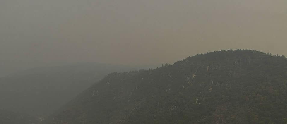
Fires in California: smoke is visible in the north of France
The fires currently ravaging the American West are so powerful that they are leaving traces all the way to Europe and at home in the Hauts-de-France.
 
This is from 2018 and deals with forensic wildfire cause (North West Public Broadcasting - Oregon):

Using physical evidence such as the patterns of burns scars on trees, the direction of grass stems on the ground or which side of a rock is covered in char and soot, investigators will trace their way back to as small an area as possible where the fire could have started. Sometimes they can narrow it down to one object. Often, it’s an area of about 10 feet by 10 feet.

Looking at the big picture from Oregon down through California, the fires are mapped with real time stamped statistics. A review of individual wildfires has some listed as lightning (complex fires California), and most others range from under investigation, unknown or human cause.

This article is from is from the insurance industry and 2020 is captured (discusses lighting complexes through California and not more
recently to the North):

Facts + Statistics: Wildfires
2020: From January 1 to September 8, 2020 there were 41,051 wildfires compared with 35,386 wildfires in the same period in 2019, according to the National Interagency Fire Center. About 4.7 million acres were burned in the 2020 period, compared with 4.2 million acres in 2019.

1600498904862.png


Here is another link for the Northwest Interagency Coordination Center with a list of each major fire and its status reported.

This link takes a look at California wildfire history with the headline: California May Need More Fire to Fix its Wildfire Problem

snip:


California is supposed to burn.

Before settlers populated the region in the 1800s, about 5 to 12% of the land that now makes up the Golden State caught fire each year — more than has burned so far in 2020, the most destructive year in modern history. Some of the historic fires were caused by lightning and others were set by Native Americans as a land-management tool, but they mostly burned with low intensity and touched much of the state with great regularity.

But after more than a century of aggressive fire suppression, California’s vegetation has grown much denser than the fire-adapted ecosystem had evolved to handle. Competition for water left forests vulnerable to drought and bark beetles, killing more than 150 million trees in the state.

Even as leaders rethink the role of fire, development throughout the state has made it much more difficult to let things burn.

“With the number of houses and the number of people we've got, there are some places where you're just not going to get fire on those landscapes,” said Malcolm North, a U.S. Forest Service ecologist. “We’re in a state with 40 million people. We'll never have fire on a scale we used to have historically.”
 
Thanks for the info/links Voyageur. I wholly agree that these fires become dangerous because of the build-up of fuels. In areas around us, for example, where fires are generally allowed to burn(Wilderness Areas) and have so recently, the flames rarely become canopy fires(kills trees) and simply burn all the fuel on the ground. In theory this also allows the larger trees to thrive. The traditional approach= rare.

Unfortunately we also have the logging....Sierra Pacific Industries does a great job of clearing their [stolen] land including all those nice big trees (nearly all "checkerboard" on google maps/earth in NorCal is clearing by SPI). Of course the branches aren't worth anything so they are trimmed off on-site and left behind as more fuel. :huh: Lately I've seen more loaded logging trucks on the road then ever and the local mill had to build a new storage area for all those cut trees. Greed$$$$.

SPI owners: "Lets cut 'em all down before the fires get them".

Malcolm North said:
“We’re in a state with 40 million people. We'll never have fire on a scale we used to have historically.”

:rotfl:Famous last words.
 
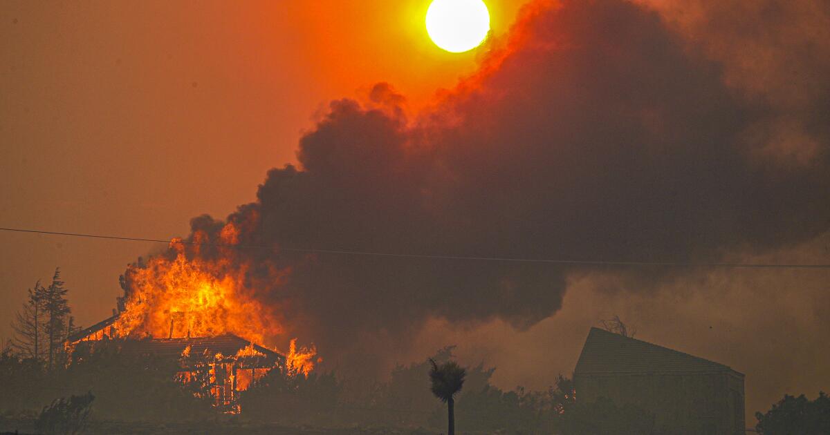
Roland Pagan on Saturday stood knee-deep in swirls of smoke on a mesa where the two-story home it took him nine years to build once offered commanding views of the desert flatlands below.

Almost exactly 24 hours earlier, Pagan, 80, stood on a nearby hill and peered through binoculars, watching his house in Juniper Hills collapse in flames.

“The ferocity of this fire was shocking,” he said, shaking his head in sadness. “It burned my house alive in just 20 minutes.”

The Bobcat fire exploded Friday amid intense winds, burning homes in the Antelope Valley and spreading in multiple directions.

As of Saturday, the fire had burned more than 93,842 acres and was threatening some desert communities along Highway 138. The fire lines stretched across 30 miles of rough terrain on the northern flanks of the San Gabriel Mountains.

Skipping Down

The fire spread rapidly onto the desert floor Friday as winds arrived. Some residents had to flee as the fire jumped around, hitting some homes but sparing others.

Flames tore through stands of yucca and juniper,
leaving behind piles of ash resembling leopard spots and transforming the landscape into a smoky wasteland.

The fire was 15% contained as of Saturday, but fire officials said they have a tough weekend ahead with hot conditions and more winds forecast.

“We are expecting another round of some pretty gusty south to southwest winds over the Bobcat fire this afternoon and into the evening hours,” said David Gomberg, meteorologist with the National Weather Service in Oxnard. The weather service was warning of an elevated fire weather threat both Saturday and Sunday due to the combination of wind and low relative humidity.

Update:

By Alex Wigglesworth, Louis Sahagun Sep. 20, 2020 9 AM UPDATED 9 AM
The Bobcat fire is approaching 100,000 acres, making it one of the largest wildfires in Los Angeles County history, and continues to threaten some desert communities as well as the Mt. Wilson Observatory in the San Gabriel Mountains on Sunday.

Although the fire is no longer bearing down on foothill communities like Arcadia and Monrovia, it is moving into some remote areas in the Antelope Valley, destroying homes and prompting numerous evacuations, officials said.

There were flare-ups overnight around Mt. Wilson, but firefighters on the ground and in the air were able to prevent any losses there.

The fire has burned nearly 94,000 acres and is only 15% contained, officials said. Winds could kick up again Sunday, but fire officials said with lower temperatures and calmer winds expected Monday and Tuesday, this might give them a chance to get the upper hand on the blaze.

Skipping Down

“The ferocity of this fire was shocking,” said Pagan, 80, who stood on a nearby hill and peered through binoculars, watching his house in Juniper Hills collapse in flames. “It burned my house alive in just 20 minutes.”

Though the fire approached the high desert community of Valyermo, a Benedictine monastery there appeared to have escaped major damage.

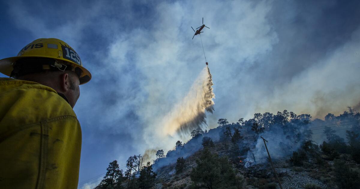
There are now more than 1,600 firefighters on the lines. They have relied on helicopters and water-dropping airplanes to deal with heat, erratic winds, low humidity and flames sweeping across vast swaths of inaccessible mountain terrain.

Skipping

The blaze is destroying forests and laying the groundwork for mudslides in some of the last refuges for federally endangered animals, including the southern mountain yellow-legged frog.

The fire burned through the Devil’s Punchbowl Natural Area, destroying the nature center, the Los Angeles County Department of Parks and Recreation said on Twitter. No animals or staff were hurt, and the wildlife sanctuary staff office was still standing, the department said.


In areas around us, for example, where fires are generally allowed to burn(Wilderness Areas) and have so recently, the flames rarely become canopy fires(kills trees) and simply burn all the fuel on the ground. In theory this also allows the larger trees to thrive. The traditional approach= rare.

Yes, it is interesting walking through older stands and seeing the markers of its history - big veterans still standing while the forest floor was cleaned out. Some of the fires (BC) from the 60's, 80's, the 2003 year and more recently, sees notable aspects, despite what ones sees of the conflagration of those events themselves, that there are all these little patterns in the landscape that for some reason were not touched; from a few tress to a few ares/ha., to many acres/ha. when it makes no sense that they would have survived at all. Some small change (wind, microsites, some form of moisture, species etc.) became critical to their survival.

Lately I've seen more loaded logging trucks on the road then ever and the local mill had to build a new storage area for all those cut trees. Greed$$$$.

This time last year in Canada, the price of lumber was somewhere around +/- $300 per thousand board feet USD. Since the covid spring - by August, the price had shot up over $1,000. per/t/bd/ft. USD. and has now settled at $578.60 USD (add +/- 30% bump CDN). Not a good time to build a wood framed house or buy a 2x4.

Perhaps the spike mirrors the run on wood at Home Depot's et al. dwindling covid wood inventory, not to mention all that plywood required to board-up 5th Avenue shops and various other cities from antifa/blm thugs; C-84 🧻 toilet paper is a given - with pulp at $1,100 a metric ton, along with the usual, and not so usual environmental tempests (including wildfires), of course, not to mention a consolidation of corporations in the markets (some well greenwashed), hence the increase of logging tucks that feed their spaghetti mills.
Stating the obvious, there are many jobs spun out of the forest sector, and many communities are dependent on it as long as there is societal need for wood fiber. Gone are the days of community forests, small operators and a light foot print.

With wildfires (at least above the 49th parallel in BC on Crown lands), there will be a big rush to salvage black logs over the winter at reduced stumpage; for the corporations, the wildfire salvaged/milled 2x4 nets the same at Home Depot.

Malcolm North (U.S. Forest Service ecologist) said:
We’re in a state with 40 million people. We'll never have fire on a scale we used to have historically.
:rotfl:Famous last words.

Scale vs. intensity, indeed the times are volatile, on every level it seems.
 
2020 wildfire season has overwhelmed the nation's firefighting capabilities
By Brian Bahouth September 24, 2020
The United States is enduring a devastating wildfire year. Fires have cut destructive swaths through California, Oregon, Washington, Colorado, and Arizona. As of September 17, according to the United States Forest Service (USFS), there have been 43,000 wildfires in the US that have burned more than 7.2 million acres, both public and private lands.

Nearly 4 million of those acres have burned in California. Since mid August, numerous large fires have been in and around very large communities in California and the Pacific northwest. Smoke impacts have been significant and widespread across the western United States.

Today in Washington DC, the Conservation and Forestry Subcommittee of the House Natural Resources Committee held a hearing titled, “The 2020 Wildfire Year, Response and Recover Efforts.”

Rep. Abigail Spanberger is a Democrat from Virginia and chair of the subcommittee. She opened the hearing with a few sobering facts.

“As we speak, there are over 70 large fires ranging across 5 million acres in the southeast, the South, the Rocky Mountains, the Pacific Northwest and California,” Spanberger said. “For some perspective, that is the equivalent of 5 million football fields, 1 million major league baseball fields, or 2.5 million typical city blocks that are currently burning.”

John Phipps is deputy chief for state and private forestry for the United States Department of Agriculture and gave testimony and answered questions during today’s subcommittee meeting.

Phipps said 2020 has been a fire season like no other.

“What we’re seeing on the landscape now is, we used to call them mega fires, but they’re even larger than that,” Phipps said. “They’re landscape-scale fires that can go 250,000 (acres) plus. We have one in California, that’s 800,000 acres. And we currently operate at a lesser scale than that. The agency doesn’t have a capacity currently, but we could. We probably need to be scaling up two to three times more, at least.”

In addition to a lack of resources, the other problem is the perception that wildfires only occur on public land.

“It’s really an all lands problem that, particularly in California, we see fires originating on private land and marching up into the forest and vice versa,” Phipps told lawmakers. “And so we’re going to have to start thinking more comprehensively, I think, across ownerships, if we want to see a different picture.

“And I would assure you, our scientists suggest that these western landscapes have an incredible capability to absorb fire and keep on going. We’re gonna see much more of the same. And to that, I don’t think that’s a desirable future. And it’s pretty alarming. And as the ranking member suggested, we need to come together and look at this differently. It’s on a scale that’s hard for people to imagine.”

Congressman Doug LaMalfa is a Republican from Oroville and the ranking member on the subcommittee. LaMalfa has represented California’s 1st Congressional District since 2013. The state’s second largest geographic district encompasses the northeast corner of the state to include Redding, Susanville, Truckee, Chico, Oroville, Nevada City/Grass Valley, and Paradise – legendary wildfire country.

The 400,000 acre North Complex fire recently destroyed some 1,200 buildings and killed 15 people in Rep. LaMalfa’s district, around his hometown of Oroville.

“I’m afraid future fire seasons only get worse unless we dramatically improve the management and health of our national forest system. In fact, the Forest Service has identified nearly 50 percent of the 193 million acres of the National Forest system is currently at high risk of wildfire, are likely to be impacted by insect and disease outbreaks.

“At current pace, it will take the Forest Service nearly 30 years to treat these acres. Our national forests are facing an epidemic of declining health, which is in direct correlation to disastrous policies that have led to a dramatic decrease in management. Even on the portions of the National Forest outside of roadless and wilderness areas.”

LaMalfa called for categorical exclusions from the requirements of the National Environmental Policy Act (NEPA) when doing fire mitigation and restoration. He also called for expanded grazing allotments in areas with heavy underbrush fuel loading. Both proposals are environmentally controversial.

Phipps compared today’s forests to those around the time of European settlement.

“Pre-settlement, the average forest had 64 trees per acre. Currently, the average forest in California has 320, that’s 80 percent more density. And how did that happen?

“It happened because we’ve been trying for over 110 years to put out every fire we can. And we’ve been really successful at that. But it’s creating a situation where we, all across all jurisdictions, we attempt to put out all those fires, and as a result, we’re selecting away the good fire, and the 2 percent that normally gets away, the catastrophic fire, when that happens under the right conditions, there’s no stopping it basically.

“We’re there to help people get out of the way. But there’s just tragic loss of life, and these fires burn at high severity. And it’s just really a bad trajectory that we’re on, and it’s going to take some, really a paradigm shift in thinking.”

Today’s subcommittee meeting was in part intended to scope the funding other resources needed for next year.

Twenty years ago, 15 percent of the US Forest Service’s annual budget was spent on fire suppression. Now, according to John Phipps, that number is 55 percent and growing.

Congress has allocated $1 billion dollars for fighting wildfires in 2020. With an additional $1.9 billion from the 2018 Fire Funding Fix, Phipps said they were able to do more suppression and fuels mitigation, but 2 to 3 times more money will be needed in 2021 and every year beyond.

Phipps said the 2020 fire season literally crashed the system.

“This year was an extraordinary year, and the system was not designed … it broke the system to try to respond to all that amount of fire, all at the same time. And it’s likely the case that we need to maintain the fire suppression capability while we’re working to manage the landscape better, at least over a 10-year period.”

Brian Bahouth is editor of the Sierra Nevada Ally and a career public media journalist.

Rt / 0:14:18 Various descriptions of extreme fire behavior, the lighting event (on Aug 21, 2020), and other insights.
The North Complex Fire has been burning for 33 days as of this writing. Nearly 300,000 combined acres in Plumas and Butte counties have burned. The conflagration stretches forty miles from Oroville to Quincy, California. And while fire fighters gradually gain control over the vast complex of fires, 15 people have died and more than 1,200 structures have been destroyed.

On September 8, officials divided the vast North Complex Fire into three zones; North, South, and West. Josh Edelson is a freelance photographer based in the Bay Area who has been shooting the North Complex Fire West Zone for the Wall Street Journal and other outlets. Edelson visited Oroville and Berry Creek, the scene of massive destruction. On this edition of the Wild Hare, we chat with Josh Edelson about his recent work.

00:00 / 51:57
On the fifth and final episode of California Burning, we look for solutions that address the many different factors associated with the wildfires plaguing our State.
This includes a talk about alternative building materials that can withstand fire, and a tour of a fire resistant house that survived the Carr fire while the rest of his neighborhood burnt.

We’ll also hear from a man starting a movement to restore ecosystems as well as a business woman using biochar to address the problems surrounding excess forest fuel and dead trees from bark beetle infestations.
American Forests: Home - American Forests Ecosystem Restoration Camps: New Home
Enplan’s wildfire viewer mapping system: Real-time wildfire map | WILDFIRE VIEWER


Georgios Papavasileiou
Sep 12 2020 @eumetsat
Satellite images from Meteosat-11 earlier this morning reveal #smoke over #Europe originating from the #wildfires in the western #USA.

California fires: Go behind the scenes of incredible photos captured by Times staffers
Sep 27, 2020·
90

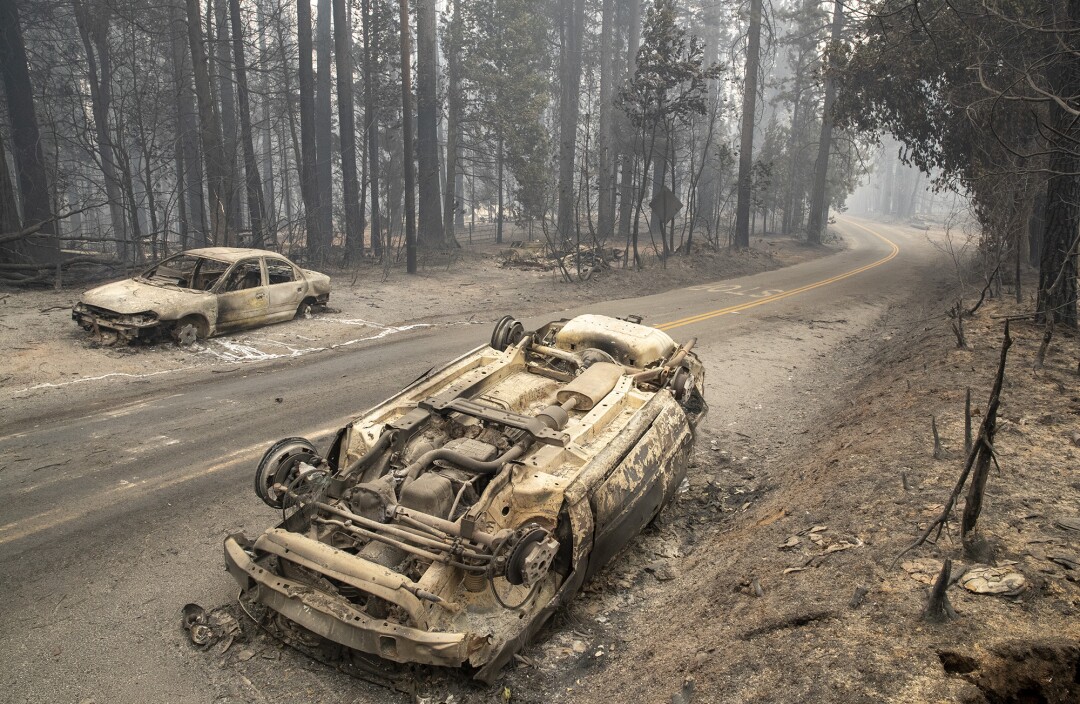
An overturned car on ash-covered Bald Rock Road in the aftermath of the Bear fire on Thursday, Sept. 10, 2020, in Brush Creek, Calif. (Brian van der Brug / Los Angeles Times)


Forest fire in Ymittos on the afternoon of Saturday, September 26, 2020. The winds are blowing with intensities up to 5 Beaufort in the area. Photo by John Valavanis. See live image from the weather camera in Penteli: Κάμερες Αστεροσκοπείου Πεντέλης
 
Last edited:
Thanks again c.a.

Just when we thought maybe these fires would fizzle out(or it would start raining), an evening of strong winds and low humidity have brought them back to life. We now have the Zog Fire nearby which started yesterday and is now at 15k acres.(!!) Friends who watched the smoke plume from the mountain said it looked very much like the Carr Fire that roared through a couple of years back. Very, very hot. Unstoppable.


Ei9OpmnUMAAy9N6.png


1186326-1.jpg


Looks like the Glass Fire also started at about the same time down in Napa. And that August Complex just won't go away. Almost at 1 million acres. Maybe California needs to 'fall into the sea' at this point.??

Who needs a Solar Minimum? Seems here we're creating our own....
 
Explosive development of CAL WOOD FIRE just 10 miles NW of Boulder, CO
Video Oct 17, 2020 - 5:17
Coverage of the Cal Wood Fire a new wildfire in Boulder County, Colorado just 10 miles NW of the city of Boulder! This wildfire is the first significant fire that has moved into the Foothills. The Cameron Peak Fire has grown to nearly 190,000 acres, the largest in state history for Colorado


This is a summary of all incidents, including those managed by CAL FIRE and other partner agencies.
4,105,786 Acres Acres Burned
8,486 Incidents Number of Wildfires
31 Fatalities Confirmed Loss of Life
9,247 Structures Structures Damaged or Destroyed


Meanwhile: In Southern Cali
 
The city of Berkeley urged residents of the hills to consider staying elsewhere amid what is expected to be the year's biggest wind event set to begin Sunday.

"Hills residents should consider pre-emptively evacuating to the homes of friends, family, or to hotels until dangerous weather subsides," a press release from Berkeley reads.

Warning of the potential for wildfires during the wind event and possible blocked roads and exit routes due to fallen trees, the press release urged hills residents to "reduce the risk to your household" by leaving Sunday afternoon before a fire starts, especially for those residents who could have trouble evacuating quickly or leaving by foot.

SD:

The National Weather Service has a red flag warning in effect 11 a.m. Sunday through 5 a.m. Tuesday for the North Bay and East Bay mountains. All other Bay Area locations fall under the warning 8 p.m. Sunday through 11 a.m. Monday. The NWS said the event will likely deliver winds on par with those that fanned flames during the 2017 Wine Country firestorm and last year's 2019 Kincade Fire, but conditions could be even more severe with winds blowing into nearly every nook and cranny of the region.

Winds Howl Over Bay Area Peaks, Increasing Fire Danger In North And East Bay
Oct 25, 2020 KPIX CBS SF Bay Area / 10:33
Team coverage of high winds creating dangerous fire weather, forcing widespread PG&E power shutoff in East and North Bay (10-25-2020)


From ZME Science:

Australia’s wildfires created a ‘record-breaking’ smoke plume in the upper atmosphere


Australia's bushfires set a record for the largest smoke cloud generated by a wildfire, a new paper reports. The plume was at least three times larger than any previously recorded one.

Researchers at the University of Saskatchewan's (USask) Institute of Space and Atmospheric Studies say that last winter's Australian wildfires created a smoke cloud that pushed all the way to the stratosphere, some 35 kilometers above the surface, and reached incredible sizes. At its largest, it measured 1,000 kilometers across. The cloud remained intact for three months and traveled over 66,000 kilometers.

King smoke
"When I saw the satellite measurement of the smoke plume at 35 kilometres, it was jaw dropping. I never would have expected that," said Adam Bourassa, professor of physics and engineering physics, who led the USask group which played a key role in analyzing NASA satellite data.
The fires seen in Australia this year were so devastating that the summer of 2020 has been nicknamed the "Black Summer". It's an apt name — the blazes claimed over 5.8 million hectares of forest in the continent's southeast and bellowed massive amounts of smoke.

An international research team led by Sergey Khaykin from Laboratoire Atmosphères, Milieux, Observations Spatiales (LATMOS) in France. The findings, they hope, will help us better understand how wildfires interact with and affect our planet's atmosphere.
"We're seeing records broken in terms of the impact on the atmosphere from these fires," said Bourassa. "Knowing that they're likely to strike more frequently and with more intensity due to climate change, we could end up with a pretty dramatically changed atmosphere."
Bourassa's team has experience in a specific type of satellite measurement that can pick up on smoke in the upper layers of the atmosphere. He explains that wildfires such as those in Australia and Western Canada (in 2017, the world's second-largest to date) got so big that they generated their own clouds, Pyrocumulonimbus, and their own thunderstorms.

The smoke these wildfires produce, together with particulates from meteor 'smoke' and volcanic eruptions, all jointly contribute to the increased dust-load in the atmosphere. This changes its electric charge rebalancing mechanisms, producing more intense storms and precipitation in the form of record rainfall, hail, lightning strikes, atmospheric 'anomalies' etc.

See also:
 

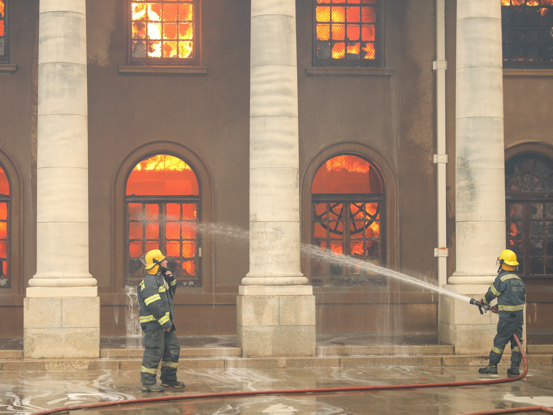
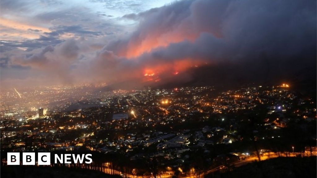
A wildfire on the slopes of South Africa's Table Mountain forced University of Cape Town students to evacuate, as runaway flames set several campus buildings ablaze and firefighters used helicopters to water-bomb the area. The fire started early near a memorial to politician Cecil Rhodes, located on Devils Peak, another part of Cape Town's mountainous backdrop, before spreading rapidly up the slopes. The university, ranked among the best on the continent, is largely built on the slopes of Devil's Peak and is situated close to where the fire started


"The fire that initially started in the vicinity of Rhodes Memorial just under 24 hours ago continues to rage and has spread in the direction of Vredehoek," city officials said in a statement.

Disa Park, which refers to three identical residential buildings close to the foot of Table Mountain, has also been evacuated.
The nearby University of Cape Town has also been shut and students evacuated.
The fire destroyed the Reading Room at its 200-year-old Jagger Library and the historic Mostert's Mill. Other buildings were also affected.
"Some of our valuable collections have been lost," the university said.
This includes some 3,500 archival collections, including the Bleek-Lloyd collection of San language and mythology, the university added.
 
Back
Top Bottom