Fires around the world


Live map: See the Carr fire near Redding in real time

3 Marin firefighters burned by ‘blow torch’ of flames at Shasta County inferno
Posted: 07/27/18, 4:11 PM PDT Updated: 4 hrs ago
Marin County fire Chief Jason Weber said Friday he was evaluating whether to dispatch fresh firefighters to battle the Carr fire in Shasta County after three members of his department suffered burn injuries Thursday night.

Weber said the injured firefighters, who staffed one of the engine companies, were defending a home east of Redding at about 7:45 p.m. when the “fire made a pretty significant run.”

“They were adjacent to a pinyon pine tree grove, which is highly volatile, Weber said. “The fire literally laid down like a blow torch with the wind on it. They were several hundred feet away but the radiant heat was extreme.

“With the leadership of the company officer they took refuge in the engine,” Weber said, “and were spared more significant injury by those actions.”

Engineer Scott Pederson, 37, who has served 19 years with the department; firefighter Tyler Barnes, 34, who has four years with the department, and firefighter Brian Cardoza, 26, who has been with the department just three months, were treated for second-degree burns at Mercy Hospital in Redding and released Friday morning.

Pederson suffered burns to his hands. Barnes suffered less severe burns to his nose and ears. Cardoza, whose face was burned, was sent to the University of California at Davis on Friday for additional treatment.

Weber said that at 1 a.m. Thursday his department dispatched five engines and 17 firefighters to the Carr fire. The Marin County firefighters were assigned to the fire front to defend homes and rescue residents.

He said after the incident he pulled the entire strike team off the line.

“As you can imagine, they’re pretty shook up. We’re providing them with some peer support and are getting them some rest,” Weber said. “They’ve been out firefighting for a couple of days now.”

Weber said protocol calls for an accident review of the incident in conjunction with the California Department of Forestry and Fire Protection.

The Mill Valley Fire Department, the Tiburon Fire Protection District, and the Central Marin Fire Department each dispatched one engine and four firefighters to the Carr fire on Thursday morning, said Mill Valley fire Chief Tom Welch.

“They had a very, very active night last night in multiple threatened Redding neighborhoods,” Welch said.

He said that while the fire’s intensity lessened Friday morning, he expected it to pick up again by the afternoon.

Asked if the fire’s fury caused him to be concerned for personnel, Welch said, “I’m always worried about our staff, but they are well trained and very experienced. They make good decisions, so I sleep well knowing that.”

The Novato Fire District, Kentfield Fire Protection District and Ross Valley Fire Department also have each dispatched four firefighters to the Cranston fire, which has scorched about 11,500 acres in Riverside County.

Weber said the number of severe fires so far this year has put his department back on its heels.

“The folks are just tired,” he said. “We’ve been going strong since the middle of June with fire activity.

“On the heels of last year where we were engaged in active firefighting from June until December and then the mudslides in January, there just hasn’t been a break,” Weber said. “We’re certainly on an unsustainable path for the California fire service if things don’t change.”


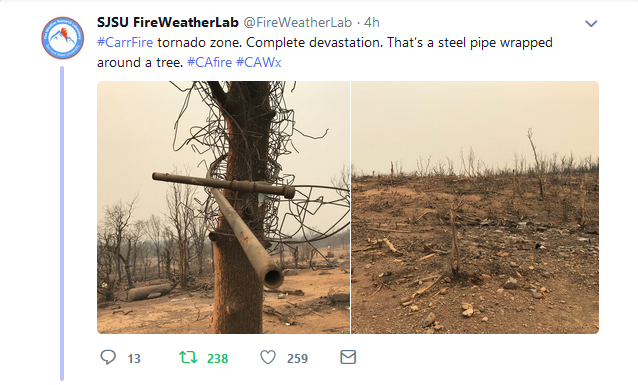
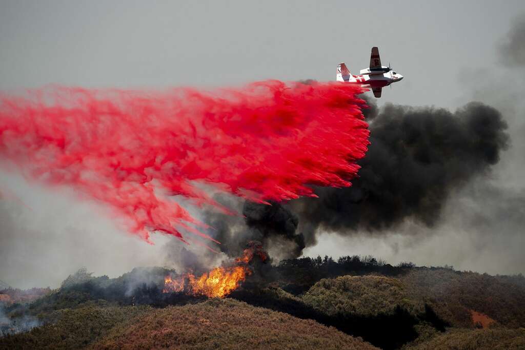
The Carr Fire has grown to 80,906 acres and is 5 percent contained. Numerous mandatory evacuations are in place.


Redding Man Searching For Wife, Great-Great-Grandchildren After They Fled From Carr Fire
Video
 
Hi Everyone. We live not far from the Carr Fire and the view from our mountain pass is apocalyptic. We went through a major fire last year(evacuation) but this appears unprecedented. Just today we were in Mendocino, just a county or two to the south and they are also dealing with fires that are "out of control". And we had a pretty wet winter.....(no more "drought")

We sometimes wonder if it's not "the big one" in terms of earthquakes(although that could be also) but wildfires.

FWIW, beautiful and open-minded as it is, we're in our last year of residing here(or less).

Much love to all those in the line of fire. This may be only the beginning here.
 
758156bd32c0df22249b11e1230cc610.png


Wildfire for Lake County, CA This alert expired 2 hours ago ·
Lake County CA Sheriff's Department via Nixle
https://www.google.org/publicalerts/alert?source=sos&hl=en&aid=8370ac11b94903ff
Advisory Evacuation for Soda Bay, Riviera Heights, Buckingham Park, Riviera West, Clear Lake Riviera and portions of Loch Lomond and Cobb

This is an Advisory Evacuation Notice for the Soda Bay, Riviera Heights, Buckingham Park, Riviera West, Clear Lake Riviera and portions of Loch Lomond and Cobb. This includes all residents living north of Lake-Sonoma County Line; east of Bottle Rock Road; south of Clear Lake; and west of Soda Bay Road, Red Hills Road, and Highway CA-175; including the subdivisions of Soda Bay, Riviera Heights,

Buckingham Park, Riviera West, and Clear Lake Riviera west of Soda Bay Rd. This is an evacuation advisory for the above locations. At this time, an evacuation is recommended, however not required at this time. We encourage those who are able to evacuate to consider doing so now. If you have somewhere you can go, such as a friend or relatives home, we recommend doing so. We are inviting everyone to take preparations in the likely event a mandatory evacuation order is issued. Preparations should include gathering all medications, important documents, making plans for pets, and notifying family members where you may be going. During a mandatory evacuation, it will be extremely hectic and traffic conditions will be very congested. By evacuating early, you do your part in keeping yourself, your neighbors, and our first responders safe. As a reminder, this is not a mandatory evacuation at this time. In the event of a mandatory evacuation, emergency shelters will be designated and identified.
Map:


California wildfires still ‘growing faster than you can imagine’
9:48 pm PDT, Monday, July 30, 2018
Snip:
Image 11 of 98

An air tanker drops retardant on a wildfire burning near Lakeport, Calif., on Monday, July 30, 2018. A pair of wildfires that prompted evacuation orders for thousands of people are barreling toward small lake towns in Northern California. (AP Photo/Noah Berger)
LAKEPORT, Lake County — Firefighters made small but promising headway Monday on the two main fires bedeviling Northern California, but nobody was prepared to say the danger was over as the flames in Redding and near Clear Lake were being beaten away from homes and into wilderness areas.

The worst of the threat remained in the resort towns on the western edge of Clear Lake, where the 68,487-acre Mendocino Complex fire surged to within a mile of the city of Lakeport, before being shoved back another mile by an army of fire crews armed with water-dropping helicopters.

The string of little communities hugging the lake’s northern shoreline, normally bustling with motor boats and fishermen this time of year, sat empty after emergency officials shooed more than 15,000 people away to safer locations to the south over the weekend and Monday.

Rob Brown, a Lake County supervisor and veteran of earlier blazes in the area, said firefighters are “doing what they can to keep it out of populated areas, and so far they’ve made great progress.”


That fire whirl is scary stuff.

I can smell the smoke from the Carr fire here in Sonoma County, CA. Reminds me of last fall when my family and I were temporarily evacuated, then returned home, taking in some people who lost everything in the 2017 fires.

My area is now on a red flag alert till 11:00pm this coming Saturday. It will be hot, dry and windy. We're prepared just in case.
 
  • Like
Reactions: Ca.
Taken about an hour ago again from Oregon Pass looking east toward Weaverville. The plume on the left threatens Lewiston and on the right, Douglas City. From what we can tell, most "updated" maps online are from days ago and inaccurate.
IMG_3374.JPG
 

Complicated also the situation in #Monchique, in the Portuguese Algarve with 1,000 hectares already burned, strong heat and wind. 700 firefighters, 130 military and 10 air media fight in this level 3 fire


Mendocino Complex EVACUATION ORDER 8-4-18 (1:15 PM)
News – 30 min. ago
Mendocino Complex EVACUATION ORDER 8-4-18 (1:15 PM) - InciWeb the Incident Information System
Mandatory Evacuation Lake County:
North of SR 20, east of the Lake-Mendocino County Line, south of the Lake-Mendocino County Line, west of the Lake-Glenn County Line. This includes the areas of the Lake Pillsbury basin, Elk Mountain Rd, Bear Creek, Pine Mountain, and the surrounding areas. Residents should evacuate west on Elk Mountain Road to Eel River Road to the Town of Potter Valley.


[B]WeatherNation[/B]‏Verified account @[B]WeatherNation[/B]
Another wildfire has popped up in the West. This one is north of Salt Lake City, Utah and named the #GaringFire
https://twitter.com/WeatherNation/status/1025837527477800961
1:15 PM - 4 Aug 2018
206890baf12fc18532d879a6b7423352.png


Published on Aug 2, 2018
Drone video shows what's left of Lake Keswick Estates after the merciless Carr Fire, one of the most destructive wildfires in California history.

Video from plane’s cockpit captures California’s Carr Fire
Carr Fire levels, ravages Redding neighborhood
Published on Aug 3, 2018
Footage from the cockpit of a California National Guard C-130 plane captures the Carr Fire burning near Redding in Northern California. Video courtesy of California National Guard

Comments are disabled for this video.
 
500 firefighters battled to control massive blaze in Germany that injured at least 40
7 Aug, 2018 19:59
Dozens have been injured in a massive fire in the German town of Siegburg. Almost a dozen homes were destroyed by the flame, which was tackled by hundreds of firefighters and led to the shutdown of roads and a railway line.

At least 40 people have been injured in a large-scale fire that broke out in the town of Siegburg, located some 30 kilometers south-east of Cologne, a local police department confirmed in a Twitter post, adding that at least six people sustained severe injuries in the blaze.

The flame engulfed a neighborhood located close to an InterCity Express (ICE) line – a high-speed train service operated by the German railway company Deutsche Bahn – prompting the suspension of railway services between Cologne and Frankfurt as well as causing train delays of up to 90 minutes on some other lines. Police also had to block some major highways running near Siegburg for several hours.

A video posted on YouTube by the local Koelner Stadt-Anzeiger daily, as well as photos from the scene, show several homes burnt out from the ground floor to the rooftop. Some eight buildings were destroyed by fire, according to German media.


One week earlier.
https://www.youtube.com/watch?v=iNj_je5jh-I
Jul 26, 2018
An der Bahnhaltestelle der KVB Amsterdamer Straße/Gürtel in Köln hat es an den Gleisen der Linie 13 gebrannt.
At the railway stop of the KVB Amsterdamer Straße / Gürtel in Cologne, it burned on the tracks of the line 13.
And one comment:
Living near Nordpark.Has seen it live .. it's hard to stand the heat, and today supposedly rain but puff pie! In the North Park no bird sings tomorrow morning, where else you can not miss the concert with the windows open.

Today during the walk I saw many birds dead. Trees lose leaves and the grass is burned.

Put water in a bowl in the garden or on a balcony eigentlich I always have water and food there and quite a lot of visitors like squirrels, parrots, sparrows, blackbirds, robins, chickadees but for a few days almost no one to see, only a few sparrows are still drinking , Cologne is cursed, everywhere in Germany there are lower temperatures and rain, but not with us. Well then .. "Welcome to hell"


Vids-Tweets
In Wateren, just over the Drents-Frisian border south of Appelscha, more than 75 hectares of heather were burnt down on Tuesday. It took the fire department hours to get the fire under control.

It is still unclear how the fire started. Rumors that two boys have been arrested on suspicion of arson turn out to be wrong.

A total of 150 firefighters were deployed to combat the fire. They used sixteen tank car sprayers and eight water tanks with a capacity of 15,000 liters of water each. Six ambulances were also on stand-by.

Initially, eight fire brigades were called up, including those from Appelscha and Noordwolde. Later this became much more, among others from Lemmer, Joure, Wolvega and Tjalleberd. The fire engines could not enter the burnt heathland because it would cause too much damage to nature.

Farmers from the area also helped fight the fire. A large part of the area was also deposited because of the smoke development. The flames also quickly surrounded themselves by the wind.

Translated from Dutch by Microsoft
Update 19:05 Hours: The fire-fighting is still in every case until 21.00 hours to extinguish. For that time, the campsite guests can not return yet. 150 firefighters are busy fighting the fire. A total of 75 hectares were burned. #natuurbrand #wateren

Blush helicopter from Defense deployed

At 5.45 pm the firefighters got reinforcement on the ground of a fire fighting helicopter from Defense. It was a chinook with a water bag underneath, called the bambi bucket, which holds 10,000 liters of water. The heli would also be used at the big fire at Schiermonnikoog but was then canceled at the last moment.

The helicopter first filled in the Achterste Plas, a sand excavation at Hoogersmilde, the water bag and later also used water from the Canadaplas between Wateren and Appelscha. Filling can only happen at a place where the water is deep enough, no obstacles and no people swim. Besides the chinook, a police helicopter circled in the air to map the fire from above.

Campsites vacated

There are several recreation parks and campsites in the immediate vicinity. Campsites Hertenweide, Zonnekamp, De Blauwe Lantaarn and park Beek en Brink are vacated. The camping guests are taken care of in the Alberthoeve.

A person has become unwell on De Blauwe Lantaarn. This was transported to the hospital with a trauma helicopter.

A large part of the guests could return to their tents and caravans from 9 pm. The fire department stays in the area all night to extinguish and intervene when the fire flares up again.

Waters lie at the Drents-Friese Wold and the Doldersummerveld, two large nature reserves.


Aug 7, 2018 / 2:23

NIFC on Twitter
@[B]NIFCfire[/B] 10:32 AM - 6 Aug 2018
Today 127 wildfires have burned 1.6 million acres in 14 states. More than 28K firefighters and support personnel are assigned: 558 crews, 1,907 engines, 186 helicopters. Source: NICC, IMSR. Photo credit: Inciweb, US Forest Service #PL5
 
Published on Aug 6, 2018 (Looking East)
The early phase of the Holy Fire is captured from the Santiago Peak camera in Orange County.

Published on Aug 7, 2018

Published on Aug 8, 2018
The Holy Fire is heading downslope towards Elsinore... weather conditions today are favorable for continued growth.

Published on Aug 8, 2018
Last 8 hours of Day 2: the Holy Fire is characterized by aggressive growth and sustained air attacks, including a near burn over of the peak and associated communication gear. Fire camera also catches phos-cheking to protect those assets!

Prep...?

Holy Fire Aug 9, 2018
More Than 20K People Forced To Flee (CBS, News U can Trust...:shock:....?)
/ 4:28 Holy Fire has burned more than
6,000 acres and destroyed 12 buildings.

THE ORCHARD............ Santa Rosa Tubbs Fire Update
Published on Aug 7, 2018 / 2:41
 
Last edited:
Opinion: Aug 11, 2018

Boles Fire Anomaly Investigation 2014 - "New Normal" Begins in California
RT / 21:47
Boles Fire - Wikipedia


Yosemite Valley to Reopen to Visitors on Tuesday, August 14th, at 9:00 a.m. - Yosemite National Park (U.S. National Park Service)
Date: August 10, 2018
The Mariposa Grove of Giant Sequoias to reopen on Monday, August 13th

Video
In the Republic of Sakha, forests are burning on an area of 700,000 hectares, the Avialesohrana FBU reported. "Star" publishes footage shot by fire brigade at the site of the state of emergency.

According to the latest data, 28 fires were recorded in Yakutia. At present, Avialesohran specialists are fighting against three sources of ignition. In extinguishing, about 120 people participate.

On the eve of the head EMERCOM of Russia Eugene Zinichev called on the authorities of Yakutia to pay special attention to the situation with natural and forest fires. It is noted that fires do not threaten the villages and objects of the economy of the republic. ■

Wildfires rage in northern B.C.
CBC News Published on Aug 8, 2018
A growing wildfire near the northern B.C. community of Telegraph Creek has destroyed more than two dozen buildings. Several large fires have forced evacuation orders around the community over the past several days
 
Last edited:
There are millions of dollars worth of electronic equipment on Santiago Peak, which I believe is the highest point in the Santa Ana Mountains in Southern California. The sites serve as transmitters for radio and TV stations, repeaters for emergency management agencies, and private radio systems.

On August 8 there was quite an air show working to protect the site as the Holy Fire burned nearby. The live camera operated by HPWREN streamed live on YouTube and I took the opportunity to obtain some screen grabs. The aircraft you will see include an MD-87 and an S2T. Then below there is a shot of the 747 at Santiago Peak taken by Evver G Photography.

The DC-10 made some drops in this area too but while I was watching it was mostly out of the camera frame. One of its passes left retardant on the camera lens.

(To see all articles about the Holy Fire on Wildfire Today, including the most recent, click HERE.)


Back
Top Bottom