Floods & Landslides

The warm front of the disturbance linked to #tempête #Domingos brings abundant rain which quickly crosses France from west to east this morning. This rain will be followed by sometimes heavy showers this afternoon.


Screenshot 2023-11-04 at 17-51-17 La Chaîne Météo (@lachainemeteo) _ X.png

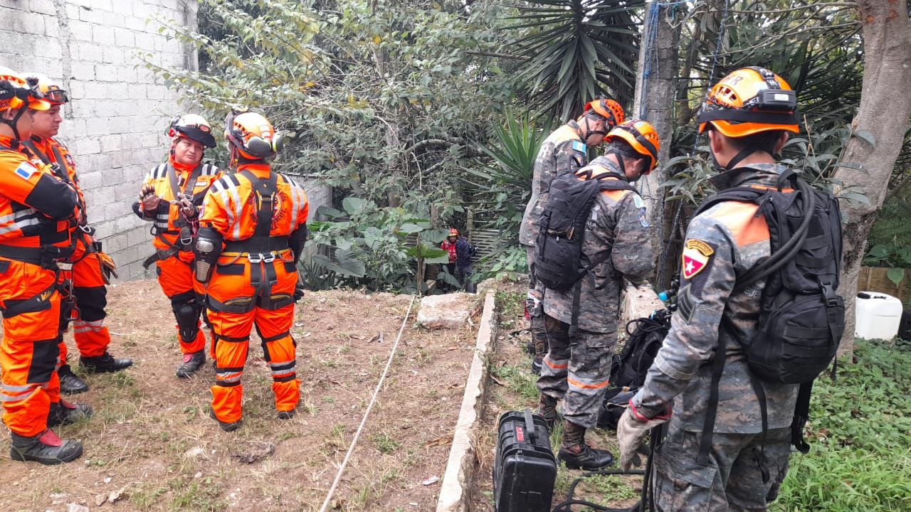
Due to the strong #pluies which have been occurring since mid-October, many rivers have flooded in the southwest and in Nord-Pas-de-Calais. Worrying situation because no improvement is expected for a week.

Be careful this weekend due to significant accumulations of #pluies in the south: we expect locally the equivalent of 2 to 3 weeks of precipitation in addition to that which has already fallen. As soils saturated with water can no longer absorb water, risks of #inondations are to be feared.


The day after #Porto #Corse Caution: further heavy rain is forecast next night in the western foothills and the Corsican mountains, which could cause the rivers to react Georges Diddens

Screenshot 2023-11-04 at 21-15-08 Actus Meteo on X.png
@VigiMeteoFrance revises upwards the accumulations in #Corse with peaks up to 200 mm on central relief next night Golo upstream joins Gravona and Tavignano in orange flood alert, with the reaction of the watercourses a little stronger than during the episode of November 2


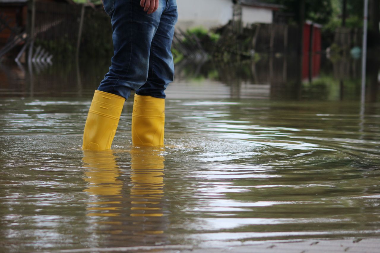
More footage of flooding in Mecca, Saudi Arabia 3 November 2023 #ClimateCrisis #floods #flooding #SaudiArabia
 
The northern prefecture of Arras sees unprecedented amounts of rain and wind from the aftermath of storms #Ciaran #Domingos, (with the next ten days experiencing no let-up in sight).


Screenshot 2023-11-07 at 16-29-21 Météo Express on X.png


Water, always water, and more water. In this context of low pressure, the country will receive a series of rainy spells over the next ten days at least. We have already reached remarkable levels of precipitation at the end of October on soils saturated with water; this raises fears of further #crues .. @wxcharts

Images of the floods in Hesdigneul-lès-Boulogne in Pas-de-Calais, hard hit by the major flood of the Liane since yesterday. ( © Christophe Savina)

The floods affecting the #Liane and #AA basins in #PasDeCalais are impressive. He fell loc. Almost 30% of the annual rainfall since mid-October. And it's not over: the next disturbance tomorrow will bring up to 40 mm... #inondation


Worrying situation in Pas-de-Calais. Nearly sixty municipalities affected by floods. Update on the situation and upcoming weather conditions in the Special Edition of @BFMGrandLille @BFMLittoral .#VigilanceRouge #Inondation
 
The first decade of November was particularly depressed, with a deficit reaching -20 hPa between Normandy and Nord-Pas de Calais. In Lille, this is the new record for the lowest average pressure for the first decade of November (since at least 1836).

2 minutes before the last duplex of our mission, the storm gained strength in the distance, thunder rumbled. We even see a little hail. The showers have been coming since the beginning of the morning.7/9

L-1 The recurring precipitation of recent weeks has allowed the small water tables in the north of the department and in the mountains to be well recharged. On the other hand, the improvement is much slower on the large aquifers in the West and South-West of the department.
L-2 Their level, although increasing, still remains at low to very low levels; however, we have noted a greater recharge over the past ten days, particularly on the Saint-Étienne-de-Saint-Geoirs piezometer in Bièvre. .


Meanwhile:
Heavy snowfall is underway in Bonneval-sur-Arc at 1800m in Savoie. The rain will eventually take over with a high risk of avalanches! (via @Viewsurf)

Impressive layer of snow in Les Saisies in Savoie this Saturday. This morning, the nivose of the Col des Saisies located at 1614 meters measured 67 cm of snow on the ground! ( © We Are Seizures)


Screenshot 2023-11-14 at 22-01-57 Michael Snyder on X.png

Germany
#Nass it will continue in the next 2 to 3 days! The #Westwetterlage continues! More weather maps at: https://daswetter.com/modelle/

Screenshot 2023-11-14 at 20-17-30 Met4Cast. on X.png

Screenshot 2023-11-14 at 22-25-47 Met4Cast. on X.png

The heavy rains of the day generated a new major flood of the Liane in Pas-de-Calais, reaching 4.91 meters in Wirwignes! This is the 5th exceptional flood peak in just two weeks! ( © Vigicrues)

On the border of France and Genève
Images of the major flood from #Arve in progress to #Sallanches in #HauteSavoie . This section has been placed on RED alert by Vigicrues with a flood peak expected in the middle of the night. (video La Galerie des Alpes, Titouan Fevre)

Screenshot 2023-11-14 at 22-30-09 Météo-Contact on X.png

 
Landslide in zone 3 of Las Calaveras, #Guatemala City (November 22, 2023). #Massive #Landslide
Rescue efforts continue for 6 missing persons, where in addition, some 60 people were evacuated.

Landslide causes distress in Las Calaveras sector, zone 3 of the capital city

Six people are still missing after a landslide in the 6th avenue end of the sector Las Calaveras, colonia El Gallito, zone 3 of Guatemala City.

This tragedy has plunged the community into an emergency situation, leaving behind a trail of destruction.

The landslide has resulted in severe damage to five houses, and residents report material losses and the urgent need to find housing solutions.
 
The Pineapple Express moves towards the Pacific Northwest, bringing flooding and higher-elevation snow.


Since yesterday, the annual 1000mm exceeded at #Niort- a large third (35 %) fell between mid-Oct and mid-Nov- The last time this happened was in 2000 (1084 mm)- this threshold of 1000 mm had been exceeded 7 times between 1990 and 2000 Annual totals via
@infoclimat


In the second #Wochenhälfte mild #Luftmassen prevail everywhere in #Deutschland ! More weather maps at: https://daswetter.com/modelle/

Related:
 
● Saudi Arabia
Heavy floods on the streets after rains in the Yanbu of Al Madinah, Saudi Arabia 🇸🇦 (09.12.2023)

● Indonesia
Major flood due to extreme rains in the Semagung of Central Java, Indonesia 🇮🇩 (08.12.2023)

● Paraguay
Heavy floods on streets due to extreme rainfall in the Asunción of Paraguay 🇵🇾

● India
Massive floods due to intense rains after Cyclone Michaung in Chennai of Tamil Nadu, India 🇮🇳 (04.12.2023)
 
After #tempête #Elin yesterday, a new storm is forming off the coast of Ireland this Sunday. Named #Fergus , this storm will feed an atmospheric river in central France, bringing a lot of rain and the risk of flooding.

Thaw and precipitation: Warning of floods! Rain up to over 2000 m!

There is still permafrost in southeastern Germany - even though the low-pressure area "Udo" is already bringing mild air masses to Central Europe. However, the heavy cold air is difficult to displace at ground level, so the warming will only really take hold on Saturday. Then really!
Winter has already arrived in large parts of Germany, especially in the southeast of the country . In many places there was a solid snow cover; in Munich the depth of the snow cover even reached over 40 cm. However, the tide turns this Friday. Low pressure area “Udo” is advancing from the Atlantic to Central Europe, bringing milder air masses with it. However, these first reach the higher air layers and only gradually establish themselves at ground level. A strong inversion occurs. In Bavaria the 850 hPa temperature is around 5 to 6 °C on Friday, but there is still permanent frost at ground level. There is a significant risk of ice due to freezing rain.


With the occlusion front of "Udo" the temperatures gradually rise again. Already on Saturday, the low pressure area "Vanja II" will move along a similar trajectory and will be influenced by the mild Atlantic air. On Saturday the temperature in southwest Germany will rise to up to 10 degrees, and on Sunday the remaining parts of Germany will also be affected.

The zero degree limit is rising rapidly

This warming is of course also noticeable in higher air layers. The zero degree limit rises to over 2000 m, and on Saturday evening in Baden-Württemberg it can even go up to 2500 m within the warm air area of "Vanja II" . The consequence is clear: thaw is forecast in all German low mountain ranges and if the zero temperature limit really rises that high, then it will also occur in many parts of the Alps.

Screenshot 2023-12-10 at 17-22-51 Tauwetter und Niederschläge Warnung vor Hochwasser! Regen bi...png
Together with the stratiform precipitation that forms in the mild and moist Atlantic air, snowmelt causes rising river levels and flooding. Unlike flash floods caused by convective heavy rain events, such floods can be predicted well and with a long lead time. The flood forecast center is already warning of rising river levels from Saturday evening.

In addition to the Danube, the focus is also on the Rhine . A large proportion of Alpine meltwater finds its way into the Rhine via Lake Constance. Meltwater from the western slopes of the Black Forest also gets there. An increase of around 750 cm is expected for the measuring station in Maxau (near Karlsruhe) by Sunday. In the new week it will go over 800 cm. To put it into perspective: the current water level is 654 cm, the reporting height is 700 cm and the threshold values for a two-year or ten-year flood are 780 cm and 858 cm. Preparatory measures are already being taken along the Rhine.
 
● India

Massive destruction after floods in the Tirunelveli of Tamil Nadu, India 🇮🇳

● Australia

Heavy flood on streets after overflowing Mossman river in Queensland, Australia 🇦🇺 (17.12.2023)

● US

More videos: flooding on the street due to extreme rains in Downtown Charleston of South Carolina, US 🇺🇲 (17.12.2023)
 
Weather Chaos in #CAwx

Remember what the sessions said about keeping your gas tanks full?

SACRAMENTO — Heavy rain and thunder rolled through the Sacramento region Tuesday evening, leading to multiple areas being flooded. That storm system began moving further into Northern California by the nighttime.

The storm system moving through Northern California is expected to bring more thunderstorms and rain showers during the late night Tuesday through much of Wednesday.

Follow along below for the latest updates.

Screenshot 2023-12-20 at 07-51-46 Sacramento still experiencing flooding as heavy rain moves n...png
Screenshot 2023-12-20 at 07-51-55 Sacramento still experiencing flooding as heavy rain moves n...png


Screenshot 2023-12-20 at 07-52-24 Sacramento still experiencing flooding as heavy rain moves n...png

Screenshot 2023-12-20 at 07-52-55 Sacramento still experiencing flooding as heavy rain moves n...png

Screenshot 2023-12-20 at 07-57-55 Sacramento still experiencing flooding as heavy rain moves n...png


Screenshot 2023-12-20 at 07-58-48 Sacramento still experiencing flooding as heavy rain moves n...png


Screenshot 2023-12-20 at 08-03-16 Sacramento still experiencing flooding as heavy rain moves n...png


Back
Top Bottom