Unprecedented Rainfall and Major Flooding Around the World

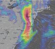
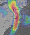
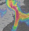
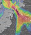
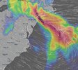
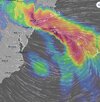
Just putting this here for the record. In about a week, it seems there's likely to be extensive flooding in the Baltimore, Philadelphia, NYC areas.
 

Attachments

  • Screenshot 2024-11-08 223041.jpg
    Screenshot 2024-11-08 223041.jpg
    139.5 KB · Views: 10
  • Screenshot 2024-11-08 223059.jpg
    Screenshot 2024-11-08 223059.jpg
    114.9 KB · Views: 8
  • Screenshot 2024-11-08 223117.jpg
    Screenshot 2024-11-08 223117.jpg
    121.6 KB · Views: 8
  • Screenshot 2024-11-08 223135.jpg
    Screenshot 2024-11-08 223135.jpg
    111.3 KB · Views: 8
  • Screenshot 2024-11-08 223207.jpg
    Screenshot 2024-11-08 223207.jpg
    142.6 KB · Views: 10
  • Screenshot 2024-11-08 223223.jpg
    Screenshot 2024-11-08 223223.jpg
    145 KB · Views: 10

Via Etnea, Catania - Sicily

This is also what often happens in the large city of Catania south of Etna. My husband told me the story that during the Roman times there was an underground dam, which easily led the large water masses down to the sea, without creating flooding in the city. As this underground dam has been re-discovered in our times later, it could have been restored, because large parts where still intact.

But instead they ignored it, and now Catania gets massive flooding several times a year, especially along the main road of Via Etnea. It is a major problem for all the stores located along that street (albeit the water also runs down quickly to the sea - that you many times don't see anything in the streets 24-36 hours later). But the damages inside must be... large.
 
I wanna share with you something that i expirienced few days ago and i think its related to this topic and find it very interesting.

So,my mom come to visit me for few days and one night we were watching news and talking about everything.And then on tv appear news about all that floods and rains and we continiued talking about that.After a little chat my mom said:“Ah,we are heading to ice age“ ^^

A big silence after that with lot of question mark above my head.

She said that very calmly,like it is normal thing that everyone knows.I`ll ask her to repeat what she said and she repeated clearly ;that we are heading to ice age.I asked her how she know that,where did she get that.And she answered again calmly:“I just know“.

I was astonished because my mom is just regular women 65y,a woman who is retired,who cleaning,cooking,cultivates the garden,watching soap nothing special.

I was impressed with it that night because i was thinking if people who are not familiar with this or similar materials are getting such signals it means that things have sped up.

I didnt know that my mom is so awesome.🤣
 
Last edited:
I am often reminded of this session in which they said this:

Session August 17, 2003

Q: (L) I don't think that was one of your options. (A) well, someone on the physics newsgroups was discussing this, so maybe it is a confirmation. (L) Look! It's raining. (After months of extraordinary heat and many deaths, rain was significant.)

{Break to go and check out the rain.}

Q: (A) So we can ask then about this weather breakthrough yesterday, is it a sign of a break through in our own situation?

A: One day there will be sheets of rain
.

{group laughter}

Q: (Perceval) Can we expect an ice age any time soon?

A: wait a couple of years and check the thermometer!!!

{group laughter}

Q: (L) Is a couple of years a clue here?

A: Is it? Hmm...

{more laughter}

Q: (L) I suppose we can take that as a yes. (Galahad) We recently pulled together some info on the Maunder Minimum. Are we correct in the direction we are taking on that?

A: We wondered how long it would take you to figure that one out.
 
Areas on the Spanish coast keeps getting water. Today it was Malaga, as seen from the first three minutes of this video:
Apparently, some area received 120 mm within a 12 hour period.

There is a cut-off low, (see Nov 6, 2024 for explanation) over Portugal. This a screenshot of the Ventusky temperature map for an altitude of 5500 m. Tracing the development, it was over France yesterday, before that over the Netherlands, it seems to have come from the area of the southern North Sea, so it has moved south-west.
2024-11-13 194659.png
Over the next few days the high altitude low pressure will move west at a slower pace and gradually weaken. By the 17th-18th it is expected to disappear.

Twitter has no lack of reports, though the quality varies. Here are a few:
 
Sheets of rain!


Red Alert on Pacific Coast as flooding worsens in Costa Rica - November rainfall already up to 10 times more than normal - 3 feet in 6 days
mmmmm
The National Emergency Commission (CNE) in Costa Rica has issued a red alert for the Pacific coast as severe flooding and heavy rains continue. The rest of the country remains under an orange alert, with the Southern Caribbean under a yellow alert.

This heightened alert follows forecasts that the intense rainy conditions are expected to persist throughout the week. "Rainfall is projected to continue for the next several days, especially along the Costa Rican Pacific coast. Additionally, there is significant soil saturation across much of the country," the CNE reported.

In just six days, Guanacaste has recorded rainfall totals that typically match the entire month of November. "In some areas, rainfall levels have been 8, 9, or even 10 times the usual amount for November. If the average monthly rainfall is 130 millimeters, some areas have received up to 900 millimeters in just six days," explained meteorologist Daniel Poleo.

Many areas are experiencing unprecedented rainfall levels, with the North Pacific region especially impacted. "It's been an extraordinarily rainy month, which explains the numerous incidents in Guanacaste and the South Pacific," Poleo added.


Meanwhile, the Ministry of Public Education (MEP) has extended the suspension of classes nationwide for the remainder of the week, citing hazardous weather conditions. "This decision was made to ensure the safety and well-being of our educational community," stated an MEP spokesperson. As of Tuesday, 114 schools have been affected by flooding and damage, with several schools in the most impacted areas now serving as shelters for evacuees.

Costa Rica's iconic national parks have also been impacted by the relentless rains, with some forced to close temporarily due to saturated soils and landslide risks. Chirripó National Park and La Amistad International Park (PILA) will be closed from today, Wednesday, until Monday, November 18. Corcovado National Park, Caño Island Biological Reserve, Piedras Blancas National Park, Golfito National Wildlife Refuge, and Ballena Marine National Park will also be closed from November 13 to 17. The Prusia Sector of Irazú Volcano National Park is closed until November 14 due to a landslide.

These closures and disruptions underscore the severity of the weather conditions currently affecting Costa Rica. Visitors are advised to stay updated on weather forecasts and exercise caution when traveling in affected regions.
 
East Sicily / East side of Etna
Nov 2024

Fasten your seat belt, ladies and gentlemen. Again, while Spain get's a lot of attention - it seems pretty much unknown what just happened on the East side of Sicily, with similar / greater rainfall numbers compared to Spain. We're talking about up to 1000mm rain during a couple of days, and 500 mm in Giarre within 8 hours.

Or so they say...

In the hinterland of Catania a weather event similar to that of Valencia: over 500 mm of rain in a few hours, more than 1,000mm in the last few days. Luckily 800 thousand people do not live in Giarre otherwise it would have been a massacre. But someone called us terrorists... and instead even with the drought everything went as widely predicted on Meteo Web


Bad weather in Sicily, today 9th consecutive day of rain: sensational 1,050mm in Giarre, exceptional rainfall DATA for the whole island​

Another day of torrential rain in Sicily : the situation is critical between Messinaand Catania , especially on the eastern side of Etna , where since midnight 511mm of rain have fallen in Giarre, 304mm in Nunziata, 225mm in Acireale, 223mm in Riposto, 201mm in Linera, 168mm in Lavinaio, 164mm in Piedimonte Etneo, 155mm in Viagrande, 154mm in Linguaglossa, 150mm in Fornazzo, 101mm in Zafferana Etnea, 97mm in Calatabiano. The situation is dramatic between Giarre and Acireale, where victims are feared due to the fury of the bad weather: numerous cars have been dragged into the sea , it is a real flood.

The torrential rain that has been falling for days in Giarre , on the northern Ionian coast of the province of Catania, is impressive: with today's exceptional precipitation, we are at 1,052.3 mm per month fallen in 9 days of rain: this is an extraordinary record for the whole of Sicily. It is still a very partial accumulation for a location that has an annual rainfall average of less than 650mm of rain. This means that in the last nine days almost double the rain that usually falls in a year has fallen!

piogge-giarre-novembre-2024.jpg

What startles me - are two things

1) is that the area of the torrential rainfalls was relatively small. The city of Catania for example didn't get as much (somewhere around 160 mm) in total, compared to 1000 mm in the Giarre area that have been reported (from private stations?) Etna does indeed pose a huge problem along its east flank, when very moist air is forced to lift above the coast, often resulting into excessive rainfalls there. That phenomena I have observed many times, on the verge of extreme - albeit not this extreme.

While there have been a lot of T-storms over Sicily during one week, yet when i checked the satellite charts on that particular day (13 Nov 2024) in the area of Giarre, i just can't see the type of clouds that would generate 500 mm within 8 hours !!

Alluvione-Giarre-2.jpg
Flooding in Giarre Nov 2024

There were no thunderstorms present in the area on the 13th Nov !

While I do not doubt the images of flooding in that area were/are real... but when you get 500+ mm as claimed, in just 8 hours, you would or could expect simply catastrophic images with most severe damages (One time in Sweden, an unprecedented 400+ mm fell within a 6 hours in a remote area Aug 1997, the so called Furufjäll catastrophe: It created such extreme damages, as if a tsunami went though the landscape, changing it forever).

Such damages or pictures I have not seen from East Sicily, other than in some local areas pretty bad flooding, a couple cars got dragged out of sea... which even 120 mm rain in 6 hours could accomplish afoot a high mountain. But 500mm rain in 6 hours...?! i feel there is something off about the story, but i can't prove it.

I did see one private station reporting 300+mm in Giarre, but not the 500+ mm rain on 13 Nov. Yet, private stations are always a bit... well, you have to be careful with what and how they measure. I saved a screen dump from that day covering 16 hours.

2024-11-13-Giarre-374-mm.jpg

So, i reserve myself about the accuracy revolving those insane high numbers of 1000 mm rain and 500+ mm in 8 hours in the Giarre region, north of Catania.

I found another map, which shows rainfalls from the SIAS network for the month of 1-13 November 2024. I still think it is a bit on the excessive side. No words about if the numbers and stations have been gone though a validation of accuracy.

Precipitazioni-mensili-Sicily.jpg
 
Heavy rains from tropical storm Sara caused part of the Saopín bridge in the town of La Ceiba, Atlantida, to collapse. The level of the Cangrejal river has risen considerably.

Tropical Storm Sara makes landfall in Honduras​

SAN PEDRO SULA, Honduras (AP) — Belize issued tropical storm warnings for the Central American country’s coast on Friday as Tropical Storm Sara moved through the Caribbean, dousing Honduras’ northern coast with heavy rain.
Sustained rain fell overnight in the Honduran city of San Pedro Sula, but there were no signs of serious flooding yet.

Sara was forecast to drop 10 to 20 inches (25 to 50 centimeters) of rain, with up to 30 inches (75 centimeters) in isolated areas in northern Honduras. The heavy rain could lead to life-threatening flooding and landslides, according to the U.S. National Hurricane Center in Miami.
Sara hit land late Thursday about 105 miles (165 kilometers) west-northwest of the Cabo Gracias a Dios on the Honduras-Nicaragua border, the National Hurricane Center reported. That is near Brus Laguna, a village of about 13,000 inhabitants. There are few other population centers nearby.

But Sara moved back out into the Caribbean overnight and by Friday morning it was located just south of the island of Roatan, a small-scale tourism destination.
The hurricane center said the storm was located about 175 miles (280 kilometers) east-southeast of Belize City and was moving west at 5 mph (7 kph), with maximum sustained winds of 50 mph (80 kph).
SARA STORm.png1731693274160.png
 
Back
Top Bottom