Inter-dimensional windows and Seth's co-ordinate points

  • Thread starter Thread starter Archaea
  • Start date Start date
Archaea said:
A: Yes, Many UFOs in Mexico. Cuernavaca is Earth's most intense window area.
Q: Why is that?
A: Complicated, but magnetic/volcanic influences contribute to the presence of a super vortex...

I've also had a look for anything about the geology around Cuernavaca, but I couldn't find anything that I thought was interesting or relevant. Although there are some nice photos of interesting geological formations around about on the internet.

I also thought that there might be pyramids or some ancient monument somewhere in that area, but I couldn't find any. I'd also like to find something which corroborates the C's statement of magnetic/volcanic influences, just to be thorough.


Found this map _http://mapserver.sgm.gob.mx/cartas_impresas/productos/cartas/cartas250/geologia/90_E14-5GM.html It is a Geological-Mineral Cuernavaca E14-5, Morelos, Puebla, Guerrero, Estado de México, Oaxaca, Esc. 1:250,000 Chart. So it is not just about Cuernavaca but also about its surroundings states. Cuernavaca being the capital from Morelos State. But it is a little techinal to me.

There are several ancient arqueological prehispanic sites near Cuernavaca, and had found one in the city of Cuernavaca, it is the ancient ruins of Teopanzolco _http://en.wikipedia.org/wiki/Teopanzolco, “Teopanzolco was built upon a hill formed from a lava flow.“
Found other things that may be related (caves), but my time is out, and need more time to elaborate, join? the info, maybe I can continue by night or in the next days.
 
So search for La Pique and look around from there. ;)

I had a look for La Pique and found this, I'm not sure if it's the same place though. From Wikipedia (http://en.wikipedia.org/wiki/Barousse_valley):

The Barousse is a small region of southwestern France, including the valley of the Ourse, a left tributary of the Garonne, in the Hautes-Pyrénées, and the smaller valley of Siradan.

The main towns are Loures-Barousse and Mauleon-Barousse.

Do you know if this is the place? I had a look for the geology of it, but I didn't find anything.

There are hundreds of these unusual disappearances and the author keeps finding them as the time goes on. So, I'd like to go by states and work from there - it's an idea at this point for me and seeing if I'm able to utilize it.

Below is the map that he had in his first book, which doesn't include the clusters in Texas and Florida as they were extensive. So, this will give you a general idea for now:

Hmmm... So I guess another hypothesis is that the orange dots on the map are windows or grid points. Going through by states sounds like a good way to go to me. There are also like 5 volcanoes in Texas, so it might be an above average density window area.

Found this map _http://mapserver.sgm.gob.mx/cartas_impresas/productos/cartas/cartas250/geologia/90_E14-5GM.html It is a Geological-Mineral Cuernavaca E14-5, Morelos, Puebla, Guerrero, Estado de México, Oaxaca, Esc. 1:250,000 Chart. So it is not just about Cuernavaca but also about its surroundings states. Cuernavaca being the capital from Morelos State. But it is a little techinal to me.

There are several ancient arqueological prehispanic sites near Cuernavaca, and had found one in the city of Cuernavaca, it is the ancient ruins of Teopanzolco _http://en.wikipedia.org/wiki/Teopanzolco, “Teopanzolco was built upon a hill formed from a lava flow.“
Found other things that may be related (caves), but my time is out, and need more time to elaborate, join? the info, maybe I can continue by night or in the next days.

Nice find mabar, I think the fact that Cuernavaca has some lava mounds formed from lava flows shows that there are some volcanic influences in that area. The Aztec structures are the icing on the cake. :)

I also tried to have a look at the geological map, but it was like reading Spanish. :lol:

Anyway, here are a few more locations:

* The Plains of San Agustin (Roswell) - Has already been discussed, is a volcanic field.

* Dulce, NM - Looked for anything regarding the geology of the Archuleta Mesa, may contain volcanic basalt, but didn't find much else. Here are some Wikipedia pages:


* Denver Airport - has already been discussed, is not a volcanic field, but it does have natural gas.

* Philadelphia experiment - Couldn't find much, but Pennsylvania in general apparently has some volcanic rocks. The Philadelphia experiment might have used artificially created portals, rather than windows. Of course there may also be another explanation. Here's something from the USGS (http://vulcan.wr.usgs.gov/LivingWith/VolcanicPast/Places/volcanic_past_pennsylvania.html):

The geologic map from Bascom and others (1909) shows that the Philadelphia area is underlain by three distinct geologic rock types: (1) the limestone and sandstone rocks of the Northern Piedmont, (2) the complex metamorphic bedrock of the Southern Piedmont, and (3) layers of sediments that occupy the Coastal Plain. The limestone and sandstone rocks of the Northern Piedmont were deposited in an ancient shallow marine environment and are approximately half a billion years old. The metamorphic bedrock of the Southern Piedmont ranges from half a billion to more than one billion years in age and was shaped by the extreme heat and pressure of geologic forces deep in the Earth. Within the Coastal Plain, sediments were deposited during the last 75 million years, forming a layer of sand and gravel on top of the older Southern Piedmont metamorphic bedrock.

* Project Montauk - Montauk is on long island in New York. It may also have used portals instead of windows. There's this about project Montauk from Wikipedia (http://en.wikipedia.org/wiki/Montauk_Project):

The Montauk Project is alleged to have been a series of secret United States government projects conducted at Camp Hero or Montauk Air Force Station on Montauk, Long Island for the purpose of developing psychological warfare techniques and exotic research including time travel. Jacques Vallée describes allegations of the Montauk Project as an outgrowth of stories about the Philadelphia Experiment.

And there's also this about volcanoes and New York (http://wiki.answers.com/Q/Are_there_any_volcanoes_in_New_York):

New York does not have any active volcanoes. but there are alot of inactive volcanoes evidence that hasn't been complety proven yet. there are some inactive proven one close to you if you would like to check them out there is two in New Hampshire named Mount Pawtuckaway and the Ossipee Mountains. and one in VA called moles hill.

* "Beast of de Beauvan" - Had a look for this on Google, but it all lead to the Cassiopaea website. I also tried to find a place called "de Beauvan" on Google, but nothing came up.

* "Spring Heel Jack" - started in London, had a look at the geology of London, but didn't find anything. I thought London might be a good place to look because of this from Wikipedia (http://en.wikipedia.org/wiki/Spring-heeled_Jack):

The first alleged sightings of Spring-heeled Jack were made in London in 1837 and the last reported sighting is said in most of the secondary literature to have been made in Liverpool in 1904.

* "Mothman" in West Virginia - occurred in Point Pleasant, there may have been volcanoes there in ancient times, but there aren't any nowadays. From the USGS (http://vulcan.wr.usgs.gov/LivingWith/VolcanicPast/Places/volcanic_past_west_virginia.html):

Prior to one billion years ago, the geologic history of West Virginia is obscure. Sometime between about 1,100 and 800 million years ago, lava was deposited in the extreme eastern part of the State forming the oldest exposed rock, the Catoctin Greenstone. The oldest bedrock (rock in place) exposed at the surface is found in the southeastern tip of Jefferson County. These rocks, of the Catoctin Formation, are approximately 570 million years old (Precambrian age) and consist of metamorphosed basalt lava flows. It is possible that some rock fragments even older than this (such as granites) were transported in glacial till and occur in Ohio River outwash, but these are not native to West Virginia.

* "Marfa lights" - There has been some oil prospecting in Marfa. From the internet somewhere (http://www.astronomycafe.net/weird/lights/marfa13.htm):

The Geology of this region is very fascinating and the areas seems to be active geothermally since there is a well known Hot Springs in this area, and petrolium prospectors have gone over this area for the last 50 years and found positive indications of oil and gas deposits.

If disappearances are related to windows, and windows are related to volcanoes then maybe that explains why there are so many disappearances in Texas. I found this on wiki answers (http://wiki.answers.com/Q/Are_there_volcanoes_in_Texas):

there are about 5 volcanoes in Texas
1.Pilot knob Austin Texas
2. the Paisano Volcano (fort Davis)
3.Burro Mesa (big bend national park)
4.Sierra Quemada (big bend national park)
5.Buckhorn Caldera (Fort Davis)

The Paisano volcano is actually in between Marfa and Alpine, Texas. Fort Davis is in that area, but off in another direction (more North). I used to live in Marfa and would pass the inactive volcano on the way into Alpine. Both are extremely small cities.

There's also this piece of trivia which I thought I'd bring up. From (http://www.reference.com/motif/science/how-is-granite-formed):

Granite is a type of igneous rock. Igneous rock is the one of the three rock types that is formed when magma or lava cools then solidifies into a rock formation. Magma or molten lava is the substances that becomes granite. When a volcano erupts, the magma flows on the Earth's surface and then steeps into the earth crust around other rocks. The magma is many different types of metamorphic rocks

So I'll keep an eye out for granite.

And I still have a few more to go, will keep posting...
 
Do you know if this is the place? I had a look for the geology of it, but I didn't find anything.

I don't think you got the right one. Google maps initially lists at least six La Piques in France but not the one we are looking for. :(

So I turned to Google maps again and searched for La Pique, Rennes-le-Chateau, France and got the one in the vicinity of the village. I then activated the 'terrain'-feature to get a relief map of the surroundings. Rennes-le-Chateau appears to be on some sort of a plane with irregular surroundings in which several mountain tops are named but I couldn't make out a pentagon like shape from them, though. Have a look yourself; maybe you've got a better eye for it? ;)
 
Palinurus said:
Do you know if this is the place? I had a look for the geology of it, but I didn't find anything.

I don't think you got the right one. Google maps initially lists at least six La Piques in France but not the one we are looking for. :(

So I turned to Google maps again and searched for La Pique, Rennes-le-Chateau, France and got the one in the vicinity of the village. I then activated the 'terrain'-feature to get a relief map of the surroundings. Rennes-le-Chateau appears to be on some sort of a plane with irregular surroundings in which several mountain tops are named but I couldn't make out a pentagon like shape from them, though. Have a look yourself; maybe you've got a better eye for it? ;)

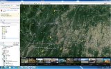
Using Google Earth I was able to zoom right into La Pique just by searching using what you used. From that vantage I was able to see the 5 peaks, I can understand why it's hard to see on a map, as they don't form a perfect geometrical shape. I found names for two of the mountains, but the other ones didn't seem to want to reveal themselves. The mountains are:
[list type=decimal]
[*]Mont Cardou
[*]Pic de Bugarach
[/list]
I've attached an image to this post of what I found.

I also did some searching for things on locations:

* Bridgend, South Wales (UK) - From Wikipedia (http://en.wikipedia.org/wiki/Geology_of_Wales):

Man has mined metals and metal ores in Wales for millennia. There are Bronze Age copper workings on the Great Orme near Llandudno and at Parys Mountain on Anglesey. Gold has been obtained since pre-Roman times at places like Dolaucothi. Lead and zinc were intensively mined in the Cwmystwyth area of mid Wales and a lead mine operated at Minera near Wrexham from the Middle Ages until the early twentieth century. In Victorian times the Sygun Copper Mine was opened near Beddgelert in Snowdonia. Ironstone is a component of the Lower Coal Measures rock sequence and where it outcrops along the northern edge of the South Wales Coalfield, it was extensively worked for the production of iron and was important in the initiation of the Industrial Revolution in South Wales.

* The great pyramid - Is near a fault line, and apparently there are a lot of caves underneath Giza (http://www.andrewcollins.com/page/articles/geology.htm). I couldn't find mush else on the geology of the area and there are no volcanoes in Egypt.

* Stonehenge & Silbury Hill - both located in Wiltshire county, England. There's a lot of chalk and limestone in those areas, I didn't find anything relevant though, i.e. nothing that I recognised as magnetic, and I don't think there are any volcanoes in England either.

While reading this stuff, I've come across limestone quite a lot, I think this is because limestone is very common and has lots of different types. I tried to find out if this was true using the internet, but it says it depends on where you are, so I don't know. I think some of the monuments and megaliths were built using limestone though. I also found this short QA on wiki answers (http://wiki.answers.com/Q/Is_limestone_magnetic):

Q: Is limestone magnetic?

A: No, the limestone is not magnetic due to the magnetic fields in the stone itself.

My list of locations is starting to get a bit hard to understand now, but I'll try to keep at it...
 

Attachments

  • RENNES - LE - DE - DEVIL.jpg
    RENNES - LE - DE - DEVIL.jpg
    324.1 KB · Views: 57
Using Google Earth I was able to zoom right into La Pique just by searching using what you used. From that vantage I was able to see the 5 peaks, I can understand why it's hard to see on a map, as they don't form a perfect geometrical shape. I found names for two of the mountains, but the other ones didn't seem to want to reveal themselves. The mountains are:

1. Mont Cardou
2. Pic de Bugarach

I've attached an image to this post of what I found.

I don't have Google Earth because I hardly ever need it -- that's why I used Google maps which clearly has less details on it.

So I now studied your attachment closely and I wonder whether a pentagon like shape could be made with some of the mountain tops a bit farther away than the ones you have indicated, while taking the numbers #4 and #5 as a baseline -- but I don't know if those were meant by the original asker in the transcripts as there were no names or other markings mentioned in the first place.

It's a bit like reverse engineering to get where we want to be and I don't like that one bit, really. But maybe we have no alternative for that, save to ditch this location altogether. What do you think?
 
Archaea said:
I also tried to have a look at the geological map, but it was like reading Spanish. :lol:
Well, yes … and to me was, like reading German? … but I would not rule it out because it has interest things, it is difficult because I am not familiar with that technical lenguage/data .. and there are also other maps (geophysics, geochemistry, and such) … I just need to go to the store and buy some time and check them out. :P

Found this site – it seems to be description of the exploring the tubes of the caves in/around Cuernavaca _http://www.cancaver.ca/int/mexico/zotz/others/lavatubes.htm named: Lava Tubes of Cuernavaca … and I was curious about this tubes, then I found this webpage...
_http://www.mexicodesconocido.com.mx/explorando-las-cuevas-del-volcan-sushiooc-estado-de-mexico.html said:
“The Ecological Corridor of the mountain chain of Chichinautzin, comprising much of the volcanic mountains between Mexico and Cuernavaca, is a region that is characterized by having more than 150 small volcanoes, each one surrounded by its own lava fields and all of them of very recent age.
[..]
… (there are) craved caves in the lava that were originated during the eruption of the Suchiooc volcano. This volcano spilled lava to the south, which went down by the strong slopes that lead to the Tepoztlán Valley. The lava, gets cold when it makes contact with the air, and it become hardened forming a rigid crust, but in the case of the Suchiooc volcano, the lava from the interior kept flowing and formed a series of tubes in the spillage already solidified, in its interior in which, as the arteries, kept spilling during the whole eruption. After the eruption ended, much of this tubes were filled with the lava that circulated in its interior, but in some cases, the flow drained them partly or totally forming the caves.”

… went to find where was this Suchiooc volcano _http://www.geonames.org/3827357/volcan-suchiooc-grande.html but seems to me to be far away from the archaeological site of Teopanzolco, although as it is said, that between Mexico City and Cuernavaca there are around 150 volcanoes … it could had been anyone.
 
(Well, I must say, living in Hawai'i, at 19.555 degrees latitude, it's been...rough. :cry: (This = awesome thread.))
 
I don't have Google Earth because I hardly ever need it -- that's why I used Google maps which clearly has less details on it.

So I now studied your attachment closely and I wonder whether a pentagon like shape could be made with some of the mountain tops a bit farther away than the ones you have indicated, while taking the numbers #4 and #5 as a baseline -- but I don't know if those were meant by the original asker in the transcripts as there were no names or other markings mentioned in the first place.

It's a bit like reverse engineering to get where we want to be and I don't like that one bit, really. But maybe we have no alternative for that, save to ditch this location altogether. What do you think?

Yeah, I downloaded Google Earth specifically to plot points for this thread, and it does have a lot of information in it. Maybe at bit too much information though, at one point I found myself looking at some Frenchman's shed... :shock:

It might be possible to make a pentagram from peaks further away, but these peaks wouldn't be visible from La Pique (as far as I can tell from Google Earth). I think a better way to go might be to ditch the idea that the 5 peaks are somehow related to the actual physics of the window, and instead focus on looking for any magnetic/volcanic anomalies in the area.

But that's just what I think.

Found this site – it seems to be description of the exploring the tubes of the caves in/around Cuernavaca _http://www.cancaver.ca/int/mexico/zotz/others/lavatubes.htm named: Lava Tubes of Cuernavaca … and I was curious about this tubes, then I found this webpage...

So there are caves underground there as well... Hmmm...

… went to find where was this Suchiooc volcano _http://www.geonames.org/3827357/volcan-suchiooc-grande.html but seems to me to be far away from the archaeological site of Teopanzolco, although as it is said, that between Mexico City and Cuernavaca there are around 150 volcanoes … it could had been anyone.

Well, if windows are related to volcanoes, then I can see why this would be a highly intense window area, 150 volcanoes is a lot of volcanoes. Nice find mabar.

(Well, I must say, living in Hawai'i, at 19.555 degrees latitude, it's been...rough. :cry: (This = awesome thread.))

Ohh... So you live near one of these grid points/conduits maybe. Do you want to get a radio and start broadcasting various waveforms and then see if there's any paranormal activity reported in the area afterwards? It would be like an experiment.

Continuing on with some more locations:

* Chicago - I remember Seth saying that the area around Chicago had a cluster of coordinate points. I found this about the geology of the area (http://faculty.ccc.edu/jtassin/geology201/homework/Chicagogeo/chicagogeology.htm’):

Chicago is located in the interior lowlands of North America. It is on an arch between the Illinois basin to the south and west and the Michigan Basin to the northeast but things were not always so. Granite lies deep under the Chicago region. It was formed about 1.8 billion years ago as a result of mountain building during the pre-Cambrian.

[...]

Because the area was near the equator at that time, warm shallow seas produced large amounts of material that formed limestones. The limestone was deposited flat over a wide area but the subsiding basins have caused it to be bent into a saucer shape with the rock under Chicago at the rim. This rock is the Niagran dolomite (a type of limestone).It is called the Niagran because it is the cap rock at Niagara Falls.

* El Toro base - Was located in orange county, before it was abandoned. The area is now the orange county great park. I found this about the geology of orange county (http://www.ivc.edu/academics/schoolPST/geology/Pages/ocgeo.aspx):

The backbone of Orange County is the Santa Ana Mountain Range which extends from the Puente Hills near Prado Dam southeast beyond the county limits. The highest, northern-most peaks in the range are composed of Triassic-Jurassic Period metasedimentary rocks of the Bedford Canyon Formation. This formation contains the oldest exposed rocks in Orange County which were formed during the earliest part of the great "Age of Reptiles", about 225 million years ago. These rocks include argillite, quartzite, slate, and small exposures of shale and limestone which contain poorly preserved mollusk fossils.

Underlying the Bedford Canyon Formation and exposed to the southeast of Santiago Peak, is the granitic core of the mountains. The large, round, white, granodiorite boulders are easily seen from the Lower San Juan Creek Campground, over the summit of the Ortega Highway, and along the eastern flank of the mountains above Lake Elsinore.

* Death Valley - From Wikipedia (http://en.wikipedia.org/wiki/Geology_of_the_Death_Valley_area):

Igneous activity associated with the extension occurred from 12 to 4 Ma. Both intrusive (plutonic/solidified underground) and extrusive (volcanic/solidified above ground) igneous rocks were created. Basaltic magma followed fault lines to the surface and erupted as cinder cones and lava flows.

* Edwards Air Force Base - Is near Lancaster, California. Apparently this isn't far from the Neenach Volcano. From the nps (http://www.nps.gov/pinn/naturescience/faults.htm):

Located near the boundary of the Pacific Plate and the North American Plate, Pinnacles National Monument is an excellent example of tectonic plate movement. The Pinnacles Rocks are believed to have originated in the Neenach Volcano, near present-day Lancaster, California.

* Antelope Valley - Couldn't find much on the geology of the Antelope valley, but it has ground water. It also has a website dedicated to the paranormal activity that goes on there (http://www.antelopevalleyhaunts.com/mythandlegends.htm). also found this short QA on the internet (http://www.chacha.com/question/what-type-of-rock-is-the-antelope-valley-composed-of):

Q:What type of rock is the antelope valley composed of?

A: Pleistocene & Holocene age unconsolidated alluvial & lacustrine deposits that constists of compact gravel,salt, sand, silt, & clay

* Las Vegas - According to (http://www.birdandhike.com/Rocks/_Rock_index.htm) the area around Las Vegas contains igneous Rocks which are formed when magma cools. It also says this:

Fortification Hill (photo) on the east side of Lake Mead provides a spectacular view of igneous rocks. The black hill is lava from an ancient volcano (background), the top of which eroded away to reveal the light-colored granitic core. Out at Lake Mead, the dark-colored mountains along the Colorado River are volcanic. Granite is uncommon in southern Nevada, but occurs out in the Gold Butte Region (north of Lake Mead along the Nevada-Arizona border).

* Sedona - this website (http://www.sedonacentralreservations.com/pages/sedona-geology.aspx) shows something called the San Francisco Volcanic field. And this quote is from this website (http://www.sedonaverdevalley.org/geology.html):

The Redwall Limestone also houses numerous aquifers. Occasionally sinkholes develop when the water dissolves the underlying limestone and the ceiling layers collapse. One of these sinkholes—known locally as the Devil’s Dining Room—spooked local cowboys when they looked down into the newly created sinkhole, only to see ghostly clouds of red dust swirling near the bottom.

[...]

The top of the Colorado Plateau has a basalt cap, laid down by lava flows from nine to fifteen million years ago. Ancient seas, drifting dunes, lava flows and inland rivers have all contributed to the beauty of this area, but the main forces were always erosion and time. The current rate of erosion is about one foot every 625 years. If there had been no lava cap on this end of the plateau the erosion would have been much faster, and these canyons would be a lot closer to Flagstaff.

I might just throw the rest of the list in my next post, there's not much left, but it might be a little messy.
 
I've gone through the rest of the locations in my list. I cut out a few of them though as they were more like clues than actual locations.

* Crop circles in Indonesia - some occurred in a place called Yogyakarta. I was able to find this about Yogyakarta (http://geotechpedia.com/Publication/Show/2751/GEOLOGY-OF-YOGYAKARTA--JAVA--THE-DYNAMIC-VOLCANIC-ARC-CITY):

Yogyakarta city, the capital of Yogyakarta Special Province, is situated at the southern part of the volcanic arc island of Java. The geology of the city and province is controlled by active plate tectonic phenomena such as the active volcano and active subduction of Indo-Australia oceanic plate below the Euro-Asian continental plate. The city and the province accordingly are prone to geohazards (landslides, floods, volcanic eruption and earthquakes) as well as eco-geological problems. Indeed, geological conditions in this region significantly control the socio-environmental problems of the city and province.

* 18 deg N & S: where ocean current water warms up (from the Conduits) - I tried to find the coordinates of where ocean water warms up, but I couldn't find anything. Here's the Wikipedia page about ocean currents (http://en.wikipedia.org/wiki/Ocean_current).

* South pole (location of Atlantian crystal) - From Wikipedia (https://en.wikipedia.org/wiki/Antarctica#Geology):

Geologically, West Antarctica closely resembles the Andes mountain range of South America. The Antarctic Peninsula was formed by uplift and metamorphism of sea bed sediments during the late Paleozoic and the early Mesozoic eras. This sediment uplift was accompanied by igneous intrusions and volcanism. The most common rocks in West Antarctica are andesite and rhyolite volcanics formed during the Jurassic period. There is also evidence of volcanic activity, even after the ice sheet had formed, in Marie Byrd Land and Alexander Island. The only anomalous area of West Antarctica is the Ellsworth Mountains region, where the stratigraphy is more similar to the eastern part of the continent.

[...]

The main mineral resource known on the continent is coal.[37] It was first recorded near the Beardmore Glacier by Frank Wild on the Nimrod Expedition, and now low-grade coal is known across many parts of the Transantarctic Mountains. The Prince Charles Mountains contain significant deposits of iron ore. The most valuable resources of Antarctica lie offshore, namely the oil and natural gas fields found in the Ross Sea in 1973. Exploitation of all mineral resources is banned until 2048 by the Protocol on Environmental Protection to the Antarctic Treaty.


* North Pole (Atlantian crystal) - I wasn't able to find much., however, I was able to find out that there are oil and petroleum fields in the arctic circle.

That concludes the list of locations, next thing to do is plot them all in Google Earth and try to see patterns. If I live near a window maybe one will materialize itself for me. :lol:
 
I learned an interesting piece of trivia last night. In my attempt to not watch T.V. I went out and bought seasons 3 & 4 of the X files. :-[ In season 3 episode 3 the bad guy can control electricity with his mind. In one part Mulder says that lightning emits radio waves at a frequency of 8 Hz. I thought this was interesting, even though Mulder is a bit coo-coo, and ran a Google search. From (http://theinspireproject.org/default.asp?contentID=4):

The source of most natural radio signals is lightning. When a lightning bolt strikes, a massive amount of charge is moved and this acts in much the same way as moving charge in a radio transmitting antenna. The frequencies emitted by lightning range from 0 Hz to over 100 kHz with all frequencies being emitted simultaneously with the visible flash of lightning.

So there is quite a large radio frequency range emitted by lightning. So, if lightning is related to the opening and closing of windows, then maybe these are the frequencies which accomplish this effect. Of course, correlation isn't causation, so there might be another explanation, but it's something to think about I reckon. There's also this about EMP's created by lightning, from Wikipedia (http://en.wikipedia.org/wiki/Electromagnetic_pulse):

Lightning electromagnetic pulse (LEMP). The discharge is typically an initial huge current flow, at least mega-amps, followed by a train of pulses of decreasing energy.

The C's have said that EMP's open windows... I think...

I still haven't started plotting the locations in Google Earth yet, as my computer is on my floor, but it is on my to do list.
 
Seems like an evening well spent! :lol:

The C's have said that EMP's open windows... I think...

I still haven't started plotting the locations in Google Earth yet, as my computer is on my floor, but it is on my to do list.

Take all the time you need -- there is no hurry. I'm delving into the unstable gravity wave posts on the forum ATM. No specifics to report yet.
 
Palinurus said:
Seems like an evening well spent! :lol:

The C's have said that EMP's open windows... I think...

I still haven't started plotting the locations in Google Earth yet, as my computer is on my floor, but it is on my to do list.

Take all the time you need -- there is no hurry. I'm delving into the unstable gravity wave posts on the forum ATM. No specifics to report yet.

Yeah, :) the X files is a great show.

I thought I's add a link here to the thread Two intros to parapsychology: Richard Broughton and Dean Radin Started by Approaching Infinity (http://cassiopaea.org/forum/index.php/topic,31689.0.html) as a particular part of the review seemed to me to be relevant here:

Psi improves when geomagnetic field fluctuations decrease. This ties in with the lunar cycle. New moon, medium GMF, medium spike in telepathy scores. Full moon, low GMF, high spike in telepathy scores. (Four of six jackpots in one casino occurred within one day of the full moon.)

I'm still keen to plot locations, and I still haven't started. :-[
 
I finished reading the pdf which Approaching Infinity linked to regarding the orthotenic lines, and I checked out some links that were in the references. I'm going to post some things which I thought were interesting. Reference #45 from the article links to this site (http://www.ufoinfo.com/onthisday/papers/orthoteny.htm) where the author responds to some criticisms of his work with orthotenic lines. He says this:

Studying these maps on the computer screen, two linear patterns emerge. The first is there appears to be an interlocking grid with lines converging on hotspots that appear as major intersections of great circle routes. In France, this grid bears similarity to the one proposed by Garreau and Lavier (4), who plotted 202 landing cases from 1947 to 1975. BAVIC is rotated 29° from their set of East-West lines, CAMAC is rotated 29° from their set of North-South lines, and AUPER is rotated 146° from their East-West lines. I have shown the BAVIC-CAMAC-AUPER grid superimposed upon the Garreau and Lavier grid in Figure 1. These lines tend to be oriented in such a manner as to conform to natural features and landmarks. For example, lines tend to intersect with the mouths of rivers, parallel coastlines, and pass through straits and channels.

The second noticeable pattern is that there appear to be sets of two, three or four parallel lines that overlap this grid. They give the appearance of satellite trackings, and suggest that these lines are not part of the permanent grid but trace flight paths.

[...]

Are these alignments illusory? I would deem this unlikely. Does my method for developing these alignments capitalize on chance? Undeniably. But is there a pattern that is so obvious upon visual inspection that it would be hard to deny something is going on? It certainly looks that way to me. And it becomes even plainer and more convincing when you scrutinize these mappings up close. For this reason I am offering to provide the UFOCAT-2003 CD-ROM to anyone who would seriously like to independently verify what I believe to be the truth (7). The maps that can be produced on paper from the mapping software do not entirely do justice to the dramatic impact I am describing here.

My second argument is that the network of great circle lines appears to be an interlocking grid and conforms to an orderly pattern. This grid would be even less likely to be due to chance, because the degrees of freedom necessary to define the grid are reduced. I believe that the orthotenic alignments represent a navigation system, possibly tied to a propulsion system, used by the UFOs. Others have suggested the existence of a grid system, but the great circle alignments provided by mapping the UFOCAT close encounter data provide confirmatory evidence for the existence of a worldwide grid.

[...]

7. Requests can be e-mailed to Donald A. Johnson, Ph.D. donjohnson@ufocat.com.

So maybe we could email this guy and ask for some maps, then see if any intersections match any of the identified locations.

Reference #43 links to this article (http://www.anndruffel.com/articles/skynet/straightlinemystery.htm). This articles talks about orthotenic lines in California, with some interesting results:

Gradually, the theory of orthotenic lines has become less a matter of controversial discussion.Conversely, over the last ten years, the study of so-called "ley lines" has become popular.Ley line study indicates that the location of ancient sites of ceremonial and religious ritual, such as Stonehenge, lie along straight lines as well.This theory was first advanced by Alfred Watkins n the 1920s (Reference 11), but much of the credit for upgrading ley-line data is due to Paul Devereux, editor of the magazine THE LEY HUNTER A recent book by Devereux and lan Thomson postulates a UFO-ancient sites (leys) link (Reference 12).Evidence of this is not yet strong.There is no demonstrated proof that ley lines and orthotenic lines are in any way associated with each other, but the fact remains that UFOs, especially in the United Kingdom and some European countries, are seen over, or in the general area of leys (Reference 13).

The study of ley lines, however, is now well past the theory point.Evidence that ancient or prehistoric cultures built their important places of ceremonial worship along straight lines (or, in the case of the longer lines spanning more than one country such as those discovered by Michel, along great-circle routes), is frilly established.

One hypotheses which tries to explain ley lines states that these sites were chosen by ancient peoples because of some inherent telluric property of the terrain along which these ceremonial sites were built. The specific earth energy (or property) believed to be involved in ley lines and ley sites is not yet identified.

Ley lines have been demonstrated to exist on most continents.Numerous ancient cultures seem to have employed this principle.Even today, many of our more modern major sites of ritual (churches, mosques, synagogues, and other centers of metaphysical study) are built on ruins of ancient religious buildings and, therefore, still lie on ley lines.

[...]

Of the sixteen (16) ufologically significant lines, three (3) had Indian sites lying upon them. The most striking line of Indian sites, i.e., Tahquitz Rock, Eagle Rock, and Stony Point, had three sites of ufological interest lying at various locations on it.[Even though groups of three UFO events in a line were otherwise ignored asinsignificant, this line was kept as possibly meaningful.]

RESULTS OF PLOTTING OF COMPARISON GROUPS:The addition of the remaining two comparison groups (IFOs and paranormal events), when plotted on the map, yielded interesting results.Except for those four instances where paranormal events had occurred at the same locations as UFO incidents, the pink flags had been expected to show non-correlation with the straight lines of ufological significance.However, of the total number of seventeen (17) paranormal events plotted, nine (9) lay on lines of ufological significance.Seven (7) others lay on lines of "combined interest" (see text below.)The one exception lay within a mile of an existing line.

The most surprising result of the study was the discovery that ten (10) of the IFO group (plotted with green flags) lay along lines of ufological significance.The remaining four (4) lay along lines of so-called combined interest.

One particular IFO sighting, a gross misidentification of Venus as a "flaming orb which repeatedly zoomed toward a witness' roof" was located where three lines intersected.Two of these lines were of ufological significance, the other a "combined interest" line.There is no ready explanation why gross misidentifications should be located along straight lines, since the IFO group was purposely chosen at the beginning of the study as a comparison group, the plotting of which would not logically be expected to have any correlation with purportedly genuine UFO activity.It is speculated here that the terrain associated with orthotenic or ley lines does contain some as-yet-unidentified type of telluric (earth) energy which is in some unknown way associated with the manifestation and/or propulsive power of UFOs.It is also speculated that the same earth energy might have the ability to influence the physiology of human witnesses, (including their physical, mental and emotional makeup), so that in the vicinity of orthotenic lines conventional objects might be mistaken for what they actually are.

[...]

STATISTICAL ANALYSIS OF THE NINETY-TWO SITES IN RELATIONSHIP TO MAJOR LINES:Summing up the statistical analysis of the ninety-two (92) plotted sites lying on straight lines discovered in this study, we will take the liberty of combining all seven groups of flags.It is apparent that a close fit of all but one flag out of 92, in spite of the fact that two entire groups of flags were not expected to fit at all, is more than coincidental. It seems possible that there is some relationship between the locations where UFOs closely approach witnesses and earth terrain where paranormal events, sites of ancient religious rituals, and gross misidentifications of conventional objects as UFOs are found.Therefore, combining all the flags plotted, we have the following count for the sixteen (16) major lines discovered during this study.Mileage is, of course, in air miles and does not take into account the contours of the terrain involved.

MAJOR LINES:
1. A nine (9)-point line extending NW from La Puente to Chatsworth comprising seven (7 )UFOevents, one (1) paranormal event and one (1) Indian siteForty (40) miles long.
2. A nine (9)- point line extending WNW from Palm Springs to Canoga Park, comprised of five (5) UFO sites, four (4) paranormal events.One hundred and twenty-eight (128) miles long.
3. An eight (8)-point line extending NNW from San Diego to Tujunga, comprised of four (4) UFO sites and four (4) paranormal events.One hundred and twenty-six (126) miles long.
4. .An eight (8)-point line extending NW from the Lake Elsinore area to Sylmar, comprised of seven (7) UFO events and one (1) IFO.Seventy-eight (78) miles long.
5. An eight (8)-point line extending W from Glendora to Reseda, comprised of six (6) UFO events and two (2 )IFOs.Forty-one (41) miles long.
6. An eight (8)-point line extending NNW from Channel waters off Laguna Beach to Chatsworth, comprised of five (5) UFO, one (1) paranormal event, one (1) Indian site, and one (1) IFO.Seventy (70) miles long.
7. An eight (8)-point line, extending NNW from Yorba Linda to Tujunga, comprised of six (6) UFO, one (1) paranormal event, and one (1) IFO. Thirty-nine (39) miles long.
8. A seven (7)-point line extending due N from Torrance into Big Tujunga Canyon, comprised of six (6 )UFO, and one (1 ) paranormal event.Twenty-nine (29 miles long.
9. A seven (7)-point line extending NW from Yorba Linda to Sylmar, comprised of four (4 )UFO, one (1) paranormal event, one (1) Indian site, and one (1) IFO. Forty-eight (48) miles long.
10. A seven (7)-point line extending NNW from Lemon Grove into Big Tujunga Canyon, comprised of five (5) UFO and two (2 ) IFOs.One hundred and twenty-eight (128) miles long.
11. A six (6)-point line extending NNW from Newport Beach toSylmar, comprised of six (6 ) UFO events.Fifty-six (56) miles long.
12. A five (5)-point line extending NNW fromSan Diego to Burbank, comprised of four (4)UFO and one (1) paranormal event.One hundred and twenty-six (126) miles long.
13. A five (5)-point line, extending NNE from Redondo Beach to Temple City, comprised of four (4) UFO points and one (1) IFO.Twenty-eight (28) miles long.
14. A four (4)-point line extending NNW from Garden Grove to Altadena, comprising four (4 UFO) points.Thirty-two (32) miles long.
15. A four (4)-point line extending NNW from Torrance to Van Nuys, comprising four (4) UFO points.Thirty (30) miles long.
16. A four (4)-point line extending NNE from Palos Verdes Peninsula to Alhambra, comprising four (4) UFO points.Twenty-four (24) miles long.

[...]

SUMMARY: Reviewing the total study in its entirety, including the following results were found:
1. The sites of UFO-related events in Southern California (in cases where the unidentified object or alleged UFO entity was in close proximity to the witness(es) lie along locations on the Earth in such a manner that a straight line can be drawn to connect them.
2. The sites of multi-point intersections of these lines are locations where particularly bizarre UFO events occurred, that is, "landings" and close encounters with large, apparently physical UFO-type craft in heavily-settled residential areas and over major highways and freeways of a large city.
3. Except for one (1) due N-S line, all lines discovered were deviated, to more or less degree, from the four main compass points.
4. Close-proximity IFOs also lay on the straight lines, and at the intersection of three straight lines a particularly bizarre misidentification of a conventional object was reported.
5. The vast majority (16 out of 17) paranormal events plotted also lay on the straight lines, strengthening the hypothesis of many researchers that paranormal events are in some way associated with UFO occurrences.

AN ADDED SPECULATION:
Acting on various information in UFO literature, some of which is scientific theorizing (Reference 20), and some apparently intuitional (Reference 21), I speculate that the hypothetical energy apparently emanating along orthotenic and ley lines might be gravitic in nature. It is further speculated that UFO sightings and other unusual events associated with these "lines of energy" might manifest at times of greater gravitational pull, due for example to the closer passages of Mars (a planet of greater relative density than earth and of high iron content), and possibly also the influence of other astronomical bodies in their closer conjunctions with the earth.

The methodology used in this study is a simple one, which can be employed by any investigator or researcher with a backlog of close encounter cases, UFO landings, and entity reports, and who has enough interest in the straight-line phenomenon to devote sufficient time and energy to suchstudy.Results from other researchers are eagerly awaited, as lines discovered mightconnect with lines found by others in their own localities.

So that all seems to fit the current grid/window theory.

My computer is still on my floor and it's uncomfortable to use it. So I don't think I'll start plotting locations in Google Earth till I get a desk. In the meantime, I might just use it mainly for reading, and avoid interface intensive activities.
 
I think HAARP might be related to windows in some way, although it might be in an "offhand" kind of way. Here's what the C's say about HAARP and the "transfer of perimeters".

From Session 17 February 1996:

Q: (L) Can I ask my other questions? Some people on the net want me to ask about this HAARP thing... seems to be some sort of antennae thing...

A: Disguise for something else.

Q: (L) What is that something else?

A: Project to apply EM wave theories to the transference of perimeters.

Q: (L) What does that mean?

A: If utilised as designed, will allow for controlled invisibility and easy movement between density levels on surface of planet as well as subterranially.

The C's have also said that HAARP is a continuation of Project Montauk.

From Session 9 June 1996:

Q: (L) What was the intention in using Oswald in this way? Was it just to have a handy person around, or did they already know, in advance, that Kennedy would be elected and that they would assassinate him?
A: Time alteration.
Q: (L) Do you mean time alteration in the sense that these events did NOT actually occur at the noted times, or that they were able to go back in time and do this to put more confusion into the picture?
A: Latter, see Montauk.
Q: (L) Obviously the consortium was operating through the FBI, the CIA, the Mafia, and God knows who else, but, can you tell us who fired the shot that caused JFK's death?
A: No, because it would put you in grave danger.
Q: (L) Speaking of Montauk, R**** quoted at length some information received from some Native American about Montauk being used to change the weather on the planet, and also sending out energy waves to generate anger and other negative emotions. Is this one of the used for the HAARP assembly?
A: No.
Q: (L) Once before you said that the HAARP assembly was a continuation of the Montauk project, and was being used to 'transfer perimeters.' I guess this meant space/time travel, correct?
A: Yes. And resurrect Antlantean crystal principle.

Q: (L) Do they plan to actually attempt to bring up the Atlantean crystals?
A: No.
Q: (L) Do they plan to use this for mind control?
A: And other uses.
Q: (L) Can you give us a few of these uses?
A: Technical.

And here's another session about HAARP and the Atlantean crystals.

From Session 4 May 1996:

(L) Getting back to the underground bases, is the HAARP project connected to these underground bases.

A: Not directly.

Q: (L) You once said that HAARP was something that was to be used to "transfer perimeters." I am assuming that this means to manipulate space, time and density.

A: Yes.

Q: Is it possible that they are planning to use this to bring up the Atlantean crystals to utilize.

A: Not so much to "bring up," as to utilize.


Q: Is there anything to BRH's idea about the "harmonics," that it must be ready to function on a certain day and time?

A: No.

This next session is what confused me about any link between HAARP and windows. Apparently HAARP has nothing to do with Transdimensional Atomic Remolecularizers or the southwest moving into 4th density, but this doesn't discount the possibility that it's related to windows somehow.

From Session 17 February 1996:

Q: (L) Is there more you can tell us about this?

A: It has nothing to do with weather or climate. These things are emanating from 4th density, as we have told you before.

Q: (L) Is this something like a Transdimensional Atomic Remolecularizer?

A: No.

Q: (L) Is it something like what you said about the whole South West going into 4th density?

A: No.


Q: (L) So, HAARP has nothing to do with the weather?

A: And also EM associated with same as reported.

Also the C's have made it clear that HAARP is for mind control, and not for controlling the weather.

Session 22 February 1997:

A: We told you that "HAARP" was being designated for capturing and modulating electromagnetic fields for the purpose of total control of brainwave patterns in order to establish a system of complete "order on the surface of the planet" in either 3rd or 4th density.

Q: (L) Is HAARP in operation at the present time?

A: Yes, in its early stages.

Q: (T) Is the spreading of all these communication towers out across the country the equivalent of a HAARP program on a continental scale?

A: Back up system.

Q: (L) So, they don't need the towers to operate the HAARP system, but they are there as the backup?

A: Towers serve dual and lateral purposes.

Q: (T) Local and regional authorities can use the towers to track people, amongst other things. (L) Is the weather being controlled or changed or in any way affected by HAARP?

A: Climate is being influenced by three factors, and soon a fourth.

Since I'm in the mood for coming up with crazy, outlandish, lunatic conspiracy theories that no rational person could ever believe, I'm going to make one up:

HAARP is designed to interfere with the thought plane through windows in order to turn the public into mindless worker drones, like the Borg.
 
If the locations of the points on the grid are linked to the locations of the magnetic poles, then when the magnetic poles move the locations of the grid points should change. So if volcanoes form on grid points, then I think volcanic craters should start to form on the new grid points when the poles move.

I tried to find what the location of the poles were before they started to move. I didn't find anything in terms of latitude and longitude, but I did find this site:

*Wandering of the Geomagnetic poles (http://www.ngdc.noaa.gov/geomag/GeomagneticPoles.shtml)

I also tried to find anything about new volcanic craters forming (maybe they're sinkholes?) but couldn't find anything. However, here's the Wikipedia page about volcanic craters.

*Volcanic craters (http://en.wikipedia.org/wiki/Volcanic_crater)

One thing to look at might be where recent volcanic craters have formed and the chronology of their formation in regards to the movement of the poles. Also the poles aren't exactly anti-podal, so I think maybe the grid, as it is now, might be squeezed in some places and stretched in others.

Since the poles were relatively stationary, as far as I know, for a long time, we should still be able to learn something about the grid from what it was before the poles started moving. To this end, I've done some mathematics.

Since, the circumference of the earth is 40,075 km according to Google. If the distance between the meridians of the grid are approximately 200 km at the equator, as the C’s have said (even though they didn’t specify that this was at the equator), then if we approximate the circumference of the earth to be 40, 000 km, we get:

Number of grid lines = 40, 000 / 200 = 200.

Since there are 360 degrees in a circle, then the degrees between grid lines are:

Degrees between grid lines = 360 / 200 = 1.8

This is specifically for latitude, but if the grid is more or less square then it would be for longitude as well.

The C’s have mentioned that 18 degrees is significant, and 1.8 goes into 18 exactly 10 times. The C’s also mentioned that one of the reasons for this being significant is that 18 degrees goes exactly into 360 degrees (20 times), so it makes sense that this would be how the grid works.

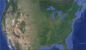
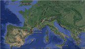
I've finished plotting all the locations in Google Earth, and it doesn’t take much imagination to see a grid. What I might do next is try to find the locations of the north and south poles before they started jumping around the place. Then use these points as the top and bottom of the grid, then check to make sure that the degrees between the points that I've plotted are roughly multiples of 1.8 degrees.

Screenshots from Google Earth are attached to this post.
 

Attachments

  • US.jpg
    US.jpg
    372.7 KB · Views: 62
  • EU.jpg
    EU.jpg
    423.6 KB · Views: 57
Back
Top Bottom