Crazy Storm Weather and Lightning - Global

The US military base (naval and air force) on the island of Guam in the Pacific Ocean hammered by Typhoon Mawar currently (May 24).


Typhoon Mawar hits Guam with 140 mph winds as potentially 'catastrophic' storm​


A powerful typhoon taking aim at Guam could be the strongest tropical cyclone to impact the U.S. island territory in decades.

As of Wednesday 7:50 p.m. local time (5:50 a.m. ET), the eye of Typhoon Mawar was passing over or very near northern Guam with 140 mile per hour winds -- equivalent to a Category 4 hurricane. Mawar could make a rare landfall on Guam, which would mark the first time since 1976 that the island was directly hit by a Category 4 typhoon.

An earlier forecast projected Mawar to hit the island as a super typhoon packing winds as strong as 160 mph -- equivalent to a Category 5 hurricane.

Most of Guam was without power by Wednesday afternoon, with the island's energy grid providing electricity to only 1,000 of its approximately 52,000 customers due to Mawar's "severe adverse conditions," according to the Guam Power Authority.

"We were able to avoid a complete island-wide blackout when the system severed into two grids," the agency said in a statement. "We are working hard to maintain the last remaining customers through the storm which contributes to quicker recovery after the winds die down later tonight or in the early morning hours."
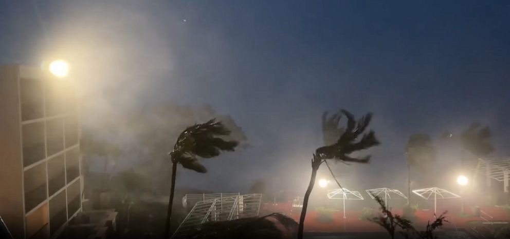
PHOTO: Tropical storm force winds hammer Tumon Bay, Guam, as Typhoon Mawar heads toward the island, May 24, 2023.

Tropical storm force winds hammer Tumon Bay, Guam, as Typhoon Mawar heads toward the island, May 24, 2023.
James Reynolds/EarthUncutTV

The National Weather Service has issued typhoon, extreme wind and flash flood warnings for Guam, which is the westernmost territory of the United States, located in Micronesia in the western Pacific Ocean.

Rainfall from Mawar could accumulate to as much as 20 inches on Guam, while the storm surge is forecast to reach as high as 25 feet. The typhoon was already producing waves up to 45 feet in the ocean near the island on Tuesday.

"Several inches of rain have already fallen," the NWS said in a bulletin on Wednesday. "Flash flooding is ongoing. Considerable flash flooding is likely, even for locations that do not normally flood."

PHOTO: Winds tear roofing off a shed as Typhoon Mawar bears down on Guam, May 24, 2023.

Winds tear roofing off a shed as Typhoon Mawar bears down on Guam, May 24, 2023.
Sean13213341/Twitter
 
The US military base (naval and air force) on the island of Guam in the Pacific Ocean hammered by Typhoon Mawar currently (May 24).
Super Typhoon Mawar Makes Landfall On Guam - Deadly Texas Tornado - Lake Levels Rise Rapidly (And other related News).
Premiered 5 hours ago

Elko Nv.


#Orages accompanied by strong rainfall intensities and marked electrical activity are circulating this morning on #PACA . These can cause problems on the road. Stay informed with @VigiMeteoFrance & @MeteoFrance_SE


Screenshot 2023-05-27 at 18-35-46 La Chaîne Météo on Twitter.png
Published: May. 27, 2023 at 12:55 AM GMT+2|Updated: 18 hours ago


Screenshot 2023-05-27 at 19-01-03 Chris Vagasky ⚡️ on Twitter.png


The strongest lightning strikes in the Makkah region
 
The dramatic moment when a man jumped out of his pickup truck as it was swept away by a creek in Nicaragua

A Nicaraguan driver whose vehicle was swept away by the waters of a stream in Veracruz, municipality of Nindirí, neighboring the capital Managua (Nicaragua), experienced dramatic moments this Monday morning.

The driver, identified as Alberto Uriel Romero Martínez, wanted to cross a flooded road in a Toyota 4x4 off-road truck, but the strong currents dragged the vehicle and carried it to a riverbed where the man had to jump to save his life.

After jumping, firefighters and police officers attempted to assist the man, but it was finally confirmed that he lost his life.

These are the first rains of the winter that begins this year in Managua, and the accumulated garbage in the riverbeds causes the water to overflow and generate floods in the neighboring areas.

According to the Nicaraguan Institute of Territorial Studies (Ineter), the first tropical wave of the winter season will enter the Central American country on June 1. Authorities warn that flooding may occur. In the pacific area of Nicaragua, rains are expected this Monday due to low pressure.

● Spain

sudden flood, today May 30, incredible in the streets of #MolinaDeSegura #Murcia Spain
Via @PRguezL.
 
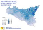
Sicily record rainfalls, May 2023

It is not directly related to crazy storm weather, yet it is about highly unusual weather for Sicily, Italy - as it has been the rainiest May month in their history.

sicilia-piogge-record-maggio-2023-1200x848.png.jpg

Meteoweb.eu wrote an article about it:

Climate, in Sicily May 2023 was the wettest in history: sensational rainfall records

According to climate change catastrophists, Sicily would have "desertified" already 20 years ago. And instead on the island it rains more and more and more and more often. May 2023 broke all records
As already clear after the atmospheric events in the middle of the month, this was the wettest May for Sicily in 2023, with a regional average of 124 mm since 1921, having abundantly exceeded the previous maximum value of 101 mm dating back to 1966 ". These are the data provided by the agrometeorological service of the Sicilian Region. The monthly average of rainfall measured by the Sias stations is equal to 126mm, confirming the good correspondence between the Sias network average and the adjusted average. As many as 82 stations of the Sias network out of 94 taken into consideration exceeded the previous maximum value of the period 2002-2022.

Apart from the accumulations, the month was completely anomalous as regards the persistent instability in the region: with the exception of only days 5, 6 and 7 May, all the remaining 28 days of the month recorded rainfall in some parts of the Island ! A particularly sensational detail in the light of the historical characteristics of May in Sicily. Furthermore, on 8 and 15 May there was no part of the region that remained dry, a circumstance which is also anomalous due to the type of spring rains.

The regional average number of rainy days , equal to 11 , was also anomalous, varying between the 17 days recorded on the stations at high altitude on the Nebrodi mountains and the 6 days recorded in Pachino (Sr). The maximum monthly accumulation on the Sias network with 361.2mm was recorded by the Antillo station (Me), where on day 2 the daily maximum was also recorded with 205.4mm . All the stations exceeded the normal values for the month, with percentage anomalies often so high as to appear off the scale, as in the case of the Aidone station , which recorded a value 26 times higher than the norm, 248mm compared to a normal value of 9.2 mm for the period 2002-2022 for the month of May.

It should be remembered that the data refer to the points of the Sias stations, not necessarily representative of the surrounding areas, given the uneven distribution determined by the type of events. There would be much to say about the impact of these rains on the territory and on agriculture and animal husbandry: the strong anomaly in some respects constitutes an advantage on the availability of water resources, but in other respects it has constituted and is constituting an adversity with often serious consequences : from fruit drop, due to associated strong wind events, to damage to forage during haymaking, to cereals in the ripening phase, to the vine due to some outbreaks of downy mildew still under observation, not to mention the hail that locally has severely damaged production. These are situations under evaluation.


END OF ARTICLE
 
Screenshot 2023-06-04 at 07-12-13 Météo Express on Twitter.png

Insane electrical activity under a violent #orage this Saturday, June 3 near Mecca in #ArabieSaoudite . The amount of #foudre is truly impressive.Video via @Arab_Storms


15-minute timelapse towards a #orage above Bourgoin-Jallieu and filmed from Villefontaine at 7:10 p.m.No hail but heavy rain fell on us afterward @MeteoIsere @meteociel @meteovilles

Storm in Francheville Le Bas. Raining cats and dogs! #meteo #orages #intemperies


Strong hailstorm hits Puebla this Saturday night... look at the size of the hail!!! @webcamsdemexico
 
Wow, fascinating

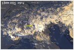
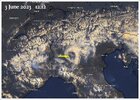
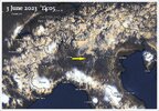
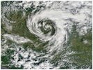
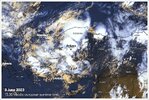
The phenomena of clouds engaging into a swirl, located over Northern Italy in the Po valley, started around 08.30 on 3 June 2023, located west of the T-storm which grew over the town of Verona. The image from Copernicus in the Twitter entry, must have been taken somewhere around 11:30.

One hour later, at 12:40 the swirl of low level clouds started gradually to dissolve and had dissipated somewhere at 15:30. I checked with Windy's archive, going back in time by playing the animation of cloud movements.

1.jpg

2.jpg

3.jpg

Higher res image

FxxvbGcX0AEdQ-o.jpg
 
Ankara, Turkey
3 June 2023

While examining the weather events over Italy and Sicily, I accidentally stumbled across this twitter entry showing weather related events from Ankara in Turkey on 3 June 2023:

"In Ankara, flood waters entered a house and came out of its balcony. It burst the windows of the house. Here are those moments..."

In order to make sure if bad weather existed over Turkey, i checked the archive at Windy.com, to see how clouds developed there. Well... indeed LOTS of large thunderstorms are visible over western and central Turkey from 3 June 2023.

Turkey_2023_06_03.jpg
 
Wyoming, Colorado, France, and an Accuweather perspective of overall events.


Screenshot 2023-06-09 at 22-33-10 ɓuıuǝddɐɥ sı sıɥʇ ǝʌǝılǝq ʇ uɐɔ I on Twitter.png

2 powerful storm lines have developed in the last few minutes, a first in Aude, followed by a second south of #Toulouse .The intensities locally exceed 300 mm/h under these #orages with therefore the risk of #grêle .Be careful in these areas

Screenshot 2023-06-09 at 22-30-34 Guillaume Séchet on Twitter.png

 
This system just blew through here with a bodacious boom.

In a very unstable air mass, the #orages have been multiplying at lightning speed since the beginning of the afternoon, from the Pyrenees and Provence Côte d'Azur to Auvergne-Rhône-Alpes, and from the Burgundy to Champagne to the north of #Paris ! Be very vigilant!

Interesting 🧐🤔


June 10, 2023
1686490031878.png


First Alert Weather Saturday night forecast 6-10-23
Jun 11, 2023

Screenshot 2023-06-11 at 15-51-23 Steve Caparotta Ph.D. on Twitter.png


Attachments

  • Screenshot 2023-06-16 at 23-30-59 lightning news - Google Search.png
    Screenshot 2023-06-16 at 23-30-59 lightning news - Google Search.png
    123.3 KB · Views: 23
Last edited:

Attachments

  • Screenshot 2023-06-18 at 08-30-15 Kulik Bertrand on Twitter.png
    Screenshot 2023-06-18 at 08-30-15 Kulik Bertrand on Twitter.png
    276.6 KB · Views: 2
  • Screenshot 2023-06-18 at 09-22-26 #okwx - Twitter Search _ Twitter.png
    Screenshot 2023-06-18 at 09-22-26 #okwx - Twitter Search _ Twitter.png
    528.3 KB · Views: 2
  • Screenshot 2023-06-18 at 09-56-41 Skip Talbot on Twitter.png
    Screenshot 2023-06-18 at 09-56-41 Skip Talbot on Twitter.png
    602.3 KB · Views: 2
Last edited:
Back
Top Bottom