Crazy Storm Weather and Lightning - Global


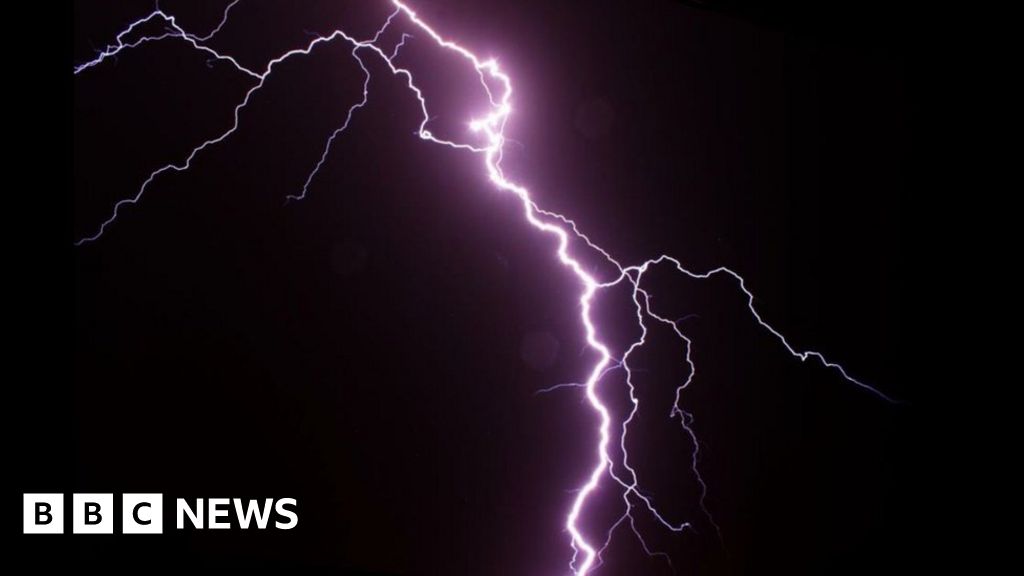
Ten children have been killed by lightning in the north-western Uganda city of Arua after sheltering in a hut during a storm.

The children were playing football when heavy rain forced them to take a break in a nearby grass-thatched structure which was struck by lightning.
Nine children, aged 13 to 15, were killed on the spot while another died on the way to hospital.
Three survivors are receiving treatment at the regional hospital.

Uganda's north-western region has been experiencing severe rains coupled with thunder and lightning.

This is the worst accident of its kind in Uganda since 2011, when 18 children were killed at a school in the mid-western region.
That year, 28 people also died from lightning strikes in a single week.

:-(
 
The Electric Discharge Detection Network has registered 5,867 cloud-to-ground lightning strikes in Catalonia, of which 863 in the #Berguedà .
Second Tweet
The map shows them by time slots and allows you to see their trajectory from southwest to northeast

Amazing Video: Lightning strikes near moving truck in BR
Aug 17, 2020


August 24, 2020
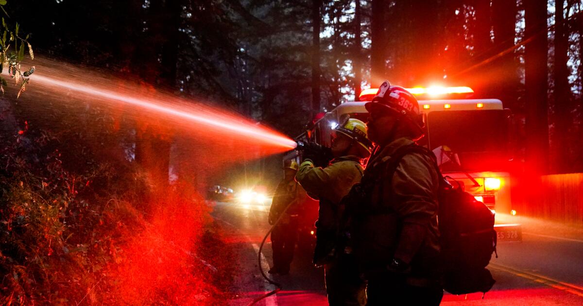
The size and scope of the fires are unprecedented, Daniel Swain, a climate scientist at UCLA, wrote in a blog post.
“As I’ve stated publicly, I’m essentially at a loss for words to describe the scope of the lightning-sparked fire outbreak that has rapidly evolved in northern California — even in the context of the extraordinary fires of recent years,” he wrote. “It’s truly astonishing.”

Already, more than 2,000 homes and commercial buildings have been destroyed by fire in California since late July. They include nearly 1,000 that were decimated since Aug. 15, which marked the start of what officials were calling a “lightning siege” of about 12,000 strikes that started an estimated 585 fires in California.


Meanwhile in Madrid


3-4 minutes (Mid Snip):
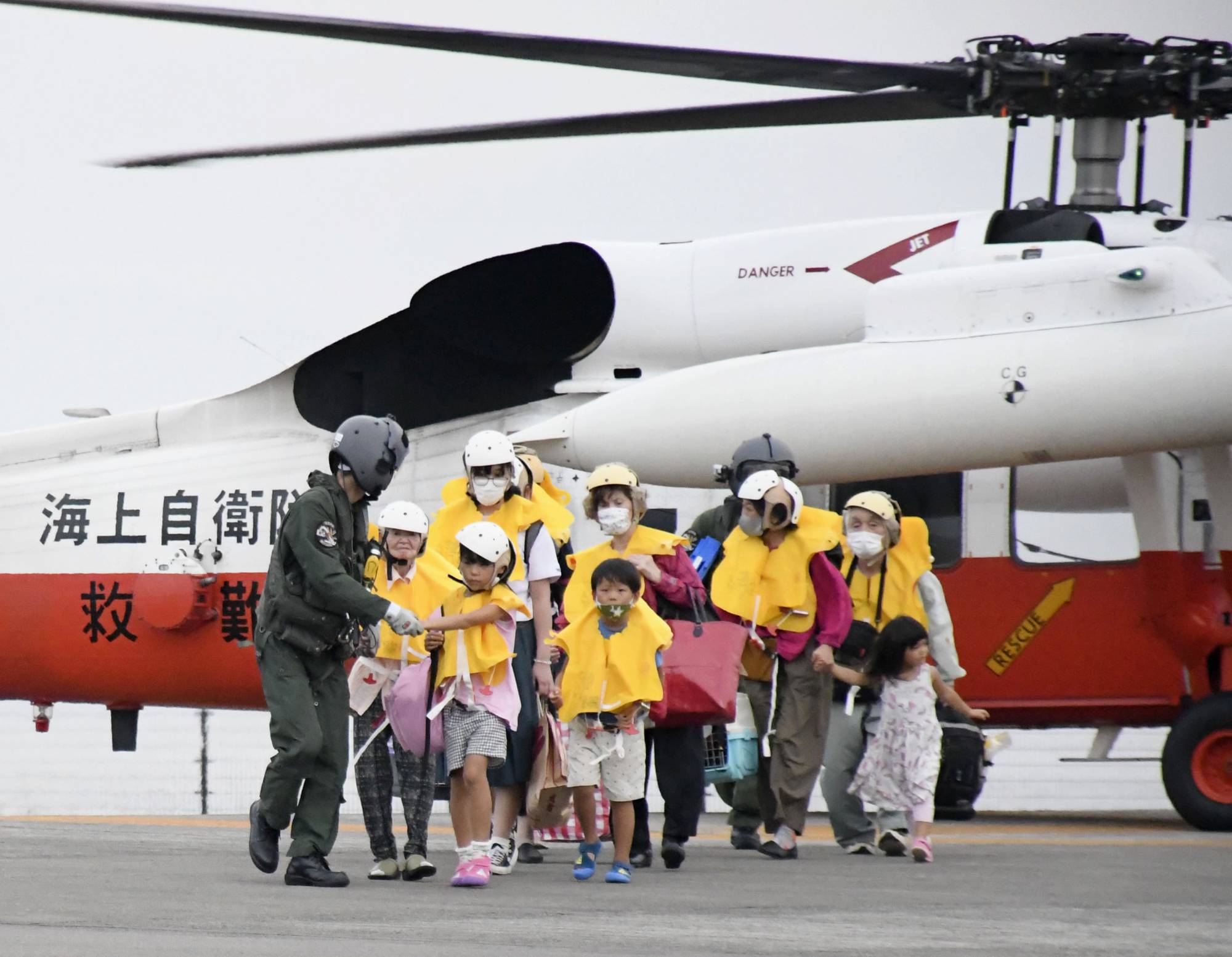
The Meteorological Agency urged extreme caution over the potential impacts of the typhoon as it is expected to intensify Sunday, potentially reaching an atmospheric pressure of 915 hectopascals at its center and packing winds of up to 306 kilometers per hour, faster than most shinkansen.

The lower the atmospheric pressure at the center, the greater the typhoon’s strength as it causes high tides when approaching coastal areas.

Through Sunday, the Okinawa region will likely be hit by gusts strong enough to topple houses. The storm will move through Amami Oshima island and approach Kyushu from Sunday to Monday, the agency said.

Southern areas of Kyushu could see rainfall of up to 800 millimeters by Monday evening, it said, also warning of high waves and tides.


Sure is looking a lot like a "global superstorm" in bits and pieces!

20000318

Q: Now, a couple of world events have recently occurred which were in an earlier list of predictions. One of these was the Ukraine explosion and the other was the flood in Africa. In fact, the flood headlines were almost in the same words you gave it. What this made me think was that, since these things are beginning to happen, since they were given as a group prediction, does this mean that the other things in that particular segment may be just around the corner in time, so to speak?
A: Could be.
Q: You also made a remark once that ice ages occur much, much faster than people ever thought...
A: Yes.
Q: Do we need to invest in some mukluks and snowshoes?
A: ??
Q: Well, what I am trying to get at is: should we start stockpiling firewood?
A: Maybe.
Q: So, it could be that fast?
A: Oh yes, and faster when in response to global"warming."
Q: When you put "warming" in quotes, you obviously mean warming in more than just an ordinary sense? Is that correct?
A: And/or not really "warm."
Q: Whitley Strieber and Art Bell have published a book about a "global superstorm." Is any of the information they have given in this book fairly accurate?
A: Derived from non-human sources known for stark accuracy, when convenient.
Q: What makes it convenient at the present time for them to be "starkly accurate?"
A: Fits into plans.
Q: Plans for what?
A: Do we not know already?
Q: In other words: world conquest and the takeover of humanity?
A: Not as simple.
Q: What would make my statement more accurate?
A: Call it amalgamation.

[....]
Q: ... Now, I want to go back to what you said about Whitley Strieber and Art Bell getting their information from "non-human" sources about world conquest and domination. Are Art and Whitley consciously aware of their connection to this source of information?
A: Amalgamation, we did not say "conquest."
Q: But, on previous occasions you have discussed the alien plan to manipulate humanity via time travel, creating an infrastructure for taking over the world. Are you saying that it will be done in such a way that there is no "outward" sign that it has happened?
A: Close.
Q: So, in other words, the world is being taken over gradually, right now, as we sit here and speak, and most people aren't even aware of it?
A: Sort of....
Q: Are people, at any point, going to become aware of it? Are they going to wake up... or is it just the way of nature?
A: Natural processes.
Q: So, aliens are never going to appear in the sky; there is never going to be a battle as you have previously stated; there is never going to be...
A: WHOA!
Q: Well, that's kind of what you are saying!
A: No. You are impatianet for a quick, packaged definition.
Q: What I am trying to get at is; you are saying it is a natural process; you are saying we are being taken over; it is not a conquest; though you did not say that it was not domination, of course - clearly domination is part of it, is that correct?
A: One could call it evolution.
Q: Well, still those things make one tend to think of natural processes that do not involve a war in the sky, spaceships shooting lasers...
A: Who says such rules apply?
Q: I'm just saying that it how you are making it sound; that it is just a strictly natural process. We are talking about 4th density beings... I guess they could...
A: Natural processes are not restricted by your preconceived boundaries.
Q: Then, let me come at it from another direction: are these beings who are behind Strieber and Bell's book part of those who will participate in some sort of battle? The problem here is that you have excluded the word "conquest." (A) I think they excluded conquest because, to a large extent, for most people, it is not a conquest; they just simply allow it. So, there is no conquest for most...
A: That is part of it, but we know you can exceed your programmed ideas if you try. Conquest, or lack thereof is a matter of opinion/perception.
Q: Let me get this straight: how is this book by Strieber and Bell going to play into the plans of STS aliens?
A: Not the book, the events depicted.
Q: So, are you saying that Whitley and Art are doing a favor for all of us by publicizing this information, that it could be helpful?
A: Makes little difference.
Q: Is there anything that COULD make a difference? Or is it necessary to make a difference?
A: In the biggest picture, no.
Q: So, it's not necessary to make a difference?
A: The soul, she counteth. The body, she doth not!
Q: So, that's the biggest picture. Narrow the picture down: is there something that could make a difference? Clearly, in the biggest picture, nothing makes a difference...
A: Native Americans asked similar questions once!
Q: Which brings up the subject of Native Americans. A big part of what is being taught by them at the present time is that the aliens, the Grays, and assorted others, are good guys - the "star people" coming here to teach us and to help us advance! They claim that it is a "good" thing to have contacts, abductions, and so on and on.
A: No. Corrupted message. Some early contacts were with benevolent STO beings.
Q: And now they are confused because they think that the present contacts are with the same beings of the past contacts?
A: Close.
20140621

Q: (L) Alright. Okay, the question on my mind: We have had in the last 10 days or 2 weeks or whatever a bunch of really odd tornadoes. There have been tornadoes appearing in places where tornadoes historically don't show up very often, if at all. Plus, there was a complete double-tornado with... What was it? It had multiple vortices?

(Niall) There were two events. One was a twin tornado, and one was one tornado with multiple vortices.

(L) Okay. So, what all of this...

A: Remember "Day After Tomorrow" and the comments we made about the coming global superstorm some "time" ago. You are presently witnessing many of the things that will intensify as time goes forward. Ain't it awesome?!!
 
INCREDIBLE NATURE SPECTACLE - AGAIN AT FLORIDA ON September 12, 2020
Florida seems to be the El Dorado of atmospheric and weather phenomena - spectacular images from there almost daily, which, like many things, currently show completely new faces.

Bildschirmfoto 2020-09-13 um 21.34.50.pngBildschirmfoto 2020-09-13 um 21.37.33.png
 
At 11:55 p.m., Thursday, September 10, a very intense thunderstorm raged over the Corsican reliefs. 300 kms away, from Genoa, I photographed this magnificent jellyfish sprite (leprechaun) Sprite jellyfish over corsica from Genoa, (300 kms away)

Hiratsuka has been thundering from the beginning. A scene of a thunderstorm at 20:50:56 on September 9, 2020, seen from a home in Hiratsuka to the northwest with a wide-angle camera. It's a change of only about 2 seconds, but you can see that lightning is proceeding while looking for a place where electricity can easily pass.

Thunder was heavy last night, and large sprites also appeared. A sprite that appeared at 0:57:52 on September 10, 2020 is seen from a wide-angle camera facing northwest from his home in Hiratsuka. Multiples appeared at the same time and illuminated the sky red.

From the electrical storm tonight in the North Sultana (Monterrey Nuevo León, Mexico)!!!
 
Last edited:


Hurricane Paulette to Track Near Bermuda With Damaging Winds, Heavy Rain and Storm Surge
By weather.com meteorologists 5 hours ago weather.com
At a Glance
  • Hurricane Paulette will track near Bermuda through Monday.
  • Damaging winds, heavy rainfall and storm surge will impact Bermuda.
  • Paulette will cause rip currents on the U.S. East Coast.
Hurricane Paulette will track near Bermuda into Monday with threats of damaging winds, heavy rainfall and storm surge. Paulette will also stir up waves and rip currents on the U.S. East Coast.

A hurricane warning has been issued for Bermuda, which will likely see tropical storm conditions by late Sunday. Hurricane conditions are possible in the archipelago by Sunday night or early Monday.

Paulette's strong winds could cause tree damage and knock out power in parts of Bermuda.

There will also be heavy rainfall in Bermuda through Monday, which might trigger flash flooding. Rainfall totals are predicted to be 3 to 6 inches.

Paulette will likely bring a storm surge and pounding surf where winds blow onshore in Bermuda. That could result in significant coastal flooding in some areas.

Increased wave activity and a threat of rip currents are expected on parts of the U.S. East Coast. These swells have already arrived in some areas and will continue into the first half of this week.

Rip currents will be possible along nearly the entire U.S. East Coast through Tuesday or Wednesday. These rip currents may occur in sunny skies.
 
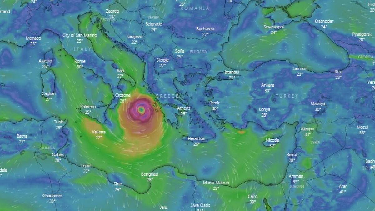
Cyclone Ianos: '`Rare extreme weather phenomenon' makes landfall in Greece
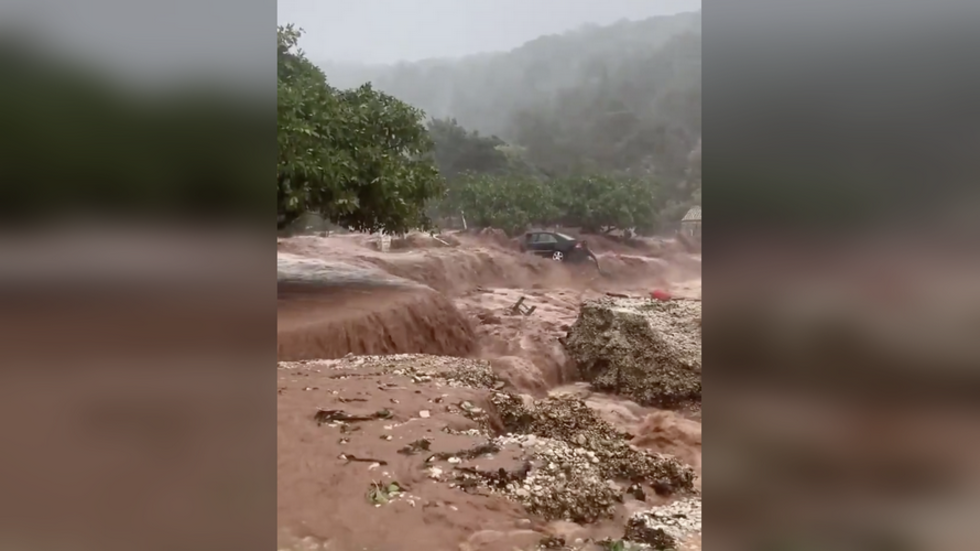
The hurricane-strength storm hit into Greece’s western islands, bringing lashing rain and gales, with reports of flooding and power cuts on the islands of Kefalonia, Zakynthos and Ithaca.
Ianos will cause heavy rainfall that will reach up to 400 mm in some areas, which could result in flash floods, according to the European Storm Forecast Experiment (ESTOFEX).
There is a risk of tornadoes developing, it added.

"Mediterranean cyclones are relatively rare phenomena, which we have encountered in Greece since 1995, but they have intensified and become more frequent in the Mediterranean region due to climate change," Hardalias added. The weather event form in the same way and look like the tropical cyclones as those seen in the US, but are weaker, generally shorter in life, and smaller in size than tropical cyclones.
 
Magnificent storm cell accompanied by a #éclairextra-cloudy, captured this September 17 near Mont-Blanc by
@suarezphoto ! #foudre#orages#impact

In connection with the subtropical storm #Alpha off Portugal, a few #orages come back from Spain and concern New Aquitaine and the Cévennes since yesterday.


In 24 hours, on the calendar day of September 19, 718 mm of rain were recorded in Valleraugue. Other stations recorded remarkable accumulations of 350 to 450 mm on

FLASH - One #tornade touched the beach of #Mourillon at #Toulon tonight. Damage has been reported concerning #restaurants neighbors. Another tornado has hit #Hyeres.
Second Tweet
Heaven he was doing weird things too


The first ever subtropical storm to hit the Iberian Peninsular has now been recorded according to The Portugal Times.

The first ever subtropical storm has been recorded in an occurrence described by meteorologists as a "historic fact".

According to weather experts, subtropical storm Alpha, which barrelled along the Portuguese coast and through some parts of Spain last weekend, was the first event of its kind to be registered since weather records began.

This was first put forward by Spanish meteorologists and later confirmed by the Portuguese Met Office (IPMA).

In some cases along the Portuguese coast, particularly the stretches along the Algarve and up to Lisbon, entire beaches were consumed by rapid rises in sea levels, while winds of up to 100km/h were registered in some inland locations.

On 18 September, 522 occurrences were registered by civil protection authorities due to strong rain and wind which wreaked havoc in various parts of the country.

The early hours of 19 September were calmer, but the Civil Protection service still registered 33 occurrences, mostly associated to falling trees, flooding, toppling structures and tidal surges in coastal areas.

Newspaper Observador reported two tornados in Beja and Palmela, which occurred due to supercells.

The districts of Leiria, Lisbon and Faro were the most affected by the unseasonably bad weather.

According to Visão magazine, Juan Jesús González Alemán, a researcher in atmospheric dynamics, quoted by Spanish daily newspaper El País, has no doubts: "it is a historical fact."

Rubén Del Campo, spokesman for the Spanish meteorological agency, added: "It was a very profound storm and, above all, rare for the time of year and for the latitudes where it passed."

Weather experts appear to be in agreement, Visão reports, that there seems to be a growing movement of weather phenomena more typical of the American coastline on Europe's doorstep. Last year, three other tropical phenomena landed in Portugal and Spain, whereas the norm would be the odd occurrence over extended periods.

Tropical storms are a type of cyclone that carry sustained winds - that is, the average wind speed in one minute - of between 60 and 120 kilometres per hour. The next step up, hurricane category, exceeds 120km/h.

Subtropical storms are hybrids that have the characteristics of the occurrences of the tropical system, but which occur at mid-latitudes.
 
Back
Top Bottom