You are using an out of date browser. It may not display this or other websites correctly.
You should upgrade or use an alternative browser.
You should upgrade or use an alternative browser.
Power outages and black-outs
- Thread starter angelburst29
- Start date
I started another thread not knowing that this was already started (oops!). Just had some random seeming blackouts/power surges in Natick, MA USA yesterday and a few weeks ago. Nothing important weather-wise seemed to be going on. Just seemed "random." They did not last long. Also around the same time I witnessed power loss at the other place I work closer to Boston. Our electronic medical record system failed for a bit which is rare and my friend who was supposed to have day surgery in Boston a few days later told that it was delayed because that same medical record system was down. Wondering if anyone else experiencing this?
60 mph wind knocks out power to over 320,000 across Western Washington
Sunday, January 6th 2019 (3-4 minutes Read)
Alaska Airlines flights back in the air after power outage
Sunday, January 6th 2019
SEATTLE (AP) — Alaska Airlines flights are back in the air after a nationwide ground stop that was apparently caused by a power outage.
Vancouver, WA
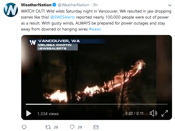
Sunday, January 6th 2019 (3-4 minutes Read)
Alaska Airlines flights back in the air after power outage
Sunday, January 6th 2019
SEATTLE (AP) — Alaska Airlines flights are back in the air after a nationwide ground stop that was apparently caused by a power outage.
The airline says all its flights were grounded between about 4:20 a.m. and 5:15 a.m. Sunday after a power outage in the Seattle area, where its operations are based.
Airline spokeswoman Oriana Branon says the power went out around 3:30 a.m. and came back on about an hour and a half later.
She says 27 flights were delayed and five were canceled.
She says inconvenienced customers are being offered compensation on a case by case basis.
Vancouver, WA
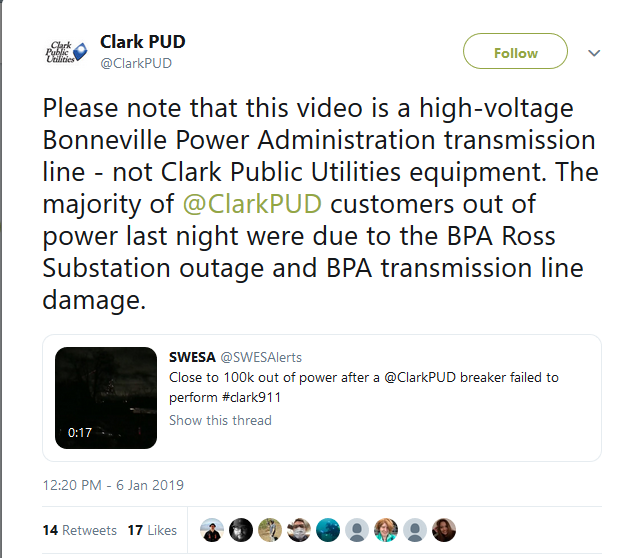
https://twitter.com/ClarkPUD/status/1082009096386015232

LIVE: Power outages climb as line of severe storms, tornadoes track across Texas, Oklahoma
May 18, 2019, 5:23:18 PM EDT 12-15 minute Read Snip:
Another round of severe weather continues to roll through the central United States Saturday as the storm system that spawned 30 preliminary tornado reports in Nebraska and Kansas Friday and Friday night tracks eastward. The severe weather is expected to span through Saturday and into Saturday evening. Like Friday, the threat of hail, high winds and damaging tornadoes are all possible once again.
The National Oceanic and Atmospheric Administration (NOAA) Storm Prediction Center confirmed at least three tornadoes on Saturday morning: two in Texas and one in Oklahoma.
Around 7:36 a.m. CDT, a tornado tore through Ballinger, Texas, causing at least one possible injury and demolishing a house off of FM2111. According to the report, the damage track in Ballinger stretches from the country club to a local high school. The tornado also snapped trees, downed power lines and damaged a baseball stadium and a water tower. There have been reports of flooding in some homes around the area.
Not even five minutes after the Ballinger tornado occurred, another tornado was reported in Geronimo, Oklahoma, at 7:38 a.m. CDT, damaging homes and trees. Area emergency management noted that the tornado may have begun as early as 7:35 a.m. CDT.
Earlier this morning just before 5 a.m. CDT, a tornado-warned storm passed near San Angelo and Abilene, Texas. The Storm Prediction Center hasn't yet confirmed any tornadoes in the area
The San Angelo National Weather Service (NWS) had to transfer operations and take shelter as the storm hit.
A resident in Abilene, Texas, tweeted about flipped cars and damage to a nursing home after another tornado-warned storm swept through the area.
Local news coverage captured a video of the damage in Abilene, showing downed trees and power lines in the road beside damaged homes.
The Dallas-Fort Worth International Airport had canceled 248 flights and delayed 149 others as of late Saturday morning, according to FlightAware. Larger metropolitan areas will also be at risk for severe weather through Saturday, including the Dallas-Fort Worth area, Oklahoma City and Little Rock.
"Although individual supercells are currently ongoing in Texas, they are expected to congeal into a larger complex as they track east," AccuWeather Meteorologist Brandon Buckingham said. "This will enhance the widespread wind threat as it tracks through Texas and Oklahoma. Individual supercells could fire up ahead of the complex later this afternoon, which will act to raise the threat for large hail and tornadoes as well."
This is only the second day of what could be more than a week-long severe outbreak over the center of the country. Buckingham warns that as the days progress, the flood threat will continue to increase over areas that have round after round of rain and thunderstorms.
1:12 p.m. CDT Saturday:
Dallas-Fort Worth Airport recorded a 62 mph wind gust this afternoon during the severe storms.
Meanwhile:
Bay Area heat wave: Rising temperatures trigger power outages
The Bay Area heat spell could mean trouble for many sweltering neighborhoods suddenly confronted with a power outage.
SAN FRANCISCO, Calif. (KTVU) - The Bay Area heat spell could mean trouble for many sweltering neighborhoods suddenly confronted with a power outage.
More outages are expected to continue into the afternoon and evening.
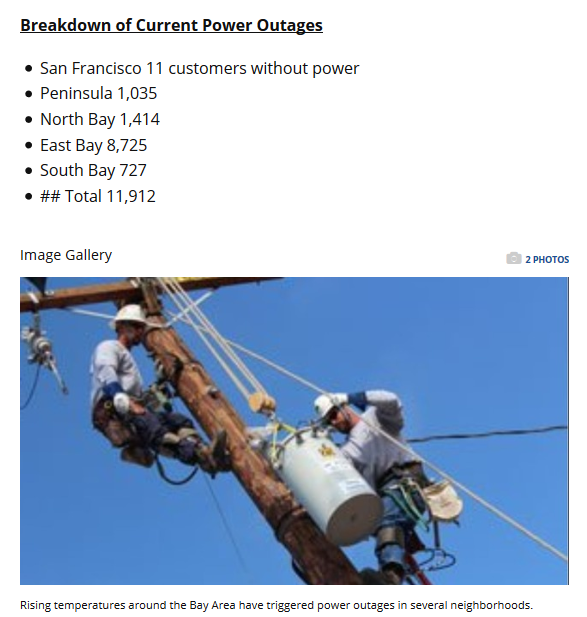
Pacific Gas &Electric activated all of its local emergency response centers across the entire Bay Area.
PG&E's Santa Rosa materials and equipment yard, like all such Bay Area facilities, is ready with crews, material, and equipment to respond outages.
Monday's rolling power outages, most notably in the East Bay.
"Yesterday it reached 104 degrees in a lot of areas. That was the highest temperature that we've seen in a couple of years actually," said Deanna Contreras, spokeswoman for the utility. "Throughout the day, about 10,000 customers were impacted; not all at once but through the day due to heat-related outages.
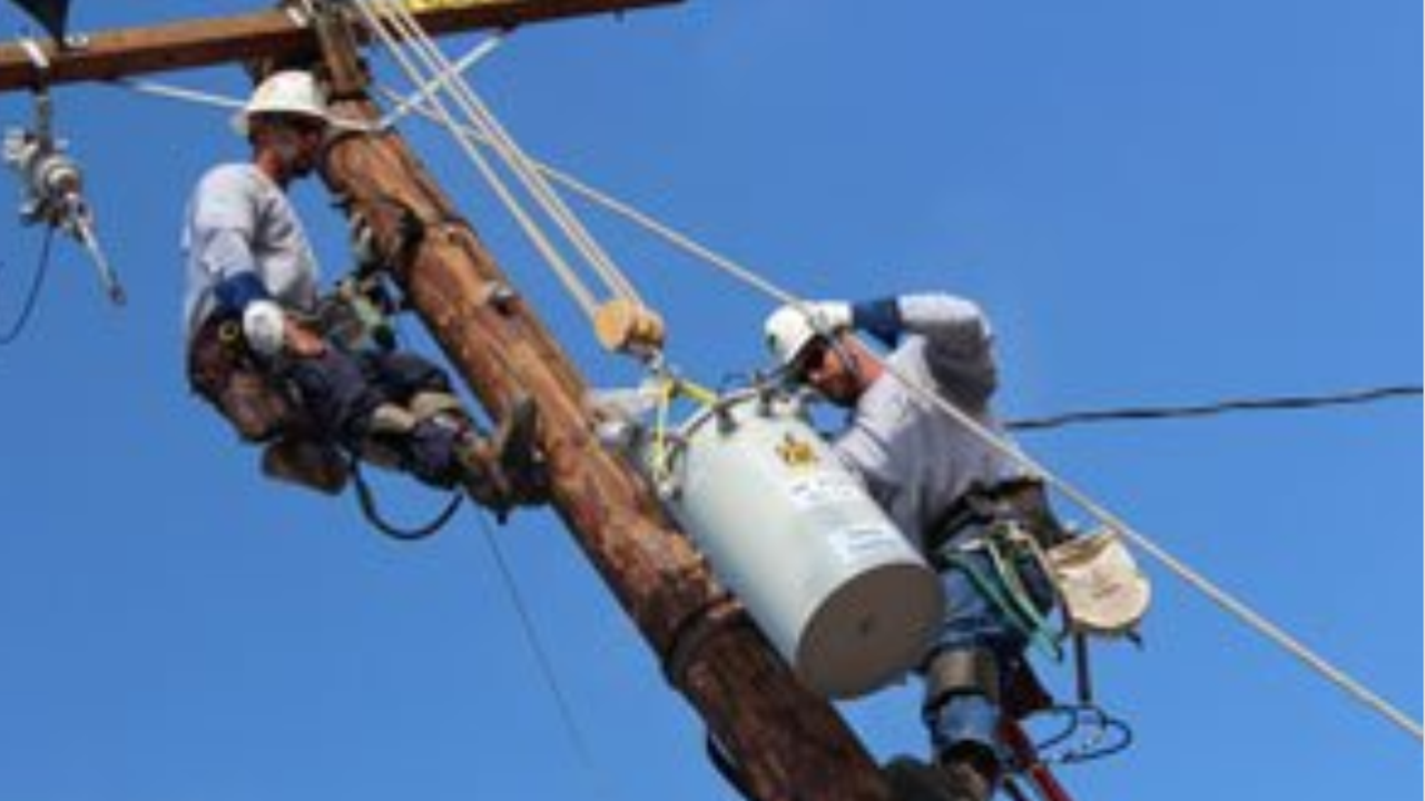
Transformers of all sizes can only carry so much load.
The problem of course whether the transformers are located up on a pole or underground.
If they carry too much load or simply get too hot, they will shut down.
"The transformers and other equipment just can't cool down fast enough, especially the underground equipment, those in the vault, they just can't cool down," said Contreras.
That coupled with an increased demand on the system when the weather heats up.
"People use their air conditioners more," she said. "People use their fans more."
Transformers step the power down from the main high voltage system to the voltage needed in homes and businesses.
When a transform fails, it usually need to be replaced and that can take a significant amount of time for crew to climb a pole or enter a vault to swap it out.
A friend from Argentina just shared this:
A couple of news items about the blackout:
There's not detailed explanations about the cause yet, but it must have been something big to cause this kind of widespread blackout.
Everyone in Argentina and other affected countries, take care.
Hey, guys, just a brief message because I don't want to waste battery. Something big and serious happened, there is no light since 7 o'clock, not in Argentina not in several bordering countries, internet is not working properly, most radios have not signals. I still couldn't find out exactly what happened. I wnet shopping just in case and I made a good reserve of non-perishable food, hygiene and water ... I am going to put the cellphone in airplane mode now to avoid wasting battery. I'll keep you posted.
A couple of news items about the blackout:
‘Never before’: MILLIONS could be without light as Argentina & Uruguay hit by nationwide blackouts
Argentina suffered a “nationwide” blackout, which also affected neighboring Uruguay, Alejandra Martinez, a spokesperson for the Buenos Aires-based electricity supplier company Edesur, told local media. “Something like this has never happened before,” she said.
Massive Power Failure Leaves 50 Mln People in Latin America Without Electricity
"At this moment, we are working to determine the reason for this failure and be able to restore the supply in the shortest possible time", said the official Twitter account of the Provincial Energy Company of Córdoba.
"The system is already being lifted from scratch. There are already cities on the coast with service and work is still being carried out towards the general restoration", UTE, the National Administration of Power Plants and Transmissions, stated.
The outage comes amid the Copa América football championship in Brazil, while in some parts of Argentina people were preparing to vote in local elections.
There's not detailed explanations about the cause yet, but it must have been something big to cause this kind of widespread blackout.
Everyone in Argentina and other affected countries, take care.
angelburst29
The Living Force
Sunday June 16, 2019 - Massive blackout hobbles South America, one-third of power back in Argentina
Power had been restored to one-third of Argentina by early afternoon, hours after a massive blackout hit South America on Sunday morning, leaving tens of millions without power, the country’s Energy Secretariat said.
Argentina's grid "collapsed" around 7 a.m. local time (11 GMT), leaving the entire country without power, Argentina´s Energy Secretariat said in a statement. The outage also cut electricity to swaths of neighboring Uruguay and Paraguay.
Energy distributors in Argentina, Paraguay and Uruguay, whose populations total nearly 55 million, said power was being restored to major cities, including Montevideo and Buenos Aires.
Argentina’s energy agency said in a statement it had begun investigating the causes of the outage, but had not provided further details by mid-day.
Energy company Edesur Argentina called the outage “exceptional” and said it would likely take the rest of the day before power was completely restored. Argentina’s Energy Secretariat said energy distributors nationwide had brought back 5,000 megawatts out of 15,000 MW of total demand.
Uruguay power company UTE said on social media that power had returned to parts of Montevideo and the southern coast of Uruguay. In Paraguay, the capital of Asuncion was unaffected by the outage but local providers said they were restoring power to smaller cities and rural areas.
The massive blackout on Father's Day left Buenos Aires dark early this morning, hobbling public transportation, cutting off water supply and crippling phone and internet communications across the city.
Images from social media showed long lines of cars at the few service stations still in operation in Argentina’s capital city and traffic lights dark, creating chaos in places even on a normally quiet Sunday.
Elsewhere in Argentina, several provinces were forced to temporarily delay local elections slated for Sunday.
A spokesman for Argentine state oil company YPF stated that all of the plants at its La Plata refinery, a critical link in the country’s oil infrastructure, had been shut down following the outage.
Argentina is home to the Vaca Muerta shale formation, one of the world’s biggest reserves of shale gas and oil. It was not immediately clear to what extent drilling operations there had been impacted.
A spokesman for Brazil’s power system operator (ONS) said the outage had not impacted the regional neighbor to the north.
There is an alert for storms (hail, rain, electrical) in -posible- initial area of the blackout of Argentina, extended till Monday In Spanish -https://www.infobae.com/sociedad/2019/06/15/rige-un-alerta-meteorologico-por-tormentas-intensas-granizo-y-actividad-electrica-en-la-ciudad/
-https://www.clarin.com/sociedad/produjo-apagon-afecta-argentina-uruguay_0_p29Qtt2Vb.html said:Massive blackout
Why the blackout that left Argentina and Uruguay without light occurred
The Energy Secretariat explained the causes of the collapse of the Argentine Interconnection System.
Argentina dawned this Sunday when Father's Day is celebrated without light. A massive cut affected practically the entire country (with the exception of the province of Tierra del Fuego) and Uruguay. The Secretariat of Energy explained to Clarín the causes of the cut.
"The storms of the littoral pulled lines of Yacyretá - Salto Grande from the system. That takes out of synchronism the power plants all over the country that have automatic protection when the frequency of 50 Hz is altered", explained sources from the secretariat.
In addition, being connected Uruguay also affected it, since it also depends on Salto Grande.
However, sources at the Yacyretá hydroelectric plant denied Clarín that the fault had been generated there. "The hydroelectric plant is in working condition according to the forecasts for these cases, and all the operational mechanisms linked to a circumstance of this nature have been activated," they explained.
In any case, they indicated that when the system collapsed, the plant activated the mechanisms to get out of operation and avoid damages.
"The percentage loss was high due to the schedule in which it occurred, of low demand. The rest of the generators could not compensate for the losses," also explained from Energy.
They reported that after 10 o'clock the energization process began from the strongest points of the system, the Yacyretá, Chocón and Salto Grande hydroelectric plants. "Transener opened the system and is being energized again to be able to regularize the service," they added.
Translated with www.DeepL.com/Translator
EDF Energy extends outages at UK nuclear plant where cracks were found
EDF Energy, owned by France's EDF, has extended outages at the two reactors at its Hunterston plant in Scotland, while the nuclear regulator assesses whether it is safe for them restart after cracks were discovered last year.
LONDON (Reuters) - EDF Energy, owned by France’s EDF, has extended outages at the two reactors at its Hunterston plant in Scotland, while the nuclear regulator assesses whether it is safe for them restart after cracks were discovered last year.
The Hunterston B nuclear plant on the west coast of Scotland is more than 40 years old and when operating can provide enough electricity to power more than 1.7 million homes.
It has two reactors and both have been offline since last year after cracks were found on the graphite core during routine inspections at the facility.
Before the plant can restart EDF Energy must show it can operate safely, even if there is an extreme and unlikely earthquake event.
It has presented safety cases to Britain’s nuclear regulator, the Office for Nuclear Regulation (ONR), which will then decide whether the reactors can be restarted.
EDF said the so-called B7 reactor is now scheduled to return to service on Oct. 1 and not the previous date of July 31.
The B8 reactor is scheduled to return on July 22 against a previous date of June 24.
“These dates present our most likely view of return to service. It is not possible for us to confirm with certainty how long this process will take,” EDF Energy said.
Meanwhile:
angelburst29
The Living Force
Sat. July 13, 2019 - Reports of extensive Power Outages in Manhattan, NYC.
It is also the Anniversary of the great NYC blackout of 1977 ... 42 years ago.
https://twitter.com/hashtag/BREAKING?src=hash&ref_src=twsrc^tfw|twcamp^tweetembed|twterm^1120726798814334976&ref_url=https://www.breakingisraelnews.com/127487/islamic-state-leader-video-5-years/
NYC Power Outage: Photos of the Blackout
A blackout across parts of the Manhattan's west side on July 13, 2019, knocked out power to tens of thousands. New Yorkers shared photos that included spooky subway stations, an evacuated movie theater and Time Square billboards gone blank.
BREAKING: Massive Power Outage In Midtown, Several Sections Of Manhattan, Thousands Affected
NEW YORK (CBSNewYork) – A large power outage has been reported throughout Midtown, Hell’s Kitchen, and Upper Manhattan.
CBS2 has learned that all restaurants have gone dark in Hell’s Kitchen.
There are also no working street lights in those affected sections of the city.
According to the Con Edison website, over 41,000 customers have lost power throughout the city as of 8 p.m.
The FDNY reports that they are receiving calls from residents without power in the West 40s all the way north to 72nd Street.
Commuters should avoid the subway as power outages in several stations have been confirmed by the MTA and Con Edison as well.
CBS2’s Alice Gainer was at one of the subway stations in Midtown where power has completely gone out.
Gainer also hit the road to see how drivers are handling the dangerous traffic conditions on Manhattan’s West Side Highway.
New Yorkers are also calling for help through social media, as at least one person has been trapped in an elevator by the outage. Richard R. O’Connor tweeted from his elevator in Manhattan Saturday evening.
Message from the universe, I supposed ... it reminded me of the coinicided date of Mexico City's deadly earthquake in 1985/2017, 19th of SeptemberSat. July 13, 2019 - Reports of extensive Power Outages in Manhattan, NYC.
It is also the Anniversary of the great NYC blackout of 1977 ... 42 years ago.
This recent video shows the darkness it is said that there are some buildings that have electricity especially those that have power plant have begun to operate. #blackoutnyc #Blackout #poweroutage ---using deepl.com
Last edited:
It happens on the 42nd anniversary of the previous blackout, and on the Manhattanhenge day.
Trending content
-
-
-
Thread 'Coronavirus Pandemic: Apocalypse Now! Or exaggerated scare story?'
- wanderingthomas
Replies: 30K -

