We've got all sorts going on where I am, including the circumzenithal arc, or upside down rainbow!
 www.bbc.co.uk
View attachment _129899629_3973d550-eee1-4720-9218-771d675e4d22.jpg.webp
View attachment _129899630_34e90fef-d516-437e-8544-cbbd479c3eb8.jpg.webp
View attachment _129899628_0f2bca53-ebd1-4399-ac30-4cd0a09e7a44.jpg.webp
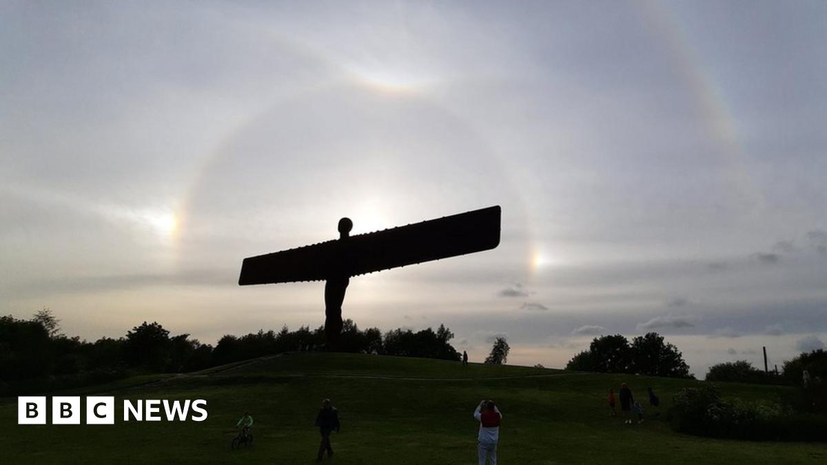
Sun halos, arcs and upside-down rainbows seen across England
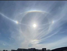
Thin, high cloud gave a spectacular show of halos, arcs and upside-down rainbows.
Much of northern England enjoyed a rare optical display on Sunday evening.
Thin, high cloud gave a spectacular show of halos, arcs and upside-down rainbows across the North East and Cumbria, not often seen together in the UK.
The phenomena are caused by sunlight reflecting and refracting through ice crystals high in the atmosphere.
BBC Look North weather presenter Jennifer Bartram said it was "very unusual".
View attachment _129899629_3973d550-eee1-4720-9218-771d675e4d22.jpg.webp
View attachment _129899630_34e90fef-d516-437e-8544-cbbd479c3eb8.jpg.webp
View attachment _129899628_0f2bca53-ebd1-4399-ac30-4cd0a09e7a44.jpg.webp

 Sweden •