It was so cold that the planes had to fly lower.
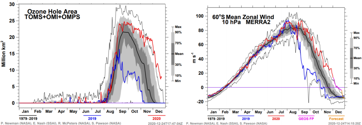
Europe had its coldest day since February. At an altitude of 12 kilometers, the temperature was so high that planes could no longer fly.
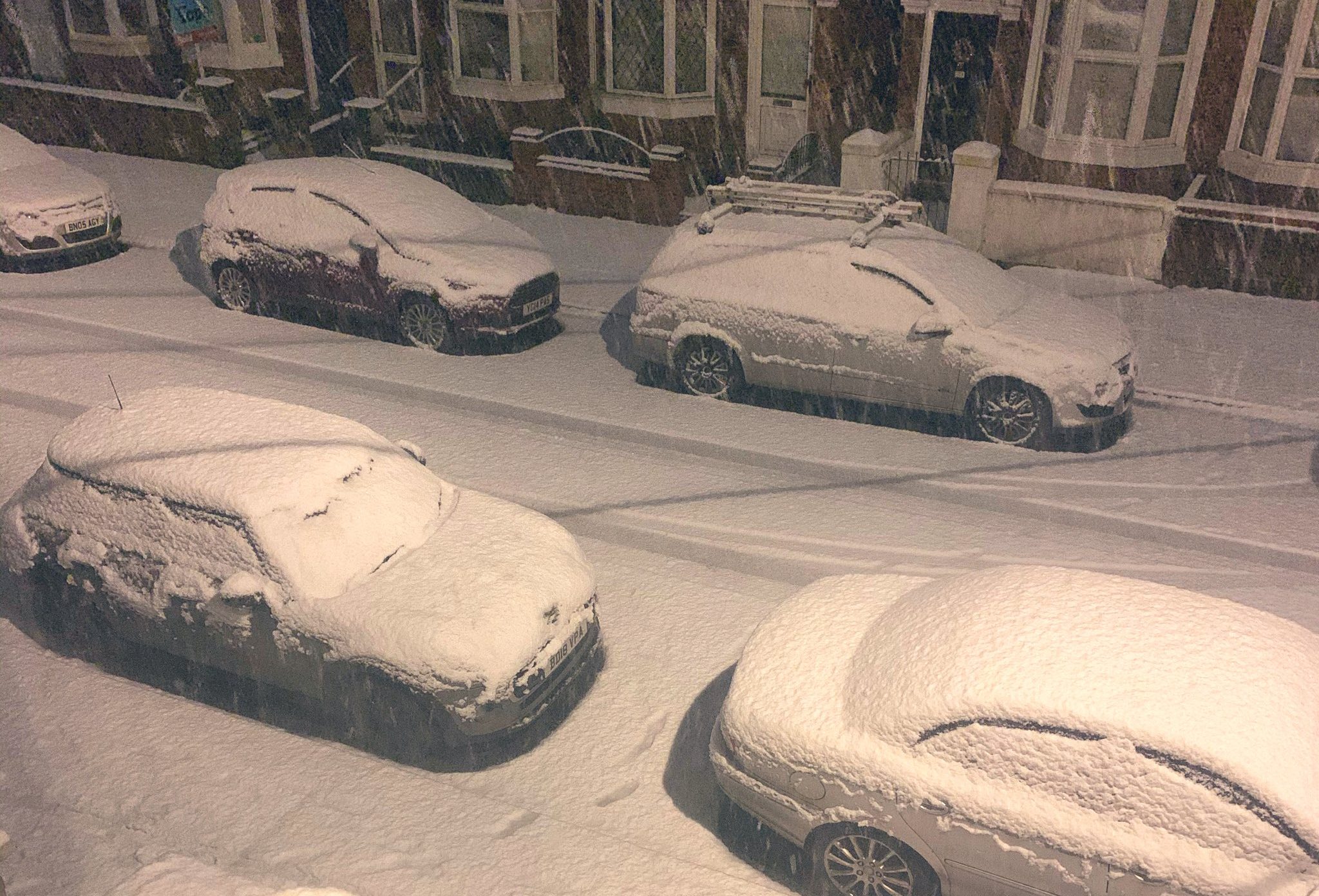
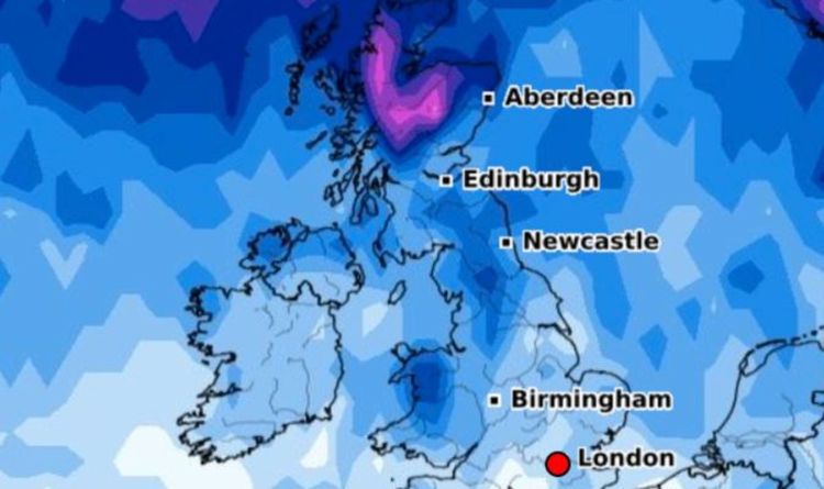
This weekend was marked by freezing cold. Very low temperatures were measured in Switzerland, but also in the rest of Europe. In addition, storm Bella was accompanied by gusts that caused power outages in France and the United Kingdom.
This cold front also had an impact on air navigation. Severin Brüngger, Easyjet pilot, shared on Saturday on Twitter a photo showing an outside temperature of -74 °C. The aircraft was then at an altitude of just under 12,000 meters. "Rarely seen such icy air. It's too cold for us. We have to go down," explained the pilot.
MeteoSwiss indicates that at such an altitude a temperature of about -60 °C would be expected. For its part, Swiss confirmed that it also had problems with the temperatures. "On the Zurich-Düsseldorf flight, our plane had to descend because the air was too cold," explains Michael Stief, spokesman for the airline. "We had to prevent the kerosene from getting too cold. That's why the aircraft had to descend about 1,000 meters, he sums up. It's standard procedure."
A Luxair aircraft, which was scheduled to land this Sunday at Paris-Charles de Gaulle airport, had to turn around because of strong winds, with gusts of up to 145 km/h recorded at the top of the Eiffel Tower. The plane, which was supposed to land in Paris this Sunday at noon, failed to do so, despite two attempts. A reader of "L'Essentiel", who was in the plane, confided that he was "a little scared". "It was moving around a lot," he adds.
"The captain then made the decision to turn around and land safely in Luxembourg," explains Luxair. "Some travelers were not very happy that they could not reach their destination," the reader-reporter said. In any case, Luxair's teams "then took care to propose appropriate alternative solutions to all passengers concerned", the company emphasizes. For example, the reader, who was due to fly to Rio via Paris, will take another flight on Monday, with a stopover in Amsterdam (Netherlands). "Passengers who do not live in Luxembourg have been offered to go to a hotel," he said.
According to the Aéroports de Paris (ADP) group, "37% of departing flights" from Paris-Charles de Gaulle airport "were delayed by an average of 50 minutes" at the height of the storm. Three planes whose initial destination was Paris-Charles de Gaulle were diverted to Orly, one from Greece, another from Switzerland and the third from Beirut, while an Aeroflot plane landed in Amsterdam.