Beijing's first snow came 23 days earlier this winter season, and the temperature in the capital may hit a 10-year record low, which has led to the suspension of buses, as well as cancellation of flights and trains.
You are using an out of date browser. It may not display this or other websites correctly.
You should upgrade or use an alternative browser.
You should upgrade or use an alternative browser.
The Ice Age Cometh! Forget Global Warming!
- Thread starter Gaby
- Start date
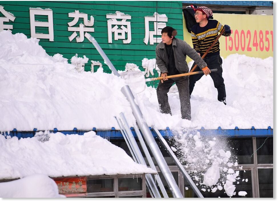
Parts of northeast China hit by record snowfall as cold wave passes
Snowstorms have wreaked havoc in northeast China in recent days, with record snowfall in some parts snarling traffic, disrupting train services and raising concerns about power supply as temperatures plunged, state media reported on Wednesday....
 www.sott.net
---------------------------------------------------------------------------------
A few videos showing the extremity of the situation -
Its no better over here in the Southern Hemisphere. It has rained a lot in Australia in the last few days and it came out of nowhere. The Msm has been downplaying and underreporting it as usual. C’s did say that there would be rains and storms in this part of the world in sync with the ice age in the northern hemisphere.
The forecast looks grim indeed!
Of course depend from the model they using , but if that is what's going to be , or close to , then just looking around UK, it seems plausible to think that there could be some issues with the Gulf Stream, looking at the predicted temperature , they looks like the "normal temperatures" that you should expect without the warming effect of the Stream.
Of course depend from the model they using , but if that is what's going to be , or close to , then just looking around UK, it seems plausible to think that there could be some issues with the Gulf Stream, looking at the predicted temperature , they looks like the "normal temperatures" that you should expect without the warming effect of the Stream.
Then there is atmospheric streams. See Laura's comment below from a page back:..it seems plausible to think that there could be some issues with the Gulf Stream, looking at the predicted temperature , they looks like the "normal temperatures" that you should expect without the warming effect of the Stream.
So now those recently discovered "atmospheric rivers" are going to be dumping snow? Hoo boy! Things are most definitely getting interesting.
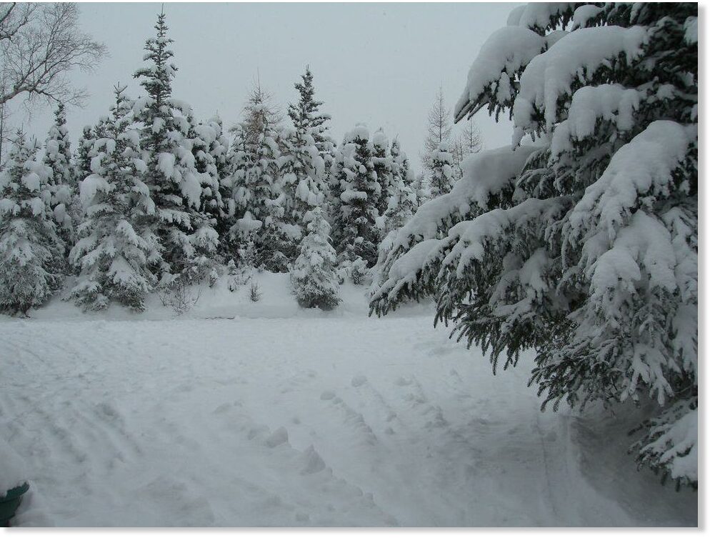
Think so, too. Coupled with localizations, some places may take a pounding, as recently seen in Mongolia above.
Apparently this early snow dump in Anchorage and southcentral Alaska on Nov. 11 was big even by Alaska standards.
 www.sott.net
-------------------------------------------------------------------------------------------------
Extract-
Many Anchorage residents were shoveling sidewalks and brushing off car windshields for the first time this year as the town got hit by its largest snowstorm of the season.
Some parts of town are reporting over a foot of snow, including 15 inches reported as of 8:25 a.m. on Huffman and Birch Road on the Anchorage Hillside, according to the National Weather Service. Valdez reported 19 inches of powder at 6:40 a.m.
Storm drops up to 19 inches of snow in Southcentral Alaska
Many Anchorage residents were shoveling sidewalks and brushing off car windshields for the first time this year as the town got hit by its largest snowstorm of the season. Some parts of town are reporting over a foot of snow, including 15 inches...
www.sott.net
-------------------------------------------------------------------------------------------------
Extract-
Many Anchorage residents were shoveling sidewalks and brushing off car windshields for the first time this year as the town got hit by its largest snowstorm of the season.
Some parts of town are reporting over a foot of snow, including 15 inches reported as of 8:25 a.m. on Huffman and Birch Road on the Anchorage Hillside, according to the National Weather Service. Valdez reported 19 inches of powder at 6:40 a.m.
XPan
The Living Force
10 days ahead of time prognosis - are not really reliable
The above 850 hPa Level prognosis was made 10 days ahead of time. It suggested a scenario for a major cold air breakout over Europe for 18 Nov 2021. (The temperatures in that prognosis represent predicted temperatures at 1.5 km height, not showing ground temperatures ! ) I consider 10 days to be far too much ahead of time, to have any real value.
4 days ahead
This new 850-hPa level prognosis was made for the same date 18 Nov 2021 but only 4 days ahead of time
Quite a change.
While the north of Europe, as well Germany + Poland are still in the blue (below 0°C at 1.5 km) - yet it ain't purple at and below -15°C, which the earlier 10 day prognosis so dramatically suggested.
Ground vs 850 hPa (1.5 km height)
Having airmasses around 0°C to -5°C at 1.5 km height this time of the year, is not really strange for November. A temperature around -5°C. at 1.5 km still allows MAX temperatures to go above 0°C on the ground in November. See below:
Ground temperature prognosis vs 1.5 km height for 18 Nov 2021
Warsaw: Max +6°C, Min +1°C || -4°C at 1.5 km
Stockholm: Max +5°C, Min +0°C || -5°C at 1.5 km
All this being said... it is going to get colder, of course, leaning towards the risk for snowfall coming soon, including here in Stockholm. So far, and for the first time this winter season, we had a tiny brief moment of snow mixed with rain on 8 Nov 2021 around 05.30 - barely really visible - and that was it.
All previous prognosis for snow, had failed.
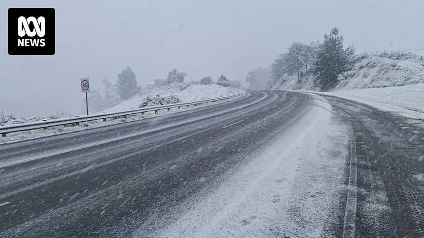
And, as I was saying about the Southern Hemisphere few posts above, The southernmost part of Australia, Tasmania just had snow overnight when it should be the beginning of the summer time.
 www.abc.net.au
Quotes from the article.
Hobart shivers through coldest November night in more than 60 years, wakes to snow
It is meant to be late spring, but temperatures in Hobart dropped to 2.9 degrees last night and many people woke to snow falling in their backyards.
www.abc.net.au
Quotes from the article.
Initial data shows the temperature in Hobart fell to 2.9 degrees Celsius overnight — which would make it the city's coldest November night since 1953.
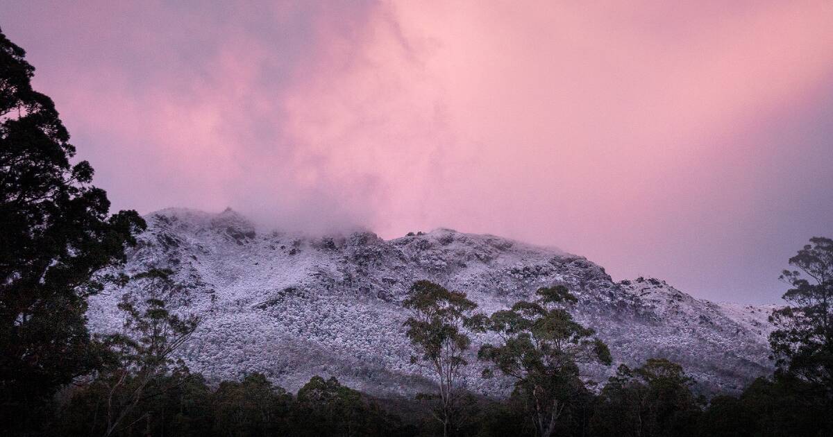
"The lowest snow would have fallen about the southern parts of Tasmania, but due to the elevated nature of the Central Plateau and some of the ranges in the west of Tasmania, they actually got more snow in the end, or very likely to have had more snow in the end, because they're just that much higher above sea level," he said.
Mr Johnston said the cold south-westerly air had come up from Antarctica.
Some shots from Snowvember in Tasmania:
Some shots from Snowvember in Tasmania:
Some videos -
Wintery weather brings wonder across the state
Summer is only two weeks away.
Intense snowfall in Sestriere, northern Italy  11/15/2021
11/15/2021Snow is falling in parts of Australia while other areas are bracing for a heatwave.
Snow and temperatures below zero although the next month is the beginning of summer in Australia
Snow and temperatures below zero although the next month is the beginning of summer in Australia
- Hobart hit with snow as city shivers through coldest November night in more than 60 years
- Snow is falling in New South Wales ski resort Perisher which expects 4 inches
- Snow also expected in Tasmania over weekend as temperatures take a plunge
- Meanwhile Perth and parts of NSW will swelter through 38C on Saturday
- Out of control bushfires can be expected in northern NSW and Queensland
Beware of twitter sometimes - this footage of kangaroos in the snow is from 2 years ago, see -
Kangaroos enjoy rare snow in Australia - BBC News
71K views
2 years ago
Trending content
-

-
Thread 'Coronavirus Pandemic: Apocalypse Now! Or exaggerated scare story?'
- wanderingthomas
Replies: 30K -
