Volcanoes Erupting All Over

8 January, Strange crater formed on the shores of the Laguna de Ixpaco, Santa Rosa, Guatemala

https://youtu.be/oq097kUKXTs
_http://www.chapintv.com/actualidad/santa-rosa--extrano-crater-se-formo-en-las-orillas-de-la-laguna-de-ixpaco--204359 said:
Personnel from the National Coordination for Disaster Reduction (CONRED) monitor a chronic geological formation in the Ixpaco Lagoon located in the municipality of Pueblo Nuevo Viñas, Santa Rosa, from which sulfur smells too strong and vapors emanate at very high temperatures.

According to neighbors who have denounced the breath affects them and causes burning in the eyes, which is felt several miles away.

This monitoring is carried out from the shores of the "Laguna de Ixpaco" as it is known to a tributary of hot and sulphur water emitted by the volcano Tecuamburro and that for many has been medicinal.

According to Renato Hecheverria, CONRED's Departmental delegate, "the report will be sent to INSIVUMEH so that professionals can come to carry out geotechnical studies and determine the causes and origin of this geological formation and determine the mitigation measures to reduce the vulnerability of a risk to a disaster that affects the population".
 
I think we are going to hear more about this particular region...
https://watchers.news/2019/01/16/large-number-of-dead-fish-sulfur-smell-mayotte-seismo-volcanic-crisis/?utm_source=dlvr.it&utm_medium=facebook said:
Large number of dead fish, sulfur smell reported, Mayotte seismo-volcanic crisis intensifies

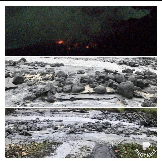
A large number of dead fish emerged at various sites off the barrier reef just east/southeast of Mayotte, the oldest volcanic island in the Comoros Basin located between Madagascar and Mozambique. This is the site of an intense earthquake swarm that started in May 2018 and continues to date.

Visual observations of dead fish are accompanied by a strong smell of gas, burning rubber, plastic or sulfur, officials said January 14. The information was confirmed by the representatives of the Fishermen's Cooperative of Mtsapere.

Specialists were immediately sent to the area to make an assessment, Mayotte Prefecture officials said in a statement released January 14 and asked fishermen to obtain additional information, including photographs, location and extent of the phenomenon and report them to DMSOI to help scientists determine the cause of the phenomenon.

There are several possible causes, including a direct link with the earthquake swarm and its volcanic origin which could have disturbed the fragile ecological balance of the shallows in which this fauna evolves, officials said.

Similar situations have been observed in lava flows at sea in Réunion in 2007 and Hawaii in the past.

Following additional information provided by fishermen, the prefecture released an update on January 15, recommending fishermen to exercise particular vigilance when approaching the following points:

12°51.99S 12°38.59S 13°01.27S 13°08.10S 13°24.03S 13°21.45S

045°26.11E 045°32.59E 045°21.04E 045°17.25E 045°01.50E 045°09.53E

Mayotte-seismo-volcanic-crisis-2018-2019-warning-locations-jan-15-2019.jpg


Image credit: Google, The Watchers

Fishermen are urged not to fish in areas giving off a strong smell of gas, burning rubber, plastic or sulfur.

"Stay away from these areas and exercise great caution. Do not take any risk," Prefecture officials said.

Fishermen were asked to immediately inform the authorities of any new event, note their geographical positions, take photographs and handle fish samples to Marine Nature Park officials.

It is strictly prohibited to proceed with the sale of recovered fish, they said.

The population is asked to be very vigilant and refuse to buy and consume fish that are not usually found on the stalls.

"The news started to increase anxiety levels again, along with mistrust towards the authorities and scientific community. Citizens are craving to understand what's going on," Laure Fallou, EMSC's seismosociologist said.

mayotte-seismo-volcanic-crisis-2018-2019.jpg


Image credit: Google, EMSC, The Watchers

The swarm started at 05:14 UTC on May 10, 2018 and increased around 12:00 UTC with magnitudes close to 3.0. Magnitudes further increased to 3.5 and 3.7 by 16:40 UTC.

The first quake felt by the population was M4.5 at 23:19 UTC on May 10, according to the BRGM, the France-based geological agency serving the territory.

This abnormal earthquake swarm continued for the next two months, creating anxiety and stress among locals and forcing authorities to open up a psychological support unit on June 12.

While there have been no serious injuries or fatalities, locals reported minor damage to buildings, including a school in Dembeni. In addition, at least 10 families have been evacuated from damaged homes and temporarily relocated.

Mayotte’s firefighters are conducting drills designed to simulate rescuing people trapped by a landslide, and emergency experts are teaching island residents to check their homes and businesses for cracked walls or other signs of stress, Africa Times reported June 30, 2018.

One resident told the paper he left his home because of meters-long cracks in the walls, along with his 80-year-old mother who had become agitated by the hundreds and hundreds of quakes that are strong enough to be felt. Many people slept in the streets when the swarm began, unsure if the shaking would become worse and potentially collapse their homes and trap them inside.

Others began to have anxiety attacks, with each quake followed by dozens of calls to Mayotte’s regional health authorities.

The head of Pamandzi College said in a television interview that some teachers are on sick leave because they do not sleep at night. Other teachers do not plan to return to Mayotte after the school holidays if the seismic activity continues, he said.


seismes_mayotte_mai_2018_07.jpg


Image credit: BRGM

An atypical very low frequency signal originating near the island of Mayotte was detected by international networks around the world just before 09:30 UTC on November 11, 2018. The signal repeated in a wave about every 17 seconds, lasting for about 20 minutes in total. Signals of this type are characteristic of volcanic phenomena, BRGM scientists say.


"The appearance of this earthquake swarm in May 2018 took scientists by surprise. Geological knowledge of the swarm zone is limited, but a clearer understanding of the phenomenon is emerging as observations continue. Different hypotheses as to their causes have been investigated."

In addition to the seismic measurements used to track how this swarm is evolving, new data were analyzed in October and November 2018, especially those on deformation of the island's surface (GPS measurements by the IGN). The team working at the Geology Laboratory of the Ecole Normale Supérieure in Paris has shown that the current phase in the swarm is accounted for by a volcanic component.

"These observations, therefore, back up the hypothesis of a combination of tectonic and volcanic effects accounting for a geological phenomenon involving a seismic sequence and a volcanic phenomenon," BRGM said in November 2018, adding that this hypothesis will need to be confirmed by future scientific studies.

"The location of the swarm is on the edge of the geological maps we have," said Nicolas Taillefer, head of the seismic and volcanic risk unit at BRGM. "There are a lot things we don't know."

seismo-volcanic-crisis-mayotte-indian-ocean.jpg


Image credit: ENS

Since mid-July [to November 2018], GPS stations on the island have tracked it sliding more than 61 mm (2.4 inches) to the east and 30 mm (1.2 inches) to the south, according to data provided by the Institut National de L’information Géographique et Forestière.

Using these measurements, Pierre Briole of the Ecole Normale Supérieure in Paris estimated that a magma body that measures about 1.4 km3 (0.3 mi3) is squishing its way through the subsurface near Mayotte.

The last known volcanic eruption in this area took place in 2050 BCE ± 500 years.


Geological background
Mayotte Island in the Mozambique Channel between the northern tip of Madagascar and the eastern coast of Africa consists of two volcanoes with diverse geochemistry that were active from the Pliocene to the Holocene.

Lavas on the NE were active from about 4.7 to 1.4 million years and on the south from about 7.7 to 2.7 million years.

Mafic activity resumed on the north from about 2.9 to 1.2 million years and on the south from about 2 to 1.5 million years. Morphologically youthful-looking maars are present on Mayotte Island, and Zinke et al. (2003) found several pumice layers of Holocene age in gravity cores on the barrier reef-lagoon complex at Mayotte. (GVP)
 
_https://www.reuters.com/article/us-japan-volcano/volcano-erupts-in-southern-japan-no-evacuation-warning-idUSKCN1PB03M said:
Volcano erupts in southern Japan, no evacuation warning

TOKYO (Reuters) - A volcano erupted on a remote island in southern Japan on Thursday, the meteorological agency said, but the warning level was kept below the scale requiring evacuation.

The Japan Meteorological Agency said the volcano on Kuchinoerabujima island, roughly 1,000 km (620 miles) southwest of Tokyo, erupted at 9:20 a.m. (0020 GMT). Live images showed thick black smoke billowing out of the mountain.

The eruption had released pyroclastic flows, or flows of super-heated ash and gas, Kyodo News said, but the flows had not reached residential areas.
The same peak erupted explosively in 2015, sending ash and smoke thousands of meters into the sky and releasing potentially deadly pyroclastic flows that reached the sea. The island’s entire population was evacuated at the time but eventually returned. Some 100 people now live there.
Japan has 110 active volcanoes and monitors 47 constantly.
Kuchinoerabu eruption and volcanic ash

https://youtu.be/OfQ18pUESXU
 
Shiveluch volcano starts erupting in Russia's Far East

MOSCOW, January 17. /TASS/. /TASS/. Volcanologists have registered an eruption of the Shiveluch volcano in Russia's Far East, the Kamchatka Volcanic Eruption Response Team (KVERT) told TASS on Thursday.

"The eruption of the Shiveluch volcano has started. Lava is coming down the slopes," KVERT said.

Volcanologists have registered increased activity at the Shiveluch volcano since the start of December. Over the last weeks, the volcano has been shooting colums of ash into the air almost every day. Scientists do not rule out that this may mean that a powerful eruption is about to happen.

The volcano is 3,283 m high. It last erupted in 2010.
 
20 January, overnight eruption of Rincon de la Vieja in Costa Rica
_http://www.ticotimes.net/2019/01/20/rincon-de-la-vieja-registers-overnight-eruption said:
Rincón de la Vieja erupted early Sunday morning, sending volcanic rock into nearby rivers, according to the Volcanological and Seismological Observatory of Costa Rica (OVSICORI).


OVSICORI data indicates a five-minute eruption occurred at 1:26 a.m. Sunday. The organization said it could not calculate the height of the ash plume due to lack of visibility.

https://youtu.be/m-9S0OtTRnw

OVSICORI shared a collage of images showing incandescent material near the Rincón de la Vieja crater (top) and volcanic material being carried by northerly rivers (middle and bottom).


Materials dragged by the current of the Azufrado River

https://youtu.be/iEqHSV7lo2c

Costa Rica’s National Emergency Commission (CNE) has not yet issued a statement. The CNE recently announced increased security measures at the nation’s active volcanoes.

Rincón de la Vieja Volcano is located in the eponymous national park in the Guanacaste province. The National Park attracts visitors due to its unique flora and fauna, natural water attractions and periodic geothermal activity.

In 2017, more than 82,000 people visited Rincón de la Vieja National Park.
 
20 January, strong eruption of Bezymianny volcano, Russia
https://watchers.news/2019/01/21/bezymianny-eruption-january-20-2019/?utm_source=dlvr.it&utm_medium=facebook said:
A strong explosive eruption took place at Bezymianny volcano, Kamchatka, Russia at 16:10 UTC (04:06 local time) on January 20, 2019. The Aviation Color Code was raised to Red. The last major eruption of this volcano took place on December 20, 2017. The latest activity period, which was preceded by a 1000-year quiescence, began with the dramatic 1955-56 eruption.

Explosions sent ash up to 10 km (32 800 feet) above sea level and ash cloud begin to drift northwest, KVERT reported 22:43 UTC.

Activity at the volcano continued with strong gas-steam plume and some amount of ash at a height of about 3.5 - 4.5 km a.s.l., drifting NW.

Ash cloud from strong explosions continues drifting NW at about 10 - 11 km a.s.l. At the time of their 22:43 UTC report, the cloud was at a distance of about 600 km (367 miles) WNW.

Ongoing activity could affect international and low-flying aircrafts, KVERT warns. Moderate eruptive activity of the volcano continues but ash explosions up to 10 km (32 800 feet) a.s.l. could occur at any time.

Ongoing activity could affect international and low-flying aircrafts.

The last time this volcano forced Aviation Color Code Red was on December 20, 2017 when it ejected ash plumes 10 - 15 km (32 800 - 49 200 feet) a.s.l. In terms of ash cloud height, it was the strongest eruption anywhere on the planet that year.

Bezymianny volcano, Ash emission to a height of ~ 15 km above sea level. 2019-01-20 16:06 UTC.

https://youtu.be/Fhbfzd9l2fI
 
January 20, Stromboli volcano continue with activity
https://www.volcanodiscovery.com/stromboli/news/73823/Stromboli-volcano-Italy-frequent-and-strong-explosions-from-6-vents-observation-report-from-close.html said:

https://youtu.be/3fVyEZEOGDI
Eruption updates & news from Stromboli:
Stromboli volcano (Italy): frequent and strong explosions from 6 vents, observation report from close

Sunday Jan 20, 2019 22:06 PM | BY: T

The activity of the volcano remains elevated - magma is still standing high inside its conduits.
When observed from close earlier today, there were 6 active vents producing intermittent strombolian explosions of small to large size (see annotated image of the crater terrace with the vents indicated as on a map):
The new cinder cone that has been built recently around the NE vent displayed mild and continuous lava spattering with intense lava glow at night, as well as strombolian explosions of small to moderate size (ejection heights racing from few tens of meters to approx. 150 m) at intervals of 10-20 minutes:

The strongest explosions, however occurred from both the easternmost vent (below the more active NE cone, far right in the picture) as well as (and more frequently) from the westernmost vent, both ejecting incandescent material to certainly more than 200 m height and bombs reaching much of the crater terrace and its surroundings. Intervals of explosions were about one every 10-15 minutes vor the western vent and more rarely from the easternmost one (once per 30-40 minutes). As has been typical for the past decades, the westernmost vent usually generated significant amounts of ashes, while all other vents had almost no ash during their explosions.

Some of the most notable eruptions, however, occurred from a vent in the NW area of the crater area: it forms a steep-sided, symmetric, conical shaped small cone and frequently erupted dense, candle-like lava fountains, as well as sometimes only mostly gas jets. Its eruptions were often accompanied by very loud detonation sounds. Occasionally, this vent also produced beautiful "smoke rings" (ring vortexes), apparently caused by pulsating gas emissions from its circular vent.

A small vent just east of the mentioned westernmost vent also erupted in similar, but weaker style (narrow jets of lava) occasionally. Last, the formerly called "central crater", in the southern central part of the crate terrace also had infrequent, typically small to moderately-sized classic strombolian eruptions. In the past this vent (located in the lower center of the image) often displayed constant glow and spattering, but did not do so today.
All in all, explosions occurred at intervals of about 2-3 minutes from all 6 vents combined.
 
22 January,
https://watchers.news/2019/01/23/eruption-at-mount-michael-saunders-island-antarctica/?utm_source=dlvr.it&utm_medium=facebook said:
Eruption at Mount Michael, Saunders Island, Antarctica
Ash cloud top was estimated at a height of about 2.1 km (7 000 feet) above sea level.

mount-michael-saunders-island-january-22-2019.jpg

Image courtesy NASA/NOAA Suomi NPP/VIIRS. Acquired January 22, 2019


Volcanic ash plume moving southeast is identifiable from visible imagery under the partially covered sky, the Buenos Aires VAAC reported 15:49 UTC.
...

Geological summary

Saunders Island is a volcanic structure consisting of a large central edifice intersected by two seamount chains, as shown by bathymetric mapping (Leat et al., 2013).

The young constructional Mount Michael stratovolcano dominates the glacier-covered island, while two submarine plateaus, Harpers Bank and Saunders Bank, extend north. The symmetrical Michael has a 500-m-wide (1 640 feet) summit crater and a remnant of a somma rim to the SE. Tephra layers visible in ice cliffs surrounding the island are evidence of recent eruptions.

Ash clouds were reported from the summit crater in 1819, and an effusive eruption was inferred to have occurred from a N-flank fissure around the end of the 19th century and beginning of the 20th century. A low ice-free lava platform, Blackstone Plain, is located on the north coast, surrounding a group of former sea stacks.

A cluster of parasitic cones on the SE flank, the Ashen Hills, appear to have been modified since 1820 (LeMasurier and Thomson, 1990). Vapor emission is frequently reported from the summit crater. Recent AVHRR and MODIS satellite imagery has revealed evidence for lava lake activity in the summit crater. (GVP)

https://www.volcanodiscovery.com/michael/news/73933/Michael-Volcano-Volcanic-Ash-Advisory-continuous-ash-emissions.html said:
michael-satellite-2019-1-22.jpg

Satellite image of Michael volcano on 22 Jan 2019

https://volcanohotspot.wordpress.com/2015/10/15/an-elusive-volcano-mount-michael-south-sandwich-islands/ said:
South Georgia and the South Sandwich Islands
(SGSSI) is a British overseas territory in the southern Atlantic Ocean. It is a remote and inhospitable collection of islands, far away from commercial shipping and air routes, consisting of South Georgia and the South Sandwich Islands, with the capital King Edward Point. There is no native population on the islands; the present inhabitants are the British Government Officer, scientists and staff of the British Antarctic Survey and the museum in Grytviken.


1548215665439.png
The South Sandwich Islands are extremely active volcanically. Mt. Michael, on Saunders Island, is roughly in the middle of the island chain. Like the other islands, Saunders is described as impossible to be explored on foot due to its rugged and deeply crevassed rocky and icy ground. Available are descriptions and drawings/photos made on excursions from a ship or helicopter, but even those cannot be obtained on more than a few days each year because of fog, rain, snow, wind and other unfavorable conditions.

Because of these difficulties and the remote location, there have been only three scientific expeditions to the chain. These challenges also make installing and maintaining any volcano-monitoring equipment, such as seismometers and GPS units, impractical. Only recently, satellite data have provided observations of volcanic activity in the island group, and offer the only practical means to regularly characterize activity in these islands.

The young Mount Michael stratovolcano dominates glacier-covered Saunders Island. The symmetrical 990-m-high edifice has a 700-m-wide summit crater and a remnant of a somma rim to the SE. Vapor emission is frequently reported from the summit crater. Tephra layers visible in ice cliffs surrounding the island are evidence of recent eruptions. Ash clouds were reported from the summit crater in 1819, and an effusive eruption was inferred to have occurred from a north-flank fissure around the end of the 19th century and beginning of the 20th century. A low ice-free lava platform, Blackstone Plain, is located on the north coast, surrounding a group of former sea stacks. A cluster of parasitic cones on the SE flank, the Ashen Hills, appear to have been modified since 1820 (LeMasurier and Thomson 1990). The biggest of them has a crater abt. 1km in diameter and 150m deep.

...
There are two interesting webcams on the BAS website: one mounted on the Oceanographic research ship ORS James Clark Ross (UK), which updates every 15 minutes. The Radio Officer will usually add a small blurb containing information about where the ship is, and if you are lucky you might just see the volcanoe(s) in an image (track ship ).

And the other is mounted on RRS Ernest Shackleton. During the Antarctic summer, it is possible to see stunning polar scenery, icebergs and mountains. During the Antarctic winter, the Shackleton undertakes survey work in the North Sea so you may catch a glimpse of an oil or gas platform. It updates approximately once every hour.
Edit: Add the parragraphs where it mentions about the webcams
 
Last edited:
https://www3.nhk.or.jp/nhkworld/en/news/20190123_18/?fbclid=IwAR3yb6uiqOhZdkeTauzT6AZ1shas8K2qbOwazqaC-jjnZT-1XR8Xhdo6kgw said:
Eruption risk at unwatched craters of 21 volcanoes

Japan's Meteorological Agency says at least 21 volcanoes across the country are at risk of erupting at craters other than those that are being closely monitored.

The agency surveyed volcanoes after Mount Kusatsu-Shirane in Gunma Prefecture north of Tokyo erupted unexpectedly last year on January 23rd (Mount Kusatsu-Shirane erupts after 35 years of calm, leaves one dead and 18 injured/ this one was last year). One Self-Defense Force member died and 11 people were injured.

The eruption at Mount Kusatsu-Shirane occurred at a crater about two kilometers away from the one that was being watched closely.

Agency officials subsequently studied in detail the locations of eruptions in the past 10,000 years at 50 volcanoes that have been monitored around the clock.

They found at least 21 volcanoes at risk of erupting at craters other than those that have been under watch by security cameras or have been subject to disaster-preparedness plans.

The volcanoes include Mount Tokachi on the northern island of Hokkaido, Mount Fuji and Mount Hakone near Tokyo, and Mount Aso and Mount Sakurajima in southwestern Japan.

The Meteorological Agency says it will step up monitoring by installing new cameras at seven of those volcanoes, and by using devices such as webcams set up by municipalities and other groups.

Professor Mitsuhiro Nakagawa of Hokkaido University says caution must be exercised even at craters that had been thought unlikely to erupt.
[/embed]
 
23 January
https://watchers.news/2019/01/23/high-impact-eruption-manam-volcano-january-23-2019/ said:
High-impact eruption at Manam volcano, ash to 15.2 km (50 000 feet) a.s.l., Papua New Guinea

A powerful eruption started at Papua New Guinea's Manam volcano around 04:48 UTC on January 23, 2019. The Aviation Color Code is Red.

The Darwin VAAC first reported the eruption at 04:49 UTC with ash estimated at a height of 12.2 km (40 000 feet) a.s.l.

The eruption is clearly ongoing despite widespread meteorological cloud in the area, the center said 05:32 UTC. Plume to 13.7 km (45 000 feet) appears to be moving W, lower-level emission to 7.6 km (25 000 feet) is moving northeast.

At 07:32 UTC, height was revised to 15.2 km (50 000 feet) and 6 km (20 000 feet) based on the movement of plumes. Volcanic ash to 15.2 km moving west remains discernible, However volcanic ash to 6 km, moving north and east, is obscured by meteorological cloud.

This volcano is experiencing similar high-impact eruptions over the past couple of months. The last one took place on January 11, 2019, with ash plume rising up to 15.2 km a.s.l. An even stronger eruption took place on January 7, up to 16.7 km (55 000 feet) a.s.l. It was the highest plume produced by the volcano since 2015 when VA rose to 19.8 km (65 000 feet) a.s.l.

A sudden, high-impact eruption took place on August 24, 2018, producing lava flows that forced 2 000 villagers to flee to safety.

A major eruption of this volcano forced the evacuation of some 9 000 people in 2004. Many of them still reside at a camp on the outskirts of Madang.
...
 
High-impact eruption at Manam volcano, ash to 15.2 km (50 000 feet) a.s.l., Papua New Guinea
It did it again, and with more force
https://watchers.news/2019/01/24/high-impact-eruption-manam-volcano-january-24-2019/?utm_source=dlvr.it&utm_medium=facebook said:
Destructive eruption at Manam volcano, residents call urgent evacuation, VA to 16.7 km (55 000 feet) a.s.l., P.N.G.

A new high-impact eruption took place at Manam volcano, Papua New Guinea around 16:20 UTC on January 24, 2019. The volcano is continuously erupting for more than 24 hours and has destroyed telecommunication towers, water sources and other infrastructure. Local residents are sending out calls for immediate evacuation. The Aviation Color Code is Red.

Volcanic ash to 16.7 km (55 000 feet) above sea level, moving west was observed on satellite imagery taken 17:00 UTC. Ongoing volcanic ash to 5.5 km (18 000 feet) is expected to be moving east, the Darwin VAAC reported 17:31 UTC.

The high-level eruption appears to have now ceased and is expected to dissipate within 12 hours.

It comes just one day after another high-impact eruption at Manam ejected ash up to 15.2 km (50 000 feet) a.s.l.

Kessy Sawang, Head of Secretariat at Manam Resettlement Authority, has sent out calls for immediate evacuation of residents living near the volcano:

Manam erupts continuously for 24 hours now as of 1 pm yesterday (unlike only 2 hours in the past). Very high temperatures. Digicel tower destroyed. People may perish next 48 hours if no help goes through.
Chairman of Manam Disaster Working Committee and Ward Member for Baliau just called. Water sources & food gardens completely destroyed.
Urgently need a temporary shelter on mainland. Need MV Godawan or transport for evacuation.​
The people of Baliau (2257) and Dugulava were sent back to the volcano by a Government decision. They have no where else to go at the moment.​
Chairman MRA Ken Fairweather says we look at Nubia. But immediate is to existing Care Centres where the other IDPs are. Going to Disaster Centre now.​
- Kessy Sawang, January 24, 2019​
https://www.facebook.com/photo.php?fbid=2321570624520204&set=pcb.2321579627852637&type=3&theater
1548364940251.png
 
Back
Top Bottom