What's the weather where you are?

Stockholm, Sweden
4 April 2022

We got snow this morning, and the air was filled with flakes. However, the promise of 5 cm snow staying on the ground during the day, was nonsense, as the temperatures still climbed to 5°C (41°F), melting everything away. It is however possible that tonight the rain will transition into snow again, especially in the outer suburbs where it likely gets a notch colder (under overcast skies)

The outlook calls for chilly weather, tonight and tomorrow very windy as a storm is passing by - and more rain and snow i the next 5-7 days with temperatures down to -6°C (min) and up to 6°C during daytime. Albeit, I have to add, that these temperatures are nothing unusual at all - fully within the margins of what April can offer in Stockholm. I mean the average MAX temperature this time of the year is only 6-7°C. Average minima around 0°C.

Snowfall can appear up until around 12 May (which is the latest date I have ever seen or experienced snowfall in Stockholm since I moved here in April 1984).

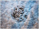
This is how it looked like this morning when it went home from work, in the southern suburbs of Stockholm.

2022-04-04-06-31-28.jpg 2022-04-04-06-32-43.jpg
2022-04-04-06-38-19.jpg
2022-04-04-06-36-18.jpg
 
Stockholm, Sweden
5 April 2022

2022-04-05-03-52-10.jpg

This morning

the city landscape definitely turned into a deep winter look. There were moments around 07.00, were I could barely see anything because of all the snowflakes (in that pesky wind). In some parts of Stockholm, 5 cm snow (2 inches) were measured. Where I live, in the southern outer suburbs, it was more like 2-3 cm.

Now, in the afternoon, it is both sunny, other times snowy - with temperatures barely reaching +2.5°C / 35.6°F. Of course some of the snow has melted, but not all. The sky is filled with many fuzzy looking Cu con (cumulus congestus) / low Cb (Cumulonimbus) clouds.


Snow depth charts

I made an illustration from snow depth charts which Sweden's weather service SMHI provides, collecting dates of late, measurable snow covers (in relation to Stockholm only), since spring 2010. As you can see, it is not uncommon with a snow cover in or near the city, during the beginning of April. It should be said, that the official measurements are only done at 0800 in the morning. Any snow cover outside of that time within the same day, will not get registered.


late_snowfall_Stockholm_Sweden.jpg


Snowfall in May in Stockholm

Snowfall is possible, but a measurable snow cover is extremely rare. From my personal observations i noticed that falling snowflakes have become more common during the 2010s (during the first ten days of May) - a phenomena which I didn't observe during the 80s, 90s or 00s. (Maybe once in may 1984, plus the sudden snowfall in May 1995)

But there is one exception: that of 12 May 1995 with a record breaking snow cover of 5-6 cm in the city. (I think wrote about this once, over a year ago) The same May 1995 however, ended with wonderful summer weather up to 28°C during the last days.

1995-05-12-002-6-cm-snö-Stockho.jpg 1995-05-12-004-5cm-snö-stockhol.jpg
1995-05-12-006-6cm-snö-stockhol.jpg

In satellite chart from 12 May 1995, it really doesn't look anything spectacular and appears to have been a rather local phenomena. A small low swirled over Stockholm, pulling down colder air from the north, creating this exceptionally late snowfall (which didn't last to the next day) If i remember correctly (?), two days later, even more snow fell just west and northwest of Stockholm

1995-05-12-0247-UTC-snöfall.jpg
 

Attachments

  • 2022-04-05-03-52-10.jpg
    2022-04-05-03-52-10.jpg
    311.5 KB · Views: 0
Here southwest of Cincinnati, OH., in these last 3 weeks it has rained a lot here, it is cold and rainy, only in the morning the sun came out a little bit and since then the whole day has been gray, I think that in these last weeks have been very few days with sun.

Also when there is snow forecast what we have are small ices as shown in this picture of March 25.
277320894_1113255732796836_7395384637847547155_n.jpeg276294903_2797806770517960_2121902062185463636_n.jpeg


now the temperature is 12 C, and at night drops to 5 C, even this coming Saturday is predicted snow again and drops to -1 C.
276030263_982709622632153_4035292173295009561_n.jpeg
 
The night before last at 4 am there was this tremendous boom that was attributed to thunder. It shook the whole house for several seconds and many others in the area reported the same thing. While I have heard loud thunder before in my life, this is the second time I have experienced this. The first time was only a few months ago, again at night when I was sleeping. Since I didn't see the lightening, I can't say for sure but this was out of the norm for me but I am reminded on this from the C's.

Q: (Pierre) I have a question about charges and discharges. The Malta Ruts suggest material removal. Were they caused by upward electric discharges?

A: Downward. Conducted.
 
Stockholm, Sweden
9 April 2022


"Record sunny March..."

I looked into the final sunshine hours charts published from the Swedish Weather Service SMHI for March 2022, and noticed that many new all time high records have been registered across the country - even Stockholm made it (which during the final days of march was unsure). So, in other words, never has a march month been so sunny like in 2022.

One of the beautiful perks of a new computer (after 13 years) is that I can crunch numbers and create charts so fluidly like I never experienced before :lol: which of course makes it a lot more fun. In the second chart below, you can read that many stations across Middle and South Sweden got record amounts of sunshine hours which I highlighted in yellow. That's a whopping daily 8.7 hours in Ø for Stockholm !

And it was indeed incredible... (My indoor plants have gone from poor to very wild) 💕

Sunshine 2022.png

Sunshine records March 2022 in Sweden.png


"... but a hesitant April"

Now April has quickly turned into a very different story (so far) - especially in terms of much lower temperatures and constant snow showers. Sometimes he have a snow cover, then it melts away, only to return anew. This has been going on basically every day... Out with Tekki last evening in the snow shower. Then in the morning when I came back from work, the playground at the school nearby this morning looked all bluish white. As of this evening... well, the snow is gone again, but the temperatures are low, only 1°C / 33.8°F

The overall snow cover over Sweden has increased during the past days, especially over north and middle Sweden.

2022-04-08-21-14-54.jpg 2022-04-09-05-36-42.jpg

2022-04-09 snowdepths Sweden.png


Stockholm, Sweden
beginning of April 1942

Winter 1941/42 was among the absolute coldest winters people had known up here - it was simply bizarre cold. I will write more about this another time because it that winter is a very interesting event (SMHI even published an old weather map of Europe (25 Jan 1942), which showed mind boggling cold temperatures; like -6°C in Istanbul, -7° in Milano, -20°C in Odessa, -18°C in Berlin, and -28°C / -18.4°F in Stockholm with heavy snowfall and storm gusts !).

So, in the beginning of April 1942, as Easter fell into the same time frame, another short period of very cold weather took place over Sweden, registering the coldest April temperatures - which are still valid. We are talking about numbers down to -25.5°C / -13.9°F in Flathult in SE Sweden, while -31.0°C / -23.8°F in Noppikoski and Grundforsen i Dalarna.

Within the Stockholm area, the temperatures plummeted down to -11°C, while -13° in Uppsala, just north of the city back in April 1942. When I compare this to the minimum temperatures we have now, they only go down to -5.6°C in the City of Stockholm. However, if we look to the outer suburbs like the "ice hole" Tullinge, it looks quite different: -13°C / 8.6°F during the first days in April 2022.

One of the things that irritates at times, when comparing temperatures, is that the cities are so much warmer now compared to the much less affected outer suburbs. Suddenly, it shows that Tullinge has been colder in April 2022, compared to how cold it was in the city of Stockholm back during Easter 1942.

So, my question of course is; when the public world leans conveniently to the temperatures measured in (warming) inner cities... do we really see the tendencies of colder weather approaching ?


Sthlm minima 1942 vs 2022.png
 
Not everything is about weather charts and numbers...
South Stockholm images • from 5 April 2022

There is, of course, also a world that can be told in images - instead of numbers and charts. Divided like a Pisces can be - with one head into the soil, the other one into the sky, I am drawn to both worlds. Sometimes I get stuck in one of them, forgetting that other worlds (and ways) actually exist.
Here i thought, that I simply show you a couple impressions I made during the morning of 5 April 2022 in southern Stockholm on my way home from work, where I often pass by a school just 300 meters away. The kids tend to leave behind all sorts of things.

2022-04-10-05-35-54.jpg 2022-04-10-05-36-31.jpg
2022-04-10-05-37-14.jpg
2022-04-10-05-37-47.jpg

The beginning of April in our apartment marks a time in which the sun for the first time of the season shines straight into our kitchen, all the way into the hall and bathroom (even drawing interesting light-figures along the entrance door) Beginning of April is, regardless outdoor conditions - a sure springtime sign, telling a story that now matter what - we are going towards lighter times. A time which will culminate into almost having eliminated the dark nights; as it never gets totally dark in Stockholm during the month of June. Like an eternal blue hour lasting for many hours. A time in which winter seems to be so distant, almost non existent...

2022-04-10-05-54-00.jpg
5 April 2022 - Sunrise at 05.54
 
Hungary, ~90 miles West of the Ukrainian border.

Local drought continues.
National Meteorological Service says here that the country-wide drought was stopped on April 1, because 10-30mm rains fell on average in Hungary in 24 hours from 8am Thursday to 8am Friday. They are announcing that the Mediterranean tropical-like cyclone arrived..

Uhum.. so this 12 day local weather forecast below says that for almost the next two weeks my area will have essentially a drought, since rains this little will barely wet the soil surface, before it all evaporates. It simply doesn't penetrate deep enough to reach tree & wine roots.

I should have posted such charts here from the beginning.
Since during those measly 1-2mm rainfalls the skies will be somewhat overcast - => rain-friendly - but my area is known for only window-shopping rain-clouds, since they usually don't release their rain-burden, only sail away..
I marked with blue, the days I'll attempt to make rain. A little demonstration. :)
Last time I boosted the weather, it reached the rain amounts in bold numbers above, which the weather service declares cessation of drought. Okay.
Now we'll see. :)
Rain-boosting_Apr-15__Apr-22.jpg
 
Last edited:
It could be almost a month since I can remember seeing at least full sunny days during the week where I'm located (southwest Cincinnati, OH.)
This last days has been mild cold and intense wind, although the temperature can be between 12 C or 15 C, the wind feels at least as if it were less than 10 degrees Celsius.
This pic is close to the sunsets around 6pm.
277815704_1405341479903264_279208845200510474_n.jpeg
 
Hungary, ~90 miles West of the Ukrainian border.

The 1mm rain the weather-service accurately forecast for Friday fell on time in the morning. It was a very light drizzle. By afternoon it already dried up: I could step on the grassy yard and the soles of my shoes were completely dry on the cracked ground.

Then on Friday afternoon, I stepped onto the center of the yard, farthest from the two house-roofs on my either side - to give space and no to impede free energy flow (If I stand too close to a roof, the downward flowing energy from the sky gets blocked). Then I simply breathed in - atmospheric ionic charge on two separate occasions, about 4-5 times each, without visualizing anything weather-related, - as this is a new type of experiment, different from last years. I was not building any mental-image about any rain in my head.
This was a good test to see: where-ever the atmospheric energy flows / goes ==> downward in this case, like a waterfall or a river - there follows attracted as (if swept by a river) the rain.

As you see the local drought got corrected, as I promised: medium intense rain fell for hours Saturday morning. Weather service had to modify their chart.
As you can see on the left original screenshot: They forecast zero rain for Saturday.

On this new attached picture, I included their updated chart / screenshot on the right side of the pic: As I reported here at least a dozen times, such weather-corrections (with water movement) usually take effect in ~12 hours at the speed of Nature. The artificially 'downward-pulled' rain was on time: began on Saturday about at dawn and fell steadily with medium intensity lashing down until about same day morning 10am.
Rain-boosting_on_Apr-15--and_result_on Apr-16.jpg


This concludes rain-making demonstration N#1. Maybe they measured their 4mm closer to city limits, because at our house, definitely more rain fell: The ground is thoroughly soaked - my estimation is ~8-10mm fell. The black earth turned to mud and there were narrow-long puddles at both sides of the street. The frequently speeding cars tires audibly were splashing and dispersing the water. The lukewarm ~30km wind is still working on drying up all the water.

Since - as I already stated here multiple times - a weather system has a definite / limited amount of water[vapour] and since we had plenty of rain and don't need more, I'll wait until nature soaked everything up, the plants drink everything.

Already you can see vigorous growth, especially freshly cut grass grows and all trees are budding.. I'll only repeat the experiment when a drought condition sets in again.
Respecting the balance of Nature. The Delphi Oracle said: "Nothing in excess!"
So I definitely don't want to drain natures atmospheric water-reserves to possibly cause serious drought later. In 5 to 7 days. we'll see. As shown on the pic, they are forecasting very minimal, insufficient rain for the next ~12 days..
 
Last edited:
Once again... full sunshine and spring
Stockholm, Sweden - 17 April 2022

2022-04-17-13-51-37.jpg

2022-04-17-13-50-43.jpg

Stepping outside is like ... "wuuoaah" springtime beautiful.

being very playful to the soul. Temperatures approach 15°C (59°F) today in Stockholm and Uppsala, just to the north of the city. It is sunny, and with a few funny clouds gracing the sky. It appears that this trend continues with up to 17°C (62.6°F) tomorrow, but later settles at lower levels around 10-12°C (50-54°F) - but with daily sunshine (and no rain). Given that the month of march was extremly dry in the south, close to 0 mm south of Stockholm, this will likely put more pressure onto the groundwater situation in Southern Sweden. Where I live with plenty of trees, you can hear the birds aplenty, day and night.

It's really enchanting to step outside, realizing that yes, really, it is springtime again.
 
More photos from the lovely springtime in Stockholm

Since your friend and my husband, we all went out together with Tekki on a very long walk in the near by nature area - I was able to make other photos than just form my balcony - showing you the impression of pre-spring time in Southern Sweden this time of the year.

2022-04-17-17-05-49.jpg

2022-04-17-17-36-23.jpg

2022-04-17-18-10-43.jpg

2022-04-17-17-14-18.jpg
Lots of jokes and laughter together with our friend from Sicily, in Stockholm

2022-04-17-17-09-51.jpg
 
Stockholm & Uppsala 19°C (66°F)
18 April 2022

Beautiful spring time temperatures now culminating in the Stockholm/Uppsala region today - being the highest in the country, as well the highest in Sweden so far this season 2022.

Stockholm's Inner City brought it to 18.5°C (65.3°F) and Uppsala a notch higher, to 19.2°C (66.6°F). However, once you go to the Archipelago just east of the city, where ice cold waters affect the air, you find temperatures of only 6-8°C (43-46°F).

The normal MAX temperature for Stockholm City for this time of the year is only +9.7°C (49°F), while the normal MIN +1.6°C (35°F)

As I went home from neighbouring Högdalen in the south this morning, where the subway depot resides within a valley - the temperatures hovered around freezing (close to) 0°C. Luckily I still wear a thick winter jacket

_-2022-04-18-at-16.16.14.jpg _-2022-04-18-at-16.15.52.jpg
 
The weather here in Alaska is nice and sunny. The high temps around 55-60°F. The trees are budding, so there's a hint of green, but no leaves yet.

Overall, it has been spring-like, but on overcast days it feels cold still.

I washed the mud off my bike, and hung my clothes line - doing outdoor spring stuff. I'm looking forward to the street cleaners to sweep the road-sand off the roads - until then it will be a little dusty.

The trend has been sunny in the early hours, and hazy in the late afternoon. It makes me wonder how much snow is 'in transit' and how much melts and sinks into the ground - the suns radiance evaporating the snow and transporting it to places with longer night cycles. Currently, the hours of daylight is 15:30 hours. At solstice, it reaches 19:21 hours.
 
Back
Top Bottom