What's the weather where you are?

SC Alaska - The blizzard that was forecast did come, but I expected it to be further north. Well, it knocked power out for 8 hours here. It warmed up about 10-15°F though, so that was nice.

A large spruce in the yard lost its top, and a little bit of snow drifted in the doorway.
Seeing the trees move in the wind was odd, as the trees were stiff from the cold, and so they didn't really sway and bend like you'd expect - looking funny. That's probably why there were so many outages - trees just snapped.

Today, the temperature dropped back down to almost 0°F, going back to a cold trend.
 
Temps have been mostly hovering between 3°C / 37.4°F and 10°C / 50°F in Hungary, ~90 miles west of the Ukrainian border. Amazingly warm and exercise-friendly winter this means in our unique "weather-box", the Carpathian Basin!

We haven't seen snow for this winter yet. One time only, around ~02:00AM I stepped out for 60 seconds and it snowed, sprinkling the top of the green grass with white, but by the morning it was gone, melted away..

Low heating bills and no pipe breaks from extreme cold!

Temps any lower than 3°C / 37.4°F would ice over the roads making cycling impossible / highly dangerous.. On top of cycling I'm doing athletic training [+fasted sprinting] outside just like in the summer! Always picking highest temperature + low wind days. This is more exercise I've ever done in my life, especially in winter. (51+yrs old)

So far this allows me to bicycle 20kms in the countryside, in the cold wind, for Artesian-water [high quality and super-tasty drinking water from a ~150~300+ meter deep well], at least 2x per week:
Building up cold-tolerance (almost Wim Hof style) by rapidly breathing in concentrated O2 from cold country air - for 70 minutes -, while doing semi-intense 'cycling muscle work'. Moving through and taking in high-energy life-force currents via [I think] super-clean air country winds: I swear Gurdjieff was right, when he wrote how after he was shot he was healed by country air and that cold mountain spring both conducting high-energy life force currents.

You simply take into your body high-life force energies in a concentrated form - for an extended period - and you get healthy! Life energy in form of highly-concentrated O2 + [I think contained] in the wind, life-force energy currents flowing through the green countryside - with elks running around on rich soil meaning beautiful crop fields -, and as an unsurprising result ==> your body-energy level goes go way up! High Energy Level means supreme Health, sicknesses can't touch you: I feel like a juggernaut!

If our 'city-mis-management'[sic] didn't turn off all four our Artesian wells in the winter, I would NOT be able to experience this amazing wonder of building cold-tolerance and getting highly energized by doing muscle-work while breathing in concentrated O2 in the countryside. Gurdjieff was right!
 
Last edited:
morgenrot.jpeg

In Lower Austria and Styria we have a mild winter BUT: We have a lot of red sunsets and even morning reds, nearly every day. This is definitely unusual and it worries me a bit because I dont know the reason. As far as I remember this does not mean anything good. Tried to find out some parallels in history but did not succeed until now.
 
View attachment 69377

In Lower Austria and Styria we have a mild winter BUT: We have a lot of red sunsets and even morning reds, nearly every day. This is definitely unusual and it worries me a bit because I dont know the reason. As far as I remember this does not mean anything good. Tried to find out some parallels in history but did not succeed until now.

One clue can be found in paintings made during the 19th century and at the very beginning of the 20th century where skies are more than usual depicted orange, pink and red, surely because these painters painted what they saw at the time of increase of dust in the atmosphere—think of big volcanic eruptions as the eruption of the Tambora in 1815 and that of the Krakatoa‎ in 1883, or the profusion of brilliant comets visiting Earth during this century:

No fewer than eight Great Comets graced nineteenth-century skies, six of these appearing within the space of just 40 years, , bestowing upon many an astronomer an enviable set of indelible memories.

1716875-principal-comets-19th-century.jpg


One painting very well known, but they are plenty of them—see below for more examples, is The Scream by Edvard Munch, 1893:

Edvard-Munch-The-Scream.jpg


There is also the Turner's paintings, as The Scarlet Sunset, 1830-40:

William-Turner-The-Scarlet-Sunset-1830-40.jpg


Or Henry Duhem with its Red Sky, 1905:

IMG_9979-1024x683.jpg


And the last one, with Claude Monet, San Giorgio Maggiore at Dusk, 1908-1912:

Claude_Monet,_Saint-Georges_majeur_au_crépuscule.jpg
 
One clue can be found in paintings made during the 19th century and at the very beginning of the 20th century where skies are more than usual depicted orange, pink and red, surely because these painters painted what they saw at the time of increase of dust in the atmosphere—think of big volcanic eruptions as the eruption of the Tambora in 1815 and that of the Krakatoa‎ in 1883, or the profusion of brilliant comets visiting Earth during this century:


1716875-principal-comets-19th-century.jpg


One painting very well known, but they are plenty of them—see below for more examples, is The Scream by Edvard Munch, 1893:

Edvard-Munch-The-Scream.jpg


There is also the Turner's paintings, as The Scarlet Sunset, 1830-40:

View attachment 69541


Or Henry Duhem with its Red Sky, 1905:

IMG_9979-1024x683.jpg


And the last one, with Claude Monet, San Giorgio Maggiore at Dusk, 1908-1912:

View attachment 69543
Thank you! I thought it might be because of many comets we have around at the time, too.
 
Wondering why we have windy weather in a corner of Western Europe, I looked at Venstusky.com

Over Baffin Island, (Canada)/west of Greenland, south of Greenland, west of the Iberian Peninsula, (Portugal and Spain) there are high pressure systems. They spin anti-clockwise. Over much of western and Norther Europe, there is a low pressure area, greenish and blue area. In fact there appears to be several smaller low pressure system within this area, near the South of Ireland, over the Netherlands,
west of southern Norway and west of Northern Norway. These spin clockwise.
1673894876312.png
If I zoom in, it looks like this:
1673895875763.png
It appears as if the anti-cyclones and cyclones act to push or draw the wind in the same direction. Shifting the lay of the map from pressure to wind speed, one gets:
1673896096391.png
The above image is at an altitude of 10 meters. Higher up, it can be more. 500 meters up it looks like this:
1673896351876.png
Since some areas near the coast have cliffs and mountains that rise from sea level to a few hundred meters, it may not surprise that the winds that hit the high cliffs are often felt stronger than at sea level.

The above map of high winds near Spain, are reflected in this image from Meteoalarm.eu, that shows the northwest of Spain. Although it is not easy to read the signatures, if there are more than one warning, which is the case in this situation, at least some are due to high winds.
1673896965497.png
Here is a larger area, that includes the above:
1673897070558.png
Tomorrow it should be another windy day, according to the forecasts and weather warnings.
 

Attachments

  • 1673895792868.png
    1673895792868.png
    1.9 MB · Views: 1
Corrections:
Over Baffin Island, (Canada)/west of Greenland, south of Greenland, west of the Iberian Peninsula, (Portugal and Spain) there are high pressure systems. They spin anti-clockwise.
Correction 1: Highs spin clockwise in the Northern Hemisphere, anti-clockwise is in the Southern Hemisphere.
In fact there appears to be several smaller low pressure system within this area, near the South of Ireland, over the Netherlands,
west of southern Norway and west of Northern Norway. These spin clockwise.
Correction 2. Lows spin clockwise in the Northern Hemisphere and anti-clockwise in the Southern Hemisphere.

Meteoalarm.eu is okay, but the local weather services better
Also, I looked at meteoalarm.eu again and found that there in some districts are two warnings with the same time and signature. Then I followed a link to the national weather service and found that there rather than two identical are two different warnings, one for wind and one for high water levels in the rivers. In other words, besides meteoalarm.eu, it can be an idea to check the local weather service to find out what they have forecasted.

Snow cover in the Northern Hemisphere appears to be low
If the data is reliable, there is comparatively little snow in many areas, including Ukraine. Since there in Ukraine is also an absence of significant frost, this affects what military action can be undertaken with heavy equipment.
1673942288580.png
 
Well, it's pretty low here right now in SW France. 992 on the barometer. And it was hailing about 25 minutes ago so that there are patches of hail all over the yard. It's spitting hail off and on. Also, 5 C outside. Nasty day for sure!
 
Well, it's pretty low here right now in SW France. 992 on the barometer. And it was hailing about 25 minutes ago so that there are patches of hail all over the yard. It's spitting hail off and on. Also, 5 C outside. Nasty day for sure!
Woah you live in France? I've definitely missed something or forgot. Can someone remind/tell me why?
 
The UK weather this winter has been swinging between quite mild and absolutely freezing cold. There has been no snow where I am, but a low of - 9°C was recorded near here last night. It is only January, so I think talk of a mild winter overall (usually when referring to energy prices) is premature.
 
Viewing the weather around the world through cameras
Ventusky.com has connection to cameras around the world, though some are not much connected while others are much more. To activate the feature, click the camera icon in the lower right side.
1674583388653.png

As a test, I clicked a few places and took some screenshots.
The first is from the Canary Island in the Atlantic.
1674583485509.png
The next shows a sunset in Cape Town. The temperature was 18 degrees.
1674583568722.png

Mauna Kea is in the Pacific, so this should be in the morning.
1674583989798.png
On the New Zealand outpost, Raoul Island, it is morning, January 25.
1674584387676.pngThe cameras are also on at night, but there is less to see. Some cameras seem not to be working.
 
Stockholm, Sweden
24 Jan 2023

like Ben wrote about the UK weather, the same goes here in Sweden: swinging between cold and mild. Albeit it's been more on the mild side than not. The last really cold period was a week before Christmas culminating around 16 Dec 2022, where we got bizarre cold weather, down to -25°C (-13°F) at the most (Norrtälje) which was far outside the city. Down to -22°C (-7.6°F) only 7 km from my place, and -14°C (6.8°F) where I live, which also was reached in the center of Stockholm. Since then, it's been mainly mild, with short breaks of cold weather, occasionally even some snow. Yet, after a couple days - it's all gone again.

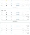
The below graph shows MIN/MAX in Stockholm City so far during January 2023.

Stockholm Jan 2023.png


And here, you see the temperature curves divided into MIN & MAX for Stockholm for September to December 2022. The thinner blue line represents station Tullinge, a former military airfield in the outer southern suburbs, around 7 km from my place - which by the way is known to be a "ice/col hole". The Tullinge MIN temperature shows, in my opinion, what the minimum temperatures would be like - without the urban influence: Much colder ! Not so much "climate warming"-like in reality.

Stockholm Autumn Winter 2022.png

☀️ Oh man, that lack of sunshine...

The lack of sunshine has been prominent during Dec 22 into Jan 23. Not as bizarre poor like during winter 2020-21, but clearly still too little sunshine. Here you see in graphs the past 3 winters starting with 2022-23 going backwards. etc in order to illustrate how little the sun was shining over Stockholm.

Sth-Daily-Average-sunshine-Dec-2022---19-Jan-2023.png

Sth-Daily-Average-sunshine-Dec-2021---Jan-2022.png

Sth-Daily-Average-sunshine-Dec-2020---Jan-2021.png


The other evening (22 Jan 2023)

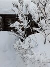
While i have been ill since last week coughing my guts out - I have not left the house at all. My husband Sal however, coming home from work, took some really interesting photos the other evening, which made my jaw drop.

Albeit the temperature was only around -3°C (26.6°F), every tree branch, had unusual long needles. It baffled me to see the effect this strong after only a brief time (it happened over night, so the accumulation of the spikes happened very fast). Normally you would see this after several nights of very cold temperatures combined with fog. The only time I have seen very long spikes, was in the Extreme North of Sweden, which isn't really surprising. But never like this so fast long-spikey.

Next day it was all gone, and the temperature had reached +1°C (33.8°F). Then it dropped again to -6°C (21.2°F) only to reach mild levels again, currently +3.5°C (38.3°F) while writing.


2023-01-22 21-00-00.jpg

2023-01-22 21-01-04.jpg

2023-01-22-21-00-20.jpg
 
SC Alaska - The weather here is hovering at about freezing (32°F), which is above normal. It's been warm since Tue. or Wed. when the temp. reach 42°F, and stayed warm since.

Very little snow accumulation since early/mid Dec. - about a inch or two.

Today is overcast, yesterday was mostly sunny, which made it feel spring like. Usually in midwinter, sunny means cold, but it was sunny and warm, making me think of spring.
 
Stockholm, Sweden
31 January 2023

2023-01-31-14-13-38.jpg

It is a sunny day (!) here in Stockholm

At my balcony the temperature shows +2.0°C. / 35.6°F - which is a very respectable value for this time of the year (milder than normal) - and I like it. Snow has been very scarce. Sometimes we had strong rainfalls. The sound of heavy rain creates an interesting, yet strange contrast this deep in January; because you normally only hear that in spring, summer and autumn.

Now that January 2023 has come to an end, it concludes as a milder than average month. Is it unusual ? No, not really: It always goes like this: when the highway of cyclones constantly passes over Scandinavia - that is what you get: Lots of clouds, poor sunshine hours, and mild temperatures.

Dominating mild weather during January in Stockholm can be found even way back in history; year 1756 and onwards. Not all winter months have been cold !


temperatures-Stockholm-Jan-2023.png

☀️ Oh man, that lack of sunshine...

Sth-Daily-Average-sunshine-Dec-2022---19-Jan-2023.png

I need to make a correction

In my previous entry about Stockholm's sunshine hours, for Dec 2022 to the left, I wrote "34.6 hours" - but that was wrong. The correct value was a mere 22 ½ sunshine hours. See below the correction.

And while I am at it - as you can see - the sun has been smiling a little more often in the end of January. Which is inspiring for both soul and body. 🤗

sunshine-Jan-2023.png
 
Back
Top Bottom