You are using an out of date browser. It may not display this or other websites correctly.
You should upgrade or use an alternative browser.
You should upgrade or use an alternative browser.
Crazy Storm Weather and Lightning - Global
- Thread starter mabar
- Start date
angelburst29
The Living Force
A massive anvil cumulo-nimbus thunderstorm cloud over Siberia left residents wondering if somebody dropped a nuclear bomb.
Creepy Mushroom Cloud Over Russian Town Scares the Hell Out of Residents (VIDEO)
http://sputniknews.com/russia/20160829/1044726040/russia-siberia-mushroom-cloud-thunderstom.html
https://www.youtube.com/watch?v=OnmIiAA4RXU
https://www.youtube.com/watch?v=L7u6ePMLe2g
Residents of Kemerovo in Russia’s Western Siberia began posting images on Sunday of what looked like the distinctive hallmark of a nuclear explosion – an isolated ominous mushroom cloud surrounded by otherwise undisturbed blue skies.
The shocking and rare sight of such a massive anvil cumulo-nimbus cloud, formed when a major thunderstorm becomes so powerful that it begins to reach the highest levels of the atmosphere causing the cloud tops to be blown to the side by wind shear, startled many local residents who feared a nuclear blast or an explosion at one of the coal mines in the Kuzbass region.
Other residents however joked about the fearsome sight of the mushroom cloud with one Instagram user, @Kemerovo_insta, joking that there was "a nuclear war today in Chusovitino."
Another user had a completely different interpretation of the extreme weather spectacle suggesting that, "A mushroom cloud has grown today so this is probably a hint that ‘mushroom season’ is in full swing. It’s time to pick mushrooms. So beautiful!"
Local emergency services report receiving a high volume of calls by petrified town residents fearing that the end of days was upon them forcing officials to assure locals that the massive thunderstorm cloud was merely a weather related incident.
Sat24 lightning video impression for Monday, September 12, 2016
360 STORM CHASE video: Ontario supercell with lightning strike, September 10, 2016
https://youtu.be/TKTL2wLndXA
Family loses home in lightning strike (Video)
http://www.wusa9.com/news/local/wednesdays-storm-causes-damage-in-montgomery-co/315381509
9:22 AM. EST September 08, 2016
BETHESDA, MD (WUSA9) -
Lightning Strikes 09-11-16
https://www.youtube.com/watch?v=aN_VmKT6CY4
360 STORM CHASE video: Ontario supercell with lightning strike, September 10, 2016
https://youtu.be/TKTL2wLndXA
360 STORM CHASE VIDEO: Transient supercell structure with inflow tail (look in the rear view) along Lake Erie shoreline in southern Ontario today using @360fly cam.
*Be sure to check out the lightning strike at 2:27 in the 360 video!
Family loses home in lightning strike (Video)
http://www.wusa9.com/news/local/wednesdays-storm-causes-damage-in-montgomery-co/315381509
9:22 AM. EST September 08, 2016
BETHESDA, MD (WUSA9) -
The worst of the damage from the storm seems to be centered in Montgomery County.
That includes a house struck by lightning and destroyed by flames in Gaithersburg, Md.
Fortunately only one of the people who lives here was home when this house was hit by lightning around 6 p.m. and she got out OK.
The house is likely a total loss, the most dramatic impact seen from Wednesday’s storm.
Lightning carved a scar in this tree in Bethesda as the storm passed through Montgomery county, the same strike knocking down power lines that sizzled in the street.
In Potomac, a much larger tree fared no better in the wind, blocking Boswell street until the chainsaws could remove it.
But the worst of the storm’s damage came from a single lightning strike on the roof of a home in Gaithersburg.
Firefighters arrived quickly, but the flames on the roof moved faster.
Neighbors described a dramatic scene: flames shooting from the roof even as heavy rain pounded down.
One woman inside made it safely to a neighbor’s house. Her home, now a charred shell.
Montgomery County sent about 75 firefighters here to get these flames out tonight under challenging conditions.
No firefighters were hurt in the effort, either.
Lightning Strikes 09-11-16
https://www.youtube.com/watch?v=aN_VmKT6CY4
Very active weather this afternoon after a prolonged quiet period after Tropical Storm Hermine a little over a week ago. The heaviest rains managed to dump all around, and again, only leaving the area with just a little light rain.
Chad
The Living Force
After apparently some of the hottest weather in September for 50 years in some parts of Britain, yesterday evening saw areas all over the country experience lightning storms, power cuts and flooding; also experienced over many areas of Europe, particularly Spain and France saw worse conditions (as noted by c.a above). As is often the case in the UK, this isn't apocalyptic weather as is seen in other areas of the world, but lightning does appear to be effecting life more often, i don't ever remember a power cut due to a storm, and i was a resident in the country for ~ 20+ years. Detailed below is the south west, Midlands and north west of the country as the storm travelled over the island:
http://hisz.rsoe.hu/alertmap/database/?pageid=event_desc&edis_id=ST-20160914-55023-GBR said:Extreme Weather in United Kingdom on September 14 2016 09:35 AM (UTC).
Thousands of homes were left without power and roads were flooded during last night's (13th Sept) thunderstorm. In Colne, Nelson and Burnley - around 20,000 houses were affected by the blackout and Electricity North West restored power by 1am this morning (14th Sept). Over in Earby, the heavy downpour left 4 feet of water on the roads and police have closed them off while they work with the community to make the area safe again. This evening we have received reports of flooding in various places in the North West. Earby was about 4ft deep and we had to close the road. Upon arrival we noticed people walking through the flooded water in the middle of the road.
Cornwall storm: Flash floods, power cuts and torrential rain as huge thunderstorms hit

Western Power Distribution map showing power cuts live at 8.30pm

Weather watch: Lightning strikes the Midlands
Emergency response teams were called out to three different addresses in the West Midlands to support families affected by the lightning.
UK weather: Summer's over as thunder, lightning storms and torrential rain hit Britain after record-breaking temperatures
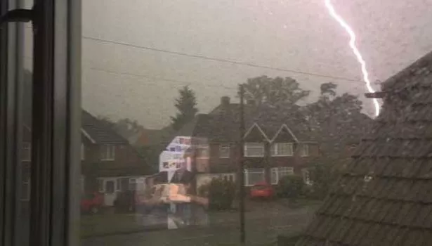
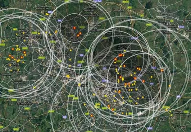
Lightning
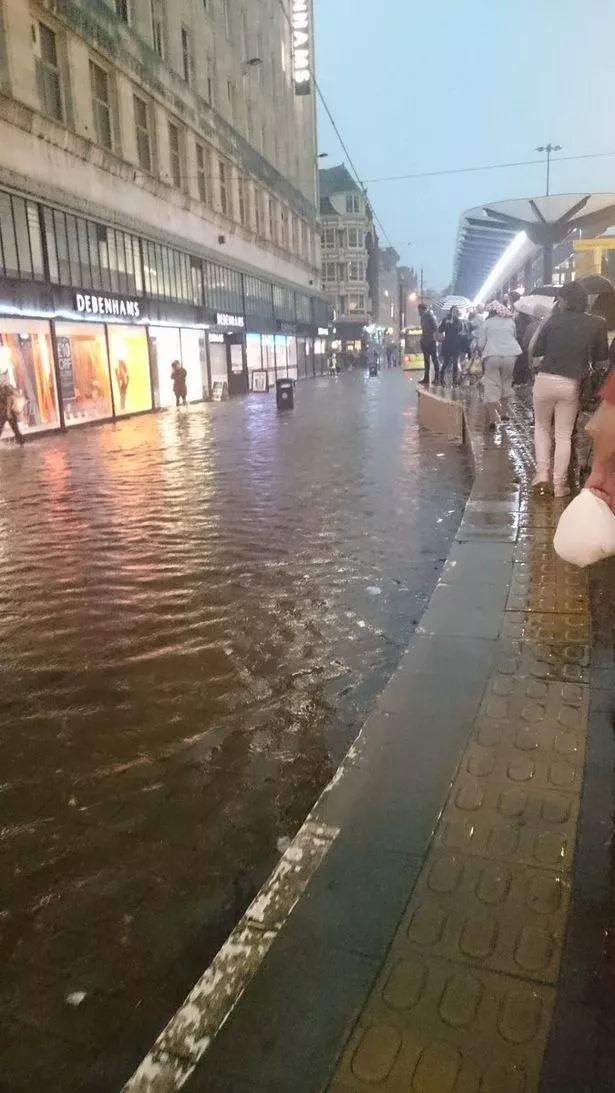
At around 7.15pm, the Met Office warned that half a month's rainfall was likely to fall in Manchester over the next hour
Storms cause power outages and transport problems across Bolton and Bury
"The strikes, which hit locations across the network, affected power to critical signalling systems as well as the overhead lines used to power trams and the Altrincham and Bury lines were both suspended for the evening. In Bolton town centre, Bolton Council lost power to the town hall and other council buildings and the outage also affected some of the council's phone lines, though all communications have since been restored.
VIDEO: Big Island Lightning Captured On CFHT Cloudcam Sept.-15-16
http://cfht.hawaii.edu/en/gallery/cloudcams/index.php?opts=movies&moviefile=data/movies-annotated/Sep15-2016.mp4
HAWAII ISLAND (BIVN) - Big Island Video News
Sep 14, 2016
http://www.bigislandvideonews.com/2016/09/14/flash-flood-warning-for-hamakua-coast/
Locations in the warning include but are not limited to Honokaa, Honomu, Kukuihaele, Waimanu Valley, Waipio Valley, Ookala, Laupahoehoe and Pa'auilo.
HAWAII ISLAND (BIVN) - Landslides in Hamakua, lightning in Hilo, flooding in upper Puna, and hail in Volcano (Sep 15, 2016)
http://www.bigislandvideonews.com/2016/09/15/severe-weather-hits-east-hawaii/
September 2016 - Lightning Strike Causes Heavy Damage to Home in Plainfield, Indiana
https://www.youtube.com/watch?v=o9XNU3ctkYo
http://cfht.hawaii.edu/en/gallery/cloudcams/index.php?opts=movies&moviefile=data/movies-annotated/Sep15-2016.mp4
HAWAII ISLAND (BIVN) - Big Island Video News
Sep 14, 2016
http://www.bigislandvideonews.com/2016/09/14/flash-flood-warning-for-hamakua-coast/
Locations in the warning include but are not limited to Honokaa, Honomu, Kukuihaele, Waimanu Valley, Waipio Valley, Ookala, Laupahoehoe and Pa'auilo.
At 5:07 p.m. HST, radar indicated heavy rain and thunderstorms along the Hamakua Coast. Rain was falling at a rate of 3 to 4 inches per hour, forecasters reported.
HAWAII ISLAND (BIVN) - Landslides in Hamakua, lightning in Hilo, flooding in upper Puna, and hail in Volcano (Sep 15, 2016)
http://www.bigislandvideonews.com/2016/09/15/severe-weather-hits-east-hawaii/
Power outages were reported from Hilo to Papaikou, as well as upper Puna. Hawaii Electric Light reports power restoration repair efforts have begun for those areas with power outages.
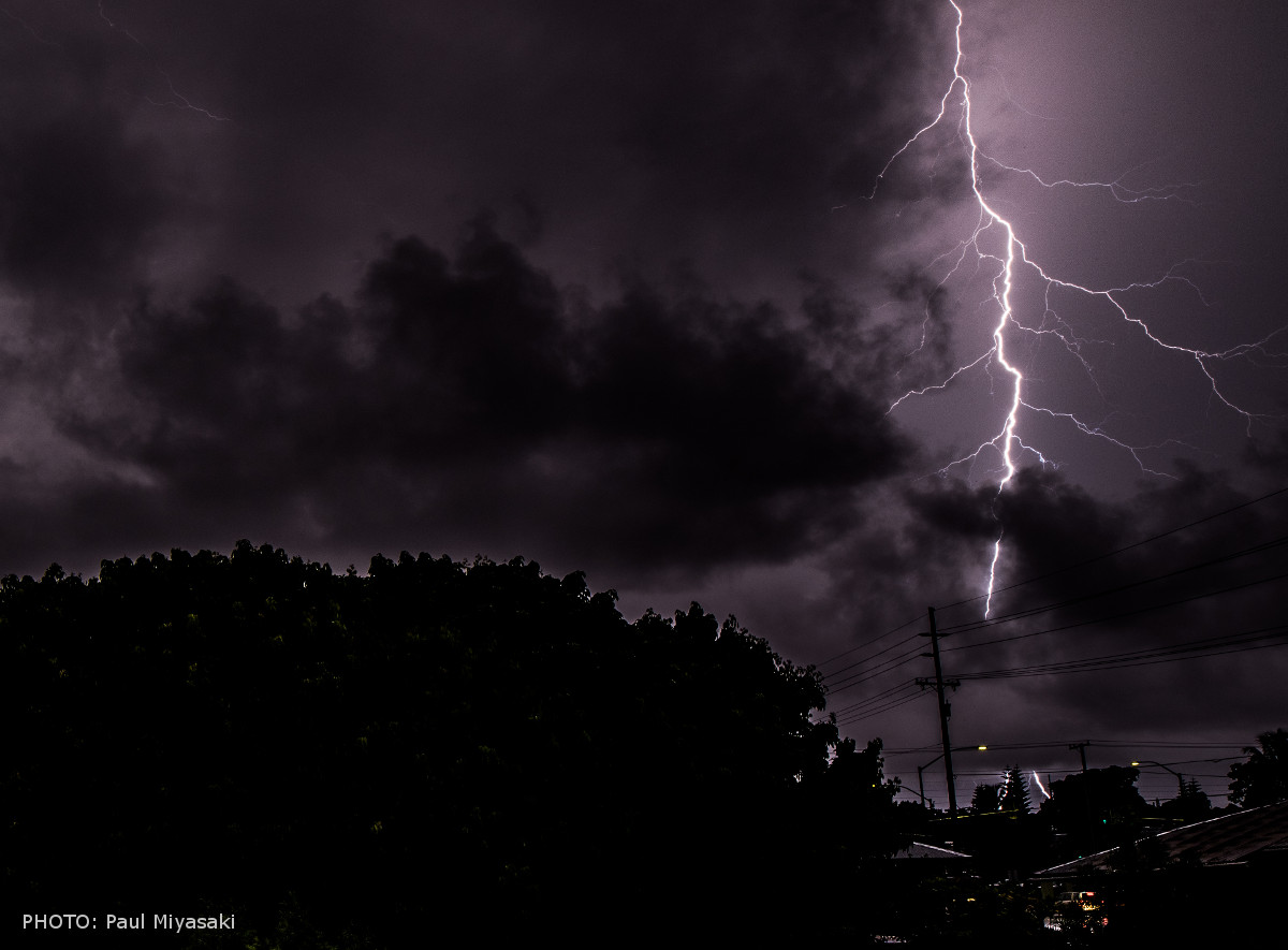
Shortly after 7 p.m., Maunakea Rangers announced the closure of the Mauna Kea Access Road at the Visitor Information Station at an elevation of 9,200 feet “due to the Maunakea Weather Center warnings for high humidity, fog, ice and below freezing temperatures for the summit this evening and near sunrise tomorrow.”
September 2016 - Lightning Strike Causes Heavy Damage to Home in Plainfield, Indiana
https://www.youtube.com/watch?v=o9XNU3ctkYo
Was looking for more info regarding a lighting at Mexico City a couple of days ago at FB Strange Sounds _https://www.facebook.com/weirdsounds/?hc_ref=PAGES_TIMELINE&fref=nf ---had not found much yet, athough (a report about Mexico being the first country in the world to have more deaths by lighting per year, from 2015 I guess numbers had change this year) ..._http://www.jornada.unam.mx/2015/11/23/politica/020n2pol ---spanish
Attachments
I didn't notice this thread when I posted this, but I had an unusual lightning experience recently. Reposting here so that it's in a more relevant category, if that's okay:
HowToBe said:An unusual happening from last week or so, here in Texas. This was after hearing a single faint rumble of thunder a few minutes earlier, a I had just taken my dad to his semi truck so he could leave for his work. I looked to the south, and in a relatively opaque section of the clouds, a ripple of purple lightning traveled from west to east. It was brief, but very clearly registered to me as purple. This was strange, so I waited to see what the thunder would sound like, but the thunder never came. I don't recall hearing any more thunder that evening.
The clouds did not seem very far away. Most of the sky was filled with semi-transparent clouds with patches of opaque ones. A few minutes earlier we had a brilliant sunset effect that lit the whole area up with a yellowish light. [...]
GOES-16 Lightning Imagery from Severe Storms April 28-29, 2017 US (720 HD)
GOES-16 IR Imagery of Severe Storms April 28-30, 2017 Animation (1080 HD) US
GOES-16's Geostationary Lightning Mapper (GLM) captured this electrifying imagery of the lightning associated with the recent severe weather over the Mississippi Valley and southern Plains this past weekend. (The animation begins at approximately noon on Friday, April 28, 2017, and ends at midnight on Saturday, April, 29.)
According to a variety of media reports, the storms caused the deaths of at least 13 people, produced widespread heavy rain resulting in flash floods, high winds that down trees and left thousands without power, a late-season blizzard in Kansas, and several tornadoes.
GLM observes total lightning, including in-cloud and cloud to ground lightning, and will continually observe lightning flashes day and night across the Western Hemisphere. Of particular note in this animation is the horizontal propagation of lightning flashes occurring behind the line of intense storms. Rapid increases of lightning are a signal that a storm is strengthening and could become more dangerous. GLM, in concert with other forecaster tools, will help provide more accurate and earlier warnings of developing severe storms and give communities more time to prepare for impending severe weather.
GOES-16 IR Imagery of Severe Storms April 28-30, 2017 Animation (1080 HD) US
GOES-16 captured this amazing infrared imagery of the strong storms that erupted over parts of the southern Plains and Mississippi Valley April 28-30, 2017. According to several media reports, the storms caused the deaths of at least 13 people, produced widespread heavy rain resulting in flash floods, high winds that down trees and left thousands without power, a late-season blizzard in Kansas, and tornadoes in Texas, Mississippi, and Kentucky.
This animation was created with Band 13, one of the new spectral bands offered by GOES-16's Advanced Baseline Imager. Band 13, the so-called "clean" longwave infrared band, is primarily used to monitor clouds and storm intensity. As shown here, the imagery produced by this band offers spectacular views of meteorological phenomena, such as the colder cloud tops (shown in green/yellow/red) associated with these storms, in rich detail.
Microburst, Hail, and Lightning in Stinnett, TX
Published on May 15, 2017
05-16-2017 Perrytown Tx.. Close Lightning Causes Fire, Shear Funnel, Hail Storm...
https://www.youtube.com/watch?v=-ok2FizYgDU
2,500 lightning strikes: Check out storm photos from across Seattle region (Video Pic's)
Updated May 6, 2017 at 12:21 am
_http://www.seattletimes.com/seattle-news/weather/2500-lightning-strikes-yesterday-check-out-photos-from-across-the-seattle-area/
Snippet:
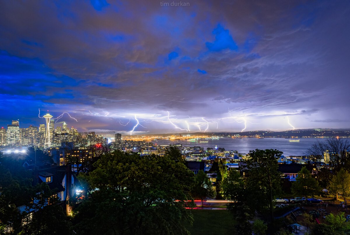
Tim Durkan @timdurkan May 5
From last night's epic storm here in Seattle - 8 layered photos taken over the course of just 20 minutes - electrifying!
Sat24 lightning video impression for Monday, May 15, 2017
Europe
https://www.youtube.com/watch?v=f6yqWlPqNWg
Published on May 15, 2017
Footage of strong "wet microburst", which is a powerful downdraft that descends quickly to earth and spreads out at rapid speeds causing high wind damage. Also footage of large crashing hail, dramatic lightning and rotating wall clouds near Stinnett, TX.
All footage shot during evening daylight and darkness on May 15, 2017 near Stinnett, TX by Meteorologists Juston Drake and Simon Brewer
Shot Description
05-16-2017 Perrytown Tx.. Close Lightning Causes Fire, Shear Funnel, Hail Storm...
https://www.youtube.com/watch?v=-ok2FizYgDU
2,500 lightning strikes: Check out storm photos from across Seattle region (Video Pic's)
Updated May 6, 2017 at 12:21 am
_http://www.seattletimes.com/seattle-news/weather/2500-lightning-strikes-yesterday-check-out-photos-from-across-the-seattle-area/
Snippet:
It’s not often Seattle gets the warm and humid weather necessary for a thunderstorm.
But yesterday, an electrical storm boomed and crackled through the region — and it was quite the sight, according to the National Weather Service, as about 2,500 lightning strikes hit the ground from Lewis County to the Canadian border.
Not only did we get a light show but we saw another wet-weather record broken.

Tim Durkan @timdurkan May 5
From last night's epic storm here in Seattle - 8 layered photos taken over the course of just 20 minutes - electrifying!
Sat24 lightning video impression for Monday, May 15, 2017
Europe
https://www.youtube.com/watch?v=f6yqWlPqNWg
Death by lightning: Govt doing little to prevent rising toll 17 May 2017
Lightning strikes have killed 62 people across Bangladesh so far in 2017
Bangladesh has seen an alarming rise in deaths caused by lightning strikes in recent years, yet the government has failed to devise an effective plan to help reduce the risk.
The government declared lightning a major disaster after 217 people were killed by strikes in 2016 alone. So far this year, the Ministry of Disaster Management and Relief says 62 people have reportedly died, bringing to 1,174 the number of people killed by lightning since 2011.
...

Source: _http://www.dhakatribune.com/bangladesh/2017/05/17/govt-prevent-death-lightning/
Lightning strikes have killed 62 people across Bangladesh so far in 2017
Bangladesh has seen an alarming rise in deaths caused by lightning strikes in recent years, yet the government has failed to devise an effective plan to help reduce the risk.
The government declared lightning a major disaster after 217 people were killed by strikes in 2016 alone. So far this year, the Ministry of Disaster Management and Relief says 62 people have reportedly died, bringing to 1,174 the number of people killed by lightning since 2011.
...

Source: _http://www.dhakatribune.com/bangladesh/2017/05/17/govt-prevent-death-lightning/
ThunderboltsProject
In this episode, Thunderbolts colleague Andrew Hall explores the evidence that lightning is the product of the electromagnetic circuitry connecting the earth and the Sun. On planet Earth, the most obvious and dramatic display of electricity in nature is lightning. But what causes lightning? Although there currently is a consensus opinion about the processes that produce lightning in clouds on Earth, most scientists freely admit that many mysteries remain. On this series, we have discussed several discoveries that add to the mysteries, including the finding that solar storms cause increased lightning on Earth, and the ongoing puzzle of lightning that occurs above thunderclouds, toward space.
Published on May 19, 2017
Dramatic lightning and severe storm footage over North Texas during another round of severe weather over the Plains.
All footage shot near Archer City and Meridian Texas during evening daylight on May 19, 2017 by Meteorologists Juston Drake and Simon Brewer
Published on May 19, 2017
Central Oregon lightning storm on May 4th 2017 puts on a show.
https://www.youtube.com/watch?v=SuWHVaWp5H0
Surreal Lightning Storm in Oklahoma 2017 (2160 HD)
Published on May 18, 2017
https://www.youtube.com/watch?v=XDZbrF1zLbI
This was a very excited and surreal lightning storm system in Oklahoma City. Watch to the end for some great stills.
05-18-2017 Oklahoma City, OK Amazing Upward Lightning
May 27 2017
Mail Online
A dramatic lightning storm over Portsmouth and the Spinnaker Tower as the sun rises on early Saturday morning (Video's and Pic's)
http://www.dailymail.co.uk/news/article-4547300/Thunderstorms-strike-South-Coast-bank-holiday-weekedn.html#ixzz4iMagTpLr
May 27 2017 (Strong language)
amazing electrical storm cardiff uk 5:27
https://www.youtube.com/watch?v=-7GKUA817aE
Frequent Lightning Thunderstorm in Exeter Devon 27th May 2017
Published on May 27, 2017
https://www.youtube.com/watch?v=b_pAUdznvNo
Published on May 28, 2017
5-27-17 Ardmore, Oklahoma Lightning Crawlers - Bolts
Stock_FRACTAL_AmazingStormTimelapses_4k (5-27-17)
Mail Online
A dramatic lightning storm over Portsmouth and the Spinnaker Tower as the sun rises on early Saturday morning (Video's and Pic's)
http://www.dailymail.co.uk/news/article-4547300/Thunderstorms-strike-South-Coast-bank-holiday-weekedn.html#ixzz4iMagTpLr
May 27 2017 (Strong language)
Sheet Lightning Storm last night over Plymouth! Never seen anything as terrifying as this before! P.S. this might not actually be the biggest EVER storms
amazing electrical storm cardiff uk 5:27
https://www.youtube.com/watch?v=-7GKUA817aE
27/5/2017 this storm started approximatly 2:45 am in cardiff wales this footage is taken from an action cam by ELECAM
Frequent Lightning Thunderstorm in Exeter Devon 27th May 2017
Published on May 27, 2017
https://www.youtube.com/watch?v=b_pAUdznvNo
After a very warm couple of days leading up to the bank holiday weekend, explosive mid-level ascent took place over Devon and Cornwall during the midnight hours of 27th May. Although this Cell didn't hit Exeter square, it is a demonstration of the biggest lightshow Devon has seen in years. Most, if not all the lightning was upper level, and the environment was relatively dry enabling you to see the towers and lightning otherwise obscured if you were directly beneath. Thunder was relatively quiet due to the upper-level nature of it. Only time I've seen lightning like his was in Oklahoma. The cell that grew close to Exeter was only about 20 minutes old. Too much CAPE for this part of the world. South Devon had far stronger lightning than this an hour before. Started filming around 2:10am. Heavily edited as there was so much..
Published on May 28, 2017
A Coronal Mass Ejection or CME that exploded off the surface of the sun last week hit earth Saturday night and triggered a very strong geomagnetic storm.
5-27-17 Ardmore, Oklahoma Lightning Crawlers - Bolts
Stock_FRACTAL_AmazingStormTimelapses_4k (5-27-17)
THE ULTIMATE LIGHTNING STORM - In Slow Motion (5:11)
Published on Jun 2, 2017
https://www.youtube.com/watch?v=1leX66NWMu8
Saint Cloud, MN Intense Lightning - 6/2/2017 (4:12)
Published on Jun 3, 2017
https://www.youtube.com/watch?v=P_7oR5QpEwc
05/30/2017 - Nevade, MO - 4K storm cloud time lapse
Published on Jun 3, 2017
Published on Jun 2, 2017
https://www.youtube.com/watch?v=1leX66NWMu8
Amazing lightning filling the sky and caught on camera in slow motion. This extremely unique storm event generated hundreds of anvil crawler lightning discharges unlike any storm I've ever witnessed
Saint Cloud, MN Intense Lightning - 6/2/2017 (4:12)
Published on Jun 3, 2017
https://www.youtube.com/watch?v=P_7oR5QpEwc
Intense and vivid lightning over Pleasant Lake on the south side of the city of Saint Cloud, MN.
05/30/2017 - Nevade, MO - 4K storm cloud time lapse
Published on Jun 3, 2017
Trending content
-
-
-
Thread 'Coronavirus Pandemic: Apocalypse Now! Or exaggerated scare story?'
- wanderingthomas
Replies: 30K


