Crazy Storm Weather and Lightning - Global

● US
UPDATE 🌀
Hurricane #Hurricane #Idalia strengthens in the Gulf of Mexico, now near Cat-3 is forecast to reach Cat-4 at landfall.
Extremely dangerous, catastrophic storms and destructive winds.
August 30/01:00 am
-winds 175km/h
-255 km S of Tallahassee #Florida
Hurricane Warning and storm surge in effect for #Florida 🇺🇸
USE EXTREME CAUTION

● Cuba

Intense #rain and strong wind gusts reported this morning in #Habana #Cuba 🇨🇺 by the passage of #Hurricane #Idalia.
In #PinardelRio they report areas without electricity and #flooding.
Via @yoanisanchez

● Turkey

Dangerous torrents, mudslide, flooding and #flooding, today in the city center of #Erzincan #Turkey 🇹🇷
August 29, 2023.
#storm #orages #Turkey #Turkish
Via @havamedyaa

● Romania

Heavy damage caused by a #storm that hit this afternoon in Satu Mare, #Romania 🇷🇴⛈️
 
● Spain


● US

Awesome video. A McDill Air Force Base (McDill AFB) aircraft captured the phenomenon known as the San Telmo Fire as they evacuated the state of #Florida in preparation for Hurricane #Idalia.
📹: @MacDill_AFB
St. Elmo's Fire is a form of static electricity that can occur on sharp objects or around an aircraft during thunderstorms. This is due to the accumulation of electrical charges on the object, which ionizes the surrounding air.

 
☝🏻🗣️ - A US Air Force plane taking off from MacDill Air Force Base in Tampa recorded the "St. Elmo's Fire" — a weather phenomenon that creates glowing plasma in an atmospheric electric field. 😯

Video:

Scary to fly through such ‘lightning show’😱
 
I just now had a chance to look at that map, and although the storm was a bit south of here, it looks like it did push some moisture up towards us, so that may have been what happened. No rain since then - unfortunately, but we did have about a 5-10 degree drop in temps this week, so that is much appreciated!
 
The lightning bolts apparently come out of the volcano towards the clouds and not the other way around.

A 4D STS being demagnetizing?

The C's have commented on this possibility in the activity of some volcano and it is a concept that I do not understand very well.

Does this happen when the 4D STS being uses its energy and spends it or is it for other reasons?

Or just the usual activity of a volcano, although it is very impressive.
 
Florida and Georgia have been hit by the hurricane Idalia.

Holy cow. Major flooding in Kissimmee.
@WFTV
#Ian

Hurricane Idalia Unleashes Fury on Florida and Georgia. Hundreds of Thousands Without Power.

Untitled-1-568.jpg


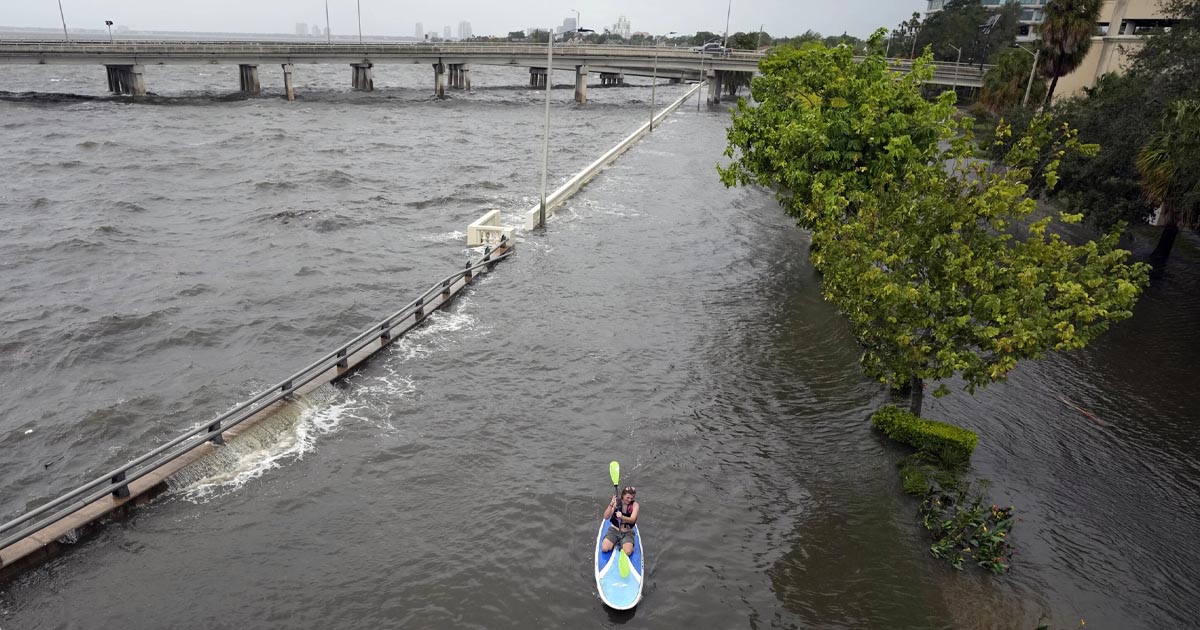
Hurricane Idalia made landfall Wednesday in Florida as a Category 3 storm and unleashed devastation along a wide stretch of the Gulf Coast, submerging homes and vehicles, turning streets into rivers, unmooring small boats and downing power lines in an area that has never before received such a pummeling.

More than 330,000 customers in Florida and Georgia were without electricity while rushing water covered streets near the coast. As the eye moved inland, high winds shredded signs, sent sheet metal flying and snapped tall trees.
I did not copy/paste the whole article.

HURRICANE IDALIA - Hurricane Idalia, gusting to 200km/h, caused extensive damage and flooding without causing any casualties after passing through Florida. It is now heading for North Carolina. #Europe1 #IDALIAhurricane #Florida

Hurricane Idalia made landfall this morning in Florida with very strong winds, rain and a dangerous storm surge.

Surge from #Idalia reversed the flow of the Steinhatchee River, sending these boats slamming into the bridge. High tides combining with surge will keep coastal flooding threats around today on Florida's Gulf Coast.
 
Idalia is today on the coasts of the two Carolinas:

Capture d’écran 2023-08-31 150021.jpg


After bringing damage and destruction in Florida, Idalia has weakened into a tropical storm. It's lashing the Carolinas with torrential rain and a potential 1 metre coastal storm surge - but will clear into the Atlantic later.

Tropical Storm Idalia is racing through the state of Georgia into South Carolina on a path to the northeast. The once category 4 hurricane has been downgraded to a tropical storm.

At 11 p.m. EDT Wednesday, Idalia was about 15 miles north-northwest of Charleston, the National Hurricane Center said.
It was moving northeast at 21 mph. The worst impacts will be felt for areas along and just inland from the coastline. Impacts include risk of freshwater flooding, storm surge, and strong winds. The Charlotte area can expect steady rain for the rest of the evening into the overnight. There's a Flood Watch in effect for areas southeast of Charlotte until 8 p.m. Thursday.

South Carolina and North Carolina coastal impactsStorm surge is one of the main impacts for communities along coastline of South Carolina and North Carolina. The low country of South Carolina can expect a storm surge of 3 to 5 feet, but high tide could bring this total higher.

North Carolina Gov. Roy Cooper, who declared a statewide emergency earlier this week as Idalia approached, warned residents in coastal and eastern inland counties to prepare for heavy rainfall and localized flooding, and urged them to stay off roads covered by water.“

Always we want to keep an eye out on flash flooding and potentially riverine flooding,” Cooper told reporters at the state’s emergency operations center. “This storm is moving faster than people had anticipated. That means we’re going to get some stronger winds than we thought we were going to get, but maybe less rain.” #WakeUpCLT #Idalia #Hurricane

Tropical Storm Idalia made its way toward South Carolina’s coast, bringing along heavy rainfall and strong wind gusts that flipped a car in Goose Creek, injuring at least two people.

The flooding from #Idalia spread into the Carolinas last night. Here's what it looked like in Charleston

More pics about the car flipped by a tornado in Goose Creek while Idalia was there
 
More damages in both Carolinas
Tropical Storm Idalia threatens the Carolinas with treacherous flooding after Florida landfall - CNN

Tropical Storm Idalia descended on the Carolinas on its way out to the Atlantic Ocean on Thursday, leaving a trail of flooding and destruction throughout the Southeast.

Idalia ploughed into Florida as a Category 3 Hurricane on Wednesday morning, before making its way inland through Georgia and the Carolinas.

Storm Idalia lashes Georgia, Carolinas after slamming Florida

It seems that the hurricane Idalia also started some fires
Georgia and the Carolinas are also being battered by Hurricane Idalia with heavy rain and wind.
 
● Mexico

Severe flooding in Guadalajara after heavy rains tonight. Images show vehicles under water on Avenida Colon, near Isla Raza (Aug 31, 2023).
Heavy #storm tonight in #Guadalajara #Mexico 🇲🇽
Several cars swept away by severe #flooding in Colonia Industrial.
Via @Trafico_ZMG

● Argentina
Intense #snowfall in #Bariloche #Argentina 🇦🇷 generates traffic complications and suspension of classes.
#snow #neige #snow

🎥 via @HavaForum

● Hong Kong

● Saudi Arabia
 
🇬🇹 #Guatemala In the country filmed volcanic lightning.

They appeared during the eruption of the Fuego volcano. The discharges are not caused by a thunderstorm, but by the emission of ash from the vent, which generated the appearance of static electricity. 😨

Video:
 

Typhoon Saola rips ups trees as Hong Kong braces for storm​

The highest storm alert is in force in Hong Kong as Typhoon Saola is approaching.

It could be the strongest storm to hit the region in decades, with the Hong Kong Observatory is warning of winds with mean speeds of 118 km/h.

Tens of millions of people in Hong Kong and adjacent areas of mainland China have taken shelter. Emergency shelters have been opening in the city of Shenzhen.

Powerful #Typhoon #Saola very close to #HongKong on the southeast coast of #China 🇨🇳
Causes catastrophic storm surge and destructive winds.
USE EXTREME CAUTION
#TyphoonSaola
Pandemonium on the waterfront
September 1/2023
Video via @Ratnesh_speaks
 
Back
Top Bottom