Bernie Rayno of
AccuWeather details a significant event in the Uppercore of the Midwest
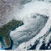
Dangerous Thunderstorm Risk With Big Hail, Winds & Tornadoes Friday
Apr 16, 2026
#forecast #severe #tornadoes
Friday's threat zone, which has the potential to evolve into a severe weather outbreak, will extend from just north of the Big Bend area of the Rio Grande River in Texas to the northern parts of
Minnesota, Wisconsin and Michigan. It is possible that close to 300 reports of severe weather will occur on Friday and Friday night. Big hail, high winds to 90 mph, and tornadoes are all possible. Details.
#forecast #severe #tornadoes #hail #plains #midwest
A brief burst of heavy snow, producing whiteout conditions and strong winds, is to blame for a
seventy-two-car pileup near the
Eisenhower Tunnel in Colorado on the 14th of April
CREEK COUNTY, Colo. — Troopers for the Colorado State Patrol will determine whether anyone should be ticketed as a result of
Interstate 70 reopened in Colorado's mountains on Tuesday night, about five hours after a
snowy afternoon pileup involving approximately 70 vehicles.
The series of crashes happened before 3 p.m. in the eastbound lanes, close to the Eisenhower Tunnel, and left one person seriously hurt and a handful of others with minor injuries.
Snow
fell on and off during the day in Clear Creek County's higher elevations, but at the time of the crash a quick burst of heavy accumulation and strong winds led to dangerously slick road conditions.
"It started snowing hard like a squall, the snow got heavier and all of a sudden we hit ice. Everybody was all over the road," said driver Tom Brock, whose car was damaged but he and his wife were uninjured.
Drivers were met with
white-out conditions and many were unable to prevent their vehicles from slowing down during the descent from the tunnel. Some stepped on their brakes and with the ice on the road, the cars simply wouldn't stop.
"We came out of the tunnel and then we could tell it was slick and we saw that were just going to come into that car over there," said one crash victim.
The pileup resulted in major damage to cars, trucks and semis.
"It was terrifying watching semis jackknife behind you," said Bobby Ryan, who was heading to the Front Range after a meeting with his doctor. "It's not what I'd want to be doing when you're stuck in your car and there's a guardrail on the right and a median on the left."
Two other people, a man and a woman, said it was a rough experience sitting in their pickup truck after it crashed and then waiting as it got hit from behind -- and then the car that hit them got hit.
"Like slow motion," said the man who was in the pickup.
"And then, collison (after) collision," said the woman.
"Like a pinball," said the man.
In addition to
not being able to slow down, some drivers found their vehicles spinning down the icy interstate.
"I slowed down, was trying to get to the right but then someone in front of me spun, and then behind us it just turned into a mess," said Brock.
Many drivers, including Brock, said they were thankful for the quick response by all of the first responders. Brock described it as a "tremendous" effort.
"It's amazing how professional the patrol and EMT people are out here," he said. "This is a day at the office for them, I know, but for most of us this is a big deal. They're so good at it."
The Colorado State Patrol said 19 people were evaluated for injuries at the scene and 11 chose not to be taken to the hospital. Eight were taken to the hospital and one of those people was described as having "serious bodily injuries."
Double whammy snowstorm hits Co. within
seventy-two hours apart
A fast-moving, freezing cold front will bring blizzard conditions with snow and 60 mph winds across much of Wyoming from Thursday afternoon through…

cowboystatedaily.com
A fast-moving, freezing cold front will bring blizzard conditions with snow and 60 mph winds across much of Wyoming from Thursday afternoon through Saturday. “Folks need to be ready for a shock to the system,” meteorologist Don Day says.
Snow squalls, freezing temperatures, and 60 mph wind gusts.
That’s the rest of this week in Wyoming weather that will be decidedly more winter-like than much of this past winter around the state.
Meteorologists are monitoring a fast-moving cold front that will have a sudden and dramatic impact across the state starting Thursday and moving into the weekend.
“We're going to get a little bit of everything,” said Cowboy State Daily meteorologist Don Day. “We're definitely going to see some snow and strong wind gusts. We're definitely going to have some travel concerns.
"From Thursday afternoon through Saturday morning, folks need to be ready for a shock to the system.”
We’ll See Snow
As is typical for Wyoming winter storms, the heaviest snow will fall in the mountains. Forecasts are calling for up to 12 inches of much-needed snow to bolster weak snowpacks at a critical point in the season.
“We’re looking at 7 to 8 inches in the Snowy Range and Sierra Madres,” said general forecaster Matthew McLaughlin with the National Weather Service (NWS) office in Cheyenne. “We’re expecting higher accumulations over the higher terrain in Albany, Carbon, and Laramie Counties with lighter accumulations closer to the mountains.”
Similar snowfall is expected across western Wyoming, including Yellowstone and Grand Teton national parks, where the front will hit first. As much as 5 inches of snow is expected at Old Faithful by Friday afternoon.
The snow should start falling on Thursday evening and continue into Friday morning. Lighter accumulations could range from 1 to 4 inches, depending on location and elevation.
McLaughlin said southeast Wyoming won’t get much snow, but the forecast indicates that the cold front will be strong enough to spread snow across most of the state.
“Anything is much needed at this point,” he said. “Ground temperatures are going to be warm, so accumulation will be low, but we’re seeing between trace amounts up to 2 inches across southeast Wyoming.”
Meteorologist Adam Dziewaltowski with the NWS office in Riverton said predicting the impact of this system is “tricky.” He’s monitoring bands of snow that will stretch across Wyoming, but their impact will favor depending on “how things set up.”
“There should be steady snowfall across central parts of the state, anywhere from 2 to 5 inches across Natrona and Johnson Counties,” he said. “We’re looking at good moisture across the Bighorns and Wind Rivers. Even Casper Mountain should get some good moisture.”
Dziewaltowski said the system has “deteriorated” as it’s progressed, making it less impactful than many thought (and hoped) it would be. Nevertheless, it could muster enough strength to reach even farther.
“If the front develops enough, you could possibly see some more snow in favorable locations like the Lander foothills and portions of Sweetwater County,” he said. “It’s a very fluid situation.”
The Stars Align (Dangerously)
A big cold front means a big change in air temperature. Day said the sudden drop in temperature, especially overnight, is likely to catch many people off guard.
“We need to be prepared for a couple of nights of hard, freezing temperatures,” he said. “There will be a lot of temperatures in the low to mid-20s, especially in the northern and western part of the state, and upper teens to lower 20s on Friday night into Saturday morning.”
The freezing temperatures will be accompanied by wind gusts of up to 60 mph, but this system won’t be like the destructive wind events in March.
“There will be 50 to 60 mph wind gusts, but it won’t be a prolonged wind event,” Day said. “It's going to be windy, but it won't go on for days and days. It’s a different animal compared to the wind events we’ve had recently.”
However, the combination of freezing temperatures, strong winds, and snow could quickly lead to hazardous conditions on Wyoming’s highways. Similar storms in the last few months led to rolling and partial closures due to multi-vehicle crashes.
According to Day, “all the stars will align,” particularly over central Wyoming, on Friday morning. He’s particularly concerned about Interstate 80’s “perennial problem spot” near Elk Mountain and the stretch of I-25 between Casper and Buffalo.
“I think the worst of the worst will be Friday, mainly in the morning to around the noon hour,” he said. “That's when it's going to be the coldest, the windiest, and the snowiest, all at once.”
Off Guard
While the full intensity of the incoming cold front has yet to be seen, Wyoming’s meteorologists agree that it will be impactful for most of the state.
Many Wyomingites could be caught off guard and should brace themselves for unexpected hazards.
“We could definitely see more impacts than we anticipate as this cold front progresses,” McLaughlin said. “We could definitely catch some people off guard, especially if they've been running their sprinklers with how warm it's been.”
People have been encouraged to start watering their lawns, trees, and gardens to compensate for the lack of moisture this winter.
It might be in their best interest to turn off their hoses and sprinklers before the cold front arrives.
From a weather perspective, the downside to this cold front is that it’s moving rather quickly. That means the moisture it carries won’t stick around.
“I would like this front to be moving more slowly and be more productive with the moisture, but we'll take what we can get,” Day said.
Dziewaltowski agreed that after the record-breaking warm and dry winter, any moisture is welcome. The impact of this system has decreased over the last week, but it could regain some strength once it reaches Wyoming.
“We might have some snow squalls develop with gusty winds that’ll decrease visibility on the highways,” he said. “Snow and ice should have difficulty accumulating with the April sunshine, but there are bands of heavy snow that could make travel difficult.”
Day’s message is simple: be prepared.
“We should be fine once we get into Friday afternoon, but folks need to be prepared for Thursday night and early Friday,” he said. “It could get icy, and there could be snow accumulations on the higher-elevation roadways and I-80. It’s going to be a shock to the system.”


 Find all the data here:


 Storm #Pedro : Orange alerts are in progress or forthcoming: rain-flooding, floods, waves-submersion, wind, avalanches.


 BOOM!
BOOM! 


