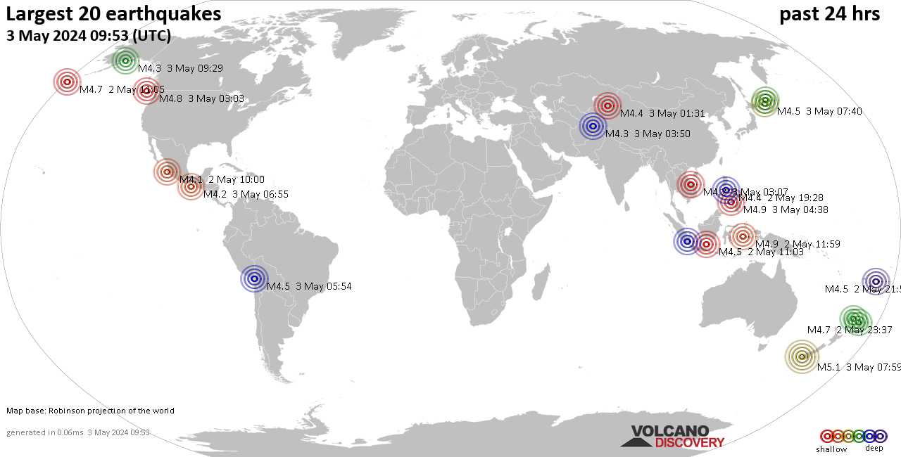
Deep earthquake in Japan
M 5.8 - 61 km NNE of Makubetsu, Japan
2022-07-02 01:59:45 (UTC)
45.881°N 142.125°E
321.6 km depth
M 5.8 - 61 km NNE of Makubetsu, Japan
2022-07-02 01:59:45 (UTC)
45.881°N 142.125°E
321.6 km depth
M 6.1 - 54 km NE of Bandar-e Lengeh, Iran
2022-07-01 21:32:07 (UTC)
26.942°N 55.227°E
10.0 km depth
Aftershock M5.0 - 49 km NE of Bandar-e Lengeh, Iran. 2022-07-01 21:47:51 (UTC)
26.881°N 55.230°E
10.0 km depth
Published on Jul 2, 2022 (1:03)Over the past week, the country was covered by strong tangible shocks reaching up to 6 magnitudes. In general, earthquakes are quite common in Iran, which is located in a seismically active zone.
The USGS reported that a 6.1 magnitude earthquake occurred on Saturday in southern Iran.
According to the preliminary data, the earthquake was felt on Friday night some 54 km northeast of the port city of Bandar Lengeh, at a depth of 10 kilometers.
The USGS information was confirmed by the European-Mediterranean Seismological Center (EMSC), and eyewitnesses of the earthquake noted in a live reports journal on the website that the shock was felt even at a distance of more than 100 km from the epicenter.
According to the Fars News Agency, at least five people have died as a result of the quake. Another 19 individuals were reported as being injured.
However, social media users said that the earthquake was felt even on the other side of the Persian Gulf, in Dubai, UAE.
In March, the same region of the country was hit by an earthquake of equal magnitude, also felt in Dubai. No casualties or damage were reported at the time.
As it stands on the boundary between the Arabian and Eurasian tectonic plates, Iran is situated in a seismically active region and frequently experiences severe earthquakes. In 856 AD, the country saw its deadliest earthquake, which left about 200,000 people dead.

Last week saw 3 M6 earthquakes, all of them M6.0 with two in Iran and one in the Philippines.Last week, again, there were no earthquakes reaching M6, though a M5.9 in Afghanistan was severe and caused both loss of life and material damage.
In the usual area, there were 0 out of 99 earthquakes worldwide equal to or greater than 4.5 and 1787 out of 2228 quakes of all sizes.
Percentage: 80.2%

There is an #earthquake swarm going on in the #Andaman Islands region, which is a subduction zone capable of producing a mega-thrust earthquake, potentially reaching over magnitude 9.
The 2004 Indian Ocean earthquake and tsunami (also known as the Boxing Day Tsunami and, by the scientific community, the Sumatra–Andaman earthquake) occurred at 07:58:53 local time (UTC+7) on 26 December, with an epicentre off the west coast of northern Sumatra, Indonesia. It was an undersea megathrust earthquake that registered a magnitude of 9.1–9.3 Mw, reaching a Mercalli intensity up to IX in certain areas. The earthquake was caused by a rupture along the fault between the Burma Plate and the Indian Plate. Wikipedia

The Andaman Sea has experienced a number of earthquake swarms as a result of complex tectonics arising from oblique subduction, active volcanic arc, the backarc spreading center, and sliver fault systems. One of the most energetic offshore earthquake swarms occurred in the off Nicobar region of the Andaman Sea in January 2005, following the 26th December 2004 (9.1 Mw) Sumatra megathrust event. After a brief quiescence, this region got reactivated again after the 21st March 2014 (6.5 Mw) event, followed by the occurrence of earthquake swarms in March 2014, October 2014, November 2015, and April 2019. In the present study, we analysed the temporal variation of the b-value of these swarms using the global network data and the Ocean Bottom Seismometer data to understand their genesis. Temporal variation of b-value suggests that b-values are larger than unity for earthquake swarms, indicating volcanic origin. Bimodal distribution of frequency magnitude relation suggests that the earthquake swarms have occurred due to complex seismic processes controlled by both tectonic and volcanic activities. We propose that a combination of magmatic pulsation in the arc volcanism in response to 2004 and 2005 megathrust events and the 6.5 Mw magnitude 21st March 2014 event in off Nicobar region, and reactivation of sliver fault systems, are the dominant mechanisms for the observed frequent earthquake swarms.


▪︎M 4.5 - 210 km SE of Port Blair, India
2022-07-08 19:15:47 (UTC)
10.386°N 94.175°E. 10.0 km depth
▪︎M 4.8 - 218 km SE of Port Blair, India
2022-07-08 19:16:15 (UTC)
10.385°N 94.263°E. 10.0 km depth
▪︎M 5.3 - 213 km SE of Port Blair, India
2022-07-08 21:04:39 (UTC)
10.394°N 94.218°E. 10.0 km depth
▪︎M 4.5 - 215 km SE of Port Blair, India
2022-07-08 21:34:33 (UTC)10.309°N 94.161°E10.0 km depth
▪︎M 5.3 - Mariana Islands region
2022-07-08 16:55:14 (UTC)
18.790°N 147.042°E. 10.0 km depth
▪︎M 5.2 - Mariana Islands region
2022-07-08 17:03:00 (UTC)
18.752°N 147.011°E. 16.3 km depth
▪︎M 5.0 - Mariana Islands region
2022-07-08 17:10:02 (UTC)
18.806°N 147.137°E. 10.0 km depth
▪︎M 4.9 - Mariana Islands region
2022-07-08 17:23:46 (UTC)
18.853°N 147.112°E. 10.0 km depth
▪︎M 5.0 - Pagan region, Northern Mariana Islands
2022-07-08 17:46:29 (UTC)
18.869°N 146.981°E. 10.0 km depth
▪︎M 5.3 - Mariana Islands region
2022-07-08 20:44:27 (UTC)
18.829°N 147.021°E 10.0 km depth

