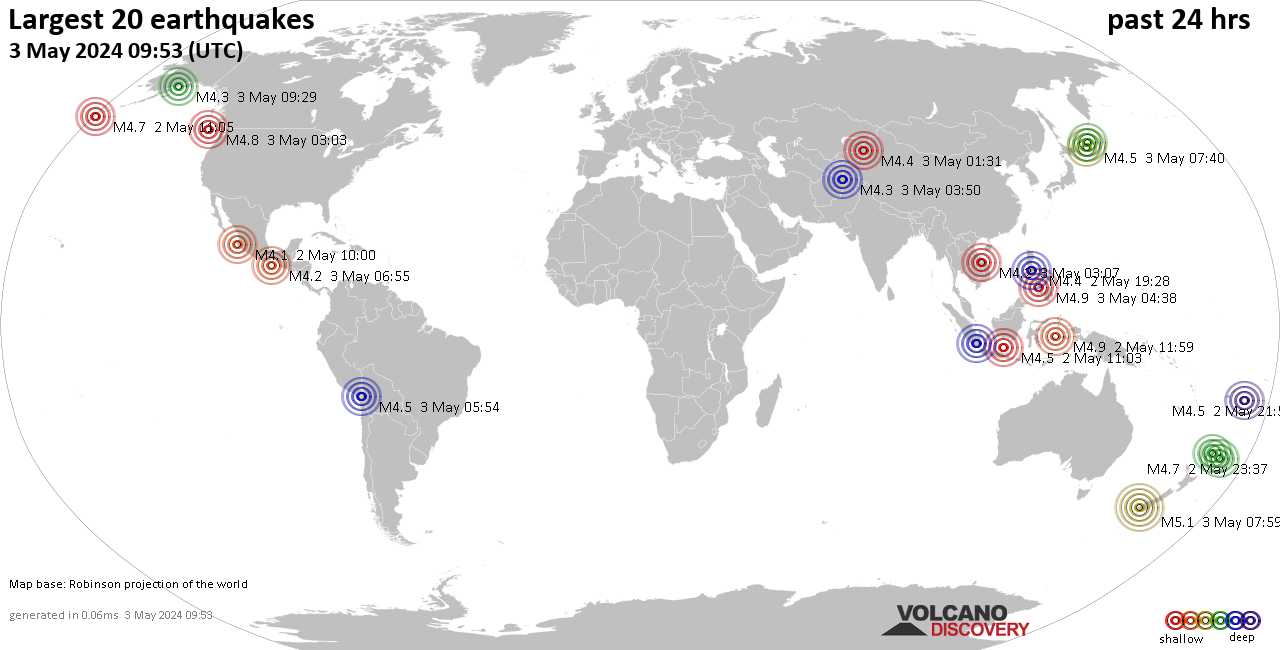
Earthquakes around the world

By Sravasti Dasgupta - 1 hour ago

Earthquake downgraded by USGS

▪︎M 5.9 - 38 km SSW of Hualien City, Taiwan
2022-06-20 01:05:07 (UTC)
23.650°N 121.484°E8.0 km depth

▪︎Aftershock
M 5.2 - 29 km SSW of Hualien City, Taiwan
2022-06-20 01:39:43 (UTC)
23.739°N 121.475°E
10.0 km depth

▪︎Moderate earthquake in Greece
M 5.0 - 21 km SE of Fry, Greece
2022-06-19 23:24:33 (UTC)
35.298°N 27.116°E
47.2 km depth
 
EARTHQUAKE REPORT PAST 24HRS

▪︎Global seismic activity level: Moderate
▪︎Estimated combined seismic energy released: 7.9 x 10¹³ joules (22 gigawatt hours, equivalent to 18939 tons of TNT or 1.2 atomic bombs!)
▪︎4 quakes above magnitude 5
▪︎38 quakes between magnitude 4 and 5
▪︎106 quakes between magnitude 3 and 4
▪︎237 quakes between magnitude 2 and 3
▪︎461 quakes below magnitude 2 that people normally don't feel.
▪︎846 quakes past 24h - 813 previous quakes
▪︎M 5.2 - South Sandwich Islands region
2022-06-20 12:59:05 (UTC) 60.066°S 27.312°W. 77.3 km depth

▪︎M 5.4 - 104 km WNW of Port-Vila, Vanuatu
2022-06-20 19:09:16 (UTC)
17.459°S 167.370°E. 10.0 km depth

Earthquake swarm Mammoth Lakes California
▪︎M 2.8 - 8km E of Mammoth Lakes, CA
2022-06-20 05:33:03 (UTC) 37.636°N 118.884°W- 0.3 km depth
▪︎M 2.7 - 8km E of Mammoth Lakes, CA
2022-06-20 08:27:36 (UTC) 37.640°N 118.890°W- 0.5 km depth
▪︎M 2.6 - 9km E of Mammoth Lakes, CA
2022-06-20 15:39:22 (UTC) 37.631°N 118.881°W. 0.1 km depth
▪︎M 3.0 - 8km E of Mammoth Lakes, CA
2022-06-20 15:39:46 (UTC) 37.631°N 118.884°W. 1.9 km depth
▪︎M 3.0 - 9km E of Mammoth Lakes, CA
2022-06-20 15:43:06 (UTC) 37.632°N 118.881°W- 0.7 km depth
▪︎M 2.5 - 9km E of Mammoth Lakes, CA
2022-06-20 20:38:02 (UTC) 37.629°N 118.874°W- 0.2 km depth

 
EARTHQUAKE REPORT PAST 24HRS

▪︎Global seismic activity level: Moderate
▪︎Estimated combined seismic energy released: 7.4 x 10¹³ joules (20.5 gigawatt hours, equivalent to 17615 tons of TNT or 1.1 atomic bombs!)
▪︎44 quakes between magnitude 4 and 5
▪︎111 quakes between magnitude 3 and 4
▪︎213 quakes between magnitude 2 and 3
▪︎521 quakes below magnitude 2 that people normally don't feel.
▪︎892 quakes past 24h - 846 previous quakes.
▪︎Earthquake M6.0 downgraded by USGS to M5.9 - Bonin Islands, Japan region
2022-06-21 07:14:54 (UTC)
27.957°N 142.814°E. 10.0 km depthh

The Japan Meteorological Agency is warning that another powerful earthquake could hit the Noto region. In June 19th Noto was hit by a M5.1 earthquake

M 5.1 - near the west coast of Honshu, Japan 2022-06-19 06:08:06 (UTC)
37.515°N 137.345°E 10.0 km depth
Honshu is the main island of the Japanese archipelago, once called Hondo. It is the largest and most populous island in Japan.

Japan agency warns of quake of similar intensity in coming week
Sunday, June 19, 4:21

The Japan Meteorological Agency is warning that another powerful earthquake could hit the Noto region on the Sea of Japan in the coming week.

The agency issued the warning after the region in Ishikawa Prefecture experienced a quake registering lower 6 on the Japanese seismic scale of zero to 7 on Sunday afternoon.

Agency official Kamaya Noriko said there is still a high risk of building collapses or mudslides. She urged people to stay away from danger.

She said seismic activity has been heightened in the region for more than a year, and the situation is likely to continue for some time.

In addition to the strong earthquake in the Bonin Islands this morning, this day the Naha region has been hit by three M4+ earthquakes

▪︎M 4.6 - 134 km WNW of Naha, Japan
2022-06-21 11:23:02 (UTC)
26.701°N 126.446°E 10.0 km depth
▪︎M 4.8 - 144 km WNW of Naha, Japan
2022-06-21 14:53:59 (UTC)
26.805°N 126.385°E. 10.0 km depth
▪︎M 4.5 - 141 km WNW of Naha, Japan
2022-06-21 16:14:55 (UTC)
26.750°N 126.399°E 10.0 km depth

 
Very deep Earthquake
M 5.6 - 141 km N of Ruteng, Indonesia
2022-06-22 05:01:18 (UTC)
7.332°S 120.442°E
499.2 km depth

We have had a day with strong seismic activity. The SSGEOS website mentions that the spike in seismic activity is due to a high lunar peak accompanied by a critical planetary alignment.

 
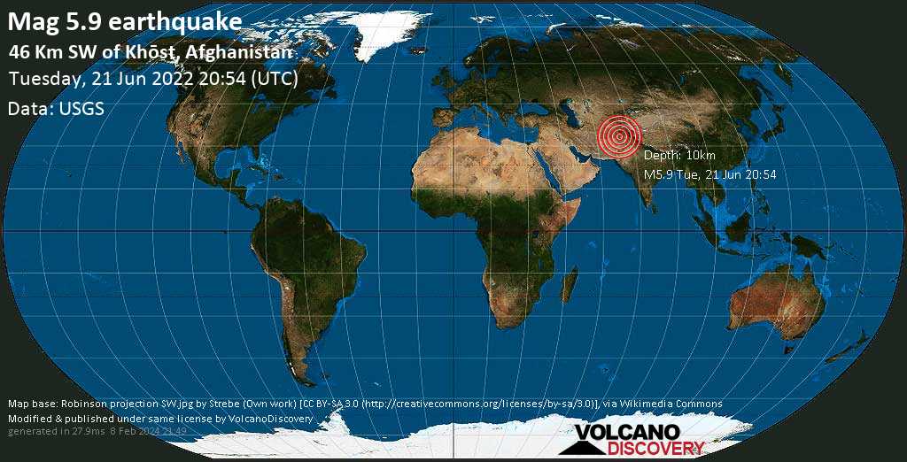
Earthquake in Afganistán M6.1 downgraded by USGS to magnitude 5.9 Aftershock M4.5

M 4.5 - 49 km SW of Khōst, Afghanistan
2022-06-21 21:50:25 (UTC)
33.036°N 69.529°E. 10.0 km depth

Earthquake Kills at Least 255 in Eastern Afghanistan, Reports Suggest

By Evgeny Mikhaylov - 49 minutes ago (Updated: 15 minutes ago)
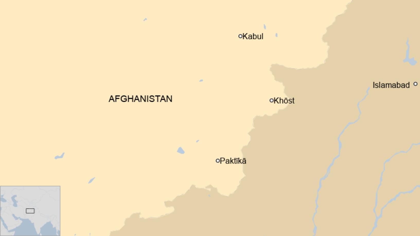
The tremors hit Paktika and Khost provices near the border with Pakistan. The epicentre was located about 44km (27 miles) from the south-eastern city of Khost, according to the USGS.

A powerful 6.1-magnitude earthquake hit Afghanistan on Wednesday, killing at least 255 people in the country's east, Al-Jazeera reported. Initial assessments, reported by state-run media earlier in the day suggested that 155 people were dead, while many more were wounded.

"According to preliminary information ... 100 people have been killed in Paktika, Gayan district, and in Afghan Dubai village, in Spera district of Khost province, 20 people have been exhumed," Elias Khel Naseri, the head of the Southwest Red Crescent zone told Sputnik

Government spokesman Bilal Karimi tweeted confirmed that hundreds were killed and injured, calling on aid agencies to send teams to the area immediately.

Several photos and videos, purportedly depicting the aftermath of the quake are circulating online, showing destroyed houses and wounded people.


Published on Jun 22, 2022 (0:57)
 
New update from Afghanistan :-(

At least 280 killed

Tremors were felt across more than 500km of Afghanistan, Pakistan and India, according to the European Mediterranean Seismological Centre, quoted by Reuters.

..was a magnitude 6.1 quake at a depth of some 51km

Horrible...


Afghan earthquake: At least 280 killed and scores wounded, says state media​


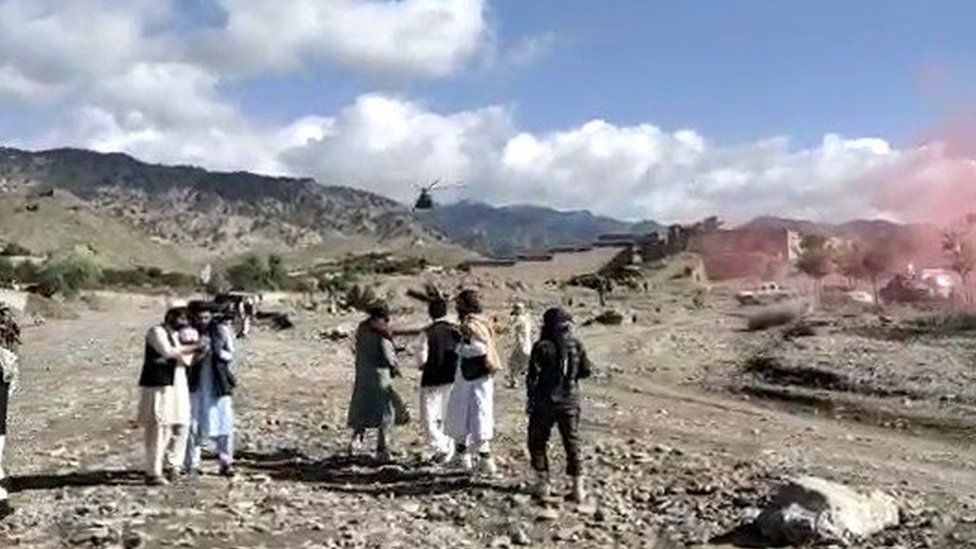
Helicopter landing in Paktika province

IMAGE SOURCE,AFGHAN GOVERNMENT NEWS AGENCY
Image caption, Rescuers have been arriving in Paktika province by helicopter


A powerful earthquake has killed at least 280 people and left scores injured in Afghanistan, according to the country's state news agency.

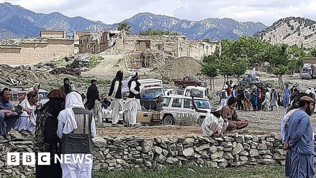
Pictures shared on social media showed people on stretchers, rubble and ruined homes in the eastern Paktika province.

A report by the Bakhtar News Agency said the death toll was likely to rise, adding more than 600 people were injured.

The quake struck about 44km (27 miles) from the south-eastern city of Khost.

"Unfortunately, last night there was a severe earthquake in four districts of Paktika province, which killed and injured hundreds of our countrymen and destroyed dozens of houses," government spokesman Bilal Karimi tweeted.

"We urge all aid agencies to send teams to the area immediately to prevent further catastrophe."
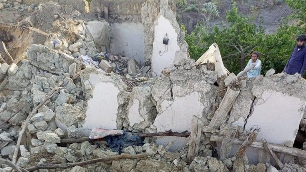
Destroyed building in Paktika

IMAGE SOURCE,AFGHAN GOVERNMENT NEWS AGENCY
Image caption, Pictures from Paktika province show extensive destruction to buildings

Tremors were felt across more than 500km of Afghanistan, Pakistan and India, according to the European Mediterranean Seismological Centre, quoted by Reuters.

The centre said that witnesses had reported feeling the quake in Afghanistan's capital, Kabul, as well as Pakistan's capital, Islamabad.

However, there have been no immediate reports of casualties, and the earthquake caused barely any damage there, according to BBC Urdu.

Rescuers carrying injured people to a helicopter in Paktika province

IMAGE SOURCE,AFGHAN GOVERNMENT NEWS AGENCY
Image caption, Footage shows people brought onto stretchers

The earthquake - which hit during the early hours as many people slept - was a magnitude 6.1 quake at a depth of some 51km, according to the US Geological Survey.

Earthquakes can cause significant damage in Afghanistan, particularly in the many rural areas where many dwellings are not as stable or well-built.

Afghanistan is also prone to quakes, as it's located in a seismically active region, over a number of fault lines including the Chaman fault, the Hari Rud fault, the Central Badakhshan fault and the Darvaz fault.

In the past 10 years, more than 7,000 people have been killed in earthquakes in the country, the UN's Office for the Coordination of Humanitarian Affairs reports. There are average 560 deaths a year from earthquakes.
Map
 
EARTHQUAKE REPORT PAST 24HRS

▪︎Global seismic activity level: Moderate
▪︎Estimated combined seismic energy released: 9.2 x 10¹³ joules (25.6 gigawatt hours, equivalent to 21987 tons of TNT or 1.4 atomic bombs!)
▪︎4 quakes above magnitude 5
▪︎38 quakes between magnitude 4 and 5
▪︎94 quakes between magnitude 3 and 4
▪︎204 quakes between magnitude 2 and 3
▪︎428 quakes below magnitude 2 that people normally don't feel.
▪︎768 quakes past 24h - 892 previous quakes.
▪︎According to Volcano discovery data the estimated seismic energy released from the M5.9 earthquake in Afghanistan was equivalent to 10676 tons of TNT.

It was a very shallow earthquake at a depth of 10 km, so the damage it caused to rustic homes is not uncommon.

In addition, Najibullah Sadid, an Afghan water resources management expert, said the earthquake had coincided with heavy monsoon rain in the region -- making traditional houses, many made of mud and other natural materials, particularly vulnerable to damage.

The death toll stands at more than 1,000 and at least 1,500 people have been injured.

 
EARTHQUAKE REPORT PAST 24HRS

The past 24 hours have been characterized by low intensity earthquakes between magnitude 3 and 4 and only three earthquakes of magnitude 5+ No significant damage reported

▪︎M 5.2 - 76 km E of Severo-Kuril’sk, Russia
2022-06-23 01:45:17 (UTC)
50.599°N 157.203°E. 35.0 km depth

▪︎M 5.2 - 118 km NW of Alotau, Papua New Guinea. 2022-06-23 02:04:31 (UTC)
9.469°S 149.800°E. 10.0 km depth

▪︎M 5.4 - southern Mid-Atlantic Ridge
2022-06-23 07:32:28 (UTC)
25.480°S 14.205°W. 10.0 km depth

▪︎Global seismic activity level: Moderate
▪︎3 quakes above magnitude 5
▪︎46 quakes between magnitude 4 and 5
▪︎118 quakes between magnitude 3 and 4
▪︎206 quakes between magnitude 2 and 3
▪︎452 quakes below magnitude 2 that people normally don't feel.
▪︎825 quakes past 24h - 768 previous quakes. Estimated combined seismic energy released: 3.5 x 10¹³ joules (9.82 gigawatt hours, equivalent to 8448 tons of TNT or 0.5 atomic bombs)

 
This day the seismic activity in the Pacific or the ring of fire increased

▪︎M 5.6 - southeast of Easter Island
2022-06-24 00:27:24 (UTC)
41.162°S 89.885°W. 10.0 km depth

▪︎M 4.7 - 59 km WNW of Kirakira, Solomon Islands
2022-06-24 03:34:26 (UTC)
10.159°S 161.469°E. 89.5 km depth

▪︎M 4.7 - 255 km NNW of Puerto Ayora, Ecuador
2022-06-24 04:26:13 (UTC)
1.507°N 90.849°W. 10.0 km depth

▪︎M 5.1 - 64 km WNW of Puerto Santa, Peru
2022-06-24 04:51:01 (UTC)
8.838°S 79.211°W. 71.1 km depth
 

Trending content

Back
Top Bottom