
Strong 6.0-magnitude earthquake strikes Taiwan’s east coast
Quake struck at a depth of only around 4 miles
 www.independent.co.uk
www.independent.co.uk
www.independent.co.uk
By Sravasti Dasgupta - 1 hour agoStrong 6.0-magnitude earthquake strikes Taiwan’s east coast
Quake struck at a depth of only around 4 miles
(Reuters) - A magnitude 6 earthquake struck the Bonin Islands, Japan region on Tuesday, the European-Mediterranean Seismological Centre (EMSC) said.
The quake was at a depth of 60 km (37 miles), the EMSC said.
Honshu is the main island of the Japanese archipelago, once called Hondo. It is the largest and most populous island in Japan.M 5.1 - near the west coast of Honshu, Japan 2022-06-19 06:08:06 (UTC)
37.515°N 137.345°E 10.0 km depth
Japan agency warns of quake of similar intensity in coming week
Sunday, June 19, 4:21
The Japan Meteorological Agency is warning that another powerful earthquake could hit the Noto region on the Sea of Japan in the coming week.
The agency issued the warning after the region in Ishikawa Prefecture experienced a quake registering lower 6 on the Japanese seismic scale of zero to 7 on Sunday afternoon.
Agency official Kamaya Noriko said there is still a high risk of building collapses or mudslides. She urged people to stay away from danger.
She said seismic activity has been heightened in the region for more than a year, and the situation is likely to continue for some time.

 www3.nhk.or.jp
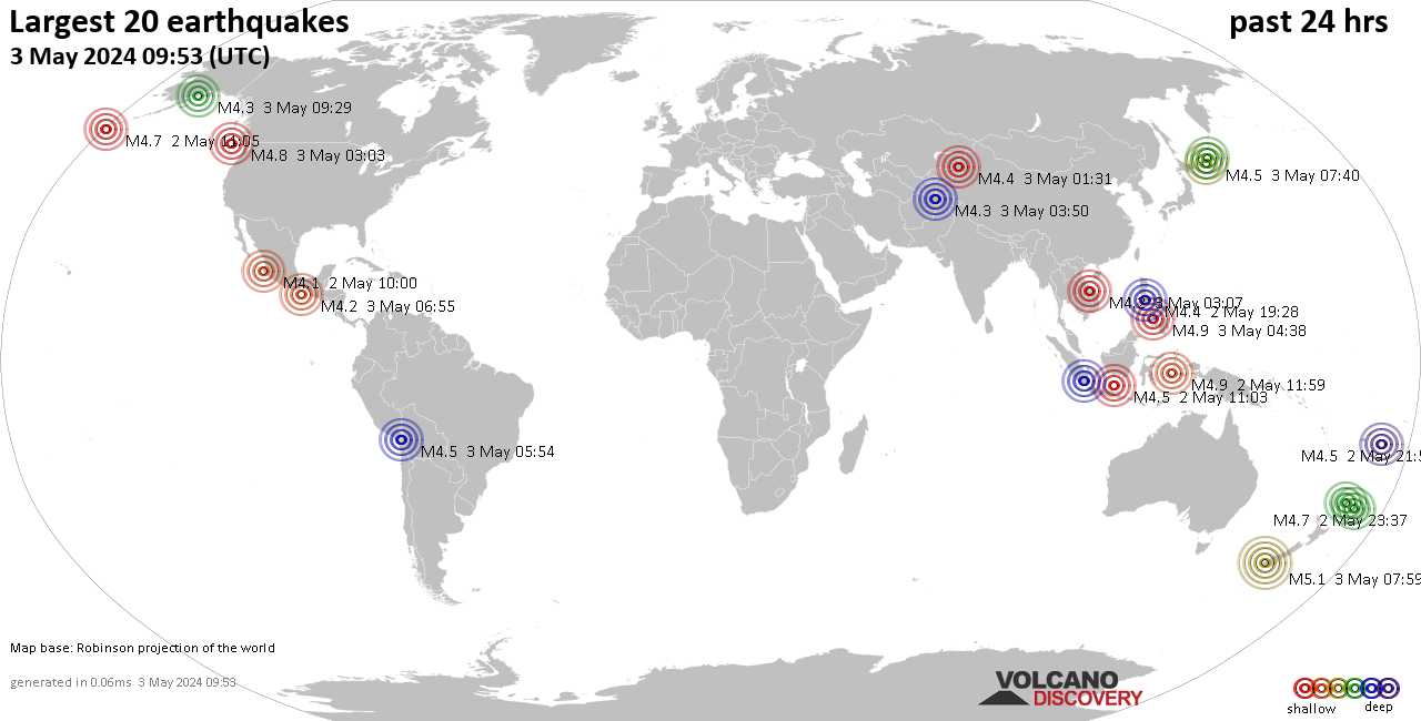
 www.volcanodiscovery.com
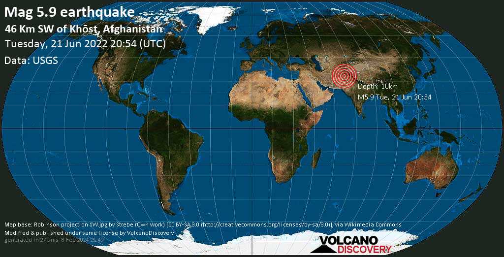
Earthquake in Afganistán M6.1 downgraded by USGS to magnitude 5.9 Aftershock M4.5
M 4.5 - 49 km SW of Khōst, Afghanistan
2022-06-21 21:50:25 (UTC)
33.036°N 69.529°E. 10.0 km depth
Published on Jun 22, 2022 (0:57)The tremors hit Paktika and Khost provices near the border with Pakistan. The epicentre was located about 44km (27 miles) from the south-eastern city of Khost, according to the USGS.
A powerful 6.1-magnitude earthquake hit Afghanistan on Wednesday, killing at least 255 people in the country's east, Al-Jazeera reported. Initial assessments, reported by state-run media earlier in the day suggested that 155 people were dead, while many more were wounded.
"According to preliminary information ... 100 people have been killed in Paktika, Gayan district, and in Afghan Dubai village, in Spera district of Khost province, 20 people have been exhumed," Elias Khel Naseri, the head of the Southwest Red Crescent zone told Sputnik
Government spokesman Bilal Karimi tweeted confirmed that hundreds were killed and injured, calling on aid agencies to send teams to the area immediately.
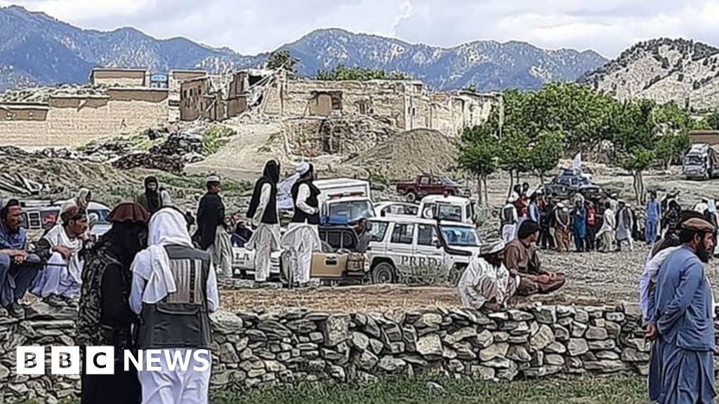
Several photos and videos, purportedly depicting the aftermath of the quake are circulating online, showing destroyed houses and wounded people.

Afghan earthquake: At least 280 killed and scores wounded, says state media

IMAGE SOURCE,AFGHAN GOVERNMENT NEWS AGENCY
Image caption, Rescuers have been arriving in Paktika province by helicopter
A powerful earthquake has killed at least 280 people and left scores injured in Afghanistan, according to the country's state news agency.
Pictures shared on social media showed people on stretchers, rubble and ruined homes in the eastern Paktika province.
A report by the Bakhtar News Agency said the death toll was likely to rise, adding more than 600 people were injured.
The quake struck about 44km (27 miles) from the south-eastern city of Khost.
"Unfortunately, last night there was a severe earthquake in four districts of Paktika province, which killed and injured hundreds of our countrymen and destroyed dozens of houses," government spokesman Bilal Karimi tweeted.
"We urge all aid agencies to send teams to the area immediately to prevent further catastrophe."

IMAGE SOURCE,AFGHAN GOVERNMENT NEWS AGENCY
Image caption, Pictures from Paktika province show extensive destruction to buildings
Tremors were felt across more than 500km of Afghanistan, Pakistan and India, according to the European Mediterranean Seismological Centre, quoted by Reuters.
The centre said that witnesses had reported feeling the quake in Afghanistan's capital, Kabul, as well as Pakistan's capital, Islamabad.
However, there have been no immediate reports of casualties, and the earthquake caused barely any damage there, according to BBC Urdu.

IMAGE SOURCE,AFGHAN GOVERNMENT NEWS AGENCY
Image caption, Footage shows people brought onto stretchers
The earthquake - which hit during the early hours as many people slept - was a magnitude 6.1 quake at a depth of some 51km, according to the US Geological Survey.
Earthquakes can cause significant damage in Afghanistan, particularly in the many rural areas where many dwellings are not as stable or well-built.
Afghanistan is also prone to quakes, as it's located in a seismically active region, over a number of fault lines including the Chaman fault, the Hari Rud fault, the Central Badakhshan fault and the Darvaz fault.
In the past 10 years, more than 7,000 people have been killed in earthquakes in the country, the UN's Office for the Coordination of Humanitarian Affairs reports. There are average 560 deaths a year from earthquakes.


 fb.watch
 www.volcanodiscovery.com
www.volcanodiscovery.com
www.volcanodiscovery.com